Villiers-le-Morhier (Villiers-le-Morhier)

- commune in Eure-et-Loir, France
- Country:

- Postal Code: 28130
- Coordinates: 48° 37' 16" N, 1° 33' 44" E


- GPS tracks (wikiloc): [Link]
- Area: 10.39 sq km
- Population: 1352
- Web site: http://www.villiers-le-morhier.com
- Wikipedia en: wiki(en)
- Wikipedia: wiki(fr)
- Wikidata storage: Wikidata: Q1137905
- Wikipedia Commons Category: [Link]
- Freebase ID: [/m/03nrn9p]
- GeoNames ID: Alt: [6430931]
- SIREN number: [212804173]
- BnF ID: [15254347p]
- VIAF ID: Alt: [131438039]
- SUDOC authorities ID: [067092136]
- INSEE municipality code: 28417
Shares border with regions:


Senantes
- commune in Eure-et-Loir, France
- Country:
- Postal Code: 28210
- Coordinates: 48° 39' 9" N, 1° 34' 54" E
- GPS tracks (wikiloc): [Link]
- Area: 7.57 sq km
- Population: 596


Saint-Martin-de-Nigelles
- commune in Eure-et-Loir, France
- Country:
- Postal Code: 28130
- Coordinates: 48° 36' 44" N, 1° 36' 33" E
- GPS tracks (wikiloc): [Link]
- Area: 12.31 sq km
- Population: 1568
- Web site: [Link]


Nogent-le-Roi
- commune in Eure-et-Loir, France
- Country:
- Postal Code: 28210
- Coordinates: 48° 38' 55" N, 1° 31' 43" E
- GPS tracks (wikiloc): [Link]
- Area: 13.01 sq km
- Population: 4109
- Web site: [Link]

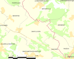
Saint-Lucien
- commune in Eure-et-Loir, France
- Country:
- Postal Code: 28210
- Coordinates: 48° 38' 53" N, 1° 37' 26" E
- GPS tracks (wikiloc): [Link]
- Area: 8.71 sq km
- Population: 255


Maintenon
- commune in Eure-et-Loir, France
- Country:
- Postal Code: 28130
- Coordinates: 48° 35' 11" N, 1° 34' 38" E
- GPS tracks (wikiloc): [Link]
- Area: 11.44 sq km
- Population: 4291
- Web site: [Link]


Coulombs
- commune in Eure-et-Loir, France
- Country:
- Postal Code: 28210
- Coordinates: 48° 39' 10" N, 1° 32' 39" E
- GPS tracks (wikiloc): [Link]
- Area: 12.48 sq km
- Population: 1377


Pierres
- commune in Eure-et-Loir, France
- Country:
- Postal Code: 28130
- Coordinates: 48° 35' 28" N, 1° 34' 1" E
- GPS tracks (wikiloc): [Link]
- Area: 10.41 sq km
- Population: 2800
- Web site: [Link]