
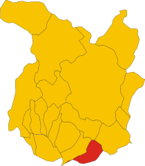
Vinci (Vinci)
.svg)
- Italian comune
 Hiking in Vinci
Hiking in Vinci, Tuscany, offers a delightful experience where you can explore picturesque landscapes, rich history, and charming villages. Vinci is most famously known as the birthplace of Leonardo da Vinci, and the surrounding area is dotted with trails that showcase the beauty of the Tuscan countryside.
Key Highlights:
-
Scenic Trails: The region offers a mix of trails ranging from easy walks to more challenging hikes. Many paths lead you through olive groves, vineyards, and rolling hills, providing stunning views of the iconic Tuscan landscape.
-
Historical Significance: As you hike, you'll encounter historical sites, including the birthplace of Leonardo, the Museum of Leonardo, and ancient churches. These spots provide a unique blend of nature and culture, allowing you to learn more about the Renaissance artist's life and his connection to the area.
-
Virgilio Trail: One of the popular hikes in the area is the Virgilio Trail, which takes you through the scenic countryside, offering panoramic views and a connection to the local flora and fauna. The trail is well-marked, making it accessible for various skill levels.
-
Local Cuisine: After a day of hiking, you can indulge in local Tuscan cuisine. There are several quaint trattorias in Vinci where you can enjoy traditional dishes, wines, and engage with the warmth of the local community.
-
Seasonal Considerations: The best times for hiking in Tuscany are during the spring (April to June) and fall (September to October) when the weather is mild and the landscape is particularly beautiful. Summers can be hot, so it's essential to stay hydrated and start hikes early in the day.
-
Wildlife and Nature: The region is home to a variety of wildlife, including birds and small mammals. Keep an eye out for local plants and flowers, particularly during the spring when everything is in bloom.
Tips for Hiking in Vinci:
- Wear proper gear: Good hiking shoes with durable soles are a must, along with comfortable, breathable clothing.
- Stay on marked trails: To preserve the environment and ensure your safety, stick to marked paths and respect local wildlife.
- Bring enough water and snacks: Hiking can be energy-intensive, especially in warmer weather, so make sure to stay hydrated and fueled.
- Check the weather: Tuscany's weather can change quickly, so it's wise to check forecasts and be prepared for various conditions.
Whether you're a seasoned hiker or just looking for a leisurely walk to soak in the beauty of Tuscany, hiking in Vinci provides an excellent opportunity to connect with nature and immerse yourself in the rich cultural history of the region.
- Country:

- Postal Code: 50059
- Local Dialing Code: 0571
- Licence Plate Code: FI
- Coordinates: 43° 47' 0" N, 10° 55' 0" E


- GPS tracks (wikiloc): [Link]
- AboveSeaLevel: 97 м m
- Area: 54.19 sq km
- Population: 14564
- Web site: http://www.comune.vinci.fi.it/
- Wikipedia en: wiki(en)
- Wikipedia: wiki(it)
- Wikidata storage: Wikidata: Q82884
- Wikipedia Commons Gallery: [Link]
- Wikipedia Commons Category: [Link]
- Freebase ID: [/m/032kkn]
- GeoNames ID: Alt: [6538567]
- BnF ID: [12227086f]
- VIAF ID: Alt: [138166165]
- OSM relation ID: [42603]
- GND ID: Alt: [4454342-6]
- archINFORM location ID: [42860]
- Library of Congress authority ID: Alt: [n86094916]
- UN/LOCODE: [ITVCI]
- ISTAT ID: 048050
- Italian cadastre code: M059
Shares border with regions:

Lamporecchio
- Italian comune
Hiking in Lamporecchio
Lamporecchio, located in the province of Pistoia in Tuscany, Italy, offers a variety of scenic hiking opportunities that showcase the region's beautiful landscapes, vineyards, and historical sites. Here are some highlights about hiking in Lamporecchio:...
- Country:
- Postal Code: 51035
- Local Dialing Code: 0573
- Licence Plate Code: PT
- Coordinates: 43° 49' 0" N, 10° 54' 0" E
- GPS tracks (wikiloc): [Link]
- AboveSeaLevel: 56 м m
- Area: 22.25 sq km
- Population: 7493
- Web site: [Link]


Quarrata
- Italian comune
Hiking in Quarrata
Quarrata, located in the Tuscany region of Italy near Pistoia, offers a variety of hiking opportunities that showcase the beautiful landscape and cultural heritage of the area. Here are some key aspects to consider if you're looking to hike in Quarrata:...
- Country:
- Postal Code: 51039
- Local Dialing Code: 0573
- Licence Plate Code: PT
- Coordinates: 43° 50' 51" N, 10° 59' 0" E
- GPS tracks (wikiloc): [Link]
- AboveSeaLevel: 48 м m
- Area: 45.91 sq km
- Population: 26460
- Web site: [Link]


Carmignano
- Italian comune
Hiking in Carmignano
Carmignano is a charming town located in Tuscany, Italy, known for its stunning landscapes, rich history, and excellent wines, particularly Carmignano wine. Hiking in this area offers a unique combination of natural beauty and cultural heritage, making it an attractive destination for outdoor enthusiasts....
- Country:
- Postal Code: 59015
- Local Dialing Code: 055
- Licence Plate Code: PO
- Coordinates: 43° 48' 37" N, 11° 0' 54" E
- GPS tracks (wikiloc): [Link]
- AboveSeaLevel: 189 м m
- Area: 38.43 sq km
- Population: 14663
- Web site: [Link]

Empoli
- Italian comune
Hiking in Empoli
Empoli, located in the Tuscany region of Italy, is not only known for its rich history and culture but also offers a variety of hiking opportunities thanks to its beautiful landscapes, rolling hills, and proximity to the Arno River. Here are some details that can guide you if you're looking to hike in and around Empoli:...
- Country:
- Postal Code: 50053
- Local Dialing Code: 0571
- Licence Plate Code: FI
- Coordinates: 43° 43' 0" N, 10° 57' 0" E
- GPS tracks (wikiloc): [Link]
- AboveSeaLevel: 28 м m
- Area: 62.21 sq km
- Population: 48626
- Web site: [Link]

Capraia e Limite
- Italian comune
Hiking in Capraia e Limite
Capraia e Limite is a charming municipality located in the Tuscany region of Italy, nestled near the scenic banks of the Arno River, just a short distance from Florence and Prato. This area is rich in natural beauty and offers a variety of hiking opportunities that allow you to experience the stunning landscapes, historical sites, and local flora and fauna....
- Country:
- Postal Code: 50050
- Local Dialing Code: 0571
- Licence Plate Code: FI
- Coordinates: 43° 45' 0" N, 10° 59' 0" E
- GPS tracks (wikiloc): [Link]
- AboveSeaLevel: 28 м m
- Area: 24.92 sq km
- Population: 7782
- Web site: [Link]

Cerreto Guidi
- Italian comune
Hiking in Cerreto Guidi
Cerreto Guidi, located in the Tuscany region of Italy, is a charming town known for its beautiful countryside, historical significance, and proximity to a variety of outdoor activities, including hiking. Here are some key points to consider for hiking in Cerreto Guidi:...
- Country:
- Postal Code: 50050
- Local Dialing Code: 0571
- Licence Plate Code: FI
- Coordinates: 43° 45' 42" N, 10° 52' 38" E
- GPS tracks (wikiloc): [Link]
- AboveSeaLevel: 123 м m
- Area: 49.32 sq km
- Population: 11010
- Web site: [Link]