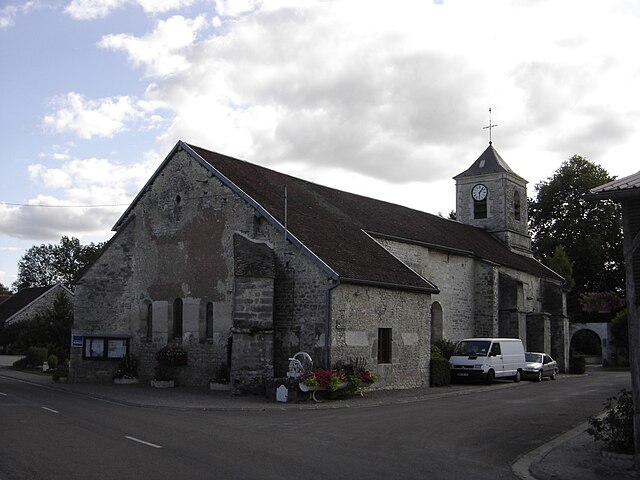
Vitry-le-Croisé (Vitry-le-Croisé)

- commune in Aube, France
- Country:

- Postal Code: 10110
- Coordinates: 48° 8' 42" N, 4° 34' 1" E


- GPS tracks (wikiloc): [Link]
- Area: 32.72 sq km
- Population: 244
- Wikipedia en: wiki(en)
- Wikipedia: wiki(fr)
- Wikidata storage: Wikidata: Q582806
- Wikipedia Commons Category: [Link]
- Freebase ID: [/m/03m8wt8]
- GeoNames ID: Alt: [6426632]
- SIREN number: [211004239]
- BnF ID: [15246530s]
- INSEE municipality code: 10438
Shares border with regions:


Noé-les-Mallets
- commune in Aube, France
- Country:
- Postal Code: 10360
- Coordinates: 48° 6' 2" N, 4° 34' 14" E
- GPS tracks (wikiloc): [Link]
- Area: 8.33 sq km
- Population: 115
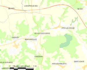
Éguilly-sous-Bois
- commune in Aube, France
- Country:
- Postal Code: 10110
- Coordinates: 48° 8' 23" N, 4° 32' 11" E
- GPS tracks (wikiloc): [Link]
- Area: 10.11 sq km
- Population: 123


Bligny
- commune in Aube, France
- Country:
- Postal Code: 10200
- Coordinates: 48° 10' 18" N, 4° 36' 59" E
- GPS tracks (wikiloc): [Link]
- AboveSeaLevel: 242 м m
- Area: 22.74 sq km
- Population: 167


Champignol-lez-Mondeville
- commune in Aube, France
- Country:
- Postal Code: 10200
- Coordinates: 48° 8' 18" N, 4° 40' 29" E
- GPS tracks (wikiloc): [Link]
- Area: 44.17 sq km
- Population: 306


Longpré-le-Sec
- commune in Aube, France
- Country:
- Postal Code: 10140
- Coordinates: 48° 11' 15" N, 4° 31' 28" E
- GPS tracks (wikiloc): [Link]
- Area: 15.71 sq km
- Population: 78
Saint-Usage
- commune in Aube, France
- Country:
- Postal Code: 10360
- Coordinates: 48° 6' 0" N, 4° 36' 36" E
- GPS tracks (wikiloc): [Link]
- Area: 16.3 sq km
- Population: 78