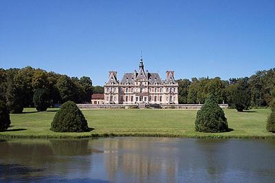
Voise (Voise)

- commune in Eure-et-Loir, France
- Country:

- Postal Code: 28700
- Coordinates: 48° 24' 1" N, 1° 42' 25" E


- GPS tracks (wikiloc): [Link]
- Area: 10.39 sq km
- Population: 289
- Web site: http://www.commune-voise.fr/
- Wikipedia en: wiki(en)
- Wikipedia: wiki(fr)
- Wikidata storage: Wikidata: Q1137664
- Wikipedia Commons Category: [Link]
- Freebase ID: [/m/03nrnbq]
- GeoNames ID: Alt: [6430934]
- SIREN number: [212804215]
- BnF ID: [15254351x]
- INSEE municipality code: 28421
Shares border with regions:


Francourville
- commune in Eure-et-Loir, France
- Country:
- Postal Code: 28700
- Coordinates: 48° 24' 16" N, 1° 39' 40" E
- GPS tracks (wikiloc): [Link]
- Area: 18.46 sq km
- Population: 821

Béville-le-Comte
- commune in Eure-et-Loir, France
- Country:
- Postal Code: 28700
- Coordinates: 48° 26' 11" N, 1° 42' 48" E
- GPS tracks (wikiloc): [Link]
- Area: 20.12 sq km
- Population: 1609


Santeuil
- commune in Eure-et-Loir, France
- Country:
- Postal Code: 28700
- Coordinates: 48° 23' 16" N, 1° 44' 0" E
- GPS tracks (wikiloc): [Link]
- Area: 9.24 sq km
- Population: 314


Saint-Léger-des-Aubées
- commune in Eure-et-Loir, France
- Country:
- Postal Code: 28700
- Coordinates: 48° 24' 43" N, 1° 44' 22" E
- GPS tracks (wikiloc): [Link]
- Area: 13.18 sq km
- Population: 273


Moinville-la-Jeulin
- commune in Eure-et-Loir, France
- Country:
- Postal Code: 28700
- Coordinates: 48° 22' 47" N, 1° 42' 1" E
- GPS tracks (wikiloc): [Link]
- Area: 6.05 sq km
- Population: 162