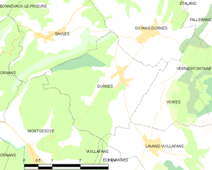
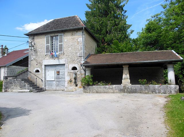
Vuillafans (Vuillafans)
- commune in Doubs, France
Vuillafans is a small commune located in the Doubs department in the Bourgogne-Franche-Comté region of eastern France. It is known for its picturesque landscapes, lush greenery, and charming rural atmosphere. Hiking in Vuillafans offers a fantastic opportunity to explore the natural beauty of the area.
Hiking Trails and Features
-
Scenic Views: The region around Vuillafans features rolling hills, forests, and the Doubs river, providing hikers with stunning views and a peaceful environment.
-
Local Flora and Fauna: The area is rich in biodiversity, with various plant species and wildlife. Keep an eye out for birds, deer, and other local animals during your hikes.
-
Marked Trails: There are several marked hiking trails in the vicinity, ranging from easy walks suitable for families to more challenging routes for experienced hikers. Maps and signage are usually available to help guide you.
-
Cultural Sites: As you hike, you may come across historical sites, traditional farms, and the charming architecture of the local villages, adding cultural context to your outdoor adventure.
-
River Walks: The Doubs river is a major attraction in the area. Hiking along the river can provide a cooling breeze and beautiful waterside views.
Practical Tips
-
Best Time to Hike: Late spring to early autumn is ideal for hiking in Vuillafans, as the weather is generally mild and the landscapes are vibrant.
-
Footwear: Wear sturdy hiking boots with good grip, particularly if you're planning on tackling more rugged trails.
-
Hydration and Snacks: Carry enough water and snacks to keep your energy up, especially for longer hikes.
-
Local Regulations: Always respect local wildlife and follow any trail regulations or guidelines to ensure a safe and enjoyable experience.
-
Guided Tours: If you're unfamiliar with the area or prefer a guided experience, consider joining a local hiking group or hiring a guide.
Hiking in Vuillafans can be a delightful experience for nature lovers and outdoor enthusiasts, offering a unique blend of natural beauty and cultural richness. Whether you're looking for a peaceful day in the great outdoors or an active adventure, this region has something to offer for everyone.
- Country:

- Postal Code: 25840
- Coordinates: 47° 3' 55" N, 6° 12' 59" E


- GPS tracks (wikiloc): [Link]
- Area: 6.14 sq km
- Population: 727
- Web site: http://www.vuillafans.fr/
- Wikipedia en: wiki(en)
- Wikipedia: wiki(fr)
- Wikidata storage: Wikidata: Q838750
- Wikipedia Commons Category: [Link]
- Freebase ID: [/m/03mgbf1]
- GeoNames ID: Alt: [6453872]
- SIREN number: [212506331]
- BnF ID: [15252859k]
- PACTOLS thesaurus ID: [pcrtWaENybpKeF]
- WOEID: [632748]
- HDS ID: [7371]
- INSEE municipality code: 25633
Shares border with regions:


Lavans-Vuillafans
- commune in Doubs, France
Lavans-Vuillafans is a picturesque village located in the Doubs department of the Bourgogne-Franche-Comté region in eastern France. The area is known for its natural beauty, dense forests, and scenic landscapes, making it a wonderful destination for hiking enthusiasts....
- Country:

- Postal Code: 25580
- Coordinates: 47° 5' 11" N, 6° 14' 39" E


- GPS tracks (wikiloc): [Link]
- Area: 10.16 sq km
- Population: 228


Échevannes
- commune in Doubs, France
Échevannes is a small commune located in the Doubs department in eastern France, nestled within the picturesque Jura region. This area is known for its stunning natural landscapes, characterized by rolling hills, dense forests, and tranquil lakes, making it a great spot for hiking enthusiasts....
- Country:

- Postal Code: 25580
- Coordinates: 47° 4' 27" N, 6° 13' 51" E


- GPS tracks (wikiloc): [Link]
- AboveSeaLevel: 650 м m
- Area: 5.23 sq km
- Population: 89


Durnes
- commune in Doubs, France
Durness, located in the North Highlands of Scotland, is a fantastic destination for hiking enthusiasts. Its rugged coastline, dramatic landscapes, and abundant natural beauty offer a wide range of hiking opportunities suitable for various skill levels. Here are some highlights and considerations for hiking in and around Durness:...
- Country:

- Postal Code: 25580
- Coordinates: 47° 6' 29" N, 6° 13' 53" E


- GPS tracks (wikiloc): [Link]
- Area: 8.51 sq km
- Population: 171


Châteauvieux-les-Fossés
- commune in Doubs, France
 Hiking in Châteauvieux-les-Fossés
Châteauvieux-les-Fossés is a charming village located in the Drôme department in southeastern France. It is surrounded by beautiful natural landscapes that are perfect for hiking enthusiasts. Here are some key points about hiking in and around Châteauvieux-les-Fossés:...
- Country:

- Postal Code: 25840
- Coordinates: 47° 3' 51" N, 6° 12' 7" E


- GPS tracks (wikiloc): [Link]
- AboveSeaLevel: 431 м m
- Area: 4.46 sq km
- Population: 12


Montgesoye
- commune in Doubs, France
Montgesoye is an idyllic destination for hiking enthusiasts, nestled in the enchanting landscapes of the Jura Mountains in France. This region offers a variety of trails that cater to different skill levels and preferences....
- Country:

- Postal Code: 25111
- Coordinates: 47° 4' 50" N, 6° 11' 28" E


- GPS tracks (wikiloc): [Link]
- Area: 11.06 sq km
- Population: 472


Lods
- commune in Doubs, France
Lodz, Poland, is not traditionally renowned for hiking in the way some mountainous regions are, but it does offer unique opportunities for outdoor activities and exploring nature. The area surrounding Lodz features a mix of urban parks, forests, and trails that can cater to walkers and casual hikers. Here are some options for enjoying the outdoors around Lodz:...
- Country:

- Postal Code: 25930
- Coordinates: 47° 2' 42" N, 6° 14' 53" E


- GPS tracks (wikiloc): [Link]
- Area: 6.25 sq km
- Population: 224
- Web site: [Link]


Longeville
- commune in Doubs, France
Longeville is a charming commune in the Vosges department of the Grand Est region of France, known for its natural beauty and hiking opportunities. Here are some key points to consider when planning a hiking trip in and around Longeville:...
- Country:

- Postal Code: 25330
- Coordinates: 47° 1' 52" N, 6° 13' 40" E


- GPS tracks (wikiloc): [Link]
- Area: 9.46 sq km
- Population: 168
