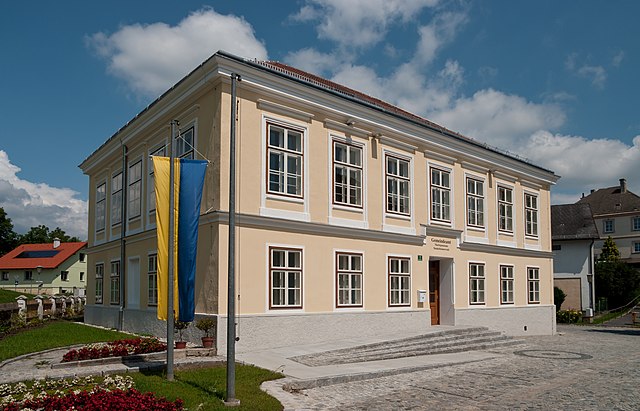
Wölbling (Wölbling)
- municipality in Austria
 Hiking in Wölbling
Wölbling, located in Austria, is a charming area ideal for hiking enthusiasts. The region's picturesque landscapes, featuring rolling hills, lush forests, and scenic views, make it an attractive destination for outdoor activities.
Hiking Trails
-
Local Nature Trails: There are several marked trails around Wölbling suitable for various fitness levels. You can opt for easy walks that meander through the countryside or more challenging paths that lead to elevated viewpoints.
-
The Wölbling Loop: This is a popular hiking route that takes you through the surrounding areas, allowing you to experience the natural beauty and wildlife. The loop generally includes both forested areas and open fields.
-
Cultural Trails: Some hiking routes may also highlight local culture and history, potentially passing by historical sites or quaint villages.
Best Times to Hike
-
Spring and Autumn: These seasons are particularly beautiful, with mild temperatures and vibrant foliage. The blooming flowers in spring and the colorful leaves in autumn enhance the hiking experience.
-
Summer: Early mornings can be ideal for hiking in summer to avoid the heat, especially in areas without much shade.
Essential Tips
-
Gear: Wear comfortable hiking shoes and dress in layers to adjust to changing temperatures.
-
Hydration: Always carry enough water, especially on longer hikes.
-
Local Guidelines: Be mindful of the local guidelines and regulations for hiking, including respecting wildlife and sticking to marked trails.
-
Navigation: A map or GPS can be very helpful, as some trails may not be well-marked.
Additional Activities
In addition to hiking, Wölbling offers opportunities for biking, nature photography, and potentially visiting local markets or enjoying regional cuisine when you finish your hike.
Conclusion
Hiking in Wölbling gives you the chance to immerse yourself in nature and experience the tranquility of the Austrian countryside. Whether you're a seasoned hiker or just starting, there are plenty of options to explore this beautiful region.
- Country:

- Postal Code: 3124
- Local Dialing Code: 02786
- Licence Plate Code: PL
- Coordinates: 48° 19' 0" N, 15° 35' 0" E


- GPS tracks (wikiloc): [Link]
- AboveSeaLevel: 342 м m
- Area: 32.37 sq km
- Population: 2571
- Web site: http://www.woelbling.at/
- Wikipedia en: wiki(en)
- Wikipedia: wiki(de)
- Wikidata storage: Wikidata: Q674408
- Wikipedia Commons Category: [Link]
- Freebase ID: [/m/03grr_9]
- GeoNames ID: Alt: [7871898]
- VIAF ID: Alt: [145235679]
- archINFORM location ID: [42636]
- Austrian municipality key: [31948]
Shares border with regions:

Paudorf
- municipality in Austria
Hiking in Paudorf
Paudorf, a small municipality located in Lower Austria, offers a scenic backdrop for hiking enthusiasts. The region is characterized by its rolling hills, vineyards, and beautiful landscapes, making it an appealing destination for both casual walkers and more serious hikers....
- Country:
- Postal Code: 3508
- Local Dialing Code: 02736
- Licence Plate Code: KR
- Coordinates: 48° 21' 0" N, 15° 37' 0" E
- GPS tracks (wikiloc): [Link]
- AboveSeaLevel: 257 м m
- Area: 30.09 sq km
- Population: 2598
- Web site: [Link]

Obritzberg-Rust
- municipality in Austria
Hiking in Obritzberg-Rust
Obritzberg-Rust is a picturesque area located in Austria, known for its beautiful landscapes and outdoor activities, including hiking. While specific trails can vary, the region typically offers a variety of hiking options ranging from easy walks to more challenging routes. Here are some general highlights about hiking in Obritzberg-Rust:...
- Country:
- Postal Code: 3123
- Licence Plate Code: PL
- Coordinates: 48° 17' 0" N, 15° 36' 0" E
- GPS tracks (wikiloc): [Link]
- AboveSeaLevel: 366 м m
- Area: 41.48 sq km
- Population: 2342
- Web site: [Link]
Dunkelsteinerwald
- municipality in Austria
Hiking in Dunkelsteinerwald
Dunkelsteinerwald is a picturesque region located in Austria, specifically in the municipality of Dunkelsteinerwald, which is part of the larger Lower Austria region. The area is characterized by its lush forests, rolling hills, and scenic landscapes, making it a fantastic destination for hiking enthusiasts....
- Country:
- Postal Code: 3392
- Local Dialing Code: 02753
- Licence Plate Code: ME
- Coordinates: 48° 18' 24" N, 15° 28' 20" E
- GPS tracks (wikiloc): [Link]
- AboveSeaLevel: 585 м m
- Area: 54.19 sq km
- Population: 2390
- Web site: [Link]

Bergern im Dunkelsteinerwald
- municipality in Austria
Hiking in Bergern im Dunkelsteinerwald
Bergern im Dunkelsteinerwald is a charming destination for hiking enthusiasts, located in Austria's Lower Austria region. The Dunkelsteinerwald itself is a picturesque forested area characterized by a mix of deciduous and coniferous trees, hills, and valleys, providing a beautiful backdrop for various outdoor activities. Here are some highlights to consider when planning your hiking adventure in this area:...
- Country:
- Postal Code: 3512
- Local Dialing Code: 02714
- Licence Plate Code: KR
- Coordinates: 48° 22' 0" N, 15° 33' 0" E
- GPS tracks (wikiloc): [Link]
- AboveSeaLevel: 305 м m
- Area: 36.53 sq km
- Population: 1253
- Web site: [Link]

Statzendorf
- municipality in Austria
Hiking in Statzendorf
Statzendorf, a small village located in Austria, is situated in a picturesque area that offers several hiking opportunities. The natural landscapes around Statzendorf are characterized by beautiful hills, forests, and charming rural vistas, making it an attractive destination for both casual walkers and more experienced hikers....
- Country:
- Postal Code: 3125
- Local Dialing Code: 02786
- Licence Plate Code: PL
- Coordinates: 48° 18' 29" N, 15° 38' 27" E
- GPS tracks (wikiloc): [Link]
- AboveSeaLevel: 295 м m
- Area: 12.44 sq km
- Population: 1362
- Web site: [Link]