Entlebuch Constituency (Wahlkreis Entlebuch)
- district in Switzerland
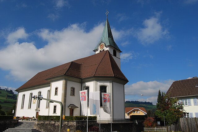
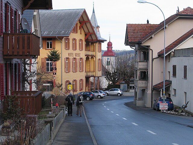
 Hiking in Entlebuch Constituency
Wahlkreis Entlebuch, located in the canton of Lucerne in Switzerland, offers a stunning landscape ideal for hiking enthusiasts. This region is known for its breathtaking natural beauty, including rolling hills, lush forests, serene lakes, and picturesque mountains.
Key Features of Hiking in Wahlkreis Entlebuch:
-
Trails for All Levels: The area provides a variety of hiking trails that cater to all skill levels, from easy walks suitable for families to more challenging routes for experienced hikers.
-
Scenic Views: Many trails offer panoramic views of the surrounding mountains, valleys, and the distinctive Entlebuch Biosphere Reserve, a UNESCO World Heritage site that showcases rich biodiversity.
-
Biosfera Entlebuch: This reserve features unique landscapes and ecosystems. You can find marked trails that guide you through fascinating natural scenery, including moorlands, meadows, and forests.
-
Cultural Highlights: Some trails lead through quaint villages where you can experience local culture, architecture, and traditional Swiss hospitality.
-
Accessibility: The region is well-connected with public transport, making it relatively easy to reach trailheads. Look for local bus services that can take you to starting points for hikes.
-
Wildlife: The area is home to diverse wildlife, including deer, chamois, and various bird species, making it a great destination for nature lovers and photographers.
Popular Hiking Trails:
- Jakobsweg: A historical pilgrimage route that runs through the region, offering a mix of cultural and natural sights.
- Schrattenfluh Panorama Trail: This route features dramatic limestone formations and offers incredible views of the surrounding mountains.
- Entlebuch Heritage Trail: A longer route that highlights the rich cultural and natural heritage of the area.
Tips for Hiking in Entlebuch:
- Weather: Be aware of weather conditions, as they can change rapidly, especially in the mountains.
- Gear: Proper hiking gear is essential; sturdy hiking shoes, layered clothing, and sufficient water are recommended.
- Navigation: Familiarize yourself with trail maps or consider bringing a GPS device or hiking app to help navigate the trails.
- Respect Nature: Follow Leave No Trace principles to preserve the area's natural beauty.
Overall, hiking in Wahlkreis Entlebuch is a rewarding experience that combines magnificent landscapes, rich cultural heritage, and diverse wildlife. It's a great destination for both day hikes and longer excursions in the Swiss outdoors.
- Country:

- Licence Plate Code: LU
- Coordinates: 46° 57' 1" N, 8° 0' 54" E


- GPS tracks (wikiloc): [Link]
- Wikidata storage: Wikidata: Q2539934
- Wikipedia Commons Category: [Link]
Includes regions:

Doppleschwand
- municipality in the canton of Lucerne, Switzerland
Hiking in Doppleschwand
Doppleschwand is a charming area in Switzerland, known for its picturesque landscapes and hiking opportunities. Located in the region of Nidwalden, it's surrounded by stunning mountains, lush forests, and tranquil valleys, making it a great destination for outdoor enthusiasts....
- Country:
- Postal Code: 6112
- Local Dialing Code: 041
- Licence Plate Code: LU
- Coordinates: 47° 0' 43" N, 8° 3' 3" E
- GPS tracks (wikiloc): [Link]
- AboveSeaLevel: 903 м m
- Area: 6.95 sq km
- Population: 786
- Web site: [Link]
Entlebuch
- municipality in the canton of Lucerne, Switzerland
Hiking in Entlebuch
Entlebuch is a stunning area located in the Canton of Lucerne, Switzerland, known for its picturesque landscapes, diverse ecosystems, and opportunities for hiking. As a UNESCO Biosphere Reserve, it features a mix of wetlands, meadows, forests, and mountains, making it an ideal destination for hikers of all levels....
- Country:
- Postal Code: 6162
- Local Dialing Code: 041
- Licence Plate Code: LU
- Coordinates: 46° 59' 34" N, 8° 3' 47" E
- GPS tracks (wikiloc): [Link]
- AboveSeaLevel: 723 м m
- Area: 56.95 sq km
- Population: 3315
- Web site: [Link]


Escholzmatt-Marbach
- municipality in the canton of Lucerne, Switzerland
Hiking in Escholzmatt-Marbach
Escholzmatt-Marbach is a beautiful hiking region located in the cantonal region of Lucerne, Switzerland. It offers a variety of trails that cater to different skill levels, making it a great destination for both novice and experienced hikers....
- Country:
- Postal Code: 6182, 6192, 6196
- Local Dialing Code: 041
- Licence Plate Code: LU
- Coordinates: 46° 55' 0" N, 7° 56' 0" E
- GPS tracks (wikiloc): [Link]
- AboveSeaLevel: 858 м m
- Area: 106.4 sq km
- Population: 4358
- Web site: [Link]

Flühli
- municipality in the canton of Lucerne, Switzerland
Hiking in Flühli
Flühli is a picturesque municipality situated in the Canton of Lucerne, Switzerland. It's an excellent destination for hikers, offering a diverse range of trails amidst stunning Alpine scenery. Here are some highlights for hiking in Flühli:...
- Country:
- Postal Code: 6173
- Local Dialing Code: 041
- Licence Plate Code: LU
- Coordinates: 46° 50' 55" N, 8° 0' 37" E
- GPS tracks (wikiloc): [Link]
- AboveSeaLevel: 1048 м m
- Area: 108.24 sq km
- Population: 1956
- Web site: [Link]


Hasle
- municipality in the canton of Lucerne, Switzerland
Hiking in Hasle
Hiking in Hasle, Lucerne, offers a beautiful experience amidst the stunning landscapes of central Switzerland. Located near the shores of Lake Lucerne and surrounded by the picturesque Swiss Alps, Hasle provides several trails suitable for various skill levels. Here are some highlights to consider if you're planning a hiking adventure in this area:...
- Country:
- Postal Code: 6166
- Local Dialing Code: 041
- Licence Plate Code: LU
- Coordinates: 46° 57' 1" N, 8° 4' 35" E
- GPS tracks (wikiloc): [Link]
- AboveSeaLevel: 1083 м m
- Area: 40.30 sq km
- Population: 1752
- Web site: [Link]
Romoos
- municipality in the canton of Lucerne, Switzerland
Hiking in Romoos
Romoos, located in the picturesque region of Central Switzerland, is known for its stunning landscapes and beautiful trails, making it an excellent destination for hiking enthusiasts. Nestled in the canton of Lucerne, Romoos offers a range of hiking options for all skill levels, from easy walks suitable for families to more challenging alpine routes....
- Country:
- Postal Code: 6113
- Local Dialing Code: 041
- Licence Plate Code: LU
- Coordinates: 47° 0' 37" N, 8° 1' 37" E
- GPS tracks (wikiloc): [Link]
- AboveSeaLevel: 791 м m
- Area: 37.29 sq km
- Population: 670
- Web site: [Link]

Schüpfheim
- municipality in the canton of Lucerne, Switzerland
Hiking in Schüpfheim
Schüpfheim is a picturesque village located in the heart of the Swiss Alps in the canton of Lucerne. It's an excellent destination for hiking enthusiasts, offering a variety of trails that cater to different skill levels and preferences. Here are some highlights about hiking in and around Schüpfheim:...
- Country:
- Postal Code: 6170
- Local Dialing Code: 041
- Licence Plate Code: LU
- Coordinates: 46° 57' 0" N, 8° 0' 54" E
- GPS tracks (wikiloc): [Link]
- AboveSeaLevel: 719 м m
- Area: 38.37 sq km
- Population: 4181
- Web site: [Link]

Werthenstein
- municipality in the canton of Lucerne, Switzerland
Hiking in Werthenstein
Werthenstein, located in the canton of Lucerne in Switzerland, is a beautiful area that offers a range of hiking opportunities amidst stunning natural scenery. The region is characterized by its picturesque landscapes, including the nearby Lake Uri and various mountain peaks....
- Country:
- Postal Code: 6106
- Local Dialing Code: 041
- Licence Plate Code: LU
- Coordinates: 47° 2' 13" N, 8° 6' 27" E
- GPS tracks (wikiloc): [Link]
- AboveSeaLevel: 893 м m
- Area: 15.80 sq km
- Population: 2115
- Web site: [Link]


Wolhusen
- municipality in the canton of Lucerne, Switzerland
Hiking in Wolhusen
Wolhusen, located in the canton of Lucerne in Switzerland, offers a variety of hiking opportunities that cater to different skill levels and preferences. The region is known for its picturesque landscapes, lush forests, and panoramic views of the surrounding mountains....
- Country:
- Postal Code: 6110
- Local Dialing Code: 041
- Licence Plate Code: LU
- Coordinates: 47° 3' 12" N, 8° 3' 24" E
- GPS tracks (wikiloc): [Link]
- AboveSeaLevel: 749 м m
- Area: 14.30 sq km
- Population: 4375
- Web site: [Link]