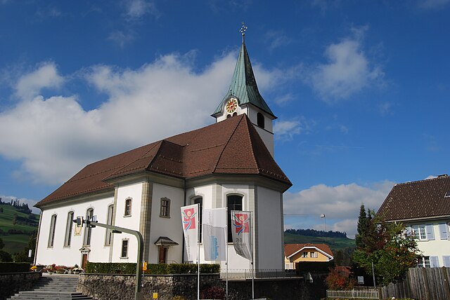
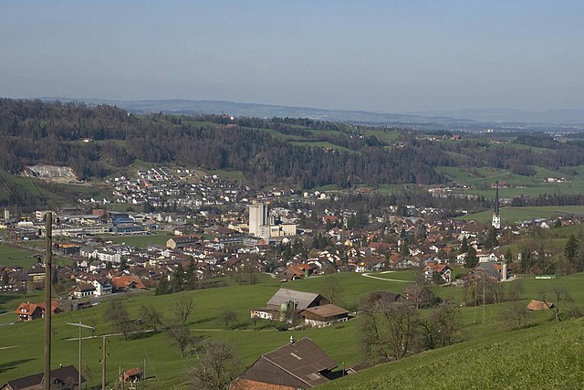
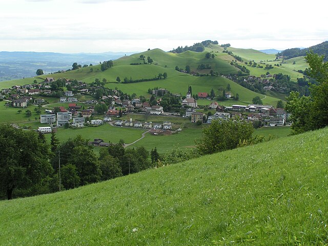
Werthenstein (Werthenstein)

- municipality in the canton of Lucerne, Switzerland
 Hiking in Werthenstein
Werthenstein, located in the canton of Lucerne in Switzerland, is a beautiful area that offers a range of hiking opportunities amidst stunning natural scenery. The region is characterized by its picturesque landscapes, including the nearby Lake Uri and various mountain peaks.
Hiking Trails
-
Bergwanderung zur Rigi: One popular hike takes you toward the famous Rigi, known as the "Queen of the Mountains." From Werthenstein, you can take routes that lead to the Rigi summit, offering breathtaking views of the surrounding Alps and lakes.
-
Lake Paths: There are several trails that follow the shores of Lake Uri. These paths provide a more leisurely hiking experience with opportunities for photography, wildlife spotting, and picnicking.
-
Hiking through Forests: The region is rich in forested areas. Trails through these woods can be refreshing, with plenty of shade and the calming sounds of nature.
-
Alpine Trails: For more experienced hikers, there are alpine trails that venture into higher elevations, where you can encounter varied terrains, including rocky paths and alpine meadows filled with wildflowers during the summer months.
Considerations
- Weather: Always check the weather forecast before heading out, as conditions can change rapidly in the mountains.
- Equipment: Proper hiking gear, including sturdy boots, weather-appropriate clothing, hydration packs, and maps or GPS, is essential for a safe and enjoyable experience.
- Safety: Inform someone about your hiking plans, and consider carrying a mobile phone for emergencies.
Accessibility
Werthenstein can be easily accessed by public transport, including trains and local buses. The area is well-marked with signposts indicating various trails and their difficulty levels.
Conclusion
Hiking in Werthenstein offers something for everyone, from peaceful lakeside strolls to challenging mountain treks. Whether you’re a beginner or an experienced hiker, you'll find the scenery and the experience in Werthenstein truly rewarding. Always remember to respect nature and leave no trace behind!
- Country:

- Postal Code: 6106
- Local Dialing Code: 041
- Licence Plate Code: LU
- Coordinates: 47° 2' 13" N, 8° 6' 27" E


- GPS tracks (wikiloc): [Link]
- AboveSeaLevel: 893 м m
- Area: 15.80 sq km
- Population: 2115
- Web site: http://www.werthenstein.ch
- Wikipedia en: wiki(en)
- Wikipedia: wiki(de)
- Wikidata storage: Wikidata: Q14562
- Wikipedia Commons Category: [Link]
- Freebase ID: [/m/0g0p9p]
- GeoNames ID: Alt: [7287561]
- VIAF ID: Alt: [245728711]
- OSM relation ID: [1682930]
- HDS ID: [591]
- Swiss municipality code: [1009]
Shares border with regions:
Entlebuch
- municipality in the canton of Lucerne, Switzerland
Hiking in Entlebuch
Entlebuch is a stunning area located in the Canton of Lucerne, Switzerland, known for its picturesque landscapes, diverse ecosystems, and opportunities for hiking. As a UNESCO Biosphere Reserve, it features a mix of wetlands, meadows, forests, and mountains, making it an ideal destination for hikers of all levels....
- Country:
- Postal Code: 6162
- Local Dialing Code: 041
- Licence Plate Code: LU
- Coordinates: 46° 59' 34" N, 8° 3' 47" E
- GPS tracks (wikiloc): [Link]
- AboveSeaLevel: 723 м m
- Area: 56.95 sq km
- Population: 3315
- Web site: [Link]

Malters
- municipality in the canton of Lucerne, Switzerland
Hiking in Malters
Malters is a charming municipality located in the canton of Lucerne, Switzerland. It’s nestled in the foothills of the Swiss Alps and offers a variety of hiking opportunities that cater to different skill levels....
- Country:
- Postal Code: 6102
- Local Dialing Code: 041
- Licence Plate Code: LU
- Coordinates: 47° 2' 34" N, 8° 11' 24" E
- GPS tracks (wikiloc): [Link]
- AboveSeaLevel: 490 м m
- Area: 28.57 sq km
- Population: 7231
- Web site: [Link]

Schwarzenberg
- municipality in the canton of Lucerne, Switzerland
Hiking in Schwarzenberg
Schwarzenberg, nestled in the beautiful Lucerne region of Switzerland, offers a variety of hiking opportunities that cater to different skill levels and preferences. The area is known for its stunning landscapes, characterized by rolling hills, lush forests, and picturesque views of the surrounding mountains....
- Country:
- Postal Code: 6103
- Local Dialing Code: 041
- Licence Plate Code: LU
- Coordinates: 47° 0' 51" N, 8° 10' 24" E
- GPS tracks (wikiloc): [Link]
- AboveSeaLevel: 838 м m
- Area: 39.31 sq km
- Population: 1690
- Web site: [Link]

Ruswil
- municipality in the canton of Lucerne, Switzerland
Hiking in Ruswil
Ruswil, a charming village located in the Canton of Lucerne, Switzerland, offers beautiful hiking opportunities surrounded by stunning landscapes. Here are some highlights for hiking in and around Ruswil:...
- Country:
- Postal Code: 6017
- Local Dialing Code: 041
- Licence Plate Code: LU
- Coordinates: 47° 5' 1" N, 8° 7' 34" E
- GPS tracks (wikiloc): [Link]
- AboveSeaLevel: 638 м m
- Area: 45.31 sq km
- Population: 6856
- Web site: [Link]


Wolhusen
- municipality in the canton of Lucerne, Switzerland
Hiking in Wolhusen
Wolhusen, located in the canton of Lucerne in Switzerland, offers a variety of hiking opportunities that cater to different skill levels and preferences. The region is known for its picturesque landscapes, lush forests, and panoramic views of the surrounding mountains....
- Country:
- Postal Code: 6110
- Local Dialing Code: 041
- Licence Plate Code: LU
- Coordinates: 47° 3' 12" N, 8° 3' 24" E
- GPS tracks (wikiloc): [Link]
- AboveSeaLevel: 749 м m
- Area: 14.30 sq km
- Population: 4375
- Web site: [Link]