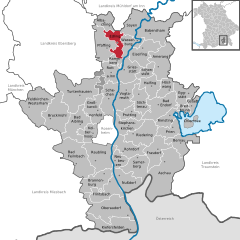
Wasserburg am Inn (Wasserburg am Inn)

- town in Bavaria, Germany
 Hiking in Wasserburg am Inn
Wasserburg am Inn is a picturesque town in Bavaria, Germany, located on a peninsula surrounded by the Inn River. The region offers stunning landscapes and a rich history, making it a delightful location for hiking enthusiasts. Here are some highlights about hiking in and around Wasserburg am Inn:
Hiking Trails
-
Inn River Trails: The bank of the Inn River features several scenic walking and hiking paths. These trails offer beautiful views of the river, the surrounding landscapes, and the town itself. You can enjoy leisurely walks or more challenging hikes along varied terrains.
-
Bavarian Countryside: The area surrounding Wasserburg is characterized by rolling hills, meadows, and forests. You can find numerous trails that lead through charming villages and past historical sites, giving you a taste of the local culture.
-
Nature Reserves: Nearby nature reserves provide opportunities for hiking and wildlife observation. The diverse flora and fauna make these areas particularly enjoyable for nature lovers.
Walks and Loops
- Circular Hikes: Many local trails are designed as circular routes, allowing you to start and finish at convenient points. This is great for day hikes, as you can explore different areas without the need for a shuttle.
Difficulty Levels
- The hiking trails range from easy walks suitable for families to more challenging hikes for experienced walkers. Make sure to check trail markings and maps for difficulty ratings.
Seasonal Considerations
-
Spring and Summer: These seasons are excellent for hiking, with pleasant weather and blooming flora. Trails are generally well-maintained during this time.
-
Autumn: The fall foliage adds a stunning backdrop to your hikes, offering fantastic photo opportunities.
-
Winter: While some trails may become more challenging due to snow, winter hiking can also be an adventure, especially if you enjoy a more serene environment.
Safety Tips
- Check Weather Conditions: Before heading out, it's always wise to check the weather forecast.
- Gear Up: Wear appropriate footwear and bring necessary supplies such as water, snacks, and a first aid kit.
- Navigation: Use local maps or hiking apps to ensure you stay on the right path.
Local Attractions
Don’t forget to explore the town of Wasserburg am Inn itself, known for its medieval architecture, charming old town, and local eateries. After a long hike, it’s perfect to relax and enjoy a traditional Bavarian meal.
Conclusion
Hiking around Wasserburg am Inn offers a combination of natural beauty, cultural exploration, and tranquility. Whether you're a seasoned hiker or just looking for a pleasant walk, this area has something to offer you. Always remember to leave no trace and respect nature while you explore!
- Country:

- Postal Code: 83512
- Local Dialing Code: 08071
- Licence Plate Code: AIB; WS; RO
- Coordinates: 48° 3' 39" N, 12° 14' 0" E


- GPS tracks (wikiloc): [Link]
- AboveSeaLevel: 427 м m
- Area: 18.80 sq km
- Population: 12759
- Web site: http://www.wasserburg.de
- Wikipedia en: wiki(en)
- Wikipedia: wiki(de)
- Wikidata storage: Wikidata: Q259617
- Wikipedia Commons Category: [Link]
- Freebase ID: [/m/04b1_g]
- GeoNames ID: Alt: [2813755]
- BnF ID: [16145764c]
- VIAF ID: Alt: [130828243]
- OSM relation ID: [2186945]
- GND ID: Alt: [4064711-0]
- archINFORM location ID: [3182]
- Library of Congress authority ID: Alt: [n82051147]
- MusicBrainz area ID: [5612ed71-4cdf-49f4-ae6f-706ea4229940]
- WOEID: [704107]
- Quora topic ID: [Wasserburg-Am-Inn]
- Facebook Places ID: [107993302554498]
- Bavarikon ID: [ODB_A00001337]
- German municipality key: 09187182
Includes regions:
Elend
- human settlement in Germany
Hiking in Elend
Elend, located in the vicinity of Wasserburg am Inn in Bavaria, Germany, offers a picturesque setting for hiking enthusiasts. The area features a mix of flatlands and rolling hills, with scenic views of the Inn River and surrounding countryside....
- Country:
- Postal Code: 83512
- Local Dialing Code: 08071
- Coordinates: 48° 1' 20" N, 12° 10' 29" E
- GPS tracks (wikiloc): [Link]
- AboveSeaLevel: 448 м m
Shares border with regions:

Edling
- municipality of Germany
Hiking in Edling
Edling is a charming village located in Bavaria, Germany, near the scenic foothills of the Alps. While it may not be as widely recognized as a hiking hotspot compared to larger nearby cities, it offers access to beautiful landscapes and trails for outdoor enthusiasts. Here are some key points about hiking in and around Edling:...
- Country:
- Postal Code: 83533
- Local Dialing Code: 08071
- Licence Plate Code: RO
- Coordinates: 48° 4' 0" N, 12° 10' 0" E
- GPS tracks (wikiloc): [Link]
- AboveSeaLevel: 475 м m
- Area: 20.04 sq km
- Population: 3067
- Web site: [Link]
Eiselfing
- municipality of Germany
Hiking in Eiselfing
Eiselfing is a charming municipality located in Bavaria, Germany, known for its picturesque landscapes and proximity to several hiking opportunities in the surrounding areas. While Eiselfing itself might not be a major hiking destination with extensive trails, it serves as an excellent base for exploring the nearby regions, including the foothills of the Alps....
- Country:
- Postal Code: 83549
- Local Dialing Code: 08071
- Licence Plate Code: RO
- Coordinates: 48° 3' 0" N, 12° 14' 0" E
- GPS tracks (wikiloc): [Link]
- AboveSeaLevel: 470 м m
- Area: 34.89 sq km
- Population: 2429
- Web site: [Link]