Rosenheim (Landkreis Rosenheim)
- district of Bavaria, Germany
Rosenheim district, located in Bavaria, Germany, offers a diverse range of hiking opportunities amidst beautiful landscapes, charming villages, and stunning natural scenery. Here are some highlights for hiking in the region:
Hiking Trails
-
Mangfall Mountains: These mountains provide various trails ranging from easy walks to more challenging hikes. The area is characterized by lush forests, rocky outcrops, and sweeping views.
-
Chiemsee: The largest lake in Bavaria, Chiemsee has several well-marked paths along its shores. You can enjoy leisurely hikes with picturesque views of the water and the surrounding Alps.
-
Alpenvorland: This area features rolling hills and meadows, ideal for pleasant hikes. You can find various trails suitable for families and beginners, often leading to small picturesque villages.
-
Wendelstein: Hiking to the summit of Wendelstein offers breathtaking panoramic views. There are several routes, including more steep and challenging paths for experienced hikers.
Trail Difficulty Levels
- Easy Trails: Accessible for families and beginners, often well-marked and with gentle gradients.
- Moderate Trails: Suitable for hikers with some experience, featuring varied terrain and more elevation changes.
- Challenging Trails: For experienced hikers, these trails involve steep ascents, rocky paths, and require proper equipment.
Nature and Scenery
The region is famous for its natural beauty, including dense forests, alpine meadows, and stunning mountain backdrops. Wildlife enthusiasts may also enjoy spotting local fauna.
Best Times to Hike
- Spring: Wildflowers bloom, and temperatures are mild, making it a great time for hiking.
- Summer: Perfect for longer hikes, but be prepared for warmer weather and bring plenty of water.
- Autumn: The fall colors create a breathtaking landscape, and the weather is usually still pleasant.
- Winter: If you're experienced, winter hiking is possible, but ensure you have the right gear and check conditions.
Local Tips
- Stay Hydrated: Always carry enough water, especially on longer hikes.
- Trail Maps: Make use of local hiking maps or apps that provide trail information and conditions.
- Accommodations: Rosenheim has various options for lodging, from hotels to guesthouses, many of which cater to hikers.
Safety
- Always inform someone of your hiking plans.
- Check the weather forecast before heading out and be prepared for changing conditions.
- Wear appropriate footwear and gear based on the trail difficulty.
With its stunning scenery and varied hiking opportunities, the Rosenheim district is an excellent destination for hikers looking to explore the natural beauty of Bavaria.
- Country:

- Capital: Rosenheim
- Licence Plate Code: WS; RO; AIB
- Coordinates: 47° 55' 12" N, 12° 10' 12" E


- GPS tracks (wikiloc): [Link]
- AboveSeaLevel: 512 м m
- Area: 1439.40 sq km
- Population: 190104
- Web site: http://www.landkreis-rosenheim.de/
- Wikipedia en: wiki(en)
- Wikipedia: wiki(de)
- Wikidata storage: Wikidata: Q10526
- Wikipedia Commons Category: [Link]
- Wikipedia Commons Maps Category: [Link]
- Freebase ID: [/m/019xgs]
- GeoNames ID: Alt: [3220840]
- VIAF ID: Alt: [132552139]
- OSM relation ID: [2156362]
- GND ID: Alt: [4050558-3]
- archINFORM location ID: [2589]
- Library of Congress authority ID: Alt: [n82164761]
- TGN ID: [7077290]
- Historical Gazetteer (GOV) ID: [adm_139187]
- Facebook Places ID: [109304865754580]
- Bavarikon ID: [ODB_A00002358]
- ISNI: Alt: [0000 0004 0394 5667]
- NUTS code: [DE21K]
- Ringgold ID: [155948]
- German district key: 09187
Includes regions:


Frasdorf
- municipality of Germany
Frasdorf, located in Bavaria, Germany, is a charming village situated near the foothills of the Alps, making it a great destination for hiking enthusiasts. The surrounding area offers a variety of trails that cater to different skill levels, from gentle walks to more challenging hikes with stunning views of the Alpine landscape....
- Country:

- Postal Code: 83112
- Local Dialing Code: 08052
- Licence Plate Code: RO
- Coordinates: 47° 48' 0" N, 12° 17' 0" E


- GPS tracks (wikiloc): [Link]
- AboveSeaLevel: 598 м m
- Area: 32.72 sq km
- Population: 2382
- Web site: [Link]

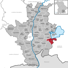
Bernau am Chiemsee
- municipality of Germany
Bernau am Chiemsee, located in Bavaria, Germany, offers beautiful hiking opportunities in a picturesque lakeside setting. The region is characterized by stunning views of the Chiemsee, the largest lake in Bavaria, and the surrounding mountain ranges, particularly the Alps....
- Country:

- Postal Code: 83233
- Local Dialing Code: 08051
- Licence Plate Code: RO
- Coordinates: 47° 49' 0" N, 12° 22' 0" E


- GPS tracks (wikiloc): [Link]
- AboveSeaLevel: 544 м m
- Area: 26.68 sq km
- Population: 4859
- Web site: [Link]

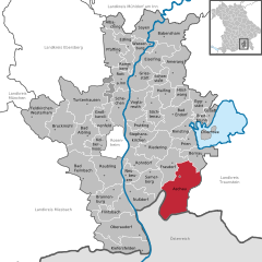
Aschau im Chiemgau
- municipality of Germany
Aschau im Chiemgau is a beautiful destination for hiking enthusiasts, located in the Bavarian Alps near the Chiemsee lake in Germany. The region is characterized by stunning landscapes, lush forests, rolling hills, and breathtaking mountain views. Here are some highlights and tips for hiking in Aschau im Chiemgau:...
- Country:

- Postal Code: 83229
- Local Dialing Code: 08052
- Licence Plate Code: RO
- Coordinates: 47° 46' 37" N, 12° 19' 23" E


- GPS tracks (wikiloc): [Link]
- AboveSeaLevel: 615 м m
- Area: 79.61 sq km
- Population: 5647
- Web site: [Link]


Prien am Chiemsee
- municipality in the district of Rosenheim, in Bavaria, Germany
Prien am Chiemsee, located in Bavaria, Germany, offers a beautiful setting for hiking enthusiasts. Nestled near the shores of Lake Chiemsee, often referred to as the "Bavarian Sea," this area boasts stunning landscapes that include rolling hills, scenic views of the Alps, and lush forests....
- Country:

- Postal Code: 83209
- Local Dialing Code: 08051
- Licence Plate Code: RO
- Coordinates: 47° 52' 0" N, 12° 20' 0" E


- GPS tracks (wikiloc): [Link]
- AboveSeaLevel: 533 м m
- Area: 20.69 sq km
- Population: 10355
- Web site: [Link]

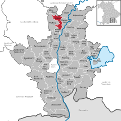
Edling
- municipality of Germany
Edling is a charming village located in Bavaria, Germany, near the scenic foothills of the Alps. While it may not be as widely recognized as a hiking hotspot compared to larger nearby cities, it offers access to beautiful landscapes and trails for outdoor enthusiasts. Here are some key points about hiking in and around Edling:...
- Country:

- Postal Code: 83533
- Local Dialing Code: 08071
- Licence Plate Code: RO
- Coordinates: 48° 4' 0" N, 12° 10' 0" E


- GPS tracks (wikiloc): [Link]
- AboveSeaLevel: 475 м m
- Area: 20.04 sq km
- Population: 3067
- Web site: [Link]


Bad Endorf
- municipality of Germany
Bad Endorf, located in Bavaria, Germany, offers a beautiful setting for hiking enthusiasts. Nestled near the Chiemsee, the largest lake in Bavaria, and surrounded by picturesque landscapes, there are plenty of hiking opportunities suitable for different skill levels....
- Country:

- Postal Code: 83093
- Local Dialing Code: 08053
- Licence Plate Code: RO
- Coordinates: 47° 54' 0" N, 12° 18' 0" E


- GPS tracks (wikiloc): [Link]
- AboveSeaLevel: 522 м m
- Area: 40.11 sq km
- Population: 8269
- Web site: [Link]

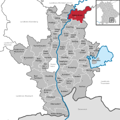
Babensham
- Municipality in Bavaria, Germany
Babensham is a village in the scenic surroundings of the North Yorkshire Moors in England, making it a lovely spot for hiking enthusiasts. The region typically offers beautiful walking trails, including routes that traverse through woodlands, along river valleys, and up to hilltops with breathtaking views....
- Country:

- Postal Code: 83547
- Local Dialing Code: 08071
- Licence Plate Code: RO
- Coordinates: 48° 5' 0" N, 12° 16' 0" E


- GPS tracks (wikiloc): [Link]
- AboveSeaLevel: 488 м m
- Area: 54.31 sq km
- Population: 2349
- Web site: [Link]


Schechen
- municipality of Germany
Schechen, located in Bavaria, Germany, offers beautiful hiking opportunities amidst picturesque countryside and scenic landscapes. While it may not be as widely known as some of the larger tourist destinations, it can be a gem for those seeking tranquility and natural beauty....
- Country:

- Postal Code: 83135
- Local Dialing Code: 08067; 08039; 08031
- Licence Plate Code: RO
- Coordinates: 47° 56' 0" N, 12° 8' 0" E


- GPS tracks (wikiloc): [Link]
- AboveSeaLevel: 440 м m
- Area: 31.54 sq km
- Population: 3489
- Web site: [Link]


Kolbermoor
- town in Bavaria, Germany
Kolbermoor, located in Bavaria, Germany, is a charming town near the banks of the River Mangfall and nestled at the foothills of the Alps. While Kolbermoor itself may not have extensive hiking trails directly within its borders, it serves as an excellent starting point for various hiking opportunities in the surrounding regions....
- Country:

- Postal Code: 83059
- Local Dialing Code: 08061; 08031
- Licence Plate Code: RO
- Coordinates: 47° 51' 0" N, 12° 4' 0" E


- GPS tracks (wikiloc): [Link]
- AboveSeaLevel: 461 м m
- Area: 19.87 sq km
- Population: 18371
- Web site: [Link]


Pfaffing
- municipality of Germany
Pfaffing is a picturesque region located in Bavaria, Germany, known for its beautiful landscapes and opportunities for hiking. While the specific trails and features may vary, here are some general aspects you can expect when hiking in Pfaffing:...
- Country:

- Postal Code: 83539
- Local Dialing Code: 08076
- Licence Plate Code: RO
- Coordinates: 48° 3' 0" N, 12° 7' 0" E


- GPS tracks (wikiloc): [Link]
- AboveSeaLevel: 492 м m
- Area: 35.39 sq km
- Population: 4152
- Web site: [Link]
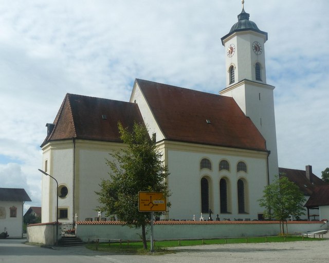

Albaching
- municipality of Germany
Albaching, located in Bavaria, Germany, offers beautiful hiking opportunities for outdoor enthusiasts. Surrounded by picturesque landscapes, rolling hills, and extensive forests, this area provides a serene setting for both casual walkers and more experienced hikers....
- Country:

- Postal Code: 83544
- Local Dialing Code: 08076
- Licence Plate Code: RO
- Coordinates: 48° 7' 0" N, 12° 7' 0" E


- GPS tracks (wikiloc): [Link]
- AboveSeaLevel: 507 м m
- Area: 18.15 sq km
- Population: 745
- Web site: [Link]


Soyen
- municipality of Germany
It seems there may be a typo or misunderstanding regarding "Soyen." If you meant to refer to a specific location, please provide more context or check the spelling....
- Country:

- Postal Code: 83564
- Local Dialing Code: 08071
- Licence Plate Code: RO
- Coordinates: 48° 7' 0" N, 12° 12' 0" E


- GPS tracks (wikiloc): [Link]
- AboveSeaLevel: 475 м m
- Area: 28.96 sq km
- Population: 2304
- Web site: [Link]

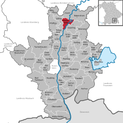
Wasserburg am Inn
- town in Bavaria, Germany
Wasserburg am Inn is a picturesque town in Bavaria, Germany, located on a peninsula surrounded by the Inn River. The region offers stunning landscapes and a rich history, making it a delightful location for hiking enthusiasts. Here are some highlights about hiking in and around Wasserburg am Inn:...
- Country:

- Postal Code: 83512
- Local Dialing Code: 08071
- Licence Plate Code: AIB; WS; RO
- Coordinates: 48° 3' 39" N, 12° 14' 0" E


- GPS tracks (wikiloc): [Link]
- AboveSeaLevel: 427 м m
- Area: 18.80 sq km
- Population: 12759
- Web site: [Link]


Ramerberg
- municipality of Germany
Ramerberg is a charming village located in Bavaria, Germany, near the picturesque Chiemsee Lake and surrounded by beautiful nature. While it may not be as widely recognized as some major hiking destinations, it offers several opportunities for hiking enthusiasts to explore the scenic countryside and enjoy the natural beauty of the area....
- Country:

- Postal Code: 83561
- Local Dialing Code: 08039
- Licence Plate Code: RO
- Coordinates: 48° 1' 0" N, 12° 9' 0" E


- GPS tracks (wikiloc): [Link]
- AboveSeaLevel: 480 м m
- Area: 8.09 sq km
- Population: 1050
- Web site: [Link]
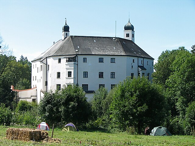

Amerang
- municipality of Germany
Amerang, located in Bavaria, Germany, is a picturesque area that offers various hiking opportunities. The region is characterized by its beautiful landscapes, rolling hills, and lush green forests, making it an ideal spot for nature lovers and outdoor enthusiasts....
- Country:

- Postal Code: 83123
- Local Dialing Code: 08075
- Licence Plate Code: RO
- Coordinates: 47° 59' 30" N, 12° 18' 34" E


- GPS tracks (wikiloc): [Link]
- AboveSeaLevel: 537 м m
- Area: 39.80 sq km
- Population: 2727
- Web site: [Link]
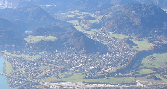

Kiefersfelden
- municipality of Germany
Kiefersfelden is a picturesque town located on the border between Germany and Austria, near the banks of the River Inn. It offers a variety of hiking opportunities that cater to different skill levels and preferences. Here are some highlights and tips for hiking in the Kiefersfelden area:...
- Country:

- Postal Code: 83088
- Local Dialing Code: 08033
- Licence Plate Code: RO
- Coordinates: 47° 37' 0" N, 12° 11' 0" E


- GPS tracks (wikiloc): [Link]
- AboveSeaLevel: 490 м m
- Area: 36.72 sq km
- Population: 5575
- Web site: [Link]


Bad Feilnbach
- municipality of Germany
Bad Feilnbach is a charming town located in Bavaria, Germany, surrounded by beautiful landscapes that make it a great destination for hiking enthusiasts. The area is characterized by lush forests, rolling hills, and stunning views of the Alps. Here are some key points about hiking in Bad Feilnbach:...
- Country:

- Postal Code: 83075
- Local Dialing Code: 08066; 08064
- Coordinates: 47° 47' 0" N, 12° 1' 0" E


- GPS tracks (wikiloc): [Link]
- AboveSeaLevel: 512 м m
- Area: 57.49 sq km
- Population: 8076
- Web site: [Link]


Oberaudorf
- municipality of Germany
Oberaudorf is a charming village located in Bavaria, Germany, close to the border with Austria. It offers a variety of hiking opportunities suitable for all levels of hikers, from beginners to experienced trekkers. Here are some highlights of hiking in Oberaudorf:...
- Country:

- Postal Code: 83080
- Local Dialing Code: 08033
- Licence Plate Code: RO
- Coordinates: 47° 38' 51" N, 12° 10' 19" E


- GPS tracks (wikiloc): [Link]
- AboveSeaLevel: 480 м m
- Area: 59.29 sq km
- Population: 5033
- Web site: [Link]
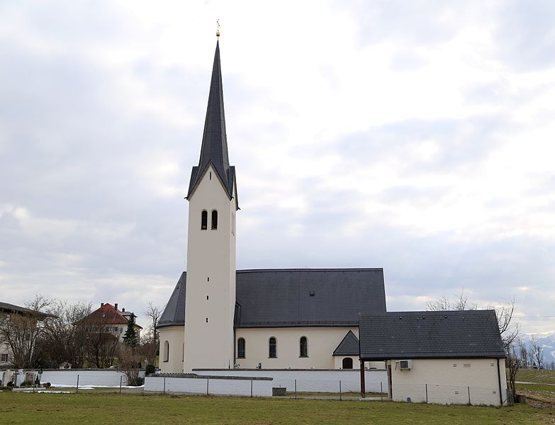

Riedering
- municipality of Germany
Riedering is a beautiful area located in Bavaria, Germany, offering stunning landscapes and various hiking opportunities. Nestled near the foothills of the Alps, it provides access to picturesque trails that cater to different skill levels. Here are some highlights about hiking in Riedering:...
- Country:

- Postal Code: 83083
- Local Dialing Code: 08036
- Licence Plate Code: RO
- Coordinates: 47° 50' 0" N, 12° 12' 0" E


- GPS tracks (wikiloc): [Link]
- AboveSeaLevel: 493 м m
- Area: 37.94 sq km
- Population: 4336
- Web site: [Link]


Feldkirchen-Westerham
- municipality of Germany
 Hiking in Feldkirchen-Westerham
Feldkirchen-Westerham, located in Bavaria, Germany, offers a variety of beautiful hiking trails and scenic landscapes, making it a great destination for outdoor enthusiasts. The region is known for its charming countryside, lush forests, and rolling hills, providing hikers with a mix of nature walks, more challenging hikes, and picturesque views....
- Country:

- Postal Code: 83620
- Local Dialing Code: 08063
- Licence Plate Code: RO
- Coordinates: 47° 54' 0" N, 11° 51' 0" E


- GPS tracks (wikiloc): [Link]
- AboveSeaLevel: 551 м m
- Area: 52.24 sq km
- Population: 8190
- Web site: [Link]


Flintsbach
- municipality of Germany
Flintsbach am Inn, located in the Bavarian Alps of Germany, offers a variety of hiking opportunities for both beginners and experienced hikers. The area is known for its stunning landscapes, including rolling hills, lush forests, and panoramic views of the surrounding mountains. Here are some key points about hiking in Flintsbach:...
- Country:

- Postal Code: 83126
- Local Dialing Code: 08034
- Licence Plate Code: RO
- Coordinates: 47° 43' 0" N, 12° 8' 0" E


- GPS tracks (wikiloc): [Link]
- AboveSeaLevel: 479 м m
- Area: 31.3 sq km
- Population: 2154
- Web site: [Link]
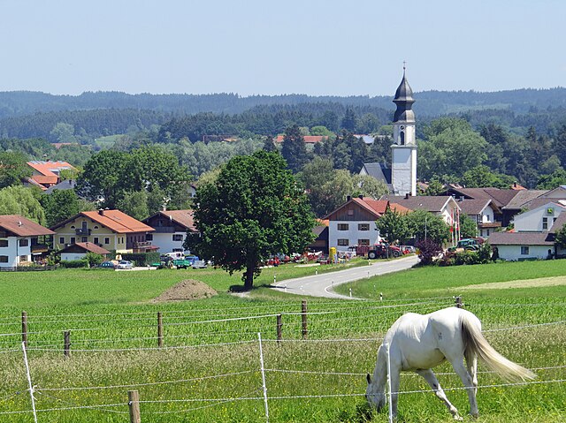

Söchtenau
- municipality of Germany
Söchtenau, located in Bavaria, Germany, is a charming area that offers a variety of hiking opportunities with scenic views of the surrounding landscape. Here are some highlights and tips for hiking in Söchtenau:...
- Country:

- Postal Code: 83139
- Local Dialing Code: 08055
- Licence Plate Code: RO
- Coordinates: 47° 55' 52" N, 12° 13' 47" E


- GPS tracks (wikiloc): [Link]
- AboveSeaLevel: 480 м m
- Area: 25.62 sq km
- Population: 2039
- Web site: [Link]


Prutting
- municipality of Germany
Prutting, while not widely known, can refer to several locations or may be a misspelling or lesser-known area. If you meant "Prutting" as a specific spot, please provide more context or check the spelling....
- Country:

- Postal Code: 83134
- Local Dialing Code: 08036
- Licence Plate Code: RO
- Coordinates: 47° 54' 0" N, 12° 12' 0" E


- GPS tracks (wikiloc): [Link]
- AboveSeaLevel: 496 м m
- Area: 16.22 sq km
- Population: 1769
- Web site: [Link]


Großkarolinenfeld
- municipality of Germany
Großkarolinenfeld, located in Bavaria, Germany, is a charming village that offers access to beautiful hiking trails and stunning landscapes. The area is characterized by gentle rolling hills, lush forests, and scenic views of the Alps in the distance. Here are some key points about hiking in and around Großkarolinenfeld:...
- Country:

- Postal Code: 83109
- Local Dialing Code: 08031
- Licence Plate Code: RO
- Coordinates: 47° 53' 28" N, 12° 4' 52" E


- GPS tracks (wikiloc): [Link]
- AboveSeaLevel: 467 м m
- Area: 29.73 sq km
- Population: 5207
- Web site: [Link]


Rimsting
- municipality of Germany
Rimsting, located in Bavaria, Germany, is a charming village by the Chiemsee, often referred to as the "Bavarian Sea." It’s an excellent location for hiking enthusiasts, offering beautiful landscapes, scenic views, and a variety of trails suitable for different skill levels. Here are some highlights of hiking in the Rimsting area:...
- Country:

- Postal Code: 83253
- Local Dialing Code: 08051
- Licence Plate Code: RO
- Coordinates: 47° 53' 0" N, 12° 20' 0" E


- GPS tracks (wikiloc): [Link]
- AboveSeaLevel: 551 м m
- Area: 20.00 sq km
- Population: 2847
- Web site: [Link]


Stephanskirchen
- municipality of Germany
Stephanskirchen is a picturesque area located in Bavaria, Germany, near the city of Rosenheim. It offers a variety of hiking opportunities that attract outdoor enthusiasts of all skill levels....
- Country:

- Postal Code: 83071
- Local Dialing Code: 08036; 08031
- Licence Plate Code: RO
- Coordinates: 47° 51' 0" N, 12° 11' 0" E


- GPS tracks (wikiloc): [Link]
- AboveSeaLevel: 473 м m
- Area: 26.51 sq km
- Population: 8909
- Web site: [Link]


Brannenburg
- municipality of Germany
Brannenburg, located in Bavaria, Germany, is an excellent destination for hiking enthusiasts. Nestled in the scenic foothills of the Alps, it offers a variety of trails suited for different skill levels and preferences. Here are some highlights of hiking in the area:...
- Country:

- Postal Code: 83098
- Local Dialing Code: 08034
- Licence Plate Code: RO
- Coordinates: 47° 44' 0" N, 12° 6' 0" E


- GPS tracks (wikiloc): [Link]
- AboveSeaLevel: 509 м m
- Area: 33.66 sq km
- Population: 4672
- Web site: [Link]

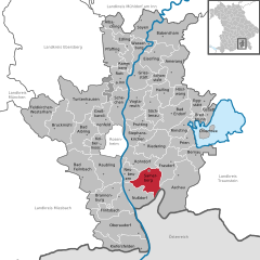
Samerberg
- municipality of Germany
Samerberg is a beautiful region located in Bavaria, Germany, known for its stunning landscapes, diverse hiking trails, and outdoor recreational opportunities. Here’s what you can expect when hiking in Samerberg:...
- Country:

- Postal Code: 83122
- Local Dialing Code: 08032
- Licence Plate Code: RO
- Coordinates: 47° 47' 0" N, 12° 13' 0" E


- GPS tracks (wikiloc): [Link]
- AboveSeaLevel: 700 м m
- Area: 33.39 sq km
- Population: 1981
- Web site: [Link]


Neubeuern
- municipality of Germany
Neubeuern, situated in Bavaria, Germany, is surrounded by picturesque landscapes and offers a variety of hiking opportunities. The town itself is located near the foothills of the Alps, making it an excellent base for nature enthusiasts and hikers. Here are some highlights and suggestions for hiking in the Neubeuern area:...
- Country:

- Postal Code: 83115
- Local Dialing Code: 08035
- Licence Plate Code: RO
- Coordinates: 47° 46' 0" N, 12° 9' 0" E


- GPS tracks (wikiloc): [Link]
- AboveSeaLevel: 478 м m
- Area: 15.32 sq km
- Population: 3358
- Web site: [Link]


Nußdorf am Inn
- municipality of Germany
Nußdorf am Inn, located in the Bavaria region of Germany, is a charming village situated along the banks of the Inn River, not far from the scenic foothills of the Alps. It offers a variety of hiking opportunities suitable for different skill levels. Here’s what you can expect when hiking in this picturesque area:...
- Country:

- Postal Code: 83131
- Local Dialing Code: 08034
- Licence Plate Code: RO
- Coordinates: 47° 44' 0" N, 12° 9' 0" E


- GPS tracks (wikiloc): [Link]
- AboveSeaLevel: 465 м m
- Area: 28.61 sq km
- Population: 2682
- Web site: [Link]


Raubling
- municipality of Germany
Raubling is a picturesque municipality located in Bavaria, Germany, near the foothills of the Alps. It's an excellent destination for outdoor enthusiasts and hikers, offering a range of trails suitable for different skill levels. Here’s what you need to know about hiking in Raubling:...
- Country:

- Postal Code: 83064
- Local Dialing Code: 08035
- Licence Plate Code: RO
- Coordinates: 47° 47' 17" N, 12° 6' 17" E


- GPS tracks (wikiloc): [Link]
- AboveSeaLevel: 460 м m
- Area: 44.20 sq km
- Population: 8894
- Web site: [Link]
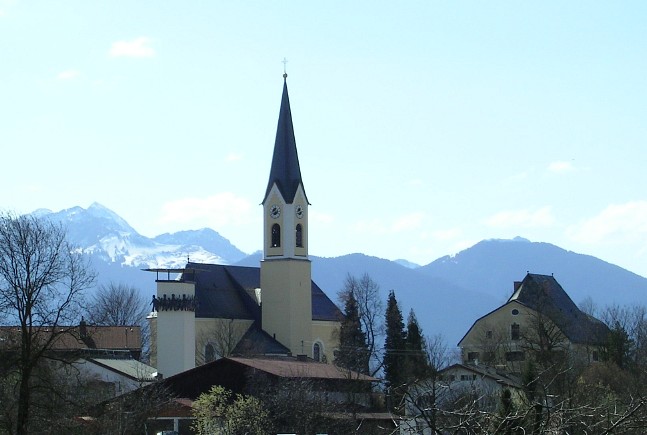

Rohrdorf
- municipality of Germany
Rohrdorf, located in Bavaria, Germany, is a picturesque area that offers a variety of hiking opportunities amidst beautiful landscapes. Here are some key points to consider when hiking in and around Rohrdorf:...
- Country:

- Postal Code: 83101
- Local Dialing Code: 08032; 08031
- Licence Plate Code: RO
- Coordinates: 47° 47' 56" N, 12° 10' 3" E


- GPS tracks (wikiloc): [Link]
- AboveSeaLevel: 476 м m
- Area: 28.67 sq km
- Population: 4266
- Web site: [Link]
Eiselfing
- municipality of Germany
Eiselfing is a charming municipality located in Bavaria, Germany, known for its picturesque landscapes and proximity to several hiking opportunities in the surrounding areas. While Eiselfing itself might not be a major hiking destination with extensive trails, it serves as an excellent base for exploring the nearby regions, including the foothills of the Alps....
- Country:

- Postal Code: 83549
- Local Dialing Code: 08071
- Licence Plate Code: RO
- Coordinates: 48° 3' 0" N, 12° 14' 0" E


- GPS tracks (wikiloc): [Link]
- AboveSeaLevel: 470 м m
- Area: 34.89 sq km
- Population: 2429
- Web site: [Link]


Tuntenhausen
- municipality of Germany
Tuntenhausen, located in Bavaria, Germany, is a charming area perfect for hiking enthusiasts. The region offers a mix of scenic landscapes, including gentle hills, forests, and meadows, making it suitable for various skill levels....
- Country:

- Postal Code: 83104
- Local Dialing Code: 08067
- Licence Plate Code: RO
- Coordinates: 47° 56' 0" N, 12° 1' 0" E


- GPS tracks (wikiloc): [Link]
- AboveSeaLevel: 508 м m
- Area: 68.98 sq km
- Population: 4454
- Web site: [Link]


Bruckmühl
- municipality of Germany
Bruckmühl, located in Bavaria, Germany, offers a variety of hiking opportunities for outdoor enthusiasts. Nestled in the picturesque landscape of the foothills of the Alps, it is surrounded by lush forests, rolling hills, and scenic views, making it a great spot for hikers of all levels....
- Country:

- Postal Code: 83052
- Local Dialing Code: 08062
- Licence Plate Code: RO
- Coordinates: 47° 53' 0" N, 11° 55' 0" E


- GPS tracks (wikiloc): [Link]
- AboveSeaLevel: 511 м m
- Area: 50.22 sq km
- Population: 12196
- Web site: [Link]
Schonstett
- municipality of Germany
Schönstett is a small town in Bavaria, Germany, known for its picturesque landscapes, lush greenery, and proximity to various hiking trails. Here are some key points to consider if you're planning to hike in and around Schönstett:...
- Country:

- Postal Code: 83137
- Local Dialing Code: 08055
- Licence Plate Code: RO
- Coordinates: 47° 59' 0" N, 12° 15' 0" E


- GPS tracks (wikiloc): [Link]
- AboveSeaLevel: 492 м m
- Area: 13.6 sq km
- Population: 1006
- Web site: [Link]


Vogtareuth
- municipality of Germany
Vogtareuth is a small town located in Bavaria, Germany, and it offers a variety of hiking opportunities that allow you to explore the beautiful scenery of the region. The area is characterized by its picturesque landscapes, including rolling hills, lush meadows, and woodlands, making it a great destination for outdoor enthusiasts....
- Country:

- Postal Code: 83569
- Local Dialing Code: 08038
- Licence Plate Code: RO
- Coordinates: 47° 56' 49" N, 12° 10' 53" E


- GPS tracks (wikiloc): [Link]
- AboveSeaLevel: 484 м m
- Area: 34.24 sq km
- Population: 2192
- Web site: [Link]


Eggstätt
- German municipality
Eggstätt, located in Bavaria, Germany, offers beautiful hiking opportunities, especially within the Eggstätt-Hemhofer Seenplatte, a scenic landscape characterized by lakes, forests, and gentle hills. Here are some highlights and tips for hiking in this picturesque area:...
- Country:

- Postal Code: 83125
- Local Dialing Code: 08056
- Licence Plate Code: RO
- Coordinates: 47° 55' 37" N, 12° 22' 45" E


- GPS tracks (wikiloc): [Link]
- AboveSeaLevel: 539 м m
- Area: 24.29 sq km
- Population: 1889
- Web site: [Link]


Griesstätt
- municipality of Germany
Griesstätt, a small village located in Bavaria, Germany, near the scenic Chiemsee lake, offers a variety of hiking opportunities. The region is characterized by its picturesque landscapes, rolling hills, and views of the Alps, making it an attractive destination for hikers of all levels....
- Country:

- Postal Code: 83556
- Local Dialing Code: 08039
- Licence Plate Code: RO
- Coordinates: 48° 0' 0" N, 12° 11' 0" E


- GPS tracks (wikiloc): [Link]
- AboveSeaLevel: 492 м m
- Area: 29.52 sq km
- Population: 1902
- Web site: [Link]

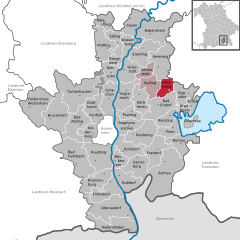
Höslwang
- municipality of Germany
Höslwang is a picturesque village located in Bavaria, Germany, near the foothills of the Alps, making it an excellent destination for hiking enthusiasts. The area is characterized by its stunning natural landscapes, including rolling hills, lush forests, and clear lakes. Here are several key points about hiking in Höslwang:...
- Country:

- Postal Code: 83129
- Local Dialing Code: 08055
- Licence Plate Code: RO
- Coordinates: 47° 57' 14" N, 12° 19' 45" E


- GPS tracks (wikiloc): [Link]
- AboveSeaLevel: 594 м m
- Area: 16.18 sq km
- Population: 934
- Web site: [Link]


Rott am Inn
- municipality in the district of Rosenheim in Bavaria in Germany
Rott am Inn is a charming town located in Bavaria, Germany, near the banks of the Inn River. The area is known for its beautiful landscapes, making it a great destination for hiking enthusiasts. Here are some key points to consider for hiking in and around Rott am Inn:...
- Country:

- Postal Code: 83543
- Local Dialing Code: 08039
- Licence Plate Code: RO
- Coordinates: 47° 58' 0" N, 12° 7' 0" E


- GPS tracks (wikiloc): [Link]
- AboveSeaLevel: 481 м m
- Area: 19.57 sq km
- Population: 3000
- Web site: [Link]


Breitbrunn am Chiemsee
- municipality of Germany
 Hiking in Breitbrunn am Chiemsee
Breitbrunn am Chiemsee is a picturesque village located on the shores of Lake Chiemsee in Bavaria, Germany. The area is known for its stunning landscapes, rich natural beauty, and a variety of outdoor activities, making it a wonderful destination for hiking enthusiasts....
- Country:

- Postal Code: 83254
- Local Dialing Code: 08054
- Licence Plate Code: RO
- Coordinates: 47° 53' 0" N, 12° 24' 0" E


- GPS tracks (wikiloc): [Link]
- AboveSeaLevel: 536 м m
- Area: 8.12 sq km
- Population: 1260
- Web site: [Link]


Bad Aibling
- town in Bavaria, Germany
Bad Aibling, located in Bavaria, Germany, offers a charming setting for hiking enthusiasts. This scenic area is surrounded by beautiful landscapes, rolling hills, and the foothills of the Alps, making it a fantastic destination for various hiking experiences....
- Country:

- Postal Code: 83035–83043
- Local Dialing Code: 08061
- Coordinates: 47° 52' 0" N, 12° 1' 0" E


- GPS tracks (wikiloc): [Link]
- AboveSeaLevel: 498 м m
- Area: 44.41 sq km
- Population: 18595
- Web site: [Link]
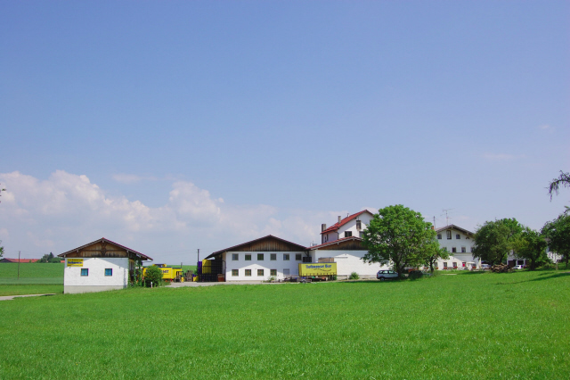

Halfing
- municipality of Germany
It seems there might be a typo in your request. If you're looking for information about hiking in "Halfling," it might not correspond to any well-known destination, as Halfling often refers to a fictional race in fantasy literature, particularly in J.R.R. Tolkien's works....
- Country:

- Postal Code: 83128
- Local Dialing Code: 08055
- Licence Plate Code: RO
- Coordinates: 48° 3' 0" N, 12° 7' 0" E


- GPS tracks (wikiloc): [Link]
- AboveSeaLevel: 502 м m
- Area: 22.81 sq km
- Population: 2005
- Web site: [Link]

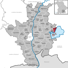
Gstadt am Chiemsee
- municipality of Germany
Gstadt am Chiemsee, located on the shores of Chiemsee, is a picturesque destination ideal for hiking enthusiasts. The area is known for its stunning landscapes, including views of the Alps, serene lakeshores, and lush forests. Here are some highlights for hiking in Gstadt am Chiemsee:...
- Country:

- Postal Code: 83257
- Local Dialing Code: 08054
- Licence Plate Code: RO
- Coordinates: 47° 53' 0" N, 12° 25' 0" E


- GPS tracks (wikiloc): [Link]
- AboveSeaLevel: 538 м m
- Area: 10.70 sq km
- Population: 1013
- Web site: [Link]
Rotter Forst-Nord
- unincorporated area in Germany
Rotter Forst-Nord is a forested area located north of Bonn, Germany, known for its beautiful landscapes and abundance of hiking trails. Here are some key points to consider when hiking in Rotter Forst-Nord:...
- Country:

- Coordinates: 47° 58' 0" N, 12° 5' 0" E


- GPS tracks (wikiloc): [Link]
Rotter Forst-Süd
- unincorporated area in Germany
Rotter Forst-Süd, located in the vicinity of the city of Bonn in Germany, is a part of the larger area known as the "Siebengebirge" or "Seven Mountains." This forested region is known for its beautiful landscapes, hiking trails, and diverse flora and fauna, making it an excellent destination for outdoor enthusiasts....
- Country:

- Coordinates: 47° 57' 0" N, 12° 4' 0" E


- GPS tracks (wikiloc): [Link]
Shares border with regions:


Miesbach
- district of Bavaria, Germany
Miesbach is a scenic district located in Bavaria, Germany, known for its stunning landscapes, rolling hills, and proximity to the Alps. It offers a wealth of hiking opportunities for both beginners and experienced hikers. Here are some highlights about hiking in the Miesbach district:...
- Country:

- Capital: Miesbach
- Licence Plate Code: MB
- Coordinates: 47° 44' 24" N, 11° 48' 36" E


- GPS tracks (wikiloc): [Link]
- AboveSeaLevel: 741 м m
- Area: 864.00 sq km
- Population: 93630
- Web site: [Link]
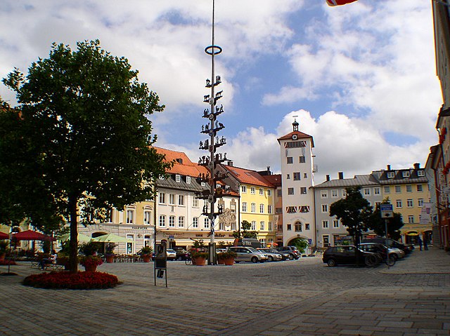

Traunstein
- district of Bavaria, Germany
Traunstein, located in Bavaria, Germany, is a beautiful area known for its picturesque landscapes, charming villages, and a variety of hiking opportunities. The region is characterized by its rolling hills, mountains, and lakes, making it ideal for outdoor enthusiasts. Here are some highlights for hiking in Traunstein:...
- Country:

- Capital: Traunstein
- Licence Plate Code: TS
- Coordinates: 47° 53' 24" N, 12° 34' 48" E


- GPS tracks (wikiloc): [Link]
- AboveSeaLevel: 560 м m
- Area: 1533.92 sq km
- Population: 145408
- Web site: [Link]


Mühldorf
- district of Bavaria, Germany
Mühldorf District, located in Bavaria, Germany, offers a range of hiking opportunities that cater to different skill levels and preferences. The area features scenic landscapes, including rolling hills, forests, and rivers, making it an attractive destination for nature lovers and outdoor enthusiasts....
- Country:

- Capital: Mühldorf
- Licence Plate Code: MÜ
- Coordinates: 48° 15' 0" N, 12° 25' 12" E


- GPS tracks (wikiloc): [Link]
- AboveSeaLevel: 447 м m
- Area: 805.32 sq km
- Population: 92882


Ebersberg
- district of Bavaria, Germany
Ebersberg District, located in Bavaria, Germany, is a fantastic destination for hiking enthusiasts. This region offers a mix of lush forests, rolling hills, picturesque landscapes, and scenic views, making it perfect for both casual walkers and more experienced hikers....
- Country:

- Capital: Ebersberg
- Licence Plate Code: EBE
- Coordinates: 48° 4' 48" N, 11° 55' 12" E


- GPS tracks (wikiloc): [Link]
- AboveSeaLevel: 601 м m
- Area: 549.30 sq km
- Population: 96283
- Web site: [Link]


Munich
- district of Bavaria, Germany
Hiking in and around Munich, the capital of Bavaria, offers a wonderful blend of urban landscapes and stunning natural scenery. While Munich itself is a vibrant city with parks and green spaces, many hiking opportunities are just a short distance away in the surrounding region....
- Country:

- Capital: Munich
- Local Dialing Code: 089
- Licence Plate Code: WOR; M; AIB
- Coordinates: 48° 0' 0" N, 11° 40' 12" E


- GPS tracks (wikiloc): [Link]
- AboveSeaLevel: 513 м m
- Area: 52020.58 sq km
- Population: 343405
- Web site: [Link]

Kufstein District
- district of Austria
The Kufstein District, located in the federal state of Tyrol, Austria, is a fantastic area for hiking enthusiasts. It features stunning alpine landscapes, charming villages, and well-established trails that cater to various skill levels....
- Country:

- Capital: Kufstein
- Licence Plate Code: KU
- Coordinates: 47° 30' 0" N, 12° 6' 0" E


- GPS tracks (wikiloc): [Link]
- AboveSeaLevel: 646 м m
- Area: 969.90 sq km
- Population: 105466
- Web site: [Link]


Rosenheim
- town in Bavaria, Germany
Rosenheim, located in Bavaria, Germany, is a picturesque town that serves as a gateway to some stunning hiking opportunities in the surrounding Alps and foothills. Here are some highlights and tips for hiking in and around Rosenheim:...
- Country:

- Postal Code: 83026; 83024; 83022
- Local Dialing Code: 08031
- Licence Plate Code: RO
- Coordinates: 47° 51' 22" N, 12° 7' 44" E


- GPS tracks (wikiloc): [Link]
- AboveSeaLevel: 447 м m
- Area: 37.52 sq km
- Population: 60464
- Web site: [Link]
