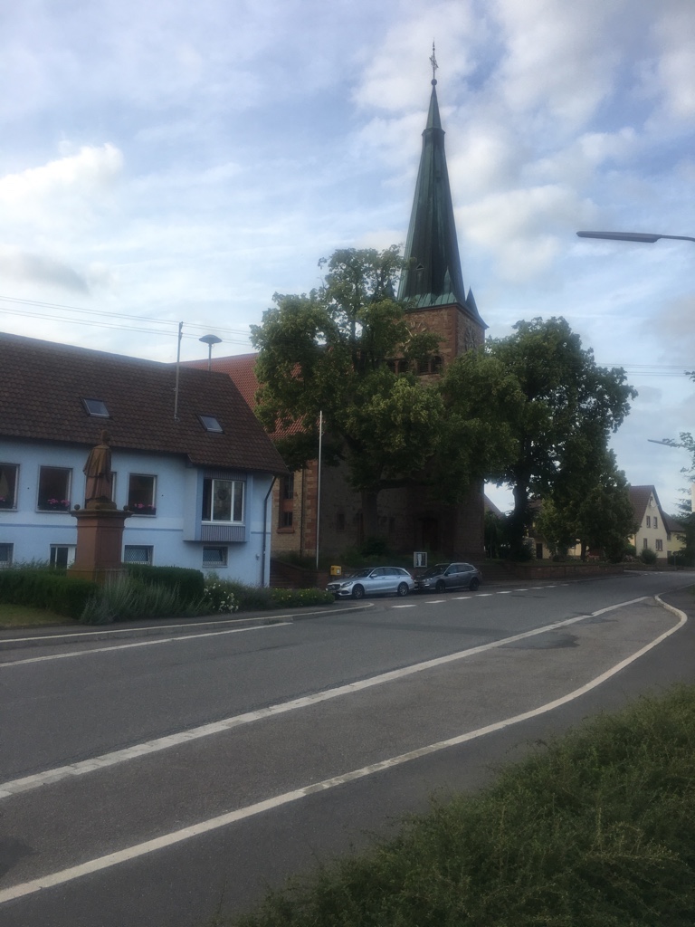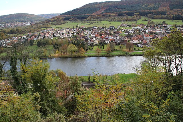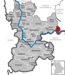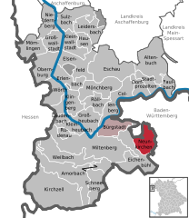
Wertheim (Wertheim)
- municipality in Germany
Wertheim am Main is a beautiful town located at the confluence of the Main and Tauber rivers in Bavaria, Germany. The region is known for its picturesque landscapes, rich history, and a variety of outdoor activities, including hiking.
Hiking Opportunities in Wertheim am Main
-
Wertheim Trail (Wertheimer Rundwanderweg):
- This circular trail is approximately 12 km long and offers scenic views of the Main River and the surrounding countryside. It takes you through vineyards, forests, and past historical landmarks, including the ruins of Wertheim Castle.
-
Burg Weg (Castle Path):
- A trail leading to the ruins of the medieval Wertheim Castle, providing stunning views of the town and the rivers. The hike can be combined with other routes in the area for longer adventures.
-
Tauber Valley Trails:
- The nearby Tauber Valley offers numerous hiking trails along the river, with beautiful landscapes of vineyards and rolling hills. The “Pfalz” hiking trail, for example, takes you through charming villages and provides opportunities for wine tasting.
-
Nature Trails:
- Several nature trails around Wertheim highlight the local flora and fauna. These trails are generally well-marked and vary in difficulty, making them suitable for families and casual hikers.
-
Vineyard Hikes:
- The region is famous for its wine production, and many trails take you through the vineyards, where you can enjoy the scenery and perhaps visit a winery for a tasting.
Tips for Hiking in Wertheim am Main
-
Best Time to Hike: Spring and autumn are ideal for hiking in this area, with mild weather and beautiful foliage. Summer can be warm, while winter might see some snow, which can also create a picturesque hiking experience.
-
Equipment: Wear sturdy hiking boots and bring plenty of water and snacks. A map or a GPS app is advisable, although many trails are marked.
-
Guided Tours: If you prefer a guided experience, look for local hiking tours that offer insights into the region's history and nature.
-
Local Attractions: Don't miss exploring the historic old town of Wertheim, which features charming streets, shops, and the impressive Wertheim Castle, particularly if you're looking for a break from hiking.
Wertheim am Main provides a great blend of history, nature, and outdoor activity, making it an excellent destination for hikers of all skill levels. Enjoy your time exploring this beautiful part of Bavaria!
- Country:

- Postal Code: 97877
- Local Dialing Code: 09397; 09342
- Licence Plate Code: TBB
- Coordinates: 49° 45' 0" N, 9° 31' 0" E


- GPS tracks (wikiloc): [Link]
- AboveSeaLevel: 145 м m
- Area: 138.63 sq km
- Population: 23405
- Web site: https://www.wertheim.de/
- Wikipedia en: wiki(en)
- Wikipedia: wiki(de)
- Wikidata storage: Wikidata: Q61912
- Wikipedia Commons Category: [Link]
- Wikipedia Commons Maps Category: [Link]
- Freebase ID: [/m/05ly69]
- GeoNames ID: Alt: [6558018]
- BnF ID: [137385074]
- VIAF ID: Alt: [136046547]
- OSM relation ID: [401778]
- GND ID: Alt: [4065663-9]
- archINFORM location ID: [11407]
- MusicBrainz area ID: [0e846baa-bd62-4e6a-9135-6657202434ba]
- UN/LOCODE: [DEWTM]
- EMLO location ID: [5360d7c4-9e33-47be-98f9-8abdbf4380b2]
- Pleiades ID: [119015]
- German municipality key: 08128131
Includes regions:
Dörlesberg
- quarter of Wertheim, Baden-Württemberg, Germany
Dörlesberg is a picturesque village located in the Baden-Württemberg region of Germany, which is known for its beautiful landscapes and hiking opportunities. Nestled amidst rolling hills, vineyards, and forests, Dörlesberg offers a variety of trails suitable for hikers of all levels....
- Country:

- Coordinates: 49° 42' 45" N, 9° 30' 12" E


- GPS tracks (wikiloc): [Link]
- AboveSeaLevel: 294 м m

Dertingen
- quarter of Wertheim, Baden-Württemberg, Germany
Dertingen is a small district in the municipality of Tauberbischofsheim in Baden-Württemberg, Germany. While it may not be a widely known hiking destination, the surrounding areas in the Tauber Valley and the neighboring regions offer beautiful landscapes, picturesque villages, and various hiking trails....
- Country:

- Postal Code: 97877
- Local Dialing Code: 09397
- Coordinates: 49° 46' 0" N, 9° 37' 10" E


- GPS tracks (wikiloc): [Link]
- AboveSeaLevel: 168 м m
Bettingen
- quarter of Wertheim, Baden-Württemberg, Germany
Bettingen is a picturesque area located near Wertheim, Germany, which is known for its beautiful landscapes and rich history. Hiking in this region offers a variety of trails that cater to different skill levels, allowing hikers to experience stunning views, local flora and fauna, and historical landmarks....
- Country:

- Postal Code: 97877
- Local Dialing Code: 09342
- Coordinates: 49° 46' 20" N, 9° 33' 45" E


- GPS tracks (wikiloc): [Link]
- AboveSeaLevel: 150 м m

Nassig
- quarter of Wertheim, Baden-Württemberg, Germany
Nassig is a charming village located in the Odenwald region of Germany, known for its picturesque landscapes and numerous hiking opportunities. Here’s an overview of what you can expect when hiking in Nassig and the surrounding areas:...
- Country:

- Postal Code: 97877
- Local Dialing Code: 09342
- Coordinates: 49° 44' 10" N, 9° 27' 8" E


- GPS tracks (wikiloc): [Link]
- AboveSeaLevel: 315 м m

Mondfeld
- quarter of Wertheim, Baden-Württemberg, Germany
Mondfeld, a picturesque area located in the rural part of Germany, offers a range of hiking opportunities amidst stunning natural scenery. While it's less frequented than more famous hiking destinations, the region is characterized by its lush forests, rolling hills, and charming villages, making it an excellent spot for both beginner and experienced hikers....
- Country:

- Coordinates: 49° 47' 2" N, 9° 25' 6" E


- GPS tracks (wikiloc): [Link]
- AboveSeaLevel: 139 м m
Dietenhan
- quarter of Wertheim, Baden-Württemberg, Germany
Dietenhan is a lovely spot for hiking enthusiasts, nestled within the picturesque landscapes of Germany. While it may not be as widely known as other hiking destinations, it offers a number of trails that showcase the natural beauty of the region. Here are some key points to consider when hiking in Dietenhan:...
- Country:

- Postal Code: 97877
- Local Dialing Code: 09342
- Coordinates: 49° 44' 35" N, 9° 36' 24" E


- GPS tracks (wikiloc): [Link]
- AboveSeaLevel: 192 м m
Grünenwört
- quarter of Wertheim, Baden-Württemberg, Germany
Grünenwört is a picturesque area that offers a range of hiking opportunities, particularly well-suited for those who enjoy exploring natural landscapes, serene environments, and local flora and fauna. While specific trails in Grünenwört may not be as well-known as those in larger hiking destinations, you can expect a variety of paths that cater to different skill levels....
- Country:

- Postal Code: 97877
- Local Dialing Code: 09342
- Coordinates: 49° 46' 17" N, 9° 28' 4" E


- GPS tracks (wikiloc): [Link]
- AboveSeaLevel: 136 м m
Höhefeld
- quarter of Wertheim, Baden-Württemberg, Germany
Höhefeld, while not as widely recognized as some larger hiking destinations, offers a charming and serene experience for nature lovers and hikers. Situated in a scenic area, it typically features trails that weave through beautiful woods, rolling hills, and possibly near bodies of water....
- Country:

- Postal Code: 97877
- Local Dialing Code: 09348
- Coordinates: 49° 42' 46" N, 9° 36' 39" E


- GPS tracks (wikiloc): [Link]
- AboveSeaLevel: 315 м m
Kembach
- quarter of Wertheim, Baden-Württemberg, Germany
Kembach, located in the vicinity of Wertheim in Germany, is known for its picturesque landscapes and natural beauty, making it a great destination for hiking enthusiasts. The surrounding region features a mix of forested areas, rolling hills, and scenic views of the Main River....
- Country:

- Postal Code: 97877
- Local Dialing Code: 09342
- Coordinates: 49° 44' 32" N, 9° 37' 38" E


- GPS tracks (wikiloc): [Link]
- AboveSeaLevel: 217 м m

Lindelbach
- quarter of Wertheim, Baden-Württemberg, Germany
Lindelbach is a small district located within the town of Wertheim in Bavaria, Germany. It offers a picturesque setting for hiking enthusiasts, with beautiful landscapes, rolling hills, and access to the nearby Odenwald and Spessart mountain ranges. Here are some highlights regarding hiking in Lindelbach and its surroundings:...
- Country:

- Postal Code: 97877
- Local Dialing Code: 09342
- Coordinates: 49° 45' 28" N, 9° 35' 5" E


- GPS tracks (wikiloc): [Link]
- AboveSeaLevel: 218 м m

Urphar
- quarter of Wertheim, Baden-Württemberg, Germany
Urphar, located in the state of Madhya Pradesh, India, is a lesser-known destination that offers scenic beauty and opportunities for nature enthusiasts and hikers. While it may not be as famous as some other trekking spots in India, it still provides a unique experience for those willing to explore it....
- Country:

- Postal Code: 97877
- Local Dialing Code: 09342
- Coordinates: 49° 44' 59" N, 9° 34' 22" E


- GPS tracks (wikiloc): [Link]
- AboveSeaLevel: 144 м m
Waldenhausen
- quarter of Wertheim, Baden-Württemberg, Germany
Waldenhausen, a charming area often characterized by its picturesque landscapes and natural beauty, provides excellent opportunities for hiking. While specific trails can vary depending on the exact region you’re in, here are some general points to consider while hiking in areas like Waldenhausen:...
- Country:

- Postal Code: 97877
- Local Dialing Code: 09342
- Coordinates: 49° 44' 40" N, 9° 31' 25" E


- GPS tracks (wikiloc): [Link]
- AboveSeaLevel: 151 м m


Wertheim
- chef-lieu of Wertheim am Main
Wertheim, located at the confluence of the Main and Tauber rivers in Germany, is a charming town known for its historical sites, including a medieval castle. The surrounding area offers a variety of hiking opportunities, suitable for different skill levels and preferences. Here are some highlights and tips for hiking in and around Wertheim:...
- Country:

- Postal Code: 97877
- Local Dialing Code: 09342
- Coordinates: 49° 45' 32" N, 9° 30' 31" E


- GPS tracks (wikiloc): [Link]
- AboveSeaLevel: 139 м m

Sonderriet
- quarter of Wertheim, Baden-Württemberg, Germany
Sonderriet is not a widely known hiking destination, and there's limited specific information about it in available records. However, if you're referring to a region in a particular country or a local area with hiking trails, it could be beneficial to know more about its geographical location and characteristics....
- Country:

- Coordinates: 49° 43' 3" N, 9° 26' 22" E


- GPS tracks (wikiloc): [Link]
- AboveSeaLevel: 316 м m
- Area: 7.51 sq km

Reicholzheim
- quarter of Wertheim, Baden-Württemberg, Germany
Reicholzheim is a small village located in the scenic region of Baden-Württemberg, Germany, and is surrounded by beautiful landscapes ideal for hiking enthusiasts. The area features a variety of trails that cater to different skill levels, allowing both beginners and experienced hikers to enjoy the natural beauty of the surroundings....
- Country:

- Postal Code: 97877
- Local Dialing Code: 09342
- Coordinates: 49° 43' 38" N, 9° 32' 5" E


- GPS tracks (wikiloc): [Link]
- AboveSeaLevel: 158 м m
- Area: 17.41 sq km
- Population: 1260
- Web site: [Link]

Sachsenhausen
- quarter of Wertheim, Baden-Württemberg, Germany
Sachsenhausen, located near Wertheim in Germany, is an area that offers beautiful hiking opportunities. The region is characterized by its picturesque landscapes, including forested hills, river valleys, and charming villages, making it a popular destination for outdoor enthusiasts....
- Country:

- Postal Code: 97877
- Local Dialing Code: 09342
- Coordinates: 49° 43' 53" N, 9° 29' 32" E


- GPS tracks (wikiloc): [Link]
- AboveSeaLevel: 290 м m
Shares border with regions:


Kreuzwertheim
- market municipality in Bavaria, Germany
Kreuzwertheim is a picturesque town located at the confluence of the Main and Tauber rivers in Bavaria, Germany. The surrounding area offers various hiking opportunities, showcasing beautiful landscapes, vineyards, and charming villages....
- Country:

- Postal Code: 97892
- Local Dialing Code: 09342
- Licence Plate Code: MSP
- Coordinates: 49° 46' 0" N, 9° 31' 0" E


- GPS tracks (wikiloc): [Link]
- AboveSeaLevel: 144 м m
- Area: 19.98 sq km
- Population: 3813
- Web site: [Link]


Neubrunn
- market municipality in Bavaria, Germany
Neubrunn, located in Lower Franconia, Germany, is an excellent spot for hiking enthusiasts. This charming small town is surrounded by picturesque landscapes, including rolling hills, vineyards, and lush forests, making it a delightful area for outdoor activities....
- Country:

- Postal Code: 97277
- Local Dialing Code: 09307
- Coordinates: 49° 44' 0" N, 9° 40' 0" E


- GPS tracks (wikiloc): [Link]
- AboveSeaLevel: 293 м m
- Area: 26.54 sq km
- Population: 2124
- Web site: [Link]


Dorfprozelten
- municipality of Germany
Dorfprozelten is a charming village located in Bavaria, Germany, near the banks of the Main River. It's a lovely area for hiking, offering picturesque landscapes, tranquil paths, and a blend of natural beauty and cultural experiences. Here are some highlights of hiking in and around Dorfprozelten:...
- Country:

- Postal Code: 97904
- Local Dialing Code: 09392
- Licence Plate Code: MIL
- Coordinates: 49° 47' 0" N, 9° 23' 0" E


- GPS tracks (wikiloc): [Link]
- AboveSeaLevel: 141 м m
- Area: 10.39 sq km
- Population: 1741
- Web site: [Link]


Stadtprozelten
- human settlement in Germany
Stadtprozelten, a charming town located on the banks of the Main River in Bavaria, Germany, offers access to several scenic hiking trails that showcase the region's natural beauty. Here are some highlights of hiking in and around Stadtprozelten:...
- Country:

- Postal Code: 97909
- Local Dialing Code: 09392
- Licence Plate Code: MIL
- Coordinates: 49° 47' 7" N, 9° 24' 44" E


- GPS tracks (wikiloc): [Link]
- AboveSeaLevel: 134 м m
- Area: 10.84 sq km
- Population: 1504
- Web site: [Link]


Helmstadt
- market municipality in Bavaria, Germany
Helmstadt, a small village in Germany, offers a variety of hiking opportunities that cater to different skill levels. The surrounding landscape is characterized by rolling hills, dense forests, and picturesque countryside, making it ideal for both casual walkers and more seasoned hikers. Here are some key points to consider for hiking in and around Helmstadt:...
- Country:

- Postal Code: 97264
- Local Dialing Code: 09397; 09369
- Coordinates: 49° 46' 0" N, 9° 43' 0" E


- GPS tracks (wikiloc): [Link]
- AboveSeaLevel: 301 м m
- Area: 22.80 sq km
- Population: 2307
- Web site: [Link]


Faulbach
- municipality of Germany
Faulbach, located in Germany, offers a variety of hiking opportunities, especially for those who appreciate scenic landscapes and tranquil nature. While it may not be as widely known as some other hiking destinations, it has its own charm and appeal. Here are some points to consider when hiking in Faulbach:...
- Country:

- Postal Code: 97906
- Local Dialing Code: 09392
- Licence Plate Code: MIL
- Coordinates: 49° 47' 7" N, 9° 26' 39" E


- GPS tracks (wikiloc): [Link]
- AboveSeaLevel: 140 м m
- Area: 10.97 sq km
- Population: 2588
- Web site: [Link]


Triefenstein
- market municipality in Bavaria, Germany
Triefenstein, a quaint village located in the district of Main-Spessart in Bavaria, Germany, is surrounded by beautiful natural landscapes that make it an excellent spot for hiking enthusiasts. The region offers a variety of trails suitable for different skill levels, from leisurely walks to more challenging hikes....
- Country:

- Postal Code: 97855
- Local Dialing Code: 09395
- Licence Plate Code: MSP
- Coordinates: 49° 48' 0" N, 9° 36' 0" E


- GPS tracks (wikiloc): [Link]
- AboveSeaLevel: 180 м m
- Area: 25.47 sq km
- Population: 4332
- Web site: [Link]


Neunkirchen, Lower Franconia
- municipality of Germany
 Hiking in Neunkirchen, Lower Franconia
Neunkirchen in Lower Franconia, Germany, offers a variety of hiking opportunities, showcasing the beautiful landscapes and natural features of the region. Here are some highlights:...
- Country:

- Postal Code: 63930
- Local Dialing Code: 09378
- Licence Plate Code: MIL
- Coordinates: 49° 42' 25" N, 9° 23' 58" E


- GPS tracks (wikiloc): [Link]
- AboveSeaLevel: 329 м m
- Area: 16.65 sq km
- Population: 1511
- Web site: [Link]


Holzkirchen, Lower Franconia
- municipality of Germany
 Hiking in Holzkirchen, Lower Franconia
Holzkirchen, located in Lower Franconia, Germany, is a charming village that offers a range of hiking opportunities in its picturesque surroundings. Here are some key points to consider for hiking in and around Holzkirchen:...
- Country:

- Postal Code: 97292
- Local Dialing Code: 09369
- Coordinates: 49° 47' 0" N, 9° 41' 0" E


- GPS tracks (wikiloc): [Link]
- AboveSeaLevel: 198 м m
- Area: 8.42 sq km
- Population: 945
- Web site: [Link]


Hasloch
- municipality of Germany
Hasloch, located in the beautiful region of Bavaria, Germany, is a charming village surrounded by scenic landscapes, making it a great destination for hiking enthusiasts....
- Country:

- Postal Code: 97907
- Local Dialing Code: 09342
- Licence Plate Code: MSP
- Coordinates: 49° 48' 0" N, 9° 30' 0" E


- GPS tracks (wikiloc): [Link]
- AboveSeaLevel: 140 м m
- Area: 10.38 sq km
- Population: 1387
- Web site: [Link]


Werbach
- municipality in Baden-Württemberg in Germany
Werbach is a picturesque village located in the Main-Tauber-Kreis district of Baden-Württemberg, Germany. The surrounding area offers a variety of hiking opportunities that showcase the natural beauty of the region, with rolling hills, dense forests, and charming rural landscapes....
- Country:

- Postal Code: 97956
- Local Dialing Code: 09341
- Licence Plate Code: TBB
- Coordinates: 49° 40' 15" N, 9° 38' 22" E


- GPS tracks (wikiloc): [Link]
- AboveSeaLevel: 187 м m
- Area: 43.18 sq km
- Population: 3276
- Web site: [Link]


Külsheim
- municipality in Germany
Külsheim is a charming village located in the Main-Tauber district of Baden-Württemberg, Germany. The region surrounding Külsheim offers a variety of hiking opportunities, characterized by picturesque landscapes, rolling hills, vineyards, and serene forests....
- Country:

- Postal Code: 97900
- Local Dialing Code: 09345
- Licence Plate Code: TBB
- Coordinates: 49° 40' 10" N, 9° 31' 14" E


- GPS tracks (wikiloc): [Link]
- AboveSeaLevel: 327 м m
- Area: 81.46 sq km
- Population: 5234
- Web site: [Link]


Freudenberg
- town in Baden-Wurtemberg, Germany
Freudenberg, located in the Baden-Württemberg region of Germany, is a picturesque destination for hiking enthusiasts. Nestled in the beautiful landscape of the Northern Black Forest, it offers a variety of trails catering to different skill levels, from easy walks to more challenging hikes. Here are some highlights for hiking in Freudenberg:...
- Country:

- Postal Code: 97896
- Local Dialing Code: 09378; 09377; 09375
- Licence Plate Code: TBB
- Coordinates: 49° 45' 0" N, 9° 20' 0" E


- GPS tracks (wikiloc): [Link]
- AboveSeaLevel: 133 м m
- Area: 34.78 sq km
- Population: 3760
- Web site: [Link]
