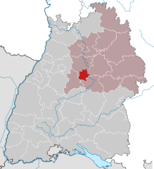
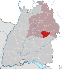
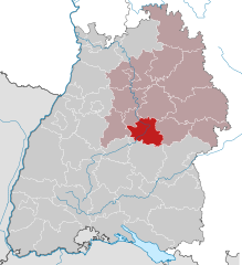
Stuttgart Government Region (Regierungsbezirk Stuttgart)

- government region of Baden-Württemberg, Germany
 Hiking in Stuttgart Government Region
Stuttgart, located in the southwestern region of Germany, is surrounded by beautiful natural landscapes that offer a variety of hiking opportunities. The region is characterized by its rolling hills, vineyards, and dense forests, making it an ideal spot for outdoor enthusiasts. Here are some highlights of hiking in the Stuttgart region:
1.
- Terrain: This region boasts a mix of wooded areas, meadows, and some rocky outcrops. The paths are well-marked and suitable for various fitness levels.
- Trails: You can find numerous hiking trails here, including the popular "Schwäbische Wald Trail," which features beautiful views and diverse landscapes.
- Highlights: Explore the numerous small villages, enjoy local flora and fauna, and visit historical landmarks along the way.
2.
- Terrain: The vineyards surrounding Stuttgart offer gentler hikes with stunning views of the city and the Neckar River.
- Trails: The “Vineyard Trail” connects several wine towns and allows hikers to appreciate not only nature but also local wines.
- Highlights: Wine tasting opportunities, picturesque views, and the chance to learn about viticulture in the region.
3.
- Terrain: A city park with beautiful gardens, hills, and trails that are more leisurely.
- Trails: Walking trails throughout the park make it ideal for a relaxing hike.
- Highlights: The Killesberg Tower offers panoramic views of Stuttgart, alongside various sculptures and floral displays.
4.
- Terrain: Dense forests with plenty of shaded paths.
- Trails: Well-marked paths that are perfect for both short walks and longer hikes.
- Highlights: The Bärenschlössle is a cozy restaurant where you can rest and enjoy a meal amidst nature.
5.
- Terrain: The area around Castle Solitude features rolling hills and woodlands.
- Trails: Various hiking trails that lead to and around the castle provide options for different skill levels.
- Highlights: The castle itself is an 18th-century building offering historical insights and stunning views.
Tips for Hiking in Stuttgart Region
- Weather: Check the weather before heading out, as conditions can change quickly.
- Gear: Wear appropriate hiking shoes and bring water, snacks, and a map or a GPS-enabled device.
- Transport: Stuttgart has good public transport options, making it easy to reach trailheads.
- Safety: Always let someone know your hiking plans if you’re going alone, and stick to marked trails for safety.
Overall, Stuttgart and its surroundings offer a range of hiking experiences, from city parks to expansive forest trails, ensuring that there is something for every type of hiker.
- Country:

- Capital: Stuttgart
- Coordinates: 49° 0' 0" N, 9° 40' 12" E


- GPS tracks (wikiloc): [Link]
- AboveSeaLevel: 365 м m
- Area: 10558 sq km
- Web site: http://www.rp.baden-wuerttemberg.de/
- Wikipedia en: wiki(en)
- Wikipedia: wiki(de)
- Wikidata storage: Wikidata: Q8172
- Wikipedia Commons Category: [Link]
- Freebase ID: [/m/01bp6k]
- GeoNames ID: Alt: [3214105]
- VIAF ID: Alt: [134349049]
- OSM relation ID: [22041]
- GND ID: Alt: [4058287-5]
- TGN ID: [7075017]
- ISNI: Alt: [0000 0001 2323 9995]
- NUTS code: [DE11]
- BabelNet ID: [01219689n]
- GRID ID: [grid.461756.7]
- Microsoft Academic ID: [2801416502]
Includes regions:

Stuttgart
- capital city of German federated state Baden-Württemberg
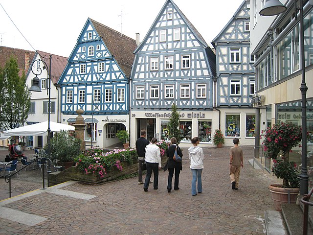
Hiking in Stuttgart
Hiking in Stuttgart offers a fantastic blend of urban and natural experiences. The city is surrounded by beautiful landscapes, vineyards, and wooded hills, making it an excellent base for outdoor enthusiasts. Here are some highlights and popular hiking areas around Stuttgart:...
- Country:
- Postal Code: 70619; 70599; 70597; 70569; 70567; 70565; 70563; 70499; 70469; 70376; 70439; 70437; 70435; 70378; 70374; 70372; 70329; 70327; 70199; 70197; 70195; 70193; 70192; 70191; 70190; 70188; 70186; 70184; 70182; 70180; 70178; 70176; 70174; 70173
- Local Dialing Code: 711
- Licence Plate Code: S
- Coordinates: 48° 46' 34" N, 9° 10' 39" E
- GPS tracks (wikiloc): [Link]
- AboveSeaLevel: 247 м m
- Area: 207.33 sq km
- Population: 632743
- Web site: [Link]


Heilbronn
- German city in the state of Baden-Württemberg
Hiking in Heilbronn
Heilbronn, located in Baden-Württemberg, Germany, is a charming city surrounded by beautiful landscapes, making it a great destination for hiking enthusiasts. Here’s an overview of hiking in the area:...
- Country:
- Postal Code: 74001–74081
- Local Dialing Code: 7131; 7066
- Licence Plate Code: HN
- Coordinates: 49° 9' 0" N, 9° 13' 0" E
- GPS tracks (wikiloc): [Link]
- AboveSeaLevel: 160 м m
- Area: 99.89 sq km
- Population: 123771
- Web site: [Link]

Heilbronn
- district in Germany
Hiking in Heilbronn
Heilbronn is a district located in the state of Baden-Württemberg, Germany, characterized by its diverse landscapes, rolling vineyards, and a mix of cultural and historical attractions. Here are some highlights of hiking in the Heilbronn district:...
- Country:
- Capital: Heilbronn
- Licence Plate Code: HN
- Coordinates: 49° 9' 36" N, 9° 15' 0" E
- GPS tracks (wikiloc): [Link]
- AboveSeaLevel: 166 м m
- Area: 1099.93 sq km
- Population: 334388
- Web site: [Link]


Main-Tauber
- district of Baden-Württemberg, Germany
Hiking in Main-Tauber
Main-Tauber-Kreis, located in the Baden-Württemberg state of Germany, is a beautiful region known for its stunning landscapes, historic towns, and rich cultural heritage, making it an excellent destination for hiking enthusiasts. Here are some key aspects of hiking in this picturesque area:...
- Country:
- Capital: Tauberbischofsheim
- Licence Plate Code: TBB
- Coordinates: 49° 34' 12" N, 9° 42' 36" E
- GPS tracks (wikiloc): [Link]
- AboveSeaLevel: 190 м m
- Area: 1304.41 sq km
- Population: 132181
- Web site: [Link]


Hohenlohe
- district of Baden-Württemberg, Germany
Hiking in Hohenlohe
Hohenlohe, located in Baden-Württemberg, Germany, offers a variety of hiking opportunities amidst beautiful landscapes, quaint villages, and rich cultural heritage. The region is characterized by its rolling hills, dense forests, and picturesque vineyards, making it an attractive destination for outdoor enthusiasts....
- Country:
- Capital: Künzelsau
- Coordinates: 49° 16' 12" N, 9° 37' 12" E
- GPS tracks (wikiloc): [Link]
- AboveSeaLevel: 319 м m
- Area: 776.76 sq km
- Population: 110181
- Web site: [Link]


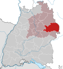
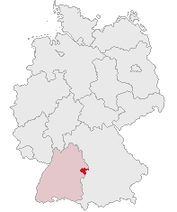
Landkreis Schwäbisch Hall
- district of Baden-Württemberg, Germany
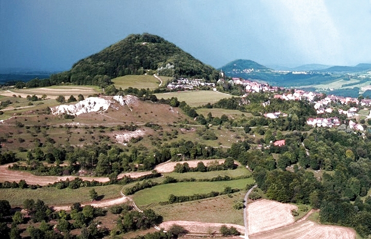
Hiking in Landkreis Schwäbisch Hall
Schwäbisch Hall district, located in Baden-Württemberg, Germany, is known for its picturesque landscapes, charming villages, and rich history, making it a great destination for hiking enthusiasts. Here are some highlights and tips for hiking in the area:...
- Country:
- Capital: Schwäbisch Hall
- Licence Plate Code: SHA
- Coordinates: 49° 9' 0" N, 9° 54' 36" E
- GPS tracks (wikiloc): [Link]
- AboveSeaLevel: 426 м m
- Area: 1484.00 sq km
- Population: 191614
- Web site: [Link]

Ostalb
- district of Baden-Württemberg, Germany
Hiking in Ostalb
Ostalbkreis, located in the state of Baden-Württemberg in Germany, is a fantastic destination for hiking enthusiasts. The region is characterized by its diverse landscapes, which include rolling hills, dense forests, and picturesque valleys, providing a variety of trails suitable for all levels of hikers....
- Country:
- Capital: Aalen
- Licence Plate Code: AA
- Coordinates: 48° 52' 0" N, 10° 6' 0" E
- GPS tracks (wikiloc): [Link]
- AboveSeaLevel: 436 м m
- Area: 1511.57 sq km
- Population: 311587
- Web site: [Link]

Heidenheim
- district in Baden-Württemberg, Germany
Hiking in Heidenheim
Heidenheim, located in Baden-Württemberg, Germany, is a region that offers a variety of hiking opportunities amidst beautiful landscapes, historical sites, and natural attractions. Here are some aspects to consider when hiking in Heidenheim and its surroundings:...
- Country:
- Licence Plate Code: HDH
- Coordinates: 48° 38' 24" N, 10° 7' 12" E
- GPS tracks (wikiloc): [Link]
- AboveSeaLevel: 599 м m
- Area: 627.13 sq km
- Population: 130527
- Web site: [Link]
Göppingen
- district in Baden-Württemberg, Germany
Hiking in Göppingen
Göppingen district, located in the Baden-Württemberg region of Germany, is a fantastic area for hiking enthusiasts. The landscape is characterized by a mix of rolling hills, forests, and charming villages, making it an ideal destination for various levels of hikers....
- Country:
- Capital: Göppingen
- Licence Plate Code: GP
- Coordinates: 48° 42' 0" N, 9° 39' 0" E
- GPS tracks (wikiloc): [Link]
- AboveSeaLevel: 349 м m
- Area: 642.36 sq km
- Population: 252749
- Web site: [Link]

Rems-Murr
- district in Baden-Wurttemberg, Germany
Hiking in Rems-Murr
Rems-Murr-Kreis, located in the Baden-Württemberg region of Germany, offers a diverse landscape for hiking enthusiasts. The area is characterized by rolling hills, vineyards, forests, and picturesque villages, making it an attractive destination for hikers of all skill levels. Here are some highlights and tips for hiking in Rems-Murr-Kreis:...
- Country:
- Capital: Waiblingen
- Licence Plate Code: WN
- Coordinates: 48° 55' 0" N, 9° 32' 0" E
- GPS tracks (wikiloc): [Link]
- AboveSeaLevel: 481 м m
- Area: 858.14 sq km
- Population: 419456
- Web site: [Link]

Esslingen
- district in Baden-Württemberg, Germany
Hiking in Esslingen
Esslingen district, located in the state of Baden-Württemberg, Germany, offers a variety of hiking opportunities that showcase both its natural beauty and historical sites. Here are some highlights for hiking in the Esslingen region:...
- Country:
- Capital: Esslingen am Neckar
- Licence Plate Code: ES
- Coordinates: 48° 41' 24" N, 9° 19' 12" E
- GPS tracks (wikiloc): [Link]
- AboveSeaLevel: 263 м m
- Area: 641.48 sq km
- Population: 524127
- Web site: [Link]


Böblingen
- district of Baden-Württemberg, Germany
Hiking in Böblingen
Böblingen, located in Baden-Württemberg, Germany, is surrounded by beautiful landscapes, making it an excellent area for hiking enthusiasts. The district features various trails that cater to different skill levels, from casual walks to more challenging hikes....
- Country:
- Capital: Böblingen
- Licence Plate Code: LEO; BB
- Coordinates: 48° 42' 0" N, 9° 0' 36" E
- GPS tracks (wikiloc): [Link]
- AboveSeaLevel: 444 м m
- Area: 617.82 sq km
- Population: 381281
- Web site: [Link]


Ludwigsburg
- district in Baden-Württemberg, Germany
Hiking in Ludwigsburg
Ludwigsburg is a district located in the state of Baden-Württemberg, Germany, and is known for its picturesque landscapes and rich cultural heritage. While the area itself may not be as prominent as some of the larger mountain ranges in Germany, it offers several beautiful hiking opportunities that cater to different skill levels....
- Country:
- Capital: Ludwigsburg
- Licence Plate Code: LB
- Coordinates: 48° 54' 0" N, 9° 12' 0" E
- GPS tracks (wikiloc): [Link]
- AboveSeaLevel: 266 м m
- Area: 686.83 sq km
- Population: 534074
- Web site: [Link]
Shares border with regions:


Lower Franconia
- administrative region of Franconia in Bavaria, Germany
Hiking in Lower Franconia
Lower Franconia, located in the northern part of Bavaria, Germany, is a great destination for hiking enthusiasts. This region is known for its diverse landscapes that range from rolling hills to picturesque vineyards and nature reserves, offering a variety of trails suitable for different skill levels....
- Country:
- Capital: Würzburg
- Coordinates: 50° 1' 28" N, 9° 55' 55" E
- GPS tracks (wikiloc): [Link]
- AboveSeaLevel: 289 м m
- Area: 8530.99 sq km
- Population: 1298849
- Web site: [Link]