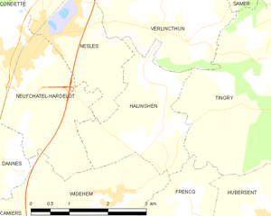
Widehem (Widehem)
- commune in Pas-de-Calais, France
- Country:

- Postal Code: 62630
- Coordinates: 50° 35' 9" N, 1° 40' 19" E


- GPS tracks (wikiloc): [Link]
- Area: 7.2 sq km
- Population: 243
- Web site: http://www.communewidehem.fr
- Wikipedia en: wiki(en)
- Wikipedia: wiki(fr)
- Wikidata storage: Wikidata: Q268049
- Wikipedia Commons Category: [Link]
- Freebase ID: [/m/03ck741]
- GeoNames ID: Alt: [2967379]
- SIREN number: [216208876]
- BnF ID: [15269328t]
- OSM relation ID: [157654]
- INSEE municipality code: 62887
Shares border with regions:


Lefaux
- commune in Pas-de-Calais, France
- Country:

- Postal Code: 62630
- Coordinates: 50° 32' 34" N, 1° 39' 35" E


- GPS tracks (wikiloc): [Link]
- Area: 8.25 sq km
- Population: 236


Neufchâtel-Hardelot
- commune in Pas-de-Calais, France
- Country:

- Postal Code: 62152
- Coordinates: 50° 37' 7" N, 1° 38' 27" E


- GPS tracks (wikiloc): [Link]
- Area: 20.85 sq km
- Population: 3750
- Web site: [Link]


Dannes
- commune in Pas-de-Calais, France
- Country:

- Postal Code: 62187
- Coordinates: 50° 35' 21" N, 1° 36' 50" E


- GPS tracks (wikiloc): [Link]
- Area: 10.23 sq km
- Population: 1343
- Web site: [Link]


Frencq
- commune in Pas-de-Calais, France
- Country:

- Postal Code: 62630
- Coordinates: 50° 33' 38" N, 1° 41' 54" E


- GPS tracks (wikiloc): [Link]
- Area: 19.81 sq km
- Population: 810


Halinghen
- commune in Pas-de-Calais, France
- Country:

- Postal Code: 62830
- Coordinates: 50° 36' 9" N, 1° 41' 31" E


- GPS tracks (wikiloc): [Link]
- Area: 5.53 sq km
- Population: 331


Camiers
- commune in Pas-de-Calais, France
- Country:

- Postal Code: 62176
- Coordinates: 50° 33' 58" N, 1° 36' 49" E


- GPS tracks (wikiloc): [Link]
- Area: 16.13 sq km
- Population: 2662
- Web site: [Link]
