
Neufchâtel-Hardelot (Neufchâtel-Hardelot)

- commune in Pas-de-Calais, France
- Country:

- Postal Code: 62152
- Coordinates: 50° 37' 7" N, 1° 38' 27" E


- GPS tracks (wikiloc): [Link]
- Area: 20.85 sq km
- Population: 3750
- Web site: http://www.ville-neufchatel-hardelot.fr
- Wikipedia en: wiki(en)
- Wikipedia: wiki(fr)
- Wikidata storage: Wikidata: Q1025285
- Wikipedia Commons Category: [Link]
- Freebase ID: [/m/02z7qr7]
- GeoNames ID: Alt: [2990678]
- SIREN number: [216206045]
- BnF ID: [15269045k]
- VIAF ID: Alt: [157471931]
- OSM relation ID: [180658]
- Library of Congress authority ID: Alt: [no2006035079]
- PACTOLS thesaurus ID: [pcrtQi69b0uzlq]
- INSEE municipality code: 62604
Shares border with regions:


Nesles
- commune in Pas-de-Calais, France
- Country:
- Postal Code: 62152
- Coordinates: 50° 37' 38" N, 1° 39' 23" E
- GPS tracks (wikiloc): [Link]
- Area: 5.04 sq km
- Population: 960


Widehem
- commune in Pas-de-Calais, France
- Country:
- Postal Code: 62630
- Coordinates: 50° 35' 9" N, 1° 40' 19" E
- GPS tracks (wikiloc): [Link]
- Area: 7.2 sq km
- Population: 243
- Web site: [Link]


Dannes
- commune in Pas-de-Calais, France
- Country:
- Postal Code: 62187
- Coordinates: 50° 35' 21" N, 1° 36' 50" E
- GPS tracks (wikiloc): [Link]
- Area: 10.23 sq km
- Population: 1343
- Web site: [Link]

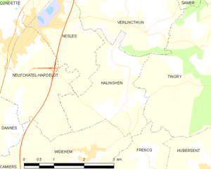
Halinghen
- commune in Pas-de-Calais, France
- Country:
- Postal Code: 62830
- Coordinates: 50° 36' 9" N, 1° 41' 31" E
- GPS tracks (wikiloc): [Link]
- Area: 5.53 sq km
- Population: 331


Saint-Étienne-au-Mont
- commune in Pas-de-Calais, France
- Country:
- Postal Code: 62360
- Coordinates: 50° 40' 54" N, 1° 37' 33" E
- GPS tracks (wikiloc): [Link]
- Area: 14.05 sq km
- Population: 5093
- Web site: [Link]


Condette
- commune in Pas-de-Calais, France
- Country:
- Postal Code: 62360
- Coordinates: 50° 39' 16" N, 1° 38' 0" E
- GPS tracks (wikiloc): [Link]
- Area: 16.26 sq km
- Population: 2539
- Web site: [Link]