Windhaag bei Freistadt (Windhaag bei Freistadt)
- municipality in Austria
 Hiking in Windhaag bei Freistadt
Windhaag bei Freistadt is a charming village located in the Mühlviertel region of Austria, surrounded by scenic landscapes perfect for hiking enthusiasts. The area is known for its rolling hills, lush forests, and beautiful meadows, making it a great spot for outdoor activities.
Popular Hiking Trails
-
Mühlviertler Hochland Trail: This long-distance trail weaves through the natural beauty of the Mühlviertel and offers various sections that can be explored from Windhaag. The trail features picturesque views, quaint villages, and cultural landmarks.
-
Local Forest Trails: There are several marked trails in and around Windhaag that navigate through dense forests, providing hikers with the chance to experience local flora and fauna. These trails vary in difficulty, accommodating both novice and experienced hikers.
-
Schwarzenberg Bock: A popular hiking route that leads to a vantage point overlooking the surrounding region. It’s a relatively moderate hike, making it suitable for families.
Tips for Hiking in Windhaag
- Weather Conditions: Always check the weather forecast before heading out, as conditions can change rapidly in the mountains.
- Footwear: Wear sturdy hiking boots to support your feet on uneven terrain.
- Navigation: Use a map or hiking app to stay on track. While trails are often well-marked, it's easy to lose the main route in dense forest areas.
- Hydration and Snacks: Carry enough water and snacks, especially for longer hikes. There may not be facilities along the trails.
Local Attractions
Besides hiking, Windhaag itself offers cultural sites such as:
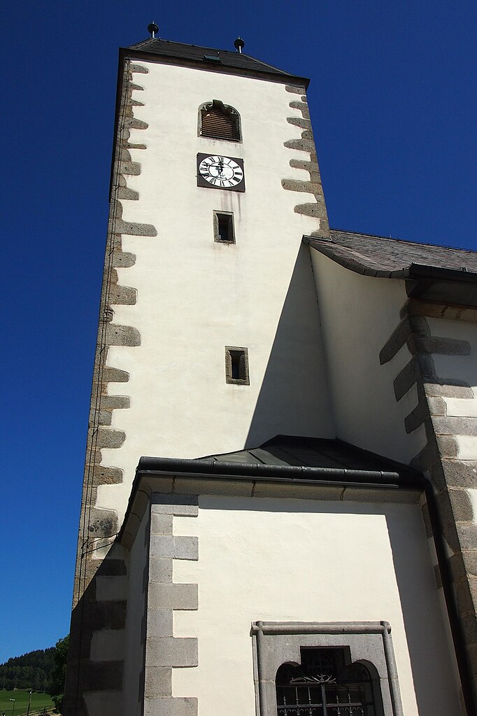
- The Church of St. Mary: A beautiful landmark with historical significance.
- Local Art and Crafts: The region is known for its artisan goods, so consider a visit to local shops or markets.
Conclusion
Hiking in Windhaag bei Freistadt provides a wonderful opportunity to enjoy nature and explore the beautiful Austrian countryside. Just remember to plan ahead and respect the natural environment while enjoying your outdoor adventure!
- Country:

- Postal Code: 4263
- Local Dialing Code: 07943
- Licence Plate Code: FR
- Coordinates: 48° 35' 10" N, 14° 33' 50" E


- GPS tracks (wikiloc): [Link]
- AboveSeaLevel: 723 м m
- Area: 42.9 sq km
- Population: 1579
- Web site: http://www.windhaag.at/
- Wikipedia en: wiki(en)
- Wikipedia: wiki(de)
- Wikidata storage: Wikidata: Q543940
- Wikipedia Commons Category: [Link]
- Freebase ID: [/m/03gv3r1]
- GeoNames ID: Alt: [7873130]
- VIAF ID: Alt: [249390994]
- Austrian municipality key: [40626]
Shares border with regions:
Grünbach, Upper Austria
- municipality in Austria
Hiking in Grünbach, Upper Austria
Grünbach is a charming area located in Upper Austria, known for its beautiful landscapes and hiking opportunities. Here are some key points about hiking in Grünbach:...
- Country:
- Postal Code: 4264
- Local Dialing Code: 07942
- Licence Plate Code: FR
- Coordinates: 48° 32' 20" N, 14° 32' 10" E
- GPS tracks (wikiloc): [Link]
- AboveSeaLevel: 721 м m
- Area: 36.1 sq km
- Population: 1887
- Web site: [Link]

Leopoldschlag
- municipality in Austria
Hiking in Leopoldschlag
Leopoldschlag, located in Austria near the border with the Czech Republic, is a beautiful destination for hiking enthusiasts. Surrounded by the stunning landscapes of the Northern Alps, it offers a variety of trails suitable for different skill levels....
- Country:
- Postal Code: 4262
- Local Dialing Code: 07949
- Licence Plate Code: FR
- Coordinates: 48° 37' 0" N, 14° 30' 0" E
- GPS tracks (wikiloc): [Link]
- AboveSeaLevel: 630 м m
- Area: 25.67 sq km
- Population: 1023
- Web site: [Link]

Sandl
- municipality in the district of Freistadt in Upper Austria, Austria
Hiking in Sandl
Sandl is a beautiful area in Austria, known for its scenic landscapes and tranquil surroundings, making it a great destination for hikers of all skill levels. Nestled in the Mühlviertel region of Upper Austria, Sandl offers a variety of hiking trails that showcase the natural beauty of the region, including rolling hills, lush forests, and panoramic views....
- Country:
- Postal Code: 4251
- Local Dialing Code: 07944
- Licence Plate Code: FR
- Coordinates: 48° 33' 40" N, 14° 38' 40" E
- GPS tracks (wikiloc): [Link]
- AboveSeaLevel: 927 м m
- Area: 58.4 sq km
- Population: 1384
- Web site: [Link]