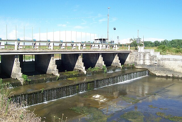
Zerbo (Zerbo)
- Italian comune
It seems there's a bit of ambiguity regarding "Zerbo" as it may refer to various places. If you are referring to a specific location, please provide more context or clarify the name. However, if you mean the Zerbo area in Italy or another region, I can give you some general hiking tips that might apply to various mountainous or rural areas.
General Hiking Tips:
-
Prepare Properly:
- Check the weather forecast and trail conditions before heading out.
- Make sure you have a suitable map or GPS device, especially if the area isn't well-marked.
-
Gear Up:
- Wear proper hiking boots with good grip and support.
- Dress in layers to adjust to changing temperatures.
-
Stay Hydrated and Nourished:
- Carry enough water and snacks to keep your energy up during the hike.
-
Respect Nature:
- Stay on marked trails to protect local flora and fauna.
- Follow the "Leave No Trace" principles to minimize your environmental impact.
-
Know Your Limits:
- Choose trails that match your fitness level and experience. Be aware of your physical limitations and turn back if needed.
-
Wildlife Awareness:
- Be aware of local wildlife and know what to do if you encounter animals.
-
Communicate:
- Inform someone about your hiking plans and expected return time, particularly if hiking alone.
If you can provide more specific details about "Zerbo," such as the country or region, I can offer more targeted advice or information about particular trails or experiences in that area!
- Country:

- Postal Code: 27017
- Local Dialing Code: 0382
- Licence Plate Code: PV
- Coordinates: 45° 6' 38" N, 9° 23' 46" E


- GPS tracks (wikiloc): [Link]
- AboveSeaLevel: 68 м m
- Area: 6.36 sq km
- Population: 410
- Web site: http://www.comune.zerbo.pv.it
- Wikipedia en: wiki(en)
- Wikipedia: wiki(it)
- Wikidata storage: Wikidata: Q40935
- Wikipedia Commons Category: [Link]
- Freebase ID: [/m/0gjy6f]
- GeoNames ID: Alt: [6541527]
- OSM relation ID: [44205]
- ISTAT ID: 018188
- Italian cadastre code: M166
Shares border with regions:
Arena Po
- Italian comune
Arena Po is a beautiful destination for hiking enthusiasts located in Italy, nestled in the stunning landscapes of the Emilia-Romagna region. This area is known for its picturesque natural scenery, rolling hills, and diverse trails that cater to various skill levels....
- Country:

- Postal Code: 27040
- Local Dialing Code: 0385
- Licence Plate Code: PV
- Coordinates: 45° 4' 0" N, 9° 21' 0" E


- GPS tracks (wikiloc): [Link]
- AboveSeaLevel: 61 м m
- Area: 22.49 sq km
- Population: 1588
- Web site: [Link]
San Zenone al Po
- Italian comune
San Zenone al Po is a charming municipality located in the Lombardy region of northern Italy. While it may not be as widely recognized for hiking as some other parts of Italy, it offers a unique rural landscape that can be appealing to hikers looking for quieter trails and an authentic experience....
- Country:

- Postal Code: 27010
- Local Dialing Code: 0382
- Licence Plate Code: PV
- Coordinates: 45° 4' 0" N, 9° 21' 0" E


- GPS tracks (wikiloc): [Link]
- AboveSeaLevel: 59 м m
- Area: 6.89 sq km
- Population: 583
- Web site: [Link]
Pieve Porto Morone
- Italian comune
Pieve Porto Morone is a small town located in the province of Lodi in the Lombardy region of Italy. While it may not be as widely recognized as popular hiking destinations, it offers a peaceful rural landscape that can be enjoyed by those looking for a more tranquil outdoor experience....
- Country:

- Postal Code: 27017
- Local Dialing Code: 0382
- Licence Plate Code: PV
- Coordinates: 45° 6' 37" N, 9° 26' 13" E


- GPS tracks (wikiloc): [Link]
- AboveSeaLevel: 58 м m
- Area: 16.4 sq km
- Population: 2670
- Web site: [Link]


Costa de' Nobili
- Italian comune
Costa de' Nobili is a beautiful area that is less well-known but offers stunning landscapes and diverse hiking opportunities. While detailed information about specific hiking trails may vary, here are some general insights into hiking in this region:...
- Country:

- Postal Code: 27010
- Local Dialing Code: 0382
- Licence Plate Code: PV
- Coordinates: 45° 8' 0" N, 9° 23' 0" E


- GPS tracks (wikiloc): [Link]
- AboveSeaLevel: 66 м m
- Area: 11.82 sq km
- Population: 382
- Web site: [Link]

