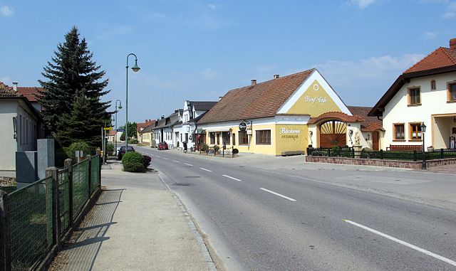
Zwentendorf an der Donau (Zwentendorf an der Donau)
- municipality in Austria
 Hiking in Zwentendorf an der Donau
Zwentendorf is a small town in Austria, located in the state of Lower Austria, near the Danube River. While it may not be as prominent as some other hiking destinations in the region, it offers some pleasant opportunities for walking and exploring the natural landscapes.
Hiking Opportunities:
-
Danube Cycle Path (Donauradweg): While primarily a cycling route, the Danube Cycle Path runs through Zwentendorf and is ideal for leisurely walks. You can enjoy stunning views of the river and nearby vineyards.
-
Surrounding Nature Reserves: The area around Zwentendorf has natural reserves and forests that offer trails for hiking. Exploring these trails can lead you through lush landscapes and offer the chance to see local wildlife.
-
Vineyard Trails: The Wachau Valley, a UNESCO World Heritage Site, is nearby and is known for its picturesque vineyards. Short hikes through these vineyards can provide breathtaking views of the surrounding landscapes and the Danube River.
-
Nearby Hills and Forests: The Vienna Woods (Wienerwald) are not too far away. This large forested area has numerous well-marked trails suitable for all experience levels, ranging from easy walks to more challenging hikes.
Tips for Hiking in Zwentendorf:
-
Weather Considerations: Always check the weather before heading out. The best times for hiking in Austria are usually spring and fall when temperatures are mild.
-
Trail Maps: Make sure to carry a good map or use hiking apps that can help you navigate the local trails.
-
Gear: Wear appropriate hiking shoes, and bring enough water and snacks, especially if you're planning a longer hike.
-
Local Knowledge: Consider reaching out to local tourism offices for updated trail information or guided hike options if you prefer.
-
Respect Nature: Follow the principles of Leave No Trace to maintain the beauty of the environment for future hikers.
By exploring the trails around Zwentendorf, you can experience the serene beauty of the Austrian countryside and have a rewarding hiking experience.
- Country:

- Postal Code: 3435
- Local Dialing Code: 02277
- Licence Plate Code: TU
- Coordinates: 48° 20' 33" N, 15° 54' 50" E


- GPS tracks (wikiloc): [Link]
- AboveSeaLevel: 182 м m
- Area: 53.9 sq km
- Population: 3982
- Web site: http://www.zwentendorf.at/
- Wikipedia en: wiki(en)
- Wikipedia: wiki(de)
- Wikidata storage: Wikidata: Q243860
- Wikipedia Commons Category: [Link]
- Freebase ID: [/m/03j5nx]
- GeoNames ID: Alt: [7871920]
- VIAF ID: Alt: [236808061]
- GND ID: Alt: [4068242-0]
- archINFORM location ID: [9903]
- Library of Congress authority ID: Alt: [nb2018023674]
- Austrian municipality key: [32141]
Shares border with regions:

Traismauer
- municipality in Austria
Hiking in Traismauer
Traismauer is a charming town in Lower Austria that offers a variety of hiking opportunities, especially for those looking to explore the scenic beauty of the region. Here are some highlights for hiking in and around Traismauer:...
- Country:
- Postal Code: 3133
- Licence Plate Code: PL
- Coordinates: 48° 20' 0" N, 15° 43' 59" E
- GPS tracks (wikiloc): [Link]
- AboveSeaLevel: 197 м m
- Area: 43.14 sq km
- Population: 6224
- Web site: [Link]

Michelhausen
- municipality in Austria
Hiking in Michelhausen
Michelhausen, located in the Lower Austrian region, offers a picturesque landscape that is ideal for hiking enthusiasts. The area is characterized by its lush greenery, rolling hills, and charming countryside, making it a pleasant escape for outdoor lovers....
- Country:
- Postal Code: 3451
- Local Dialing Code: 02275
- Licence Plate Code: TU
- Coordinates: 48° 17' 23" N, 15° 56' 15" E
- GPS tracks (wikiloc): [Link]
- AboveSeaLevel: 195 м m
- Area: 32.03 sq km
- Population: 3113
- Web site: [Link]

Kirchberg am Wagram
- municipality in Austria
Hiking in Kirchberg am Wagram
Kirchberg am Wagram, located in Austria's Lower Austria region, is an excellent destination for hiking enthusiasts. The area is known for its picturesque landscapes, vineyards, and scenic views of the Danube River. Here are some highlights and tips for hiking in this area:...
- Country:
- Postal Code: 3470
- Local Dialing Code: 02279
- Licence Plate Code: TU
- Coordinates: 48° 25' 49" N, 15° 53' 53" E
- GPS tracks (wikiloc): [Link]
- AboveSeaLevel: 224 м m
- Area: 60.26 sq km
- Population: 3670
- Web site: [Link]


Königsbrunn am Wagram
- municipality in Austria
Hiking in Königsbrunn am Wagram
Königsbrunn am Wagram is a charming village located in the Lower Austria region, near the Wagram plateau, which is known for its scenic vineyards, rolling hills, and picturesque landscapes. Hiking in this area can provide a peaceful and enjoyable experience, surrounded by nature and beautiful views....
- Country:
- Postal Code: 3465
- Local Dialing Code: 02278
- Licence Plate Code: TU
- Coordinates: 48° 25' 0" N, 15° 56' 0" E
- GPS tracks (wikiloc): [Link]
- AboveSeaLevel: 197 м m
- Area: 28.57 sq km
- Population: 1319
- Web site: [Link]

Langenrohr
- municipality in Austria
Hiking in Langenrohr
Langenrohr, located in Lower Austria, offers a variety of hiking opportunities that allow you to explore the beautiful natural landscapes of the region. While it may not be as widely known as other hiking destinations, it provides a charming experience for both beginners and seasoned hikers....
- Country:
- Postal Code: 3442
- Local Dialing Code: 02272
- Licence Plate Code: TU
- Coordinates: 48° 18' 0" N, 16° 0' 0" E
- GPS tracks (wikiloc): [Link]
- AboveSeaLevel: 182 м m
- Area: 22.57 sq km
- Population: 2369
- Web site: [Link]

Grafenwörth
- municipality in Austria
Hiking in Grafenwörth
Grafenwörth, located in Austria, is a charming destination for hiking enthusiasts. Nestled along the banks of the Danube River and surrounded by beautiful landscapes, it offers several trails that cater to various skill levels. Here are some key points about hiking in Grafenwörth:...
- Country:
- Postal Code: 3484
- Local Dialing Code: 02738
- Licence Plate Code: TU
- Coordinates: 48° 24' 24" N, 15° 46' 43" E
- GPS tracks (wikiloc): [Link]
- AboveSeaLevel: 190 м m
- Area: 46.4 sq km
- Population: 3132
- Web site: [Link]

Sitzenberg-Reidling
- municipality in Austria
Hiking in Sitzenberg-Reidling
Sitzenberg-Reidling, located in Lower Austria, offers a variety of scenic hiking opportunities for outdoor enthusiasts. The region is characterized by its rolling hills, vineyards, and charming villages, making it an ideal destination for both casual walkers and seasoned hikers. Here are some highlights and tips for hiking in this area:...
- Country:
- Postal Code: 3454
- Local Dialing Code: 02276
- Licence Plate Code: TU
- Coordinates: 48° 19' 12" N, 15° 48' 48" E
- GPS tracks (wikiloc): [Link]
- AboveSeaLevel: 205 м m
- Area: 22.15 sq km
- Population: 2102
- Web site: [Link]

Atzenbrugg
- municipality in Austria
Hiking in Atzenbrugg
Atzenbrugg, located in Lower Austria, is a picturesque area that offers numerous hiking opportunities amidst beautiful natural landscapes. The region is characterized by rolling hills, vineyards, and dense forests, making it a great destination for outdoor enthusiasts....
- Country:
- Postal Code: 3452
- Local Dialing Code: 02275
- Licence Plate Code: TU
- Coordinates: 48° 17' 28" N, 15° 54' 22" E
- GPS tracks (wikiloc): [Link]
- AboveSeaLevel: 186 м m
- Area: 25.94 sq km
- Population: 2948
- Web site: [Link]