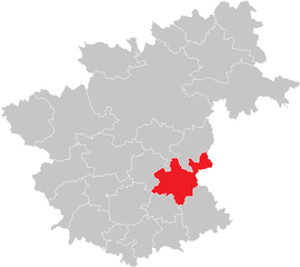
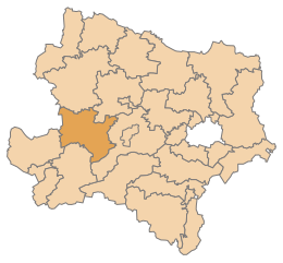
Zwettl District (Bezirk Zwettl)

- district of Austria
 Hiking in Zwettl District
Zwettl District, located in the Waldviertel region of Austria, offers a picturesque setting for hiking enthusiasts. The area is characterized by its diverse landscapes, including forests, rolling hills, and charming villages, making it a great destination for both casual walkers and experienced hikers.
Highlights of Hiking in Zwettl District:
-
Scenic Trails: The region boasts a variety of hiking trails, ranging from easy walks to more challenging routes. The natural beauty of the landscape, including the Danube-Moldau Granite Ridge, provides stunning vistas and opportunities to encounter local flora and fauna.
-
Cultural Landmarks: Many hiking trails in Zwettl lead to notable cultural sites, such as historic monasteries, castles, and quaint villages. Exploring these sites adds an extra layer of interest to your hiking experience.
-
Natura 2000 Sites: The district is home to several Natura 2000 conservation areas, which are important for biodiversity. Hiking in these protected areas can offer unique opportunities for wildlife observation.
-
Well-Marked Trails: Hiking routes are generally well-signposted, making it easy for hikers to navigate the area. Maps and guides are often available at local tourist information centers.
-
Seasonal Hiking: Each season brings its own charm to the Zwettl District. Spring and summer offer lush greenery and blooming flowers, while autumn showcases vibrant fall colors. Winter hiking can also be enchanting, with snow-covered landscapes.
-
Hiking Events: The district sometimes hosts hiking events and guided tours, which can be a great way to explore the area with knowledgeable guides and meet other hiking enthusiasts.
Suggested Hiking Routes:
-
The Zwettl Forest Trail: A moderate loop that takes you through dense forests and open fields, with opportunities to pause at scenic vistas.
-
The Hermits’ Trail: This route connects various historical hermitages and offers spiritual insights alongside its natural beauty.
-
The Castle Trail: A trail that leads through vineyards and past historical castles, providing both beautiful views and a taste of local history.
Tips for Hiking in Zwettl District:
-
Weather Preparedness: Always check the weather forecast and prepare accordingly, as conditions can change quickly in mountainous regions.
-
Proper Gear: Wear comfortable hiking boots and clothing suitable for the terrain and weather. A good backpack, hydration system, and snacks are also essential.
-
Respect Nature: Follow the Leave No Trace principles to protect the natural environment and wildlife.
-
Local Information: Visit the local tourist information centers for current maps, trail conditions, and any relevant safety information.
Whether you’re looking for a quiet stroll or a more strenuous hike, the Zwettl District offers an array of options to explore its natural and cultural richness. Enjoy your hiking adventures!
- Country:

- Licence Plate Code: ZT
- Coordinates: 48° 34' 52" N, 15° 9' 7" E


- GPS tracks (wikiloc): [Link]
- AboveSeaLevel: 665 м m
- Area: 1399.76 sq km
- Web site: http://www.noel.gv.at/service/bh/zt/bhzt.htm
- Wikipedia en: wiki(en)
- Wikipedia: wiki(de)
- Wikidata storage: Wikidata: Q694452
- Wikipedia Commons Category: [Link]
- Freebase ID: [/m/0flbzv]
- GeoNames ID: Alt: [2760421]
- VIAF ID: Alt: [147852089]
- GND ID: Alt: [10092281-8]
- archINFORM location ID: [14647]
- Library of Congress authority ID: Alt: [n88080973]
Includes regions:

Schweiggers
- municipality in Austria
Hiking in Schweiggers
Schweiggers is a charming little village located in the Waldviertel region of Austria, known for its beautiful natural landscapes and outdoor activities, making it a great spot for hiking enthusiasts. Here are some highlights about hiking in and around Schweiggers:...
- Country:
- Licence Plate Code: ZT
- Coordinates: 48° 40' 0" N, 15° 3' 0" E
- GPS tracks (wikiloc): [Link]
- AboveSeaLevel: 633 м m
- Area: 58.65 sq km
- Population: 2004
- Web site: [Link]

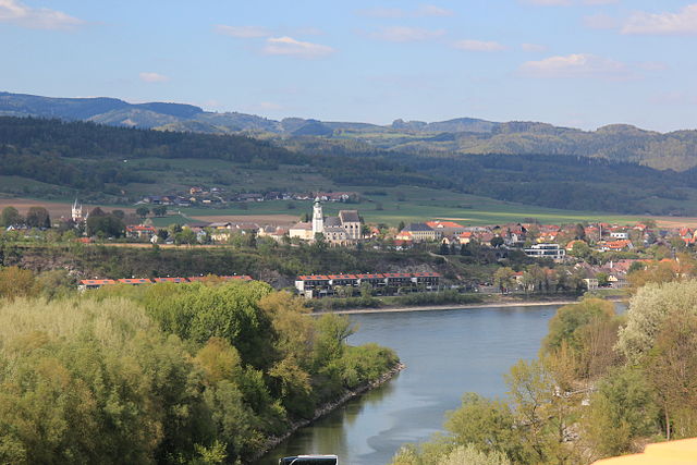
Zwettl
- city in Lower Austria
Hiking in Zwettl
Zwettl, located in the beautiful region of Lower Austria, is a fantastic destination for hiking enthusiasts. The area is characterized by its picturesque landscapes, lush forests, rolling hills, and charming villages, making it ideal for both casual walkers and serious hikers....
- Country:
- Local Dialing Code: 02822
- Licence Plate Code: ZT
- Coordinates: 48° 36' 12" N, 15° 10' 8" E
- GPS tracks (wikiloc): [Link]
- AboveSeaLevel: 612 м m
- Area: 256.07 sq km
- Population: 10908
- Web site: [Link]

Altmelon
- municipality in Austria
Hiking in Altmelon
It seems there might be a bit of confusion about "Altmelon," as it doesn't correspond to a well-known hiking destination or geographical feature as of my last update in October 2023. It’s possible you meant a different location or it could be a less well-known area....
- Country:
- Local Dialing Code: 02813
- Licence Plate Code: ZT
- Coordinates: 48° 27' 0" N, 14° 58' 0" E
- GPS tracks (wikiloc): [Link]
- AboveSeaLevel: 880 м m
- Area: 38.34 sq km
- Population: 862
- Web site: [Link]


Grafenschlag
- municipality in Austria
Hiking in Grafenschlag
Grafenschlag is known for its beautiful natural landscapes and serene hiking trails. Located in Austria, this region offers a variety of paths that cater to different skill levels, making it a great destination for both novice and experienced hikers....
- Country:
- Postal Code: 3912
- Local Dialing Code: 02875
- Licence Plate Code: ZT
- Coordinates: 48° 30' 0" N, 15° 10' 0" E
- GPS tracks (wikiloc): [Link]
- AboveSeaLevel: 780 м m
- Area: 34.05 sq km
- Population: 853
- Web site: [Link]

Arbesbach
- municipality in Austria
Hiking in Arbesbach
Arbesbach, located in the beautiful region of Lower Austria, is surrounded by lush forests, rolling hills, and scenic landscapes, making it an excellent destination for hiking enthusiasts. Here are some highlights for hiking in Arbesbach:...
- Country:
- Local Dialing Code: 02813
- Licence Plate Code: ZT
- Coordinates: 48° 28' 0" N, 14° 56' 0" E
- GPS tracks (wikiloc): [Link]
- AboveSeaLevel: 849 м m
- Area: 54.98 sq km
- Population: 1638
- Web site: [Link]

Bärnkopf
- municipality in Austria
Hiking in Bärnkopf
Bärnkopf, located in the picturesque Melk district of Austria, is a hidden gem for hiking enthusiasts. This small village is surrounded by the beautiful landscapes of the Lower Austrian region, characterized by lush forests, rolling hills, and stunning viewpoints....
- Country:
- Local Dialing Code: 02874
- Licence Plate Code: ZT
- Coordinates: 48° 23' 27" N, 15° 0' 21" E
- GPS tracks (wikiloc): [Link]
- AboveSeaLevel: 968 м m
- Area: 47.62 sq km
- Population: 355
- Web site: [Link]

Allentsteig
- municipality in Austria
Hiking in Allentsteig
Allentsteig, located in Lower Austria, is a fantastic destination for hiking enthusiasts. The region, set amidst the scenic forests and rolling hills of the Vienna Woods, offers a variety of trails suitable for different skill levels. Here are some highlights of hiking in Allentsteig:...
- Country:
- Postal Code: 3804
- Local Dialing Code: 02824
- Licence Plate Code: ZT
- Coordinates: 48° 41' 0" N, 15° 19' 0" E
- GPS tracks (wikiloc): [Link]
- AboveSeaLevel: 550 м m
- Area: 71.65 sq km
- Population: 1835
- Web site: [Link]

Groß Gerungs
- municipality in Austria
Hiking in Groß Gerungs
Groß Gerungs is a picturesque town located in the Waldviertel region of Austria, surrounded by beautiful landscapes that are ideal for hiking enthusiasts. The area offers a variety of trails that cater to different skill levels, from easy walks to more challenging hikes. Here are some key points about hiking in Groß Gerungs:...
- Country:
- Local Dialing Code: 02812
- Licence Plate Code: ZT
- Coordinates: 48° 34' 27" N, 14° 57' 28" E
- GPS tracks (wikiloc): [Link]
- AboveSeaLevel: 675 м m
- Area: 105.88 sq km
- Population: 4506
- Web site: [Link]

Großgöttfritz
- municipality in Austria
Hiking in Großgöttfritz
Großgöttfritz is a picturesque village located in the region of Lower Austria, surrounded by beautiful landscapes that make it a great destination for hiking enthusiasts. The area features a variety of trails suitable for different skill levels, ranging from easy walks for beginners to more challenging hikes for experienced trekkers....
- Country:
- Local Dialing Code: 02875
- Licence Plate Code: ZT
- Coordinates: 48° 32' 0" N, 15° 11' 0" E
- GPS tracks (wikiloc): [Link]
- AboveSeaLevel: 714 м m
- Area: 40.11 sq km
- Population: 1371
- Web site: [Link]

Echsenbach
- municipality in Austria
Hiking in Echsenbach
Echsenbach is a charming area in the Lower Austria region of Austria, surrounded by beautiful landscapes that are perfect for hiking enthusiasts. The region offers various trails that cater to different skill levels, making it an excellent destination for both beginners and experienced hikers....
- Country:
- Local Dialing Code: 02849
- Licence Plate Code: ZT
- Coordinates: 48° 43' 0" N, 15° 12' 0" E
- GPS tracks (wikiloc): [Link]
- AboveSeaLevel: 572 м m
- Area: 23.16 sq km
- Population: 1256
- Web site: [Link]

Göpfritz an der Wild
- municipality in Austria
Hiking in Göpfritz an der Wild
Göpfritz an der Wild, located in Lower Austria, is a charming destination for hiking enthusiasts who enjoy scenic landscapes and tranquil nature. The area offers a variety of trails that cater to different skill levels, making it suitable for both novice hikers and experienced trekkers....
- Country:
- Postal Code: 3800
- Local Dialing Code: 02825
- Licence Plate Code: ZT
- Coordinates: 48° 43' 0" N, 15° 24' 0" E
- GPS tracks (wikiloc): [Link]
- AboveSeaLevel: 580 м m
- Area: 60.58 sq km
- Population: 1856
- Web site: [Link]
Schwarzenau, Lower Austria
- municipality in Austria
Hiking in Schwarzenau, Lower Austria
Schwarzenau, located in Lower Austria, is a lovely area for hiking, characterized by its scenic landscapes, lush forests, and charming rural scenery. Here are some key points to consider if you're planning a hiking trip there:...
- Country:
- Postal Code: 3900
- Local Dialing Code: 02849
- Licence Plate Code: ZT
- Coordinates: 48° 44' 0" N, 15° 15' 0" E
- GPS tracks (wikiloc): [Link]
- AboveSeaLevel: 498 м m
- Area: 28.12 sq km
- Population: 1532
- Web site: [Link]

Pölla
- municipality in Austria
Hiking in Pölla
Pölla, located in Lower Austria, is an area known for its natural beauty and hiking opportunities. The region features a mix of forests, hills, and valleys, making it ideal for various hiking trails. Here are some highlights for hiking in Pölla:...
- Country:
- Local Dialing Code: 02988
- Licence Plate Code: ZT
- Coordinates: 48° 38' 0" N, 15° 27' 0" E
- GPS tracks (wikiloc): [Link]
- AboveSeaLevel: 475 м m
- Area: 104.51 sq km
- Population: 939
- Web site: [Link]

Bad Traunstein
- municipality in Austria
Hiking in Bad Traunstein
Hiking in Traunstein, Austria, offers a fantastic opportunity to explore the stunning landscapes of the Salzkammergut region. The area is characterized by its picturesque mountains, crystal-clear lakes, and lush forests, making it a favorite destination for outdoor enthusiasts....
- Country:
- Postal Code: 3632
- Local Dialing Code: 02878
- Licence Plate Code: ZT
- Coordinates: 48° 25' 0" N, 15° 5' 0" E
- GPS tracks (wikiloc): [Link]
- AboveSeaLevel: 923 м m
- Area: 47.36 sq km
- Population: 1036
- Web site: [Link]

Rappottenstein
- municipality in Austria
Hiking in Rappottenstein
Rappottenstein, a picturesque village located in Austria's Lower Austria region, is surrounded by stunning natural landscapes that make it an appealing destination for hiking enthusiasts. Here are some highlights about hiking in Rappottenstein:...
- Country:
- Local Dialing Code: 02828
- Licence Plate Code: ZT
- Coordinates: 48° 30' 54" N, 15° 3' 50" E
- GPS tracks (wikiloc): [Link]
- AboveSeaLevel: 695 м m
- Area: 65.76 sq km
- Population: 1724
- Web site: [Link]

Waldhausen
- municipality in Austria
Hiking in Waldhausen
Waldhausen is a picturesque area located in Austria, known for its beautiful landscapes and hiking opportunities. The terrain often features a mix of lush forests, rolling hills, and scenic views of the surrounding mountains, making it an excellent spot for outdoor enthusiasts of all levels....
- Country:
- Local Dialing Code: 02877
- Licence Plate Code: ZT
- Coordinates: 48° 31' 0" N, 15° 15' 0" E
- GPS tracks (wikiloc): [Link]
- AboveSeaLevel: 682 м m
- Area: 39.85 sq km
- Population: 1215
- Web site: [Link]

Schönbach
- municipality in Austria
Hiking in Schönbach
Schönbach, a quaint village located in Austria, offers a wonderful setting for hiking enthusiasts. Surrounded by the picturesque landscapes of Lower Austria, the region features a variety of trails suitable for different skill levels. Here are some key points to consider when hiking in Schönbach:...
- Country:
- Local Dialing Code: 02827
- Licence Plate Code: ZT
- Coordinates: 48° 27' 0" N, 15° 2' 0" E
- GPS tracks (wikiloc): [Link]
- AboveSeaLevel: 731 м m
- Area: 34.64 sq km
- Population: 798
- Web site: [Link]

Sallingberg
- municipality in Austria
Hiking in Sallingberg
Sallingberg, located in the beautiful region of Austria, offers a variety of hiking trails that cater to different skill levels. The area is known for its diverse landscapes, including lush forests, scenic meadows, and breathtaking mountain views....
- Country:
- Local Dialing Code: 02877
- Licence Plate Code: ZT
- Coordinates: 48° 28' 0" N, 15° 13' 58" E
- GPS tracks (wikiloc): [Link]
- AboveSeaLevel: 766 м m
- Area: 51.63 sq km
- Population: 1291
- Web site: [Link]

Gutenbrunn
- municipality in Austria
Hiking in Gutenbrunn
Gutenbrunn is a lovely area located in Austria, known for its scenic landscapes and outdoor activities, including hiking. While specific trails may vary in popularity and difficulty, here are some general features you might find when hiking in Gutenbrunn:...
- Country:
- Postal Code: 3665
- Local Dialing Code: 02874
- Licence Plate Code: ZT
- Coordinates: 48° 21' 0" N, 15° 7' 0" E
- GPS tracks (wikiloc): [Link]
- AboveSeaLevel: 858 м m
- Area: 27.4 sq km
- Population: 536
- Web site: [Link]

Kirchschlag
- municipality in Austria
Hiking in Kirchschlag
Kirchschlag in the district of Zwettl, Austria, is a charming destination for hiking enthusiasts. The area is characterized by its beautiful natural landscapes, including rolling hills, dense forests, and scenic trails that cater to various skill levels. Here are some highlights and tips for hiking in Kirchschlag:...
- Country:
- Local Dialing Code: 02872
- Licence Plate Code: ZT
- Coordinates: 48° 23' 0" N, 15° 13' 0" E
- GPS tracks (wikiloc): [Link]
- AboveSeaLevel: 820 м m
- Area: 29.3 sq km
- Population: 621
- Web site: [Link]

Langschlag
- municipality in Austria
Hiking in Langschlag
Langschlag is a charming area located in the Waldviertel region of Austria, known for its beautiful natural landscapes and numerous hiking opportunities. If you're considering hiking in Langschlag, here are some key points to keep in mind:...
- Country:
- Postal Code: 3921
- Local Dialing Code: 02814
- Licence Plate Code: ZT
- Coordinates: 48° 34' 40" N, 14° 53' 5" E
- GPS tracks (wikiloc): [Link]
- AboveSeaLevel: 765 м m
- Area: 60.99 sq km
- Population: 1782
- Web site: [Link]


Ottenschlag
- municipality in Austria
Hiking in Ottenschlag
Ottenschlag, located in the scenic Waldviertel region of Austria, is a charming destination for hiking enthusiasts. The area is characterized by its lush forests, rolling hills, and picturesque villages. Here are some highlights of hiking in and around Ottenschlag:...
- Country:
- Postal Code: 3631
- Local Dialing Code: 02872
- Licence Plate Code: ZT
- Coordinates: 48° 25' 0" N, 15° 13' 0" E
- GPS tracks (wikiloc): [Link]
- AboveSeaLevel: 849 м m
- Area: 26.15 sq km
- Population: 1002
- Web site: [Link]

Martinsberg
- municipality in Austria
Hiking in Martinsberg
Martinsberg, a charming area likely referencing the Martinsberg mountain region in Austria or another similarly named locale, offers a variety of hiking opportunities characterized by stunning landscapes, rich biodiversity, and well-marked trails....
- Country:
- Local Dialing Code: 02874
- Licence Plate Code: ZT
- Coordinates: 48° 22' 0" N, 15° 9' 0" E
- GPS tracks (wikiloc): [Link]
- AboveSeaLevel: 825 м m
- Area: 33.77 sq km
- Population: 1096
- Web site: [Link]

Kottes-Purk
- municipality in Austria
Hiking in Kottes-Purk
Kottes-Purk is a small municipality located in the province of Lower Austria, Austria. While it may not be as famous as some larger hiking destinations, it offers a quaint environment for nature lovers and hikers....
- Country:
- Local Dialing Code: 02873
- Licence Plate Code: ZT
- Coordinates: 48° 25' 0" N, 15° 18' 0" E
- GPS tracks (wikiloc): [Link]
- AboveSeaLevel: 706 м m
- Area: 58.61 sq km
- Population: 1485
- Web site: [Link]
Shares border with regions:
Melk District
- district of Austria
Hiking in Melk District
The Melk District, located in Lower Austria, is an excellent destination for hiking enthusiasts. This region is characterized by its scenic landscapes, rich history, and diverse trails suitable for various skill levels. Here are some highlights about hiking in the Melk District:...
- Country:
- Licence Plate Code: ME
- Coordinates: 48° 12' 0" N, 15° 12' 14" E
- GPS tracks (wikiloc): [Link]
- AboveSeaLevel: 220 м m
- Area: 1013.62 sq km
- Web site: [Link]


Krems-Land District
- district of Austria
Hiking in Krems-Land District
Krems-Land District, located in the foothills of the Austrian Alps and close to the picturesque Wachau Valley, offers a variety of hiking opportunities for outdoor enthusiasts. Here are some key points about hiking in this beautiful region:...
- Country:
- Licence Plate Code: KR
- Coordinates: 48° 27' 0" N, 15° 34' 1" E
- GPS tracks (wikiloc): [Link]
- Area: 923.95 sq km