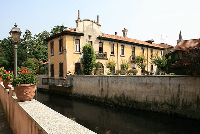
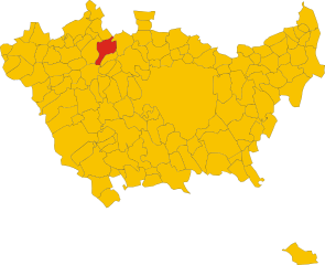
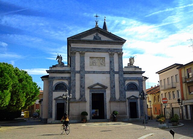
Арлуно (Arluno, Arluno)
.svg)
- коммуна Италии
 Hiking in Арлуно
Arluno, situated in the Lombardy region of Italy, is not widely known as a hiking destination compared to some other areas in Italy. However, there are opportunities for nature walks and light hiking in and around the area, with the surrounding countryside offering some pleasant trails.
-
Local Trails: You can explore local trails that wind through farmland and fields, showcasing the agricultural beauty of the region. Look for paths along the Naviglio Grande, which provides a scenic backdrop for leisurely strolls.
-
Nearby Parks: The nearby Parco Agricolo Sud Milano offers a larger area for outdoor activities, including hiking, cycling, and bird watching. It features a variety of trails where you can enjoy the natural landscape and observe local wildlife.
-
Cultural Walks: Consider combining hiking with cultural exploration. Arluno has historical sites and charming streets that can be incorporated into your hiking experience.
-
Day Trips: For more robust hiking experiences, consider a short drive to the nearby hills and mountains, such as the Prealps or areas around Lake Como or Lake Maggiore, which offer extensive and breathtaking hiking trails.
-
Wisdom for Hikers: As always, ensure you have comfortable footwear, stay hydrated, and check the weather conditions before heading out. It's also a good idea to have a map or a GPS device, especially if you're exploring less familiar trails.
While Arluno itself may not be a hiking hotspot, the surrounding areas offer plenty of options for those looking to enjoy scenic views and nature.
- Страна:

- Почтовый код: 20010
- Телефонный код: 02
- Код автомобильного номера: MI
- Координаты: 45° 30' 0" N, 8° 56' 0" E


- GPS треки (wikiloc): [Ссылка]
- Высота над уровнем моря: 156 м m
- Площадь: 12.36 кв.км
- Население: 11807
- Веб сайт: http://www.comune.arluno.mi.it
- Википедия русская: wiki(ru)
- Википедия английская: wiki(en)
- Википедия национальная: wiki(it)
- Хранилище Wikidata: Wikidata: Q42916
- Катеория в википедии: [Ссылка]
- код Freebase: [/m/0gj4cs]
- код GeoNames: Альт: [6537107]
- код VIAF: Альт: [244725986]
- ID отношения в OpenStreetMap: [45135]
- место в MusicBrainz: [2dfc61d1-7aef-4ebc-9cde-e32bca21dbc3]
- UN/LOCODE: [ITAKA]
- код ISTAT: 015010
- кадастровый код Италии: A413
Граничит с регионами:


Польяно-Миланезе
- коммуна Италии
Hiking in Польяно-Миланезе
Pogliano Milanese, located just outside of Milan, is not primarily known for extensive hiking trails like you might find in more mountainous areas, but it does offer some pleasant walking and nature opportunities. Here are a few aspects to consider when hiking around Pogliano Milanese:...
- Страна:
- Почтовый код: 20010
- Телефонный код: 02
- Код автомобильного номера: MI
- Координаты: 45° 32' 0" N, 9° 0' 0" E
- GPS треки (wikiloc): [Ссылка]
- Высота над уровнем моря: 127 м m
- Площадь: 4.78 кв.км
- Население: 8379
- Веб сайт: [Ссылка]
Нервьяно
- коммуна Италии
Hiking in Нервьяно
Nerviano is a charming town located in the Lombardy region of Italy, not far from Milan. While it might not be known as a traditional hiking destination, there are various areas nearby where hiking enthusiasts can enjoy some outdoor activities....
- Страна:
- Почтовый код: 20014
- Телефонный код: 0331
- Код автомобильного номера: MI
- Координаты: 45° 33' 0" N, 8° 59' 0" E
- GPS треки (wikiloc): [Ссылка]
- Высота над уровнем моря: 175 м m
- Площадь: 13.26 кв.км
- Население: 17270
- Веб сайт: [Ссылка]


Оссона
- коммуна Италии
Hiking in Оссона
Hiking in Ossona, a town in the Lombardy region of Italy, can be a delightful experience, as it offers a charming mix of nature and cultural sights. While Ossona itself is not a prominent hiking destination, it is located near larger natural areas and parks that provide great opportunities for outdoor activities....
- Страна:
- Почтовый код: 20010
- Телефонный код: 02
- Код автомобильного номера: MI
- Координаты: 45° 30' 0" N, 8° 54' 0" E
- GPS треки (wikiloc): [Ссылка]
- Высота над уровнем моря: 156 м m
- Площадь: 5.98 кв.км
- Население: 4288
- Веб сайт: [Ссылка]
Казореццо
- коммуна Италии
Hiking in Казореццо
Casorezzo is a small town located in the Lombardy region of Italy, not far from larger cities like Milan. While it may not be a widely recognized hiking destination, there are still opportunities for walking and enjoying the outdoors in the surrounding areas....
- Страна:
- Почтовый код: 20010
- Телефонный код: 02
- Код автомобильного номера: MI
- Координаты: 45° 31' 0" N, 8° 54' 0" E
- GPS треки (wikiloc): [Ссылка]
- Высота над уровнем моря: 166 м m
- Площадь: 6.6 кв.км
- Население: 5467
- Веб сайт: [Ссылка]


Парабьяго
- коммуна Италии
Hiking in Парабьяго
Parabiago, a town in the Lombardy region of Italy, is surrounded by scenic landscapes that offer various opportunities for hiking and outdoor activities. While Parabiago itself is not a major hiking destination, it is well-positioned to access trails and natural areas in the nearby regions. Here are some insights about hiking in and around Parabiago:...
- Страна:
- Почтовый код: 20015
- Телефонный код: 0331
- Код автомобильного номера: MI
- Координаты: 45° 33' 30" N, 8° 56' 52" E
- GPS треки (wikiloc): [Ссылка]
- Высота над уровнем моря: 184 м m
- Площадь: 14.29 кв.км
- Население: 27747
- Веб сайт: [Ссылка]

Виттуоне
- коммуна Италии
Hiking in Виттуоне
Vittuone is a town located in the Lombardy region of Italy, not far from Milan. While it may not be as famous for hiking as some of the more mountainous areas of Italy, it still offers some pleasant walking and hiking opportunities, especially for those looking to enjoy nature close to urban settings....
- Страна:
- Почтовый код: 20010
- Телефонный код: 02
- Код автомобильного номера: MI
- Координаты: 45° 29' 0" N, 8° 57' 0" E
- GPS треки (wikiloc): [Ссылка]
- Высота над уровнем моря: 146 м m
- Площадь: 6.13 кв.км
- Население: 9063
- Веб сайт: [Ссылка]


Корбетта
- коммуна Италии
Hiking in Корбетта
Corbetta, located in the Lombardy region of Italy, offers a range of opportunities for outdoor enthusiasts, albeit it's not as well-known for hiking as some of the more mountainous areas in Italy. However, it is situated in the proximity of several natural parks and trails that can make for enjoyable hiking experiences....
- Страна:
- Почтовый код: 20011
- Телефонный код: 02
- Код автомобильного номера: MI
- Координаты: 45° 28' 0" N, 8° 55' 0" E
- GPS треки (wikiloc): [Ссылка]
- Высота над уровнем моря: 140 м m
- Площадь: 18.69 кв.км
- Население: 18366
- Веб сайт: [Ссылка]


Седриано
- коммуна Италии
Hiking in Седриано
Sedriano is a charming town located in the Lombardy region of Italy, near Milan. While Sedriano itself may not be primarily known as a hiking destination, there are several nearby areas and trails that outdoor enthusiasts can explore....
- Страна:
- Почтовый код: 20018
- Телефонный код: 02
- Код автомобильного номера: MI
- Координаты: 45° 29' 0" N, 8° 58' 0" E
- GPS треки (wikiloc): [Ссылка]
- Высота над уровнем моря: 145 м m
- Площадь: 7.75 кв.км
- Население: 12099
- Веб сайт: [Ссылка]
Ванцаго
- коммуна Италии
Hiking in Ванцаго
Vanzago, located in the Lombardy region of Italy, is primarily known as a small town near Milan. While it may not be as famous for hiking as some of the more mountainous regions of Italy, there are still opportunities for outdoor activities and walking trails in and around the area. Here’s a brief overview:...
- Страна:
- Почтовый код: 20010
- Телефонный код: 02
- Код автомобильного номера: MI
- Координаты: 45° 32' 0" N, 9° 0' 0" E
- GPS треки (wikiloc): [Ссылка]
- Высота над уровнем моря: 154 м m
- Площадь: 6.05 кв.км
- Население: 9175
- Веб сайт: [Ссылка]


Санто-Стефано-Тичино
- коммуна Италии
Hiking in Санто-Стефано-Тичино
Santo Stefano Ticino is a charming municipality located in the metropolitan area of Milan, Italy. While it's not widely known for rugged hiking trails like some of the more mountainous regions of Italy, it offers a few opportunities for pleasant walks in a picturesque setting....
- Страна:
- Почтовый код: 20010
- Телефонный код: 02
- Код автомобильного номера: MI
- Координаты: 45° 29' 0" N, 8° 55' 0" E
- GPS треки (wikiloc): [Ссылка]
- Высота над уровнем моря: 152 м m
- Площадь: 5.01 кв.км
- Население: 4954
- Веб сайт: [Ссылка]