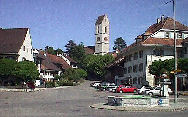
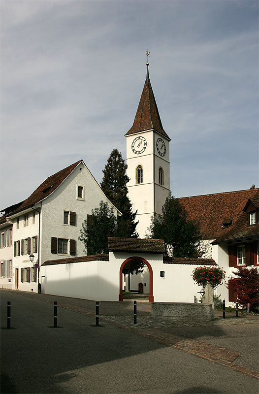
Бёктен (Böckten, Böckten)

 Hiking in Бёктен
Böckten is a charming municipality located in the canton of Basel-Landschaft in Switzerland. The area around Böckten offers beautiful landscapes, lush nature, and a variety of hiking trails suitable for different skill levels.
Hiking Trails and Routes
-
Local Trails: Various local trails wind through the picturesque countryside, including fields, forests, and small streams. These trails are typically well-marked and can be explored by both novice and experienced hikers.
-
Nearby Nature Areas: The proximity of Böckten to larger natural areas, such as the Jura Mountains to the west or the foothills of the black forest, provides plenty of opportunities for more adventurous hikes.
-
Scenic Views: Many trails offer stunning views of the surrounding landscapes, including vineyards and rolling hills, which are characteristic of the region.
Hiking Tips
-
Best Time to Hike: Late spring to early autumn (May to September) is the best time for hiking, as the weather is typically mild and the scenery is vibrant.
-
Preparation: Always check local weather conditions before heading out and carry necessary supplies such as water, snacks, a map, and a first-aid kit.
-
Respect Nature: Stay on marked trails to protect the environment and local wildlife.
-
Local Regulations: Be aware of any local regulations or guidelines for hiking in the area, including any access restrictions.
Community and Resources
-
Local Guides: Seek out local hiking guides or clubs for organized hikes and additional insights into the region’s flora, fauna, and history.
-
Visitor Centers: If available, visit local tourist information centers for maps and current trail conditions.
Hiking in Böckten allows you to experience the serenity of nature, enjoy breathtaking views, and immerse yourself in the tranquil Swiss countryside. Happy hiking!
- Страна:

- Почтовый код: 4461
- Телефонный код: 061
- Код автомобильного номера: BL
- Координаты: 47° 27' 45" N, 7° 50' 8" E


- GPS треки (wikiloc): [Ссылка]
- Высота над уровнем моря: 473 м m
- Площадь: 2.28 кв.км
- Население: 804
- Веб сайт: http://www.boeckten.ch
- Википедия русская: wiki(ru)
- Википедия английская: wiki(en)
- Википедия национальная: wiki(de)
- Хранилище Wikidata: Wikidata: Q66731
- Катеория в википедии: [Ссылка]
- код Freebase: [/m/0g80y3]
- код GeoNames: Альт: [7285275]
- код VIAF: Альт: [126521477]
- ID отношения в OpenStreetMap: [1683638]
- идентификатор HDS: [1218]
- код швейцарского муниципалитета: [2842]
Граничит с регионами:

Гельтеркинден
Hiking in Гельтеркинден
Gelterkinden, located in the canton of Basel-Landschaft in Switzerland, is an excellent destination for hiking enthusiasts. The region is characterized by picturesque landscapes, diverse terrain, and a mix of forests, hills, and meadows. Here are some key points to consider when hiking in Gelterkinden:...
- Страна:
- Почтовый код: 4460
- Телефонный код: 061
- Код автомобильного номера: BL
- Координаты: 47° 27' 55" N, 7° 51' 10" E
- GPS треки (wikiloc): [Ссылка]
- Высота над уровнем моря: 458 м m
- Площадь: 9.79 кв.км
- Население: 6095
- Веб сайт: [Ссылка]

Зиссах
Hiking in Зиссах
Sissach is a picturesque municipality located in the Baselland region of Switzerland, surrounded by beautiful landscapes and natural beauty, making it an excellent destination for hiking enthusiasts. Here’s what you should know about hiking in Sissach:...
- Страна:
- Почтовый код: 4450
- Телефонный код: 061
- Код автомобильного номера: BL
- Координаты: 47° 28' 0" N, 7° 49' 0" E
- GPS треки (wikiloc): [Ссылка]
- Высота над уровнем моря: 372 м m
- Площадь: 8.87 кв.км
- Население: 6666
- Веб сайт: [Ссылка]
Тюрнен
Hiking in Тюрнен
Thürnen, a picturesque village located in the German state of Baden-Württemberg, offers a range of hiking opportunities amidst beautiful natural landscapes. While 'Thürnen' might not be as renowned as some larger hiking destinations, it provides a peaceful and scenic environment for hikers looking to explore the Swabian Jura region....
- Страна:
- Почтовый код: 4441
- Телефонный код: 061
- Код автомобильного номера: BL
- Координаты: 47° 27' 26" N, 7° 49' 49" E
- GPS треки (wikiloc): [Ссылка]
- Высота над уровнем моря: 409 м m
- Площадь: 2.25 кв.км
- Население: 1403
- Веб сайт: [Ссылка]


Риккенбах
- община в Швейцарии, Базель-Ланд
Hiking in Риккенбах
Rickenbach, located in the Basel-Landschaft region of Switzerland, offers a range of scenic hiking opportunities. The area is characterized by lush green landscapes, rolling hills, and picturesque views, making it ideal for both casual walkers and serious hikers. Here are some key points to consider when hiking in Rickenbach:...
- Страна:
- Почтовый код: 4462
- Телефонный код: 061
- Код автомобильного номера: BL
- Координаты: 47° 29' 4" N, 7° 50' 57" E
- GPS треки (wikiloc): [Ссылка]
- Высота над уровнем моря: 466 м m
- Площадь: 2.90 кв.км
- Население: 594
- Веб сайт: [Ссылка]