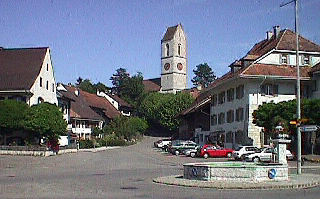
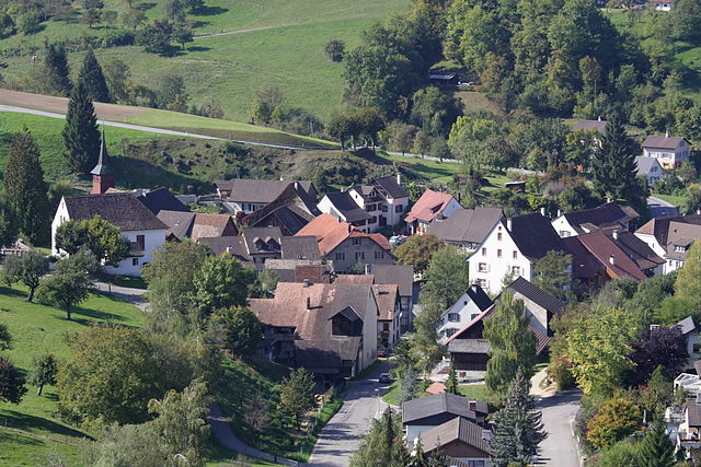
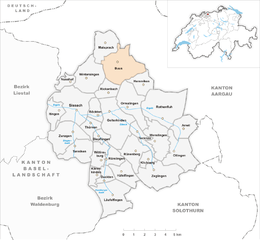
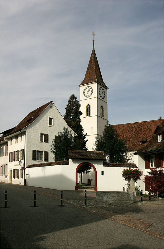
Риккенбах (Rickenbach, Rickenbach BL)

- община в Швейцарии, Базель-Ланд
 Hiking in Риккенбах
Rickenbach, located in the Basel-Landschaft region of Switzerland, offers a range of scenic hiking opportunities. The area is characterized by lush green landscapes, rolling hills, and picturesque views, making it ideal for both casual walkers and serious hikers. Here are some key points to consider when hiking in Rickenbach:
Hiking Trails
-
Network of Trails: Rickenbach is part of a broader hiking network in the region, featuring marked trails of varying lengths and difficulty levels. Trails often connect with nearby villages and scenic viewpoints.
-
Route Options: Popular routes include those leading to vantage points overlooking the surrounding areas, forests, and fields. Some well-known trails are:
- The trail to the Gipf-Oberfrick, offering stunning panoramic views.
- Local trails that wind through beautiful woodlands and farmland.
-
Themes and Highlights: Some hikes may focus on historical sites, natural features, or local flora and fauna, allowing hikers to enjoy not just the scenery but also the cultural context of the area.
Accessibility
-
Public Transport: Rickenbach is accessible by public transport from nearby towns. Check local transit schedules to plan your trip.
-
Parking: If you’re driving, there are parking areas available near trailheads, typically providing easy access to hiking routes.
Seasonal Considerations
-
Weather: Be mindful of the weather; the best hiking usually occurs from late spring to early autumn. Winters can see snowfall, making some trails less accessible.
-
Flora and Fauna: Each season brings its own beauty, with spring wildflowers, summer greenery, autumn colors, and snow-covered trails in winter.
Preparation
-
Maps and Guidance: It’s advisable to carry a detailed map or a hiking app to navigate the trails. While trails are often well-marked, having a map helps you stay oriented, especially if you’re exploring less traveled paths.
-
Gear: Wear appropriate hiking boots and clothing suitable for the weather conditions. Carry enough water, snacks, and possibly a first-aid kit for longer hikes.
-
Local Advice: If possible, check with local hiking clubs or visitor centers for updates on trail conditions and recommendations.
Safety
- Always inform someone of your hiking plans if you're going out alone. It’s good practice to adhere to local safety guidelines, including wildlife awareness and environmental preservation.
Hiking in Rickenbach can provide a refreshing escape into nature, allowing you to experience the natural beauty and tranquility of the Basel-Landschaft region. Enjoy your adventure!
- Страна:

- Почтовый код: 4462
- Телефонный код: 061
- Код автомобильного номера: BL
- Координаты: 47° 29' 4" N, 7° 50' 57" E


- GPS треки (wikiloc): [Ссылка]
- Высота над уровнем моря: 466 м m
- Площадь: 2.90 кв.км
- Население: 594
- Веб сайт: http://www.rickenbach-bl.ch
- Википедия русская: wiki(ru)
- Википедия английская: wiki(en)
- Википедия национальная: wiki(de)
- Хранилище Wikidata: Wikidata: Q67942
- Катеория в википедии: [Ссылка]
- код Freebase: [/m/0g81kp]
- код GeoNames: Альт: [7286895]
- ID отношения в OpenStreetMap: [1683695]
- идентификатор HDS: [1233]
- код швейцарского муниципалитета: [2857]
Граничит с регионами:

Гельтеркинден
Hiking in Гельтеркинден
Gelterkinden, located in the canton of Basel-Landschaft in Switzerland, is an excellent destination for hiking enthusiasts. The region is characterized by picturesque landscapes, diverse terrain, and a mix of forests, hills, and meadows. Here are some key points to consider when hiking in Gelterkinden:...
- Страна:
- Почтовый код: 4460
- Телефонный код: 061
- Код автомобильного номера: BL
- Координаты: 47° 27' 55" N, 7° 51' 10" E
- GPS треки (wikiloc): [Ссылка]
- Высота над уровнем моря: 458 м m
- Площадь: 9.79 кв.км
- Население: 6095
- Веб сайт: [Ссылка]

Винтерзинген
Hiking in Винтерзинген
Wintersingen, located in the Swiss Canton of Basel-Landschaft, offers picturesque landscapes and a variety of hiking opportunities. The region is characterized by its rolling hills, vineyards, and dense forests, providing a serene backdrop for outdoor enthusiasts....
- Страна:
- Почтовый код: 4451
- Телефонный код: 061
- Код автомобильного номера: BL
- Координаты: 47° 29' 45" N, 7° 49' 31" E
- GPS треки (wikiloc): [Ссылка]
- Высота над уровнем моря: 489 м m
- Площадь: 6.95 кв.км
- Население: 606
- Веб сайт: [Ссылка]

Буус
Hiking in Буус
Buus is a charming village in the canton of Basel-Landschaft in Switzerland, known for its scenic landscapes and access to numerous hiking trails. The area around Buus offers a diverse range of hiking opportunities, suitable for all skill levels....
- Страна:
- Почтовый код: 4463
- Телефонный код: 061
- Код автомобильного номера: BL
- Координаты: 47° 30' 19" N, 7° 51' 52" E
- GPS треки (wikiloc): [Ссылка]
- Высота над уровнем моря: 449 м m
- Площадь: 8.85 кв.км
- Население: 1035
- Веб сайт: [Ссылка]

Зиссах
Hiking in Зиссах
Sissach is a picturesque municipality located in the Baselland region of Switzerland, surrounded by beautiful landscapes and natural beauty, making it an excellent destination for hiking enthusiasts. Here’s what you should know about hiking in Sissach:...
- Страна:
- Почтовый код: 4450
- Телефонный код: 061
- Код автомобильного номера: BL
- Координаты: 47° 28' 0" N, 7° 49' 0" E
- GPS треки (wikiloc): [Ссылка]
- Высота над уровнем моря: 372 м m
- Площадь: 8.87 кв.км
- Население: 6666
- Веб сайт: [Ссылка]


Бёктен
Hiking in Бёктен
Böckten is a charming municipality located in the canton of Basel-Landschaft in Switzerland. The area around Böckten offers beautiful landscapes, lush nature, and a variety of hiking trails suitable for different skill levels....
- Страна:
- Почтовый код: 4461
- Телефонный код: 061
- Код автомобильного номера: BL
- Координаты: 47° 27' 45" N, 7° 50' 8" E
- GPS треки (wikiloc): [Ссылка]
- Высота над уровнем моря: 473 м m
- Площадь: 2.28 кв.км
- Население: 804
- Веб сайт: [Ссылка]


Ормалинген
Hiking in Ормалинген
Ormalingen, located in Switzerland, is a charming village that offers beautiful hiking opportunities for outdoor enthusiasts. Nestled in the scenic region of Baselland, the area is characterized by lush forests, rolling hills, and stunning views of the surrounding landscapes....
- Страна:
- Почтовый код: 4466
- Телефонный код: 061
- Код автомобильного номера: BL
- Координаты: 47° 28' 23" N, 7° 52' 42" E
- GPS треки (wikiloc): [Ссылка]
- Высота над уровнем моря: 457 м m
- Площадь: 4.23 кв.км
- Население: 2201
- Веб сайт: [Ссылка]