Борепер (Beaurepaire, Beaurepaire)

- коммуна во Франции
 Hiking in Борепер
Beaurepaire, located in the Isère department of France, is a charming commune that offers a variety of hiking opportunities. Nestled in the Rhône-Alpes region, it's surrounded by beautiful landscapes, including rolling hills and valleys, making it a great spot for outdoor enthusiasts.
Hiking Trails
-
Local Trails: There are numerous trails around Beaurepaire that cater to different skill levels. You can find easy walks suitable for families as well as more challenging routes for experienced hikers. The terrain varies, giving you the opportunity to enjoy both gentle slopes and more vigorous ascents.
-
Nearby Natural Sites: Being close to the Chartreuse and Vercors mountain ranges, you can also access extended hiking options. These areas provide breathtaking views and a chance to explore diverse flora and fauna.
-
Marked Routes: Many trails are marked and maintained by local hiking clubs. Be sure to pick up a local hiking map or use a hiking app to help guide you along the trails.
Hiking Preparation
-
Gear: Make sure to wear appropriate hiking footwear, carry plenty of water, and use sun protection. A good backpack and snacks are also recommended for longer hikes.
-
Weather: The weather can change quickly in mountain regions, so check the forecast before you go and dress in layers.
-
Wildlife and Nature: Keep an eye out for local wildlife as well as beautiful plant species. The region is known for its biodiversity, especially in the spring and summer months.
Accessibility
Beaurepaire is accessible by road, and you can drive to various trailheads nearby. Public transport options may also be available, but checking local schedules in advance is advisable.
Local Amenities
Post-hike, you can find local cafes and restaurants in Beaurepaire where you can enjoy regional cuisine and relax after your hike. Be sure to try some of the local specialties!
Overall, hiking in Beaurepaire, Isère, allows you to immerse yourself in the natural beauty of the French countryside while enjoying a range of outdoor activities. Whether you're a casual walker or an experienced hiker, you'll find plenty to explore and enjoy in this picturesque area.
- Страна:

- Почтовый код: 38270
- Координаты: 45° 20' 18" N, 5° 3' 16" E


- GPS треки (wikiloc): [Ссылка]
- Площадь: 18.46 кв.км
- Население: 4891
- Веб сайт: http://www.ville-beaurepaire.fr
- Википедия русская: wiki(ru)
- Википедия английская: wiki(en)
- Википедия национальная: wiki(fr)
- Хранилище Wikidata: Wikidata: Q864112
- Катеория в википедии: [Ссылка]
- код Freebase: [/m/03g_73z]
- код GeoNames: Альт: [6455078]
- номер SIREN: [213800345]
- код BNF: [152578631]
- код муниципалитета INSEE: 38034
Граничит с регионами:

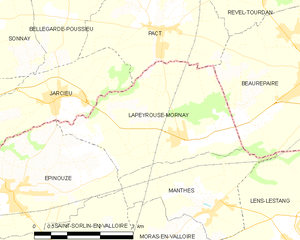
Lapeyrouse-Mornay
- коммуна во Франции
Hiking in Lapeyrouse-Mornay
Lapeyrouse-Mornay is a charming commune located in the Auvergne-Rhône-Alpes region of France, known for its picturesque landscapes and natural beauty. While it might not be as widely recognized as some of the larger hiking destinations in the region, there are still opportunities for exploring the surrounding countryside....
- Страна:
- Почтовый код: 26210
- Координаты: 45° 19' 23" N, 4° 59' 42" E
- GPS треки (wikiloc): [Ссылка]
- Площадь: 11.45 кв.км
- Население: 1214
- Веб сайт: [Ссылка]

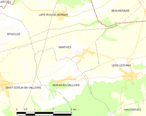
Manthes
- коммуна во Франции
Hiking in Manthes
It seems there might be a typo or misunderstanding regarding "Manthes," as it's not a well-known hiking destination based on the common references. However, if you're referring to a specific location that has a different spelling or context, please provide more details....
- Страна:
- Почтовый код: 26210
- Координаты: 45° 18' 10" N, 5° 0' 26" E
- GPS треки (wikiloc): [Ссылка]
- Площадь: 6.83 кв.км
- Население: 668
- Веб сайт: [Ссылка]


Пизьё
- коммуна во Франции
Hiking in Пизьё
Pisieu, a commune located in the Auvergne-Rhône-Alpes region of France, offers beautiful landscapes and opportunities for hiking enthusiasts. While it may not be as widely known as some larger hiking destinations, it provides access to picturesque trails through the surrounding natural areas....
- Страна:
- Почтовый код: 38270
- Координаты: 45° 23' 14" N, 5° 3' 37" E
- GPS треки (wikiloc): [Ссылка]
- Площадь: 18.76 кв.км
- Население: 538
- Веб сайт: [Ссылка]


Марколлен
- коммуна во Франции
Hiking in Марколлен
Marcollin is a charming commune in the Isère department of southeastern France, nestled at the foothills of the Alps. While it may not be as widely recognized as other hiking destinations, it offers beautiful landscapes, scenic views, and a variety of trails that cater to different skill levels....
- Страна:
- Почтовый код: 38270
- Координаты: 45° 18' 20" N, 5° 5' 16" E
- GPS треки (wikiloc): [Ссылка]
- Площадь: 10.69 кв.км
- Население: 661
- Веб сайт: [Ссылка]


Пакт
- коммуна во Франции
Hiking in Пакт
Hiking in Pact, located in the Isère department of the Auvergne-Rhône-Alpes region in France, offers an excellent opportunity to explore the natural beauty of the Alps and the surrounding landscapes. Here are some key points to consider when hiking in and around Pact:...
- Страна:
- Почтовый код: 38270
- Координаты: 45° 21' 10" N, 4° 59' 29" E
- GPS треки (wikiloc): [Ссылка]
- Площадь: 9.74 кв.км
- Население: 840
- Веб сайт: [Ссылка]


Lens-Lestang
- коммуна во Франции
Hiking in Lens-Lestang
Lens-Lestang is a charming commune located in the Drôme department of southeastern France. It offers a wonderful opportunity for hiking enthusiasts to explore scenic landscapes, picturesque villages, and diverse ecosystems. Here are some key points to consider when planning a hike in and around Lens-Lestang:...
- Страна:
- Почтовый код: 26210
- Координаты: 45° 17' 30" N, 5° 2' 33" E
- GPS треки (wikiloc): [Ссылка]
- Площадь: 16.41 кв.км
- Население: 837
- Веб сайт: [Ссылка]


Ревель-Турдан
- коммуна во Франции
Hiking in Ревель-Турдан
Revel-Tourdan, located in the Auvergne-Rhône-Alpes region of southeastern France, offers a picturesque setting for hiking enthusiasts. The area is known for its rolling hills, charming rural landscapes, and access to the rugged beauty of the surrounding mountains....
- Страна:
- Почтовый код: 38270
- Координаты: 45° 23' 4" N, 5° 2' 14" E
- GPS треки (wikiloc): [Ссылка]
- Площадь: 11.62 кв.км
- Население: 1042
- Веб сайт: [Ссылка]


Сен-Бартельми
Hiking in Сен-Бартельми
Saint-Barthélemy is a beautiful commune in the Isère department of the Auvergne-Rhône-Alpes region in southeastern France. Known for its picturesque landscapes, hiking in this area can vary from gentle strolls to more challenging hikes that reward adventurers with stunning views of the surrounding Alps and valleys....
- Страна:
- Почтовый код: 38270
- Координаты: 45° 20' 47" N, 5° 4' 49" E
- GPS треки (wikiloc): [Ссылка]
- Площадь: 7.98 кв.км
- Население: 962
- Веб сайт: [Ссылка]