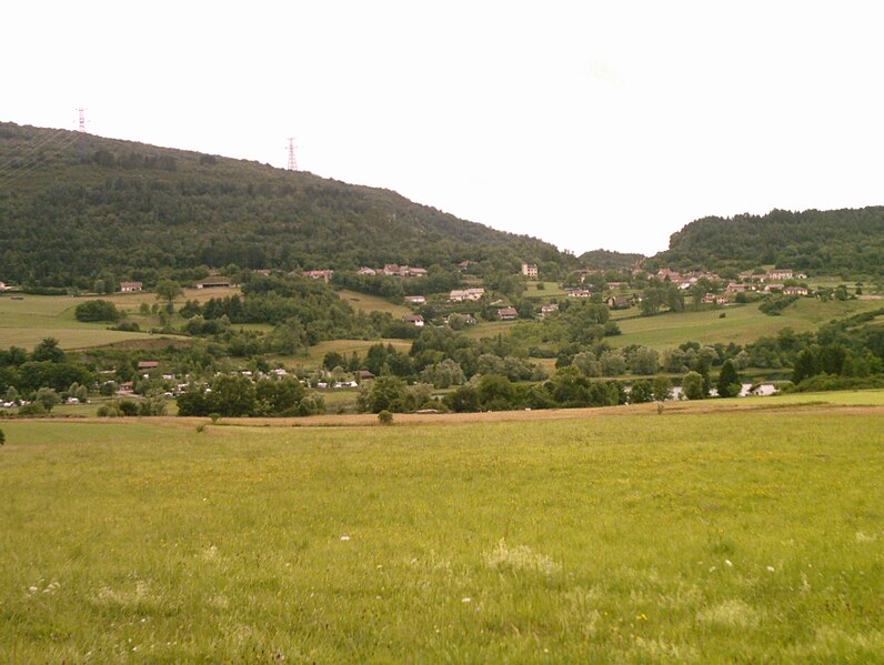
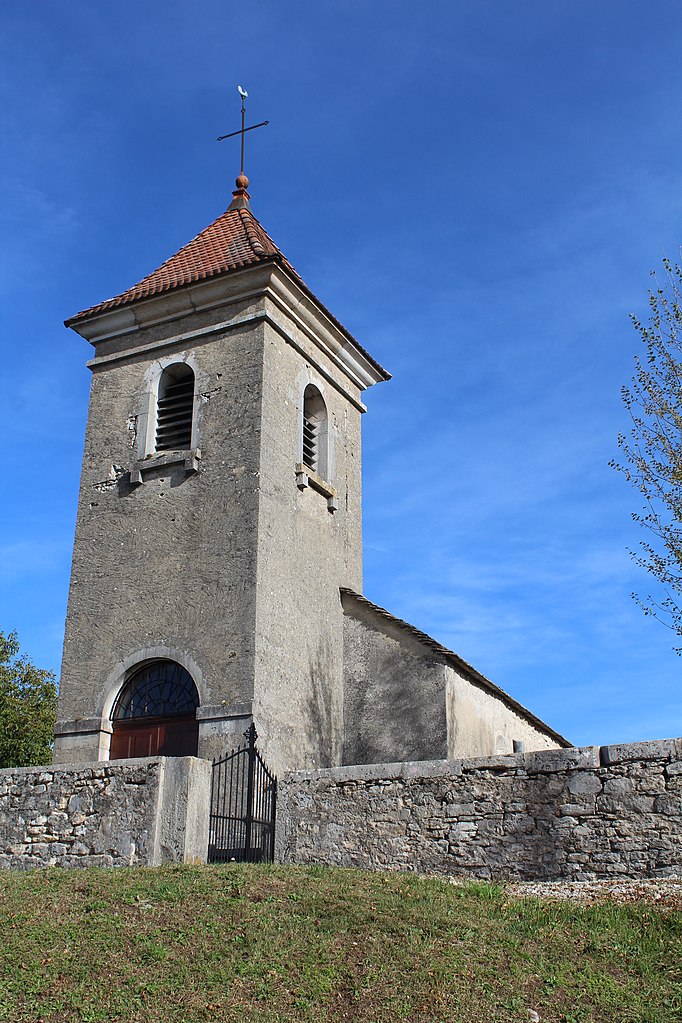
Болозон (Bolozon, Bolozon)
- коммуна во Франции
 Hiking in Болозон
Bolozon, located in the Jura region of France, is known for its stunning landscapes and natural beauty, making it an ideal destination for hiking enthusiasts. Here’s what you can expect when hiking in Bolozon:
Scenic Trails
-
Diverse Terrain: The area offers a mix of trails, including forest paths, rocky outcrops, and scenic overlooks. The varied terrain provides opportunities for both beginner and experienced hikers.
-
Views of the Jura Mountains: Many trails offer breathtaking views of the Jura mountain range, with its rolling hills and unique geological formations.
-
Lacs and Waterfalls: Bolozon is near several lakes and picturesque waterfalls, which can be great stopping points during your hike for a picnic or simply to enjoy the scenery.
Wildlife and Flora
-
Rich Biodiversity: Hikers may encounter diverse flora and fauna along the trails. Keep an eye out for local wildlife, including various bird species and, if you're lucky, some of the region's larger animals.
-
Spring Wildflowers: If hiking during spring, you’ll be treated to vibrant wildflowers blooming along the paths.
Practical Information
-
Seasonal Considerations: The best time to hike in Bolozon is from late spring to early autumn when the weather is mild. Winter hikes can be enjoyable too, but conditions may be challenging with snow and ice.
-
Trail Markings: Trails are generally well marked, but it’s always good to carry a map or a GPS device, especially if you’re exploring less traveled routes.
-
Safety Tips: Always let someone know your hiking plans, carry enough water, and wear appropriate footwear. It’s also advised to check the weather conditions beforehand.
Hiking Community
- Guided Hikes: If you’re unsure about navigating the trails, consider joining a guided hike. Local guides can offer insights about the flora, fauna, and geology of the area while ensuring a safe experience.
Overall, Bolozon is a fantastic destination for hiking, offering natural beauty, tranquility, and a chance to connect with nature. Whether you're looking for a leisurely stroll or a more challenging trek, you’ll find something to suit your preferences here.
- Страна:

- Почтовый код: 01450
- Координаты: 46° 11' 34" N, 5° 28' 28" E


- GPS треки (wikiloc): [Ссылка]
- Площадь: 4.92 кв.км
- Население: 89
- Википедия русская: wiki(ru)
- Википедия английская: wiki(en)
- Википедия национальная: wiki(fr)
- Хранилище Wikidata: Wikidata: Q213404
- Катеория в википедии: [Ссылка]
- Карты в википедии: [Ссылка]
- код Freebase: [/m/07ttbk]
- код Freebase: [/m/07ttbk]
- код GeoNames: Альт: [3031860]
- код GeoNames: Альт: [3031860]
- номер SIREN: [210100517]
- номер SIREN: [210100517]
- код муниципалитета INSEE: 01051
- код муниципалитета INSEE: 01051
Граничит с регионами:
Матафлон-Гранж
- коммуна во Франции
Hiking in Матафлон-Гранж
Matafelon-Granges is a commune in the Ain department in the Auvergne-Rhône-Alpes region of France. Nestled in the beautiful countryside, it offers various hiking opportunities for nature enthusiasts, with picturesque landscapes and charming local scenery....
- Страна:
- Почтовый код: 01580
- Координаты: 46° 15' 40" N, 5° 33' 14" E
- GPS треки (wikiloc): [Ссылка]
- Площадь: 21.54 кв.км
- Население: 647
Сонтонна-ла-Монтань
- коммуна во Франции
Hiking in Сонтонна-ла-Монтань
Sonthonnax-la-Montagne is a charming commune in the Ain department of the Auvergne-Rhône-Alpes region in France. Nestled in the countryside, it offers a variety of scenic hiking opportunities that showcase the natural beauty of the area....
- Страна:
- Почтовый код: 01580
- Координаты: 46° 13' 59" N, 5° 31' 27" E
- GPS треки (wikiloc): [Ссылка]
- Площадь: 14.14 кв.км
- Население: 321
- Веб сайт: [Ссылка]

Откур-Романеш
- коммуна во Франции
Hiking in Откур-Романеш
Hautecourt-Romanèche is a charming commune located in the Ain department of the Auvergne-Rhône-Alpes region in southeastern France. This area offers picturesque landscapes with rolling hills, forests, and the beautiful Bugey mountain range, making it an appealing destination for hikers....
- Страна:
- Почтовый код: 01250
- Координаты: 46° 9' 35" N, 5° 25' 3" E
- GPS треки (wikiloc): [Ссылка]
- Площадь: 21.6 кв.км
- Население: 792
- Веб сайт: [Ссылка]

Сиз
- коммуна во Франции
Hiking in Сиз
Cize, located in the Ain department in the Auvergne-Rhône-Alpes region of France, is a fantastic destination for hiking enthusiasts. The area is known for its stunning natural landscapes and diverse terrain, ranging from rolling hills to dense forests and scenic vistas....
- Страна:
- Почтовый код: 01250
- Координаты: 46° 12' 15" N, 5° 26' 44" E
- GPS треки (wikiloc): [Ссылка]
- Площадь: 4.52 кв.км
- Население: 171
- Веб сайт: [Ссылка]

Серьер-сюр-Эн
- коммуна во Франции
Hiking in Серьер-сюр-Эн
Serrières-sur-Ain is a charming village located in the Ain department of the Auvergne-Rhône-Alpes region in eastern France. The area is known for its picturesque landscapes, including rolling hills, forests, and the flow of the Ain River, making it an excellent spot for hiking enthusiasts....
- Страна:
- Почтовый код: 01450
- Координаты: 46° 9' 10" N, 5° 27' 4" E
- GPS треки (wikiloc): [Ссылка]
- Площадь: 8.18 кв.км
- Население: 128

Корвесья
- коммуна во Франции
Hiking in Корвесья
Corveissiat is a charming commune located in the Ain department in the Auvergne-Rhône-Alpes region of France. Nestled in the picturesque Jura Mountains, it offers beautiful natural scenery and numerous hiking opportunities for outdoor enthusiasts....
- Страна:
- Почтовый код: 01250
- Координаты: 46° 14' 35" N, 5° 28' 53" E
- GPS треки (wikiloc): [Ссылка]
- Площадь: 22.69 кв.км
- Население: 622
- Веб сайт: [Ссылка]

Лейсар
- коммуна во Франции
Hiking in Лейсар
Leyssard may not be a widely recognized hiking destination, so it might be useful to clarify if you're referring to a specific area or if there's a local name you're using for a location....
- Страна:
- Почтовый код: 01450
- Координаты: 46° 9' 21" N, 5° 28' 33" E
- GPS треки (wikiloc): [Ссылка]
- Площадь: 9.13 кв.км
- Население: 154