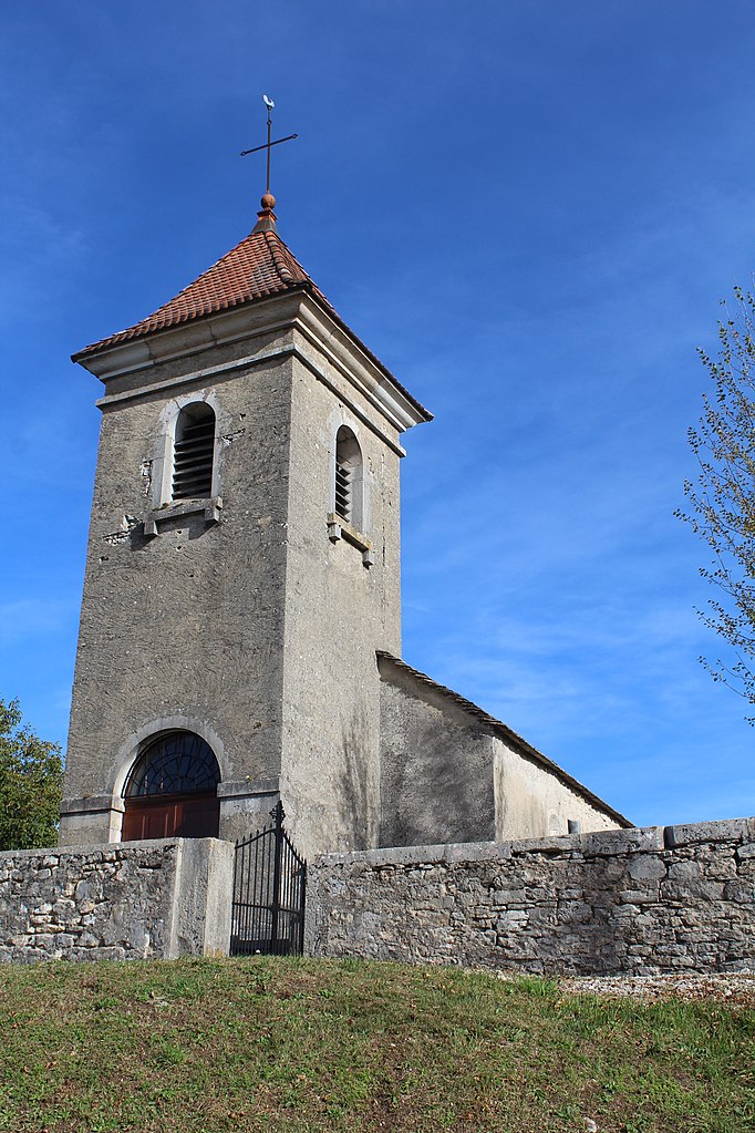
Матафлон-Гранж (Matafelon-Granges, Matafelon-Granges)
- коммуна во Франции
 Hiking in Матафлон-Гранж
Matafelon-Granges is a commune in the Ain department in the Auvergne-Rhône-Alpes region of France. Nestled in the beautiful countryside, it offers various hiking opportunities for nature enthusiasts, with picturesque landscapes and charming local scenery.
Hiking Trails:
-
Scenic Routes: The area around Matafelon-Granges features several trails that provide stunning views of the surrounding hills and valleys. Expect a mix of lush forests, meadows, and panoramic viewpoints.
-
Local Nature Reserves: Explore nearby nature reserves or woodland areas that often have marked trails. These paths may lead to some hidden gems, such as serene lakes or historical sites.
-
Elevation Changes: Many trails vary in elevation, offering both gentle walks for beginners and more challenging routes for seasoned hikers. Be sure to check the trail difficulty and length before you head out.
-
Themed Hikes: Look for themed trails that may focus on flora, fauna, or local history, providing insights into the region's natural heritage.
Tips for Hiking in Matafelon-Granges:
- Weather Preparedness: Always check the weather before you go. The weather in the French countryside can change swiftly.
- Trail Maps: Carry a map or download trails from local tourist office websites to ensure you stay on track.
- Footwear: Wear comfortable, sturdy hiking boots, as some trails can be rocky or uneven.
- Hydration and Snacks: Bring plenty of water and some snacks to keep your energy levels up, especially during longer hikes.
- Respect Nature: Stick to marked paths and respect the local wildlife and vegetation. Take any litter with you.
Nearby Attractions:
If you have extra time, consider exploring other nearby attractions, such as local villages, historical sites, or other hiking areas within the region.
Hiking in Matafelon-Granges can be a wonderful way to experience the beauty of the French countryside while enjoying physical activity. Always prioritize safety and follow local guidelines to ensure an enjoyable hiking experience.
- Страна:

- Почтовый код: 01580
- Координаты: 46° 15' 40" N, 5° 33' 14" E


- GPS треки (wikiloc): [Ссылка]
- Площадь: 21.54 кв.км
- Население: 647
- Википедия русская: wiki(ru)
- Википедия английская: wiki(en)
- Википедия национальная: wiki(fr)
- Хранилище Wikidata: Wikidata: Q275197
- Катеория в википедии: [Ссылка]
- Карты в википедии: [Ссылка]
- код Freebase: [/m/03czfv6]
- код Freebase: [/m/03czfv6]
- код GeoNames: Альт: [6618064]
- код GeoNames: Альт: [6618064]
- номер SIREN: [210102406]
- номер SIREN: [210102406]
- код муниципалитета INSEE: 01240
- код муниципалитета INSEE: 01240
Граничит с регионами:


Туаретт
- коммуна во Франции
Hiking in Туаретт
Thoirette is a small town located in the Jura region of France, known for its picturesque landscapes and outdoor activities, including hiking. The surrounding Jura mountains offer a variety of trails suitable for different levels of hikers. Here are some highlights and tips for hiking in Thoirette:...
- Страна:
- Почтовый код: 39240
- Координаты: 46° 16' 16" N, 5° 31' 57" E
- GPS треки (wikiloc): [Ссылка]
- Площадь: 8.77 кв.км
- Население: 675

Болозон
- коммуна во Франции
Hiking in Болозон
Bolozon, located in the Jura region of France, is known for its stunning landscapes and natural beauty, making it an ideal destination for hiking enthusiasts. Here’s what you can expect when hiking in Bolozon:...
- Страна:
- Почтовый код: 01450
- Координаты: 46° 11' 34" N, 5° 28' 28" E
- GPS треки (wikiloc): [Ссылка]
- Площадь: 4.92 кв.км
- Население: 89

Изернор
- коммуна во Франции
Hiking in Изернор
Izernore, located in the Ain department of the Auvergne-Rhône-Alpes region in eastern France, offers a beautiful environment for hiking enthusiasts. The area is characterized by its stunning natural landscapes, including rolling hills, forests, and views of the surrounding mountains. Here are some key points for hiking in Izernore:...
- Страна:
- Почтовый код: 01580
- Координаты: 46° 13' 14" N, 5° 33' 14" E
- GPS треки (wikiloc): [Ссылка]
- Площадь: 20.86 кв.км
- Население: 2275
- Веб сайт: [Ссылка]
Сонтонна-ла-Монтань
- коммуна во Франции
Hiking in Сонтонна-ла-Монтань
Sonthonnax-la-Montagne is a charming commune in the Ain department of the Auvergne-Rhône-Alpes region in France. Nestled in the countryside, it offers a variety of scenic hiking opportunities that showcase the natural beauty of the area....
- Страна:
- Почтовый код: 01580
- Координаты: 46° 13' 59" N, 5° 31' 27" E
- GPS треки (wikiloc): [Ссылка]
- Площадь: 14.14 кв.км
- Население: 321
- Веб сайт: [Ссылка]
Самонья
- коммуна во Франции
Hiking in Самонья
It seems like there may be a misunderstanding in the name "Samognat," as it does not correspond to a well-known hiking destination or region. If you meant a different location or if Samognat is a lesser-known local area, I would recommend checking local hiking resources or tourism websites for that particular region....
- Страна:
- Почтовый код: 01580
- Координаты: 46° 15' 28" N, 5° 34' 34" E
- GPS треки (wikiloc): [Ссылка]
- Площадь: 14.01 кв.км
- Население: 660
- Веб сайт: [Ссылка]


Coisia
- коммуна во Франции
Hiking in Coisia
It seems there might be a typo in your request, as "Coisia" is not a recognized hiking destination. If you meant "Corsica," which is a beautiful island in the Mediterranean Sea, I can provide some information on hiking there....
- Страна:
- Почтовый код: 39240
- Координаты: 46° 18' 20" N, 5° 34' 51" E
- GPS треки (wikiloc): [Ссылка]
- Площадь: 6.73 кв.км
- Население: 193

Корвесья
- коммуна во Франции
Hiking in Корвесья
Corveissiat is a charming commune located in the Ain department in the Auvergne-Rhône-Alpes region of France. Nestled in the picturesque Jura Mountains, it offers beautiful natural scenery and numerous hiking opportunities for outdoor enthusiasts....
- Страна:
- Почтовый код: 01250
- Координаты: 46° 14' 35" N, 5° 28' 53" E
- GPS треки (wikiloc): [Ссылка]
- Площадь: 22.69 кв.км
- Население: 622
- Веб сайт: [Ссылка]