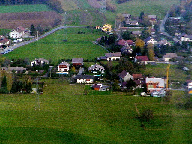
Аннмасс-Север (Canton of Annemasse-Nord, canton d'Annemasse-Nord)
- кантон Франции
 Hiking in Аннмасс-Север
Canton d'Annemasse-Nord, located in the Haute-Savoie region of France, is a fantastic area for hiking enthusiasts. The region's diverse landscapes range from gentle valleys to more rugged mountain terrain, making it ideal for hikers of all skill levels. Here are some highlights and tips for hiking in this area:
Trails and Hikes
-
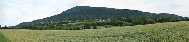
Les Voirons: This mountain range offers a variety of hiking trails with stunning views of Lake Geneva and the surrounding mountains. The trails vary in difficulty, making it suitable for both beginners and seasoned hikers.
-
Salève Mountain: Just across the border in Switzerland, Salève provides numerous trails and is easily accessible from Annemasse. The panoramic views of Geneva and the Mont Blanc massif make this a popular spot for both hikers and paragliders.
-
Chenevières Trail: A family-friendly loop that offers beautiful woodland paths with opportunities for picnicking along the way.
-
Mont Salève via the Tête de la Caille: For a more challenging hike, this route offers a steep ascent with rewarding views. It's well-marked and takes about 4-5 hours depending on your pace.
Hiking Tips
-
Weather Considerations: Always check the weather forecast before heading out. The weather can change rapidly in mountainous areas, so be prepared for various conditions.
-
Appropriate Gear: Wear sturdy hiking boots and comfortable clothing suitable for the season. Bringing layers is wise, as temperatures can fluctuate.
-
Stay Hydrated and Snack Smart: Carry enough water and some convenient energy snacks, like nuts or energy bars, especially for longer hikes.
-
Local Maps: It’s a good idea to have a local hiking map or a GPS app on your smartphone to help navigate, as some trails may not be well-marked.
-
Wildlife: Respect local wildlife and flora. Keep a safe distance from animals and do not disturb their habitats.
Additional Activities
Beyond hiking, Canton d'Annemasse-Nord also offers various outdoor activities such as mountain biking, paragliding, and even winter sports in the nearby ski resorts during the colder months.
Getting There
Annemasse is well-connected to major cities like Geneva and can be accessed via public transport, making it convenient for day trips or longer hiking excursions.
By exploring the scenic trails and enjoying the natural beauty of Canton d'Annemasse-Nord, you'll have a rewarding hiking experience. Always remember to leave no trace and respect the environment!
- Страна:

- Столица: Аннмасс
- Координаты: 46° 12' 32" N, 6° 16' 54" E


- GPS треки (wikiloc): [Ссылка]
- Хранилище Wikidata: Wikidata: Q1605743
Включает регионы:


Амбийи
- коммуна во Франции
Hiking in Амбийи
Ambilly is a small commune located in the Haute-Savoie department of the Auvergne-Rhône-Alpes region in southeastern France, near the border with Switzerland. It sits close to the city of Geneva and is known for its scenic views and access to outdoor activities, including hiking....
- Страна:
- Почтовый код: 74100
- Координаты: 46° 11' 42" N, 6° 13' 27" E
- GPS треки (wikiloc): [Ссылка]
- Площадь: 1.25 кв.км
- Население: 6175
- Веб сайт: [Ссылка]


Cranves-Sales
- коммуна во Франции
Hiking in Cranves-Sales
Cranves-Sales, located in the Haute-Savoie region of France, is a scenic destination that offers beautiful landscapes and various hiking opportunities. Nestled near the Alps and close to Lake Geneva, the area is characterized by its rolling hills, forests, and stunning views of the surrounding mountains....
- Страна:
- Почтовый код: 74380
- Координаты: 46° 11' 12" N, 6° 17' 29" E
- GPS треки (wikiloc): [Ссылка]
- Площадь: 13.61 кв.км
- Население: 6562
- Веб сайт: [Ссылка]


Lucinges
- коммуна во Франции
Hiking in Lucinges
Lucinges is a charming village located in the Haute-Savoie region of France, nestled near the French-Swiss border. It offers stunning views of the surrounding Alpine landscape and is an excellent spot for hiking enthusiasts. Here are some details about hiking in Lucinges:...
- Страна:
- Почтовый код: 74380
- Координаты: 46° 11' 27" N, 6° 19' 7" E
- GPS треки (wikiloc): [Ссылка]
- Площадь: 7.69 кв.км
- Население: 1641
- Веб сайт: [Ссылка]

Juvigny, Haute-Savoie
Hiking in Juvigny, Haute-Savoie
Juvigny, located in the Haute-Savoie region of the French Alps, is a picturesque village that offers a variety of hiking opportunities for all skill levels. The region is known for its stunning mountain landscapes, lush forests, and sweeping alpine views....
- Страна:
- Почтовый код: 74100
- Координаты: 46° 12' 52" N, 6° 16' 51" E
- GPS треки (wikiloc): [Ссылка]
- Площадь: 2.71 кв.км
- Население: 650

Saint-Cergues
- коммуна во Франции
Hiking in Saint-Cergues
Saint-Cergues is a picturesque commune located near the French-Swiss border, not far from Lake Geneva and the city of Geneva itself. The area is known for its stunning natural beauty and offers a variety of hiking opportunities for outdoor enthusiasts of all skill levels. Here are some highlights about hiking in Saint-Cergues:...
- Страна:
- Почтовый код: 74140
- Координаты: 46° 14' 9" N, 6° 19' 17" E
- GPS треки (wikiloc): [Ссылка]
- Площадь: 12.55 кв.км
- Население: 3571
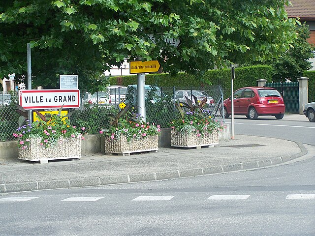

Ville-la-Grand
- коммуна во Франции
Hiking in Ville-la-Grand
Ville-la-Grand, located in the Auvergne-Rhône-Alpes region of France, offers access to a variety of hiking opportunities, particularly due to its proximity to the natural landscapes of the nearby Jura Mountains and the Alps....
- Страна:
- Почтовый код: 74100
- Координаты: 46° 12' 8" N, 6° 14' 49" E
- GPS треки (wikiloc): [Ссылка]
- Площадь: 4.49 кв.км
- Население: 8599


Machilly
- коммуна во Франции
Hiking in Machilly
Machilly is a charming commune located in the Haute-Savoie region of France, near the French-Swiss border. While it may not be as widely known as some of the larger hiking destinations in the Alps, it offers a great opportunity for outdoor enthusiasts to explore beautiful landscapes, forests, and potentially less crowded trails....
- Страна:
- Почтовый код: 74140
- Координаты: 46° 15' 6" N, 6° 19' 53" E
- GPS треки (wikiloc): [Ссылка]
- Площадь: 5.76 кв.км
- Население: 1075
- Веб сайт: [Ссылка]