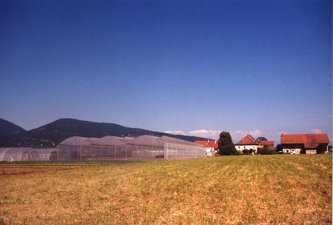
Cranves-Sales (Cranves-Sales)

- коммуна во Франции
 Hiking in Cranves-Sales
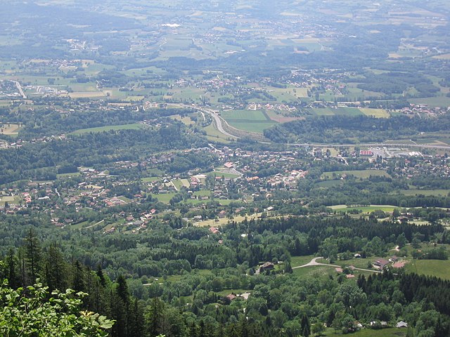
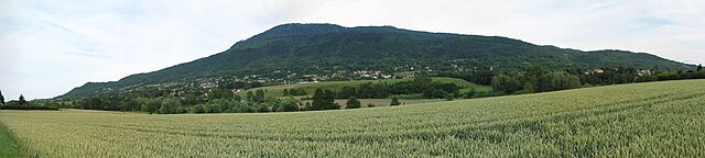
Cranves-Sales, located in the Haute-Savoie region of France, is a scenic destination that offers beautiful landscapes and various hiking opportunities. Nestled near the Alps and close to Lake Geneva, the area is characterized by its rolling hills, forests, and stunning views of the surrounding mountains.
Popular Hiking Trails:
-
Le Mont Sion: This trail offers a moderately challenging hike with rewarding panoramic views. The ascent is steep in parts, but the vistas from the summit make it worthwhile.
-
La Forêt de la Pesse: A lovely family-friendly hike that meanders through a beautiful forest. It's relatively flat, making it an excellent option for hikers of all ages and skill levels.
-
Les Crêtes de Sales: For those looking for a bit more of a challenge, this trail provides varied terrain and great views of the Mont Blanc range. Expect some elevation gain and rocky sections.
Best Time to Hike:
The best time for hiking in Cranves-Sales is during the late spring to early autumn (May to October) when the weather is milder, and the trails are clear of snow. However, conditions can change rapidly, especially in the mountains, so always check the local weather forecast before heading out.
Tips for Hiking:
- Stay Hydrated: Bring plenty of water, especially during warmer months.
- Wear Appropriate Footwear: Good hiking boots or shoes are essential for support and traction.
- Check Trail Conditions: Before you set out, look up local hiking information for any trail updates or closures.
- Leave No Trace: Respect the environment and carry out what you bring in.
Local Amenities:
Cranves-Sales has local shops, bakeries, and cafes where you can grab snacks or meals before or after your hike. It's always a good idea to sample local Savoyard cuisine!
Whether you’re seeking a leisurely stroll in nature or a more strenuous hike, Cranves-Sales provides a fantastic opportunity to enjoy the outdoors while taking in stunning Alpine scenery. Enjoy your adventure!
- Страна:

- Почтовый код: 74380
- Координаты: 46° 11' 12" N, 6° 17' 29" E


- GPS треки (wikiloc): [Ссылка]
- Площадь: 13.61 кв.км
- Население: 6562
- Веб сайт: http://www.cranves-sales.fr
- Википедия английская: wiki(en)
- Википедия национальная: wiki(fr)
- Хранилище Wikidata: Wikidata: Q580525
- Катеория в википедии: [Ссылка]
- код Freebase: [/m/03ntypm]
- код GeoNames: Альт: [6451055]
- номер SIREN: [217400944]
- код BNF: [15274352p]
- код тезауруса PACTOLS: [pcrtPfolOzLrhH]
- место в MusicBrainz: [8d9ab096-b467-49e9-8fe5-7cbe66db372e]
- код муниципалитета INSEE: 74094
Граничит с регионами:


Аннмасс
- коммуна во Франции
Hiking in Аннмасс
Annemasse, located in the Haute-Savoie region of France, near the border with Switzerland, offers a variety of hiking opportunities that showcase its beautiful alpine scenery. Here are some highlights and considerations for hiking in and around Annemasse:...
- Страна:
- Почтовый код: 74100
- Координаты: 46° 11' 42" N, 6° 14' 8" E
- GPS треки (wikiloc): [Ссылка]
- Площадь: 4.98 кв.км
- Население: 35234
- Веб сайт: [Ссылка]

Arthaz-Pont-Notre-Dame
- коммуна во Франции
Hiking in Arthaz-Pont-Notre-Dame
Arthaz-Pont-Notre-Dame is a small commune located in the Haute-Savoie department in the Auvergne-Rhône-Alpes region of southeastern France. While it may not be as widely known as some of the larger tourist destinations in the Alps, it offers some charming hiking opportunities in a picturesque setting....
- Страна:
- Почтовый код: 74380
- Координаты: 46° 9' 32" N, 6° 16' 1" E
- GPS треки (wikiloc): [Ссылка]
- Площадь: 5.96 кв.км
- Население: 1440
- Веб сайт: [Ссылка]


Lucinges
- коммуна во Франции
Hiking in Lucinges
Lucinges is a charming village located in the Haute-Savoie region of France, nestled near the French-Swiss border. It offers stunning views of the surrounding Alpine landscape and is an excellent spot for hiking enthusiasts. Here are some details about hiking in Lucinges:...
- Страна:
- Почтовый код: 74380
- Координаты: 46° 11' 27" N, 6° 19' 7" E
- GPS треки (wikiloc): [Ссылка]
- Площадь: 7.69 кв.км
- Население: 1641
- Веб сайт: [Ссылка]


Boëge
- коммуна во Франции
Hiking in Boëge
Boëge is a charming commune located in the Haute-Savoie region of the French Alps, offering beautiful landscapes and a variety of hiking options. The area is characterized by its picturesque mountain views, lush forests, and tranquil lakes, making it a fantastic destination for outdoor enthusiasts....
- Страна:
- Почтовый код: 74420
- Координаты: 46° 12' 32" N, 6° 24' 17" E
- GPS треки (wikiloc): [Ссылка]
- Площадь: 16 кв.км
- Население: 1672

Bonne, Haute-Savoie
- коммуна во Франции
Hiking in Bonne, Haute-Savoie
Hiking in Bonne, Haute-Savoie, offers a fantastic experience for outdoor enthusiasts. Situated in the picturesque region of the French Alps, Bonne is known for its stunning mountainous scenery, with a variety of trails suited for different skill levels, from beginners to advanced hikers....
- Страна:
- Почтовый код: 74380
- Координаты: 46° 10' 6" N, 6° 19' 14" E
- GPS треки (wikiloc): [Ссылка]
- Площадь: 8.58 кв.км
- Население: 3245
- Веб сайт: [Ссылка]


Vétraz-Monthoux
- коммуна во Франции
Hiking in Vétraz-Monthoux
Vétraz-Monthoux is a charming commune located in the Haute-Savoie region of France, near the city of Geneva. It boasts a variety of outdoor activities, and hiking is one of the most popular pursuits in the area. Here are some highlights regarding hiking in Vétraz-Monthoux:...
- Страна:
- Почтовый код: 74100
- Координаты: 46° 10' 27" N, 6° 15' 18" E
- GPS треки (wikiloc): [Ссылка]
- Площадь: 7.11 кв.км
- Население: 8455

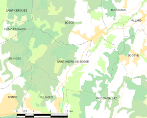
Saint-André-de-Boëge
- коммуна во Франции
Hiking in Saint-André-de-Boëge
Saint-André-de-Boëge is a charming commune located in the Haute-Savoie department in the Auvergne-Rhône-Alpes region of southeastern France. It's nestled within the scenic backdrop of the French Alps, making it an appealing destination for outdoor enthusiasts and hikers....
- Страна:
- Почтовый код: 74420
- Координаты: 46° 11' 25" N, 6° 23' 37" E
- GPS треки (wikiloc): [Ссылка]
- Площадь: 12.6 кв.км
- Население: 549
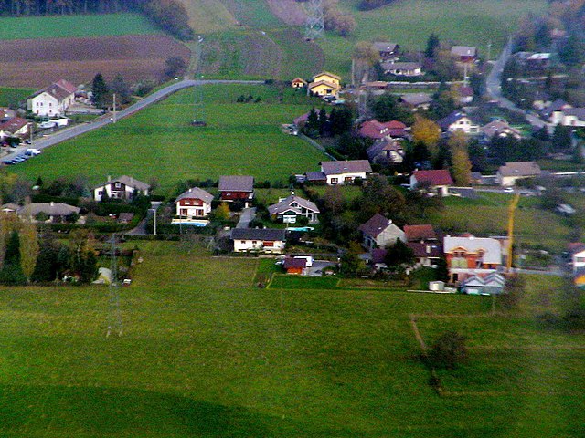

Juvigny, Haute-Savoie
Hiking in Juvigny, Haute-Savoie
Juvigny, located in the Haute-Savoie region of the French Alps, is a picturesque village that offers a variety of hiking opportunities for all skill levels. The region is known for its stunning mountain landscapes, lush forests, and sweeping alpine views....
- Страна:
- Почтовый код: 74100
- Координаты: 46° 12' 52" N, 6° 16' 51" E
- GPS треки (wikiloc): [Ссылка]
- Площадь: 2.71 кв.км
- Население: 650

Saint-Cergues
- коммуна во Франции
Hiking in Saint-Cergues
Saint-Cergues is a picturesque commune located near the French-Swiss border, not far from Lake Geneva and the city of Geneva itself. The area is known for its stunning natural beauty and offers a variety of hiking opportunities for outdoor enthusiasts of all skill levels. Here are some highlights about hiking in Saint-Cergues:...
- Страна:
- Почтовый код: 74140
- Координаты: 46° 14' 9" N, 6° 19' 17" E
- GPS треки (wikiloc): [Ссылка]
- Площадь: 12.55 кв.км
- Население: 3571
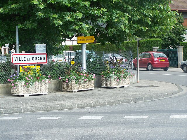

Ville-la-Grand
- коммуна во Франции
Hiking in Ville-la-Grand
Ville-la-Grand, located in the Auvergne-Rhône-Alpes region of France, offers access to a variety of hiking opportunities, particularly due to its proximity to the natural landscapes of the nearby Jura Mountains and the Alps....
- Страна:
- Почтовый код: 74100
- Координаты: 46° 12' 8" N, 6° 14' 49" E
- GPS треки (wikiloc): [Ссылка]
- Площадь: 4.49 кв.км
- Население: 8599