canton of Crémieu (canton de Crémieu)
 Hiking in canton of Crémieu
Canton de Crémieu, located in the Isère department of the Auvergne-Rhône-Alpes region of France, offers a variety of hiking opportunities with beautiful landscapes, historical sites, and charming villages. Here are some highlights for those interested in hiking in the area:
Trails and Routes
-
Grands Sentiers: The region is well-equipped with long-distance hiking trails, including the GR65, part of the traditional pilgrimage route to Santiago de Compostela. This path offers a scenic journey through picturesque towns and rural landscapes.
-
Local Circuits: There are numerous shorter circuits and marked trails around villages like Crémieu, which often feature well-preserved medieval architecture. The area is great for family hikes and beginners.
-
Natural Parks: The nearby Chartreuse and Vercors mountains are easily accessible for those looking for more challenging hikes. While not directly in the Canton de Crémieu, they can be reached with a short drive.
Flora and Fauna
The area features a mix of forested regions, open fields, and rivers. Hikers may encounter diverse wildlife such as deer, various bird species, and perhaps even local plant species unique to the region.
Historical and Cultural Sites
As you hike, you'll have the opportunity to explore several historical sites, including:
- Crémieu's Medieval Town: With its ramparts, the church of St. George, and several ancient houses, it reflects the rich history and architecture of the region.
- Château de Crémieu: The remains of the castle provide a glimpse into the area’s medieval past.
Tips for Hikers
- Best Time to Hike: Spring and early autumn are ideal for hiking due to mild weather and blooming landscapes. Summer can be warm, while winter hiking is less common in the lower elevations.
- Equipment: Proper hiking footwear is essential, especially if you plan to explore rugged trails. A good water supply and snacks are also recommended.
- Local Guides: For those unfamiliar with the region, consider hiring a local guide for a more enriching experience and to ensure safety.
Accessibility
Canton de Crémieu is accessible by road and is well-connected to larger cities in the region. Public transport options may be available, but having your transport could make accessing certain trails easier.
Whether you are looking for leisurely walks or more challenging hikes, Canton de Crémieu offers a delightful mix of natural beauty and cultural history. Happy hiking!
- Страна:

- Столица: Кремьё
- Координаты: 45° 43' 24" N, 5° 16' 10" E


- GPS треки (wikiloc): [Ссылка]
- Хранилище Wikidata: Wikidata: Q1275583
- код VIAF: Альт: [237010452]
- код кантона INSEE: [3808]
Включает регионы:


Дизимьё
- коммуна во Франции
Hiking in Дизимьё
Dizimieu is a picturesque village located in the Isère department in the Auvergne-Rhône-Alpes region of France. The surrounding area features beautiful natural landscapes, making it a great location for hiking enthusiasts. Here are some key points to know about hiking in and around Dizimieu:...
- Страна:
- Почтовый код: 38460
- Координаты: 45° 43' 6" N, 5° 17' 55" E
- GPS треки (wikiloc): [Ссылка]
- Площадь: 9.74 кв.км
- Население: 836
- Веб сайт: [Ссылка]


Шаманьё
- коммуна во Франции
Hiking in Шаманьё
Chamagnieu is a charming commune located in the Auvergne-Rhône-Alpes region of France, near the city of Lyon. It's a great spot for hiking enthusiasts, as it offers beautiful landscapes, scenic trails, and the opportunity to enjoy nature away from the hustle and bustle of urban life....
- Страна:
- Почтовый код: 38460
- Координаты: 45° 40' 48" N, 5° 9' 55" E
- GPS треки (wikiloc): [Ссылка]
- Площадь: 13.7 кв.км
- Население: 1595
- Веб сайт: [Ссылка]


Аннуазен-Шатлан
- коммуна во Франции
Hiking in Аннуазен-Шатлан
Annoisin-Chatelans, located in the Isère department of the Auvergne-Rhône-Alpes region in southeastern France, offers a variety of hiking opportunities for all skill levels. Nestled near the foothills of the French Alps, this area features beautiful landscapes, lush greenery, and scenic views....
- Страна:
- Почтовый код: 38460
- Координаты: 45° 45' 25" N, 5° 17' 36" E
- GPS треки (wikiloc): [Ссылка]
- Площадь: 13.27 кв.км
- Население: 666

Ла-Бальм-ле-Грот
- коммуна во Франции
Hiking in Ла-Бальм-ле-Грот
La Balme-les-Grottes is a charming village in the Auvergne-Rhône-Alpes region of France, known for its stunning natural surroundings and the remarkable geological formations that attract hikers and outdoor enthusiasts. Here are some highlights regarding hiking in this area:...
- Страна:
- Почтовый код: 38390
- Координаты: 45° 51' 9" N, 5° 20' 12" E
- GPS треки (wikiloc): [Ссылка]
- Площадь: 14.61 кв.км
- Население: 1011
- Веб сайт: [Ссылка]


Вессильё
- коммуна во Франции
Hiking in Вессильё
Veyssilieu is a charming commune located in the Isère department of the Auvergne-Rhône-Alpes region in France. Nestled within the stunning landscape of the French Alps, it offers various hiking opportunities for outdoor enthusiasts....
- Страна:
- Почтовый код: 38460
- Координаты: 45° 40' 48" N, 5° 13' 13" E
- GPS треки (wikiloc): [Ссылка]
- Площадь: 6.49 кв.км
- Население: 322
- Веб сайт: [Ссылка]


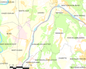
Вертриё
- коммуна во Франции
Hiking in Вертриё
Vertrieu is a great destination for hiking enthusiasts. Located in the Auvergne-Rhône-Alpes region of France, it offers beautiful natural landscapes and a variety of trails suitable for different skill levels. Here are some highlights for hiking in the area:...
- Страна:
- Почтовый код: 38390
- Координаты: 45° 52' 24" N, 5° 22' 1" E
- GPS треки (wikiloc): [Ссылка]
- Площадь: 4.59 кв.км
- Население: 666
- Веб сайт: [Ссылка]


Верна
- коммуна во Франции
Hiking in Верна
Hiking in Vernas, a picturesque area in the French Alps, offers a variety of trails suited for all skill levels, from gentle walks to challenging mountain ascents. Here are a few key highlights to consider when hiking in this beautiful region:...
- Страна:
- Почтовый код: 38460
- Координаты: 45° 46' 39" N, 5° 16' 54" E
- GPS треки (wikiloc): [Ссылка]
- Площадь: 5.87 кв.км
- Население: 257

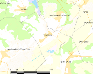
Венерьё
- коммуна во Франции
Hiking in Венерьё
Vénérieu is a small commune located in the Isère department of the Auvergne-Rhône-Alpes region in southeastern France. While it may not be as famous as other hiking destinations, it can offer some charming walking and hiking opportunities, especially for those looking to explore the lesser-known paths of the French countryside....
- Страна:
- Почтовый код: 38460
- Координаты: 45° 39' 33" N, 5° 16' 39" E
- GPS треки (wikiloc): [Ссылка]
- Площадь: 6 кв.км
- Население: 753
- Веб сайт: [Ссылка]


Треп
- коммуна во Франции
Hiking in Треп
Trept is a scenic area located in the eastern part of Germany, particularly known for its beautiful landscapes and walking trails. While it may not be as famous as some other hiking destinations in Germany, there are still plenty of opportunities for outdoor enthusiasts to explore nature and enjoy some hiking....
- Страна:
- Почтовый код: 38460
- Координаты: 45° 41' 12" N, 5° 19' 12" E
- GPS треки (wikiloc): [Ссылка]
- Площадь: 15.87 кв.км
- Население: 2024
- Веб сайт: [Ссылка]

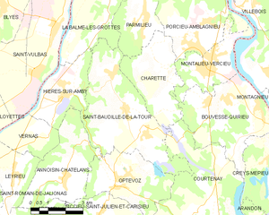
Сен-Бодий-де-ла-Тур
- коммуна во Франции
Hiking in Сен-Бодий-де-ла-Тур
Saint-Baudille-de-la-Tour is a charming commune located in the Isère department in the Auvergne-Rhône-Alpes region of southeastern France. It serves as an excellent starting point for outdoor activities, including hiking, thanks to its scenic landscapes and proximity to the Alps....
- Страна:
- Почтовый код: 38118
- Координаты: 45° 47' 23" N, 5° 20' 18" E
- GPS треки (wikiloc): [Ссылка]
- Площадь: 21.76 кв.км
- Население: 797
- Веб сайт: [Ссылка]


Сент-Илер-де-Бран
- коммуна во Франции
Hiking in Сент-Илер-де-Бран
Saint-Hilaire-de-Brens, located in the Auvergne-Rhône-Alpes region of France, is a small commune that offers a charming backdrop for hikers. The area is characterized by its beautiful landscapes, including gentle hills, rural countryside, and panoramic views....
- Страна:
- Почтовый код: 38460
- Координаты: 45° 40' 20" N, 5° 17' 28" E
- GPS треки (wikiloc): [Ссылка]
- Площадь: 7.52 кв.км
- Население: 608


Паносса
- коммуна во Франции
Hiking in Паносса
It seems like there might be a typo or misunderstanding regarding "Panossas." It doesn't correspond to any well-known hiking destination that I am aware of. However, if you're referring to a specific location, please provide more details or the correct name, and I'll be happy to help you with information about hiking in that area....
- Страна:
- Почтовый код: 38460
- Координаты: 45° 40' 43" N, 5° 12' 15" E
- GPS треки (wikiloc): [Ссылка]
- Площадь: 7.99 кв.км
- Население: 693
- Веб сайт: [Ссылка]


Пармильё
- коммуна во Франции
Hiking in Пармильё
Parmilieu is a charming commune located in the Isère department of the Auvergne-Rhône-Alpes region in southeastern France. The area is characterized by its beautiful natural scenery, which offers excellent opportunities for hiking and outdoor activities. Here are some highlights and tips for hiking in and around Parmilieu:...
- Страна:
- Почтовый код: 38390
- Координаты: 45° 50' 25" N, 5° 21' 18" E
- GPS треки (wikiloc): [Ссылка]
- Площадь: 12.83 кв.км
- Население: 691
- Веб сайт: [Ссылка]


Мора
- коммуна франции - Рона — Альпы, Изер, Ла-Тур-дю-Пен
Hiking in Мора
Moras, a scenic area, offers a variety of hiking opportunities for outdoor enthusiasts. Whether you’re a beginner or an experienced hiker, you’ll find trails that suit your skill level and preferences. Here are some general things to consider about hiking in Moras:...
- Страна:
- Почтовый код: 38460
- Координаты: 45° 41' 14" N, 5° 15' 30" E
- GPS треки (wikiloc): [Ссылка]
- Высота над уровнем моря: 345 м m
- Площадь: 8.32 кв.км
- Население: 503
- Веб сайт: [Ссылка]


Сен-Ромен-де-Жальонас
- коммуна во Франции
Hiking in Сен-Ромен-де-Жальонас
Saint-Romain-de-Jalionas is a charming commune located in the Auvergne-Rhône-Alpes region of France, specifically within the Isère department. While it may not be as widely known as some other hiking destinations, it offers opportunities for those looking to explore the natural beauty of the area....
- Страна:
- Почтовый код: 38460
- Координаты: 45° 45' 11" N, 5° 13' 12" E
- GPS треки (wikiloc): [Ссылка]
- Площадь: 13.65 кв.км
- Население: 3216

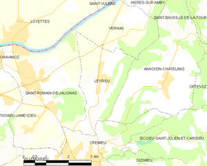
Лерьё
- коммуна во Франции
Hiking in Лерьё
Leyrieu is a charming village located in the Auvergne-Rhône-Alpes region of France. Surrounded by beautiful natural landscapes, it offers several opportunities for hiking and outdoor activities. Here are some key points to consider when hiking in Leyrieu:...
- Страна:
- Почтовый код: 38460
- Координаты: 45° 45' 28" N, 5° 15' 18" E
- GPS треки (wikiloc): [Ссылка]
- Площадь: 6.39 кв.км
- Население: 799

Солеймьё
- коммуна во Франции
Hiking in Солеймьё
Soleymieu, located in the Auvergne-Rhône-Alpes region of France, offers a delightful environment for hiking enthusiasts with its picturesque landscapes and varied terrains. Here are some key points to consider when planning a hike in Soleymieu:...
- Страна:
- Почтовый код: 38460
- Координаты: 45° 42' 35" N, 5° 20' 59" E
- GPS треки (wikiloc): [Ссылка]
- Площадь: 13.36 кв.км
- Население: 776


Кремьё
- коммуна во Франции
Hiking in Кремьё
Crémieu is a charming medieval town located in the Auvergne-Rhône-Alpes region of France, just northwest of Lyon. It offers a wonderful setting for hikers, combining historical sights with beautiful natural landscapes. Here are some key points about hiking in and around Crémieu:...
- Страна:
- Почтовый код: 38460
- Координаты: 45° 43' 29" N, 5° 15' 5" E
- GPS треки (wikiloc): [Ссылка]
- Высота над уровнем моря: 415 м m
- Площадь: 6.14 кв.км
- Население: 3312
- Веб сайт: [Ссылка]


Вильмуарьё
- коммуна во Франции
Hiking in Вильмуарьё
Villemoirieu is a charming commune located in the Isère department of the Auvergne-Rhône-Alpes region in southeastern France. It’s nestled near the foothills of the Alps and offers various hiking opportunities for outdoor enthusiasts. Here’s what you can expect when hiking in and around Villemoirieu:...
- Страна:
- Почтовый код: 38460
- Координаты: 45° 42' 57" N, 5° 14' 12" E
- GPS треки (wikiloc): [Ссылка]
- Площадь: 13.29 кв.км
- Население: 1883
- Веб сайт: [Ссылка]

Иер-сюр-Амби
- коммуна во Франции
Hiking in Иер-сюр-Амби
Hières-sur-Amby is a charming commune located in the Isère department in the Auvergne-Rhône-Alpes region of France. It’s surrounded by natural beauty and offers various hiking opportunities, making it a great destination for outdoor enthusiasts....
- Страна:
- Почтовый код: 38118
- Координаты: 45° 47' 51" N, 5° 17' 38" E
- GPS треки (wikiloc): [Ссылка]
- Высота над уровнем моря: 429 м m
- Площадь: 8.73 кв.км
- Население: 1245
- Веб сайт: [Ссылка]
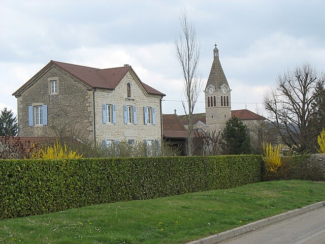
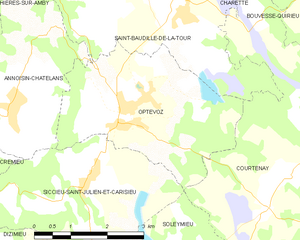
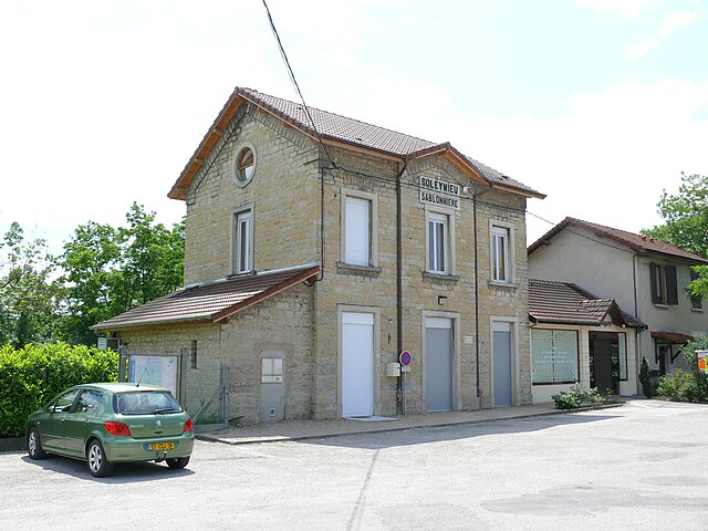
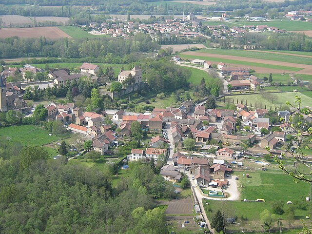
Оптевоз
- коммуна во Франции
Hiking in Оптевоз
Optevoz is a charming commune in the Isère department of the Auvergne-Rhône-Alpes region in southeastern France. While it may not be one of the most famous hiking destinations, it offers a beautiful backdrop for outdoor activities, including hiking, especially if you enjoy picturesque views and a more tranquil setting away from larger tourist crowds....
- Страна:
- Почтовый код: 38460
- Координаты: 45° 45' 9" N, 5° 19' 53" E
- GPS треки (wikiloc): [Ссылка]
- Площадь: 12 кв.км
- Население: 829
- Веб сайт: [Ссылка]


Тиньё-Жамезьё
- коммуна во Франции
Hiking in Тиньё-Жамезьё
Tignieu-Jameyzieu, located in the Auvergne-Rhône-Alpes region of southeastern France, offers a variety of outdoor activities, including hiking. The area is characterized by its beautiful landscapes and proximity to nature, making it a lovely destination for hikers of all levels....
- Страна:
- Почтовый код: 38230
- Координаты: 45° 44' 2" N, 5° 11' 14" E
- GPS треки (wikiloc): [Ссылка]
- Площадь: 13.32 кв.км
- Население: 6948
- Веб сайт: [Ссылка]


Фронтонас
- коммуна во Франции
Hiking in Фронтонас
Frontonas, located in the Auvergne-Rhône-Alpes region of France, is a charming town that offers a unique hiking experience. The surrounding natural landscape features rolling hills, forests, and picturesque views, making it an ideal destination for outdoor enthusiasts looking to explore trails off the beaten path....
- Страна:
- Почтовый код: 38290
- Координаты: 45° 38' 56" N, 5° 11' 3" E
- GPS треки (wikiloc): [Ссылка]
- Площадь: 12.65 кв.км
- Население: 2030
- Веб сайт: [Ссылка]


Сиксьё-Сен-Жюльен-э-Каризьё
- коммуна во Франции
Hiking in Сиксьё-Сен-Жюльен-э-Каризьё
Siccieu-Saint-Julien-et-Carisieu is a picturesque commune located in the Isère department of the Auvergne-Rhône-Alpes region in southeastern France. It is surrounded by beautiful landscapes that offer excellent hiking opportunities. Here are some insights into hiking in this region:...
- Страна:
- Почтовый код: 38460
- Координаты: 45° 44' 6" N, 5° 18' 58" E
- GPS треки (wikiloc): [Ссылка]
- Высота над уровнем моря: 335 м m
- Площадь: 14.22 кв.км
- Население: 600


Шозо
- коммуна во Франции
Hiking in Шозо
Chozeau, a small commune in the Isère department of the Auvergne-Rhône-Alpes region in France, offers various opportunities for hiking enthusiasts. While Chozeau itself may not be as widely known for hiking as some larger destinations, its surrounding areas provide scenic trails and beautiful landscapes, ideal for outdoor activities....
- Страна:
- Почтовый код: 38460
- Координаты: 45° 41' 47" N, 5° 12' 27" E
- GPS треки (wikiloc): [Ссылка]
- Площадь: 8.2 кв.км
- Население: 1053
- Веб сайт: [Ссылка]