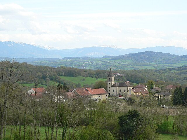
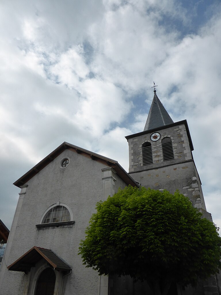
Chênex (Chênex)

- коммуна во Франции
 Hiking in Chênex
Chênex is a picturesque village located in the Haute-Savoie region of France, near Lake Geneva and the foothills of the Alps. While it may not be as well-known as some other hiking destinations, it offers access to beautiful natural landscapes and scenic trails. Here are some highlights and tips for hiking in and around Chênex:
Hiking Trails
-
Local Trails: The area around Chênex features several well-marked hiking trails that offer views of the surrounding mountains and Lake Geneva. Trails may range from easy walks to more challenging hikes, making it suitable for hikers of all skill levels.
-
Nearby Parks and Natural Areas: Consider exploring nearby parks, such as the Regional Natural Park of the Massif des Bauges or the Aravis Mountains. These parks provide more extensive hiking options with varied terrain and stunning vistas.
-
Lake Geneva Trails: The trails along the shores of Lake Geneva offer a more relaxed hiking experience. You can enjoy views of the lake and the Alps while walking through charming villages and towns.
What to Bring
- Appropriate Footwear: A good pair of hiking boots or shoes is essential, especially if you're tackling uneven terrain.
- Clothing: Dress in layers, as mountain weather can change quickly. Waterproof jackets are advisable.
- Navigation Tools: Maps, a compass, or a GPS device can be helpful, especially if you're venturing into less-marked trails.
- Water and Snacks: Stay hydrated and bring snacks for energy, especially on longer hikes.
Best Time to Hike
- The best times for hiking in the Chênex area are during spring and early autumn when the weather is generally mild. Summer can be hot, and winter may bring snow, which can limit some trails unless you’re equipped for winter hiking.
Local Amenities
- Chênex has local amenities like restaurants and shops where you can find food and supplies before or after your hike.
Safety Tips
- Always inform someone about your hiking plans and expected return time.
- Be aware of wildlife and local flora. Familiarize yourself with any potential hazards, such as steep inclines or rocky paths.
Hiking around Chênex can be a serene escape with breathtaking views and a chance to enjoy the natural beauty of the French Alps. Enjoy your hiking adventure!
- Страна:

- Почтовый код: 74520
- Координаты: 46° 6' 18" N, 5° 59' 42" E


- GPS треки (wikiloc): [Ссылка]
- Площадь: 5.38 кв.км
- Население: 806
- Веб сайт: http://www.chenex.fr
- Википедия английская: wiki(en)
- Википедия национальная: wiki(fr)
- Хранилище Wikidata: Wikidata: Q766926
- Катеория в википедии: [Ссылка]
- код Freebase: [/m/03ntys0]
- код GeoNames: Альт: [6451040]
- номер SIREN: [217400696]
- код муниципалитета INSEE: 74069
Граничит с регионами:

Jonzier-Épagny
- коммуна во Франции
Hiking in Jonzier-Épagny
Jonzier-Épagny, located in the Haute-Savoie region of France, offers an intimate hiking experience with stunning views of the surrounding landscapes, including the nearby Mont Blanc massif. Here are some key points to consider if you’re planning a hiking trip in this area:...
- Страна:
- Почтовый код: 74520
- Координаты: 46° 4' 14" N, 5° 59' 23" E
- GPS треки (wikiloc): [Ссылка]
- Площадь: 7.16 кв.км
- Население: 755


Viry
- коммуна во Франции
Hiking in Viry
Viry, located in the Haute-Savoie region of France, is a beautiful area that offers a variety of hiking opportunities for both beginners and experienced trekkers. The region is characterized by its stunning alpine scenery, lush forests, and picturesque views of the surrounding mountains, including the iconic Mont Blanc....
- Страна:
- Почтовый код: 74580
- Координаты: 46° 7' 3" N, 6° 2' 15" E
- GPS треки (wikiloc): [Ссылка]
- Площадь: 26.16 кв.км
- Население: 4806


Vers, Haute-Savoie
- коммуна во Франции
Hiking in Vers, Haute-Savoie
Hiking in Vers, located in the Haute-Savoie region of France, offers a unique experience characterized by stunning alpine scenery, diverse trails, and rich natural beauty. The region is part of the French Alps, making it an excellent destination for both beginners and experienced hikers....
- Страна:
- Почтовый код: 74160
- Координаты: 46° 5' 30" N, 6° 1' 18" E
- GPS треки (wikiloc): [Ссылка]
- Площадь: 5.91 кв.км
- Население: 812


Dingy-en-Vuache
- коммуна во Франции
Hiking in Dingy-en-Vuache
Dingy-en-Vuache, located in the Haute-Savoie region of southeastern France, offers stunning landscapes and various hiking opportunities. Nestled on the edge of the Vuache mountain range, the area is known for its beautiful natural scenery, including rolling hills, dense forests, and panoramic views of the surrounding valleys and mountains....
- Страна:
- Почтовый код: 74520
- Координаты: 46° 5' 31" N, 5° 56' 41" E
- GPS треки (wikiloc): [Ссылка]
- Площадь: 7.18 кв.км
- Население: 643
- Веб сайт: [Ссылка]

Valleiry
- коммуна во Франции
Hiking in Valleiry
Valleiry, located in the Haute-Savoie region of France, is a charming area close to the borders of Switzerland. While it may not be as well-known as some other hiking destinations in the Alps, it offers several trails that cater to various skill levels and preferences....
- Страна:
- Почтовый код: 74520
- Координаты: 46° 6' 29" N, 5° 58' 5" E
- GPS треки (wikiloc): [Ссылка]
- Площадь: 6.95 кв.км
- Население: 4360
- Веб сайт: [Ссылка]