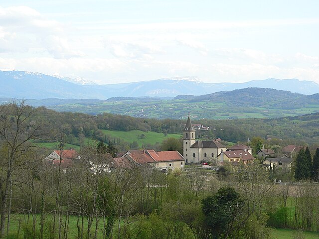
Vers, Haute-Savoie (Vers)

- коммуна во Франции
 Hiking in Vers, Haute-Savoie
Hiking in Vers, located in the Haute-Savoie region of France, offers a unique experience characterized by stunning alpine scenery, diverse trails, and rich natural beauty. The region is part of the French Alps, making it an excellent destination for both beginners and experienced hikers.
Key Points About Hiking in Vers, Haute-Savoie:
-
Scenic Trails: The area around Vers is dotted with several trails that vary in difficulty and length. You can explore gentle walks suitable for families, as well as more challenging routes for seasoned hikers.
-
Breathtaking Views: Many trails offer panoramic views of Mont Blanc and the surrounding peaks. The alpine landscape is filled with lush forests, meadows, and sometimes even glimpses of local wildlife.
-
Local Flora and Fauna: The Haute-Savoie region is home to a diverse range of plant and animal species. Hikers can enjoy the unique alpine ecosystems and might even spot ibexes or chamois along the trails.
-
Access to Other Hiking Areas: Vers serves as a great starting point for exploring nearby national parks and reserves, such as the Aiguilles Rouges Natural Reserve and the Sixt-Fer-à-Cheval Nature Reserve, which showcase more dramatic mountain landscapes and numerous hiking options.
-
Trail Markings: Most trails in the area are well marked with the traditional French trail markers (red and white or yellow), making navigation easier for hikers.
-
Seasonal Considerations: The best hiking season generally runs from late spring to early fall (May to October), allowing hikers to enjoy the full range of mountain wildflowers and pleasant weather. However, trails may be snow-covered in late spring or early fall, so checking local conditions before heading out is advised.
-
Safety Tips: As with all mountain hiking, it's essential to prepare adequately. Bring enough water, snacks, a map, and suitable clothing for changing weather conditions. If you're unfamiliar with the area, consider hiking with a guide or joining local hiking groups.
-
Cultural and Historical Sites: Besides the natural beauty, visitors can also appreciate the cultural and historical aspects of the area, including local architecture, traditional villages, and mountain huts.
Whether you're looking for a peaceful day hike or an adventurous multi-day trek, Vers in Haute-Savoie has something to offer for every type of hiker. Always ensure to check local guides or visitor centers for the best and most up-to-date trail information. Happy hiking!
- Страна:

- Почтовый код: 74160
- Координаты: 46° 5' 30" N, 6° 1' 18" E


- GPS треки (wikiloc): [Ссылка]
- Площадь: 5.91 кв.км
- Население: 812
- Википедия английская: wiki(en)
- Википедия национальная: wiki(fr)
- Хранилище Wikidata: Wikidata: Q781817
- Катеория в википедии: [Ссылка]
- код Freebase: [/m/03nt_6s]
- код GeoNames: Альт: [6453490]
- номер SIREN: [217402965]
- код BNF: [15274549b]
- код муниципалитета INSEE: 74296
Граничит с регионами:

Jonzier-Épagny
- коммуна во Франции
Hiking in Jonzier-Épagny
Jonzier-Épagny, located in the Haute-Savoie region of France, offers an intimate hiking experience with stunning views of the surrounding landscapes, including the nearby Mont Blanc massif. Here are some key points to consider if you’re planning a hiking trip in this area:...
- Страна:
- Почтовый код: 74520
- Координаты: 46° 4' 14" N, 5° 59' 23" E
- GPS треки (wikiloc): [Ссылка]
- Площадь: 7.16 кв.км
- Население: 755


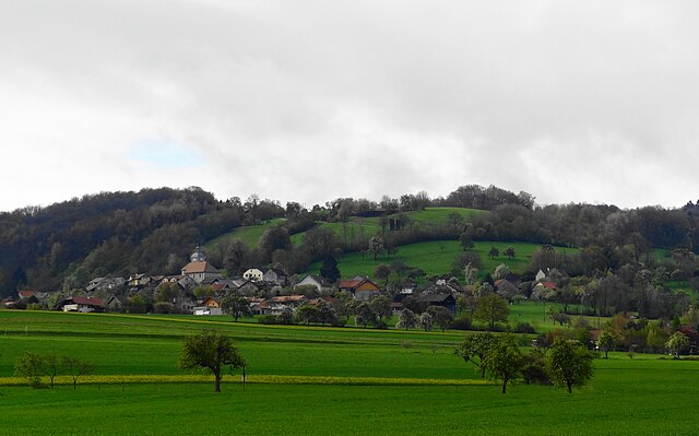
Cernex
- коммуна во Франции
Hiking in Cernex
Cernex is a picturesque village located in the Haute-Savoie region of France, close to the French Alps. While it may not be as widely recognized as some famous hiking destinations, it offers access to stunning natural landscapes and outdoor activities. Here are some insights into hiking in and around Cernex:...
- Страна:
- Почтовый код: 74350
- Координаты: 46° 3' 51" N, 6° 3' 3" E
- GPS треки (wikiloc): [Ссылка]
- Площадь: 12.66 кв.км
- Население: 974
- Веб сайт: [Ссылка]


Andilly
- коммуна во Франции
Hiking in Andilly
Andilly, located in the Haute-Savoie region of southeastern France, is surrounded by stunning landscapes and offers various hiking opportunities that cater to different skill levels and preferences. The region is part of the French Alps, known for its breathtaking mountain scenery, lakes, and charming alpine villages....
- Страна:
- Почтовый код: 74350
- Координаты: 46° 3' 22" N, 6° 3' 50" E
- GPS треки (wikiloc): [Ссылка]
- Площадь: 6.07 кв.км
- Население: 855
- Веб сайт: [Ссылка]
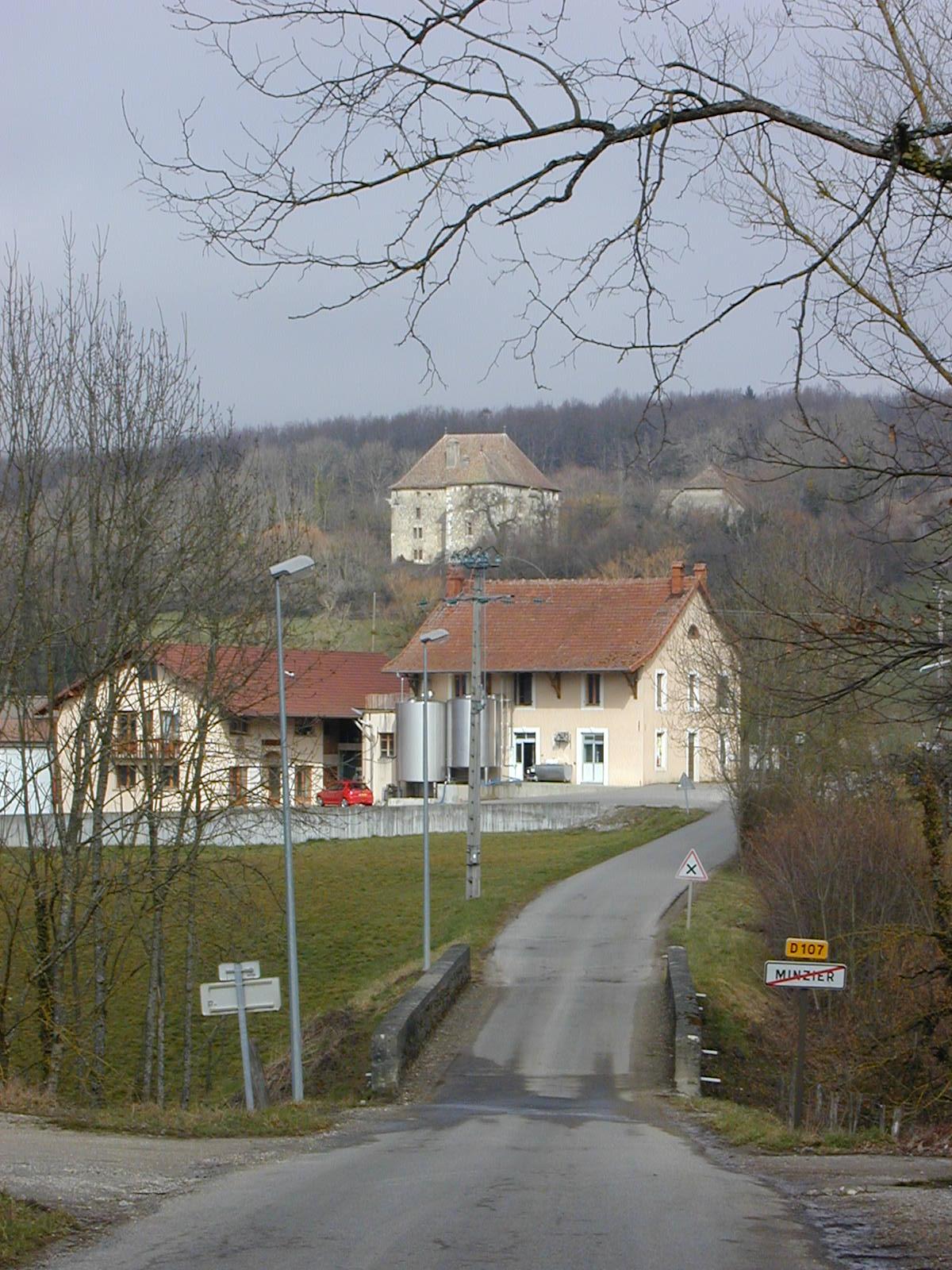

Minzier
- коммуна во Франции
Hiking in Minzier
Minzier is a beautiful location in the Haute-Savoie region of France, nestled in the French Alps. Known for its stunning natural landscapes, it's a great destination for hiking enthusiasts. Here are some details to consider if you're planning a hike in Minzier:...
- Страна:
- Почтовый код: 74270
- Координаты: 46° 3' 10" N, 5° 59' 20" E
- GPS треки (wikiloc): [Ссылка]
- Площадь: 8.79 кв.км
- Население: 976


Viry
- коммуна во Франции
Hiking in Viry
Viry, located in the Haute-Savoie region of France, is a beautiful area that offers a variety of hiking opportunities for both beginners and experienced trekkers. The region is characterized by its stunning alpine scenery, lush forests, and picturesque views of the surrounding mountains, including the iconic Mont Blanc....
- Страна:
- Почтовый код: 74580
- Координаты: 46° 7' 3" N, 6° 2' 15" E
- GPS треки (wikiloc): [Ссылка]
- Площадь: 26.16 кв.км
- Население: 4806


Chênex
- коммуна во Франции
Hiking in Chênex
Chênex is a picturesque village located in the Haute-Savoie region of France, near Lake Geneva and the foothills of the Alps. While it may not be as well-known as some other hiking destinations, it offers access to beautiful natural landscapes and scenic trails. Here are some highlights and tips for hiking in and around Chênex:...
- Страна:
- Почтовый код: 74520
- Координаты: 46° 6' 18" N, 5° 59' 42" E
- GPS треки (wikiloc): [Ссылка]
- Площадь: 5.38 кв.км
- Население: 806
- Веб сайт: [Ссылка]

Présilly
- коммуна во Франции
Hiking in Présilly
Présilly, located in the Haute-Savoie region of France, offers a variety of hiking opportunities amidst stunning Alpine scenery. This picturesque village is well-positioned near the French-Swiss border, providing access to beautiful trails and natural landscapes....
- Страна:
- Почтовый код: 74160
- Координаты: 46° 5' 35" N, 6° 4' 40" E
- GPS треки (wikiloc): [Ссылка]
- Площадь: 8.66 кв.км
- Население: 774