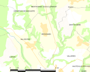
Crempigny-Bonneguête (Crempigny-Bonneguête)

- коммуна во Франции
 Hiking in Crempigny-Bonneguête
Crempigny-Bonneguête is a charming commune located in the Auvergne-Rhône-Alpes region of France, nestled in the beautiful countryside. While it may not be as well-known as some other hiking destinations in France, it offers opportunities for nature lovers and hikers to explore scenic trails, indulge in local flora and fauna, and enjoy the serenity of the area.
Hiking in Crempigny-Bonneguête:
-
Trails: The area around Crempigny-Bonneguête features a variety of trails that cater to different skill levels. Whether you are a novice hiker or an experienced trekker, you can find paths that fit your preferences. The trails often provide stunning views of the countryside, rolling hills, and nearby forests.
-
Flora and Fauna: The region is home to a diverse range of plant and animal species, making it an excellent spot for nature enthusiasts. Take your time to observe the local wildlife and enjoy the natural beauty of the area.
-
Nearby Natural Attractions: Depending on your hiking route, you may find yourself near rivers, lakes, or other natural features that are perfect for taking a break or enjoying a picnic.
-
Seasonal Considerations: Spring and early autumn are particularly lovely times to hike in the region, offering mild weather and beautiful landscapes. Depending on the season, you might encounter wildflowers in bloom or vibrant fall colors.
-
Local Culture: As you hike, take a moment to appreciate the local culture. The region has a rich history and is known for its charming villages, traditional architecture, and agricultural landscapes. Engaging with the local community can enhance your hiking experience.
When planning your hike in Crempigny-Bonneguête, be sure to check local maps and guides for detailed trail information, and consider stopping by a visitor center for updates on trail conditions and recommendations. Enjoy your adventure in this beautiful French countryside!
- Страна:

- Почтовый код: 74150
- Координаты: 45° 57' 6" N, 5° 54' 11" E


- GPS треки (wikiloc): [Ссылка]
- Площадь: 5.82 кв.км
- Население: 308
- Веб сайт: http://www.crempigny-bonneguete.fr
- Википедия английская: wiki(en)
- Википедия национальная: wiki(fr)
- Хранилище Wikidata: Wikidata: Q828234
- Катеория в википедии: [Ссылка]
- код Freebase: [/m/03ntxn8]
- код GeoNames: Альт: [6617608]
- номер SIREN: [217400951]
- код BNF: [152743531]
- код муниципалитета INSEE: 74095
Граничит с регионами:


Menthonnex-sous-Clermont
- коммуна во Франции
Hiking in Menthonnex-sous-Clermont
Menthonnex-sous-Clermont, located in the Auvergne-Rhône-Alpes region of France, offers a variety of hiking opportunities for outdoor enthusiasts. The area is characterized by its beautiful natural landscapes, including rolling hills, forests, and panoramic views of the surrounding mountains....
- Страна:
- Почтовый код: 74270
- Координаты: 45° 57' 57" N, 5° 56' 9" E
- GPS треки (wikiloc): [Ссылка]
- Площадь: 10.14 кв.км
- Население: 676


Clermont
Hiking in Clermont
Clermont, located in the Haute-Savoie region of France, is surrounded by stunning mountainous landscapes, making it a great base for hiking enthusiasts. Here are some key features about hiking in and around Clermont:...
- Страна:
- Почтовый код: 74270
- Координаты: 45° 58' 19" N, 5° 54' 29" E
- GPS треки (wikiloc): [Ссылка]
- Площадь: 6.98 кв.км
- Население: 408

Versonnex, Haute-Savoie
Hiking in Versonnex, Haute-Savoie
Versonnex is a charming village in the Haute-Savoie region of the French Alps, known for its picturesque landscapes and proximity to nature. Here are some key points about hiking in and around Versonnex:...
- Страна:
- Почтовый код: 74150
- Координаты: 45° 55' 45" N, 5° 55' 37" E
- GPS треки (wikiloc): [Ссылка]
- Площадь: 4.18 кв.км
- Население: 610


Droisy
- коммуна во Франции
Hiking in Droisy
Droisy is a small commune located in the Haute-Savoie department in the Auvergne-Rhône-Alpes region of southeastern France. Nestled in the stunning French Alps, it offers a variety of hiking opportunities that allow you to explore both its natural beauty and cultural heritage....
- Страна:
- Почтовый код: 74270
- Координаты: 45° 57' 54" N, 5° 52' 58" E
- GPS треки (wikiloc): [Ссылка]
- Площадь: 4.55 кв.км
- Население: 164

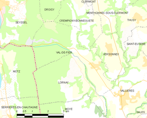
Val-de-Fier
- коммуна во Франции
Hiking in Val-de-Fier
Val-de-Fier is a beautiful natural area located in the French Alps, specifically in the Haute-Savoie region. It is known for its stunning landscapes, diverse flora and fauna, and a variety of hiking trails suitable for different skill levels. Here are some key points and tips for hiking in Val-de-Fier:...
- Страна:
- Почтовый код: 74150
- Координаты: 45° 55' 30" N, 5° 54' 18" E
- GPS треки (wikiloc): [Ссылка]
- Площадь: 10.11 кв.км
- Население: 666
- Веб сайт: [Ссылка]