
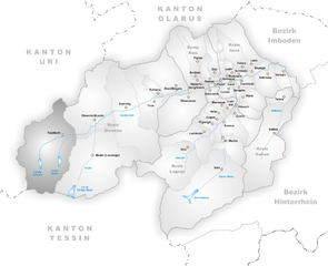
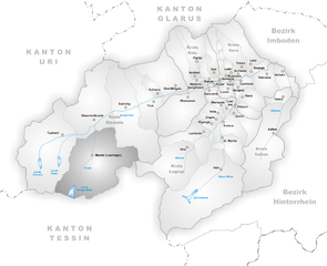
Дисентис (Disentis/Mustér, Disentis/Mustér)

- курорт в Швейцарии
 Hiking in Дисентис
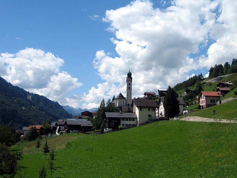
Disentis, located in the Swiss Canton of Graubünden, is a fantastic destination for hiking enthusiasts. This region is known for its breathtaking Alpine scenery, diverse landscapes, and rich cultural heritage. Here are some key points to consider when planning a hiking trip in Disentis:
Hiking Trails
-
Variety of Trails: Disentis offers a range of trails suitable for all skill levels, from easy walks to challenging mountain hikes. Whether you are a beginner or a seasoned hiker, you’ll find options that fit your experience.
-
Scenic Routes: Many trails lead you through stunning landscapes, including lush meadows, rocky terrain, and forests. The views of the surrounding mountains, such as the Benedictine Monastery of Disentis, add to the experience.
-
Popular Hikes:
- Oberalp Pass to Disentis: A scenic hike that showcases the beauty of the region, combining panoramic views with an opportunity to see various flora and fauna.
- Via Uff der Griess: A hike that involves moving through picturesque alpine landscapes, offering both a physical challenge and a visual feast.
- St. Gotthard Route: Part of the historical route linking the north and south of Switzerland, this trail provides significant cultural insights along with beautiful scenery.
Best Times to Go
- Summer and Early Autumn: The best time to hike in Disentis is typically from late June to early October, when the weather is milder, and most of the trails are accessible.
- Weather Considerations: Always check the local weather forecast before heading out, as conditions can change rapidly in the mountains.
Equipment and Safety
- Proper Gear: Wear appropriate hiking boots and clothing. Bring along layered clothing, as temperatures can fluctuate significantly throughout the day.
- Map and Compass: It’s advisable to carry a map or GPS device, especially for more remote trails, as signage can vary.
Accommodation and Support
- Mountain Huts and Refuges: Along some trails, you’ll find mountain huts where you can rest and enjoy local cuisine. They can be a great way to experience the regional culture.
- Local Guides: Hiring a local guide can enhance your experience, providing insights into the natural environment and cultural landmarks.
Transportation
- Getting There: Disentis is accessible by train and car, making it relatively easy to reach from major Swiss cities. The scenic train rides contribute to the overall experience of exploring the area.
Conclusion
Hiking in Disentis is a rewarding experience for nature lovers and adventure seekers alike. With stunning landscapes, a variety of trails, and a rich cultural backdrop, you’ll find plenty to explore and enjoy in this beautiful Swiss region. Be sure to prepare adequately and respect the natural environment while you hike. Happy trails!
- Страна:

- Почтовый код: 7180
- Телефонный код: 081
- Код автомобильного номера: GR
- Координаты: 46° 44' 3" N, 8° 50' 51" E


- GPS треки (wikiloc): [Ссылка]
- Высота над уровнем моря: 1130 м m
- Площадь: 90.98 кв.км
- Население: 2092
- Веб сайт: http://www.disentis.ch
- Википедия русская: wiki(ru)
- Википедия английская: wiki(en)
- Википедия национальная: wiki(de)
- Хранилище Wikidata: Wikidata: Q68347
- Катеория в википедии: [Ссылка]
- код Freebase: [/m/0866n6]
- код GeoNames: Альт: [2661009]
- код BNF: [12078676q]
- код VIAF: Альт: [132978748]
- ID отношения в OpenStreetMap: [1684070]
- идентификатор местоположения ArchINFORM: [8704]
- идентификатор HDS: [1614]
- код швейцарского муниципалитета: [3982]
- LIR: [1959]
Граничит с регионами:

Туеч
Hiking in Туеч
Tujetsch is a beautiful municipality located in the canton of Graubünden in Switzerland, known for its stunning landscapes and outdoor recreational opportunities. Hiking in Tujetsch offers a variety of trails suitable for different skill levels, ranging from leisurely walks to more challenging hikes. Here are some highlights and tips for hiking in this picturesque region:...
- Страна:
- Почтовый код: 7188
- Телефонный код: 081
- Код автомобильного номера: GR
- Координаты: 46° 40' 59" N, 8° 46' 0" E
- GPS треки (wikiloc): [Ссылка]
- Высота над уровнем моря: 1450 м m
- Площадь: 134 кв.км
- Население: 1256
- Веб сайт: [Ссылка]

Медель
Hiking in Медель
Medel, located in the municipality of Lucmagn in the Canton of Graubünden, Switzerland, is a stunning area for hiking enthusiasts. The region is characterized by its picturesque landscapes, including dramatic mountains, lush valleys, and tranquil lakes. Here are some key points to consider when planning your hiking trip to Medel:...
- Страна:
- Почтовый код: 7184
- Телефонный код: 081
- Код автомобильного номера: GR
- Координаты: 46° 37' 59" N, 8° 49' 59" E
- GPS треки (wikiloc): [Ссылка]
- Высота над уровнем моря: 1332 м m
- Площадь: 136.22 кв.км
- Население: 384
- Веб сайт: [Ссылка]

Сумвич
Hiking in Сумвич
Sumvitg, located in the Canton of Graubünden in Switzerland, is a charming village that offers stunning landscapes and a variety of hiking opportunities. The region is characterized by its beautiful valleys, alpine meadows, and stunning mountain vistas....
- Страна:
- Почтовый код: 7175
- Телефонный код: 081
- Код автомобильного номера: GR
- Координаты: 46° 42' 59" N, 8° 55' 59" E
- GPS треки (wikiloc): [Ссылка]
- Высота над уровнем моря: 1056 м m
- Площадь: 101.88 кв.км
- Население: 1179
- Веб сайт: [Ссылка]

Зиленен
- коммуна в Швейцарии, в кантоне Ури
Hiking in Зиленен
Silenen, a charming municipality in the canton of Uri, Switzerland, is an excellent destination for hiking enthusiasts. Nestled in a picturesque valley, Silenen offers breathtaking views of the surrounding mountains and is a great starting point for various hiking trails suitable for all levels of experience....
- Страна:
- Почтовый код: 6473
- Телефонный код: 041
- Код автомобильного номера: UR
- Координаты: 46° 47' 28" N, 8° 40' 9" E
- GPS треки (wikiloc): [Ссылка]
- Высота над уровнем моря: 510 м m
- Площадь: 144.78 кв.км
- Население: 1991
- Веб сайт: [Ссылка]

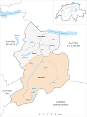
Glarus Süd
Hiking in Glarus Süd
Glarus Süd, located in the canton of Glarus in Switzerland, is a fantastic destination for hiking enthusiasts. This region boasts stunning landscapes, ranging from lush valleys to rugged mountain terrains. Here are some key points about hiking in Glarus Süd:...
- Страна:
- Почтовый код: 8756, 8762, 8765, 8766, 8767, 8772, 8773, 8774, 8775, 8777, 8782, 8783, 8784
- Телефонный код: 055
- Код автомобильного номера: GL
- Координаты: 46° 59' 40" N, 9° 4' 27" E
- GPS треки (wikiloc): [Ссылка]
- Высота над уровнем моря: 521 м m
- Площадь: 430.2 кв.км
- Население: 9581
- Веб сайт: [Ссылка]