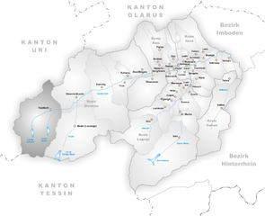
Медель (Medel, Medel)
.png)
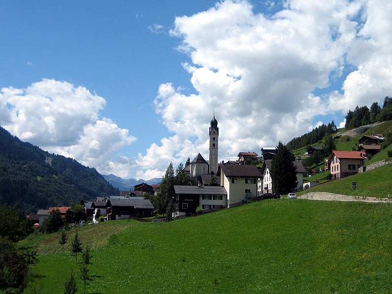
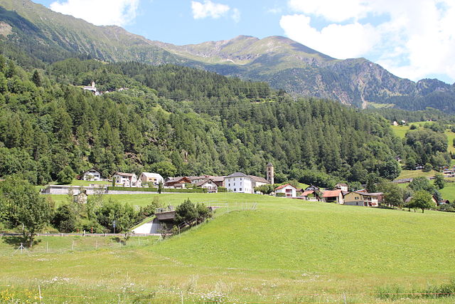
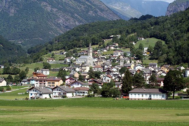
 Hiking in Медель
Medel, located in the municipality of Lucmagn in the Canton of Graubünden, Switzerland, is a stunning area for hiking enthusiasts. The region is characterized by its picturesque landscapes, including dramatic mountains, lush valleys, and tranquil lakes. Here are some key points to consider when planning your hiking trip to Medel:
Trails and Routes
-
Hiking Trails: Medel offers a variety of hiking trails suitable for different skill levels, from easy walks to challenging mountain hikes. Popular routes include:
- Medelsersee: A beautiful alpine lake that can be accessed via a moderately challenging hike. The views of the surrounding peaks are breathtaking.
- Val Medel: This valley features numerous trails that allow you to explore its natural beauty and is great for both experienced hikers and families.
-
Elevation: Many trails in the area reach significant elevations, providing panoramic views of the Swiss Alps. Ensure you are prepared for altitude changes.
-
Scenic Spots: Besides lakes, you’ll encounter stunning viewpoints, waterfalls, and possibly some wildlife along the trails. The flora and fauna in the region can be quite enchanting.
Difficulty Levels
- Easy: Family-friendly trails with gentle elevation changes.
- Moderate: Trails that may involve some steeper sections but are manageable for most hikers.
- Challenging: Routes that require good fitness, experience, and sometimes technical skills, particularly in rocky terrain.
Best Time to Visit
- Summer: June to September is ideal for hiking, as the weather is generally mild and trails are mostly snow-free.
- Autumn: September and October can offer stunning fall colors, but be cautious of changing weather conditions.
Safety Tips
- Weather: Always check the weather forecast before heading out and be prepared for sudden changes in weather conditions.
- Equipment: Wear sturdy hiking boots, and bring plenty of water, snacks, a map or GPS, and a first aid kit.
- Guided Tours: If you are unfamiliar with the area or new to hiking, consider joining a guided hiking tour to gain insight into local geology, flora, and fauna.
Local Amenities
- Accommodations: Look for local guesthouses or hotels in Lucmagn for a cozy stay. Campsites may also be available for those who prefer a more rustic experience.
- Restaurants: After a long day of hiking, enjoy some local Swiss cuisine in the restaurants in the area.
Conclusion
Hiking in Medel (Lucmagn) undoubtedly offers a memorable experience for adventurers seeking to connect with nature in one of Switzerland's most beautiful regions. Just remember to plan ahead, respect the natural environment, and enjoy your time out on the trails!
- Страна:

- Почтовый код: 7184
- Телефонный код: 081
- Код автомобильного номера: GR
- Координаты: 46° 37' 59" N, 8° 49' 59" E


- GPS треки (wikiloc): [Ссылка]
- Высота над уровнем моря: 1332 м m
- Площадь: 136.22 кв.км
- Население: 384
- Веб сайт: http://www.medel.ch
- Википедия русская: wiki(ru)
- Википедия английская: wiki(en)
- Википедия национальная: wiki(de)
- Хранилище Wikidata: Wikidata: Q64925
- Катеория в википедии: [Ссылка]
Граничит с регионами:

Туеч
Hiking in Туеч
Tujetsch is a beautiful municipality located in the canton of Graubünden in Switzerland, known for its stunning landscapes and outdoor recreational opportunities. Hiking in Tujetsch offers a variety of trails suitable for different skill levels, ranging from leisurely walks to more challenging hikes. Here are some highlights and tips for hiking in this picturesque region:...
- Страна:
- Почтовый код: 7188
- Телефонный код: 081
- Код автомобильного номера: GR
- Координаты: 46° 40' 59" N, 8° 46' 0" E
- GPS треки (wikiloc): [Ссылка]
- Высота над уровнем моря: 1450 м m
- Площадь: 134 кв.км
- Население: 1256
- Веб сайт: [Ссылка]

Сумвич
Hiking in Сумвич
Sumvitg, located in the Canton of Graubünden in Switzerland, is a charming village that offers stunning landscapes and a variety of hiking opportunities. The region is characterized by its beautiful valleys, alpine meadows, and stunning mountain vistas....
- Страна:
- Почтовый код: 7175
- Телефонный код: 081
- Код автомобильного номера: GR
- Координаты: 46° 42' 59" N, 8° 55' 59" E
- GPS треки (wikiloc): [Ссылка]
- Высота над уровнем моря: 1056 м m
- Площадь: 101.88 кв.км
- Население: 1179
- Веб сайт: [Ссылка]

Quinto
Hiking in Quinto
Quinto is a picturesque village located in the southern part of Switzerland, specifically in the Ticino canton. This area is renowned for its stunning landscapes, rich natural diversity, and variety of hiking trails. Here are some highlights for hiking in and around Quinto:...
- Страна:
- Почтовый код: 6777
- Телефонный код: 091
- Код автомобильного номера: TI
- Координаты: 46° 31' 0" N, 8° 42' 0" E
- GPS треки (wikiloc): [Ссылка]
- Высота над уровнем моря: 1915 м m
- Площадь: 75.2 кв.км
- Население: 1044
- Веб сайт: [Ссылка]


Дисентис
- курорт в Швейцарии
Hiking in Дисентис
Disentis, located in the Swiss Canton of Graubünden, is a fantastic destination for hiking enthusiasts. This region is known for its breathtaking Alpine scenery, diverse landscapes, and rich cultural heritage. Here are some key points to consider when planning a hiking trip in Disentis:...
- Страна:
- Почтовый код: 7180
- Телефонный код: 081
- Код автомобильного номера: GR
- Координаты: 46° 44' 3" N, 8° 50' 51" E
- GPS треки (wikiloc): [Ссылка]
- Высота над уровнем моря: 1130 м m
- Площадь: 90.98 кв.км
- Население: 2092
- Веб сайт: [Ссылка]

Blenio
Hiking in Blenio
Blenio Valley, located in the Ticino region of Switzerland, offers a variety of hiking opportunities set against the backdrop of breathtaking landscapes. Here are some key points about hiking in Blenio:...
- Страна:
- Почтовый код: 6717, 6718, 6719, 6720
- Телефонный код: 091
- Код автомобильного номера: TI
- Координаты: 46° 32' 0" N, 8° 57' 0" E
- GPS треки (wikiloc): [Ссылка]
- Высота над уровнем моря: 902 м m
- Площадь: 263.9 кв.км
- Население: 1826
- Веб сайт: [Ссылка]