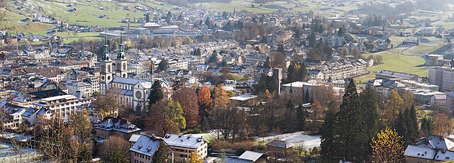
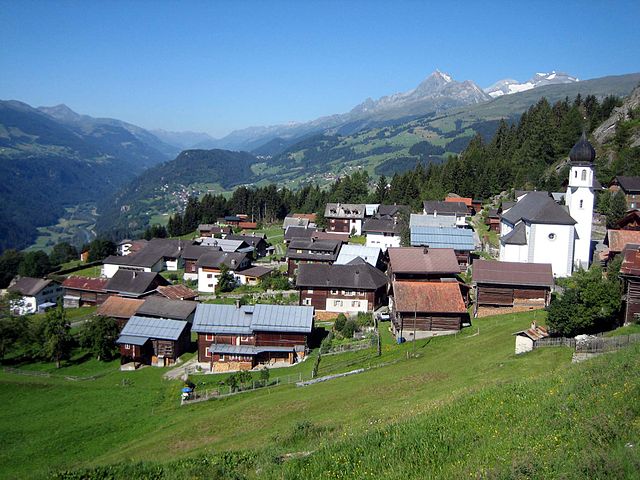
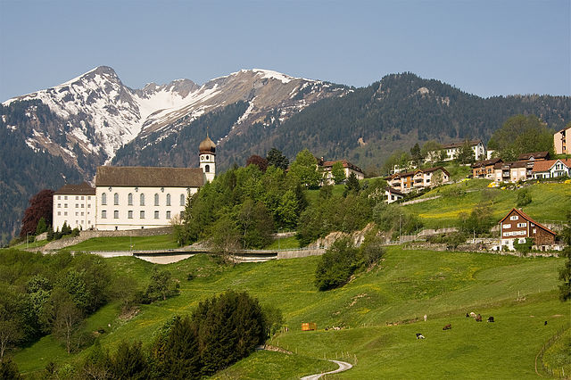
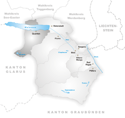
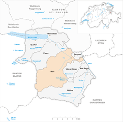
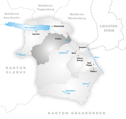
Glarus Süd (Glarus Süd)

 Hiking in Glarus Süd
Glarus Süd, located in the canton of Glarus in Switzerland, is a fantastic destination for hiking enthusiasts. This region boasts stunning landscapes, ranging from lush valleys to rugged mountain terrains. Here are some key points about hiking in Glarus Süd:
Scenic Trails
-
Variety of Trails: There are numerous hiking trails of varying difficulty levels, suitable for both beginners and experienced hikers. You can find flat, easy walks along the valley, as well as steep, challenging ascents in the mountains.
-
Stunning Views: The area is known for its breathtaking panoramas, including the impressive Glarus Alps. Some popular viewpoints include the summit of the Tödi (Piz Russein) and the surrounding peaks.
Highlights
-
Zugerberg: A well-known hiking area that offers accessible trails, providing beautiful views of the surrounding mountains and Glarus town. It’s great for family hikes and leisurely walks.
-
Glarner Hauptüberschiebung: This geological feature is fascinating for those interested in geology and offers unique hiking routes that intertwine nature and science.
-
Lake Limmern: This is a gorgeous alpine lake surrounded by mountain trails, ideal for a peaceful hike and picturesque picnic spots.
Seasonal Considerations
-
Summer: The summer months are ideal for hiking with clear trails and lush natural beauty. Be sure to bring enough water and sun protection.
-
Autumn: Fall is a great time to experience the stunning colors of the changing leaves. Some trails may be less crowded, providing a more serene experience.
-
Winter: While winter hiking is possible, it’s essential to check for avalanche risks and trail conditions. Snowshoes or crampons may be necessary for some areas.
Preparation
-
Gear: Ensure you have proper hiking gear, including sturdy boots, weather-appropriate clothing, and enough food and water for your trip.
-
Maps and Information: Use local maps and resources to navigate the trails. The Swiss Hiking Federation and local tourist offices provide valuable information about trail conditions and safety tips.
-
Guided Tours: For those unfamiliar with the area or looking for an enriched experience, guided tours are available. Local guides can offer insights into the flora, fauna, and geology of the region.
Accessibility
Glarus Süd is well-connected by public transport, making it easy to start your hiking adventures from nearby towns. Various cable cars also provide access to higher altitude trails, catering to those who prefer starting their hikes from a higher point.
Safety
Always check the weather conditions before heading out, inform someone about your hiking plan, and be aware of your surroundings to stay safe.
Whether you’re looking for a challenging ascent or a leisurely walk through stunning landscapes, Glarus Süd has something to offer for every hiking enthusiast!
- Страна:

- Почтовый код: 8756, 8762, 8765, 8766, 8767, 8772, 8773, 8774, 8775, 8777, 8782, 8783, 8784
- Телефонный код: 055
- Код автомобильного номера: GL
- Координаты: 46° 59' 40" N, 9° 4' 27" E


- GPS треки (wikiloc): [Ссылка]
- Высота над уровнем моря: 521 м m
- Площадь: 430.2 кв.км
- Население: 9581
- Веб сайт: http://www.glarus-sued.ch
- Википедия английская: wiki(en)
- Википедия национальная: wiki(de)
- Хранилище Wikidata: Wikidata: Q70695
- Катеория в википедии: [Ссылка]
- код Freebase: [/m/0g5b5_9]
- код GeoNames: Альт: [8260333]
- ID отношения в OpenStreetMap: [1683141]
- идентификатор HDS: [50185]
- код швейцарского муниципалитета: [1631]
- код NKC: [ge961207]
- код BabelNet: [02378686n]
Граничит с регионами:

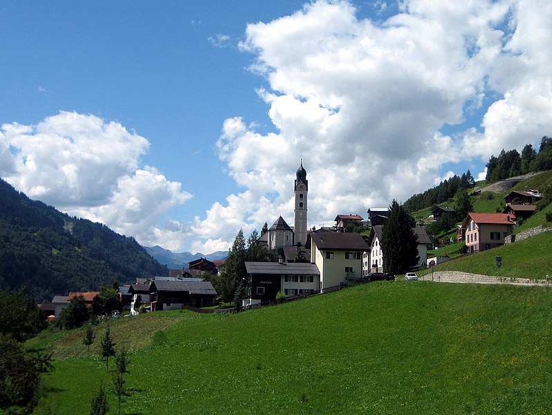
Гларус
Hiking in Гларус
Hiking in Glarus offers a stunning experience with a mix of picturesque landscapes, diverse trails, and a wealth of natural beauty. Located in the heart of Switzerland, Glarus is surrounded by impressive mountains, lush valleys, and clear lakes, making it a perfect destination for outdoor enthusiasts....
- Страна:
- Почтовый код: 8750
- Телефонный код: 055
- Код автомобильного номера: GL
- Координаты: 47° 1' 59" N, 9° 3' 59" E
- GPS треки (wikiloc): [Ссылка]
- Высота над уровнем моря: 474 м m
- Площадь: 103.6 кв.км
- Население: 12515
- Веб сайт: [Ссылка]


Вальтенсбург
Hiking in Вальтенсбург
Waltensburg-Vuorz is a beautiful destination located in the Graubünden region of Switzerland, known for its stunning landscapes and outdoor activities, including hiking. The area offers a variety of trails that cater to different skill levels, making it an ideal spot for both casual hikers and experienced trekkers....
- Страна:
- Почтовый код: 7158
- Телефонный код: 081
- Код автомобильного номера: GR
- Координаты: 46° 46' 35" N, 9° 7' 0" E
- GPS треки (wikiloc): [Ссылка]
- Высота над уровнем моря: 1876 м m
- Площадь: 32.31 кв.км
- Население: 325
- Веб сайт: [Ссылка]


Брайль-Бригельс
Hiking in Брайль-Бригельс
Breil/Brigels is a picturesque village located in the Grisons region of Switzerland, known for its stunning landscapes and a variety of outdoor activities, including hiking. The region offers a range of hiking trails suitable for different skill levels, making it an excellent destination for both novice and experienced hikers....
- Страна:
- Почтовый код: 7165
- Телефонный код: 081
- Код автомобильного номера: GR
- Координаты: 46° 47' 7" N, 9° 2' 0" E
- GPS треки (wikiloc): [Ссылка]
- Высота над уровнем моря: 2189 м m
- Площадь: 50.64 кв.км
- Население: 1248
- Веб сайт: [Ссылка]

Сумвич
Hiking in Сумвич
Sumvitg, located in the Canton of Graubünden in Switzerland, is a charming village that offers stunning landscapes and a variety of hiking opportunities. The region is characterized by its beautiful valleys, alpine meadows, and stunning mountain vistas....
- Страна:
- Почтовый код: 7175
- Телефонный код: 081
- Код автомобильного номера: GR
- Координаты: 46° 42' 59" N, 8° 55' 59" E
- GPS треки (wikiloc): [Ссылка]
- Высота над уровнем моря: 1056 м m
- Площадь: 101.88 кв.км
- Население: 1179
- Веб сайт: [Ссылка]


Трун
Hiking in Трун
Trun, a picturesque village located in the Surselva region of Graubünden, Switzerland, offers a range of hiking opportunities that showcase the stunning natural beauty of the Swiss Alps. Here are some key points to consider for hiking in and around Trun:...
- Страна:
- Почтовый код: 7166
- Телефонный код: 081
- Код автомобильного номера: GR
- Координаты: 46° 44' 36" N, 8° 58' 59" E
- GPS треки (wikiloc): [Ссылка]
- Высота над уровнем моря: 904 м m
- Площадь: 43.07 кв.км
- Население: 1172
- Веб сайт: [Ссылка]

Флимс
Hiking in Флимс
Flims, located in the Swiss canton of Graubünden, is a fantastic destination for hiking enthusiasts. This picturesque region offers stunning scenery, including impressive rock formations, forests, alpine meadows, and beautiful lakes. Here are some highlights and essential information for hiking in Flims:...
- Страна:
- Почтовый код: 7017
- Телефонный код: 081
- Код автомобильного номера: GR
- Координаты: 46° 49' 59" N, 9° 16' 59" E
- GPS треки (wikiloc): [Ссылка]
- Высота над уровнем моря: 1848 м m
- Площадь: 50.46 кв.км
- Население: 2825
- Веб сайт: [Ссылка]

Андиаст
Hiking in Андиаст
Andiast is a picturesque village located in the canton of Graubünden in Switzerland, known for its stunning landscapes and excellent hiking opportunities. Nestled in the Swiss Alps, it offers a variety of trails suitable for hikers of all levels, from leisurely walks to more challenging treks....
- Страна:
- Почтовый код: 7159
- Телефонный код: 081
- Код автомобильного номера: GR
- Координаты: 46° 46' 59" N, 9° 6' 59" E
- GPS треки (wikiloc): [Ссылка]
- Высота над уровнем моря: 1178 м m
- Площадь: 13.63 кв.км
- Население: 211
- Веб сайт: [Ссылка]

Сиат
Hiking in Сиат
Siat is a charming village located in the picturesque region of the Swiss Alps. While it may not be as well-known as some major hiking destinations in Switzerland, it offers a range of beautiful trails and outdoor experiences for those looking to explore its stunning landscapes....
- Страна:
- Почтовый код: 7157
- Телефонный код: 081
- Код автомобильного номера: GR
- Координаты: 46° 46' 59" N, 9° 9' 0" E
- GPS треки (wikiloc): [Ссылка]
- Высота над уровнем моря: 1296 м m
- Площадь: 13.48 кв.км
- Население: 181
- Веб сайт: [Ссылка]


Рушайн
Hiking in Рушайн
Ruschein, located in the Grisons region of Switzerland, offers beautiful landscapes and a variety of hiking trails suitable for all levels of experience. The area is characterized by stunning alpine scenery, including lush meadows, rugged mountains, and picturesque valleys....
- Страна:
- Почтовый код: 7154
- Телефонный код: 081
- Код автомобильного номера: GR
- Координаты: 46° 46' 59" N, 9° 11' 0" E
- GPS треки (wikiloc): [Ссылка]
- Высота над уровнем моря: 1155 м m
- Площадь: 12.54 кв.км
- Веб сайт: [Ссылка]

Пфеферс
Hiking in Пфеферс
Pfäfers, located in the canton of St. Gallen in Switzerland, is a stunning destination for hiking enthusiasts. The region is renowned for its dramatic landscapes, featuring the picturesque Rhine Gorge, often referred to as the "Grand Canyon of Switzerland." Here are some highlights and tips for hiking in Pfäfers:...
- Страна:
- Почтовый код: 7312
- Телефонный код: 081
- Код автомобильного номера: SG
- Координаты: 46° 58' 59" N, 9° 29' 59" E
- GPS треки (wikiloc): [Ссылка]
- Высота над уровнем моря: 820 м m
- Площадь: 128.53 кв.км
- Население: 1574
- Веб сайт: [Ссылка]


Муотаталь
- Kоммуна в Швейцарии
Hiking in Муотаталь
Muotathal, located in the heart of Switzerland, offers stunning landscapes and diverse hiking opportunities, making it a fantastic destination for both novice and experienced hikers. Here are some highlights and tips for hiking in this beautiful region:...
- Страна:
- Почтовый код: 6436
- Телефонный код: 041
- Код автомобильного номера: SZ
- Координаты: 46° 58' 28" N, 8° 45' 28" E
- GPS треки (wikiloc): [Ссылка]
- Высота над уровнем моря: 610 м m
- Площадь: 172.15 кв.км
- Население: 3515
- Веб сайт: [Ссылка]

Квартен
Hiking in Квартен
Quarten is a beautiful hiking destination located in the Canton of St. Gallen in Switzerland, nestled near Lake Zurich. The region is known for its stunning scenery, with breathtaking views of the Swiss Alps, lush forests, and charming alpine meadows. Here are some highlights and tips for hiking in Quarten:...
- Страна:
- Почтовый код: 8883
- Телефонный код: 081
- Код автомобильного номера: SG
- Координаты: 47° 5' 4" N, 9° 13' 15" E
- GPS треки (wikiloc): [Ссылка]
- Высота над уровнем моря: 1420 м m
- Площадь: 61.90 кв.км
- Население: 2877
- Веб сайт: [Ссылка]

Мельс
Hiking in Мельс
Mels is a picturesque village located in the canton of St. Gallen in Switzerland, surrounded by beautiful landscapes and accessible hiking trails. The area offers a variety of hiking routes suitable for different skill levels, from leisurely strolls to more challenging treks. Here are some highlights for hiking in Mels:...
- Страна:
- Почтовый код: 8887
- Телефонный код: 081
- Код автомобильного номера: SG
- Координаты: 47° 2' 59" N, 9° 25' 0" E
- GPS треки (wikiloc): [Ссылка]
- Высота над уровнем моря: 1579 м m
- Площадь: 140.00 кв.км
- Население: 8610
- Веб сайт: [Ссылка]


Дисентис
- курорт в Швейцарии
Hiking in Дисентис
Disentis, located in the Swiss Canton of Graubünden, is a fantastic destination for hiking enthusiasts. This region is known for its breathtaking Alpine scenery, diverse landscapes, and rich cultural heritage. Here are some key points to consider when planning a hiking trip in Disentis:...
- Страна:
- Почтовый код: 7180
- Телефонный код: 081
- Код автомобильного номера: GR
- Координаты: 46° 44' 3" N, 8° 50' 51" E
- GPS треки (wikiloc): [Ссылка]
- Высота над уровнем моря: 1130 м m
- Площадь: 90.98 кв.км
- Население: 2092
- Веб сайт: [Ссылка]

Зиленен
- коммуна в Швейцарии, в кантоне Ури
Hiking in Зиленен
Silenen, a charming municipality in the canton of Uri, Switzerland, is an excellent destination for hiking enthusiasts. Nestled in a picturesque valley, Silenen offers breathtaking views of the surrounding mountains and is a great starting point for various hiking trails suitable for all levels of experience....
- Страна:
- Почтовый код: 6473
- Телефонный код: 041
- Код автомобильного номера: UR
- Координаты: 46° 47' 28" N, 8° 40' 9" E
- GPS треки (wikiloc): [Ссылка]
- Высота над уровнем моря: 510 м m
- Площадь: 144.78 кв.км
- Население: 1991
- Веб сайт: [Ссылка]


Лакс
Hiking in Лакс
Laax, located in the Swiss Alps in the canton of Graubünden, is a fantastic destination for hiking enthusiasts. Known for its breathtaking landscapes, diverse trails, and stunning alpine scenery, Laax offers hiking options for all skill levels. Here are some key aspects to consider if you're planning to hike in Laax:...
- Страна:
- Почтовый код: 7031
- Телефонный код: 081
- Код автомобильного номера: GR
- Координаты: 46° 50' 45" N, 9° 13' 40" E
- GPS треки (wikiloc): [Ссылка]
- Высота над уровнем моря: 1685 м m
- Площадь: 31.68 кв.км
- Население: 1755
- Веб сайт: [Ссылка]


Пиньиу
Hiking in Пиньиу
Pigniu is a small village located in the Swiss canton of Grisons (Graubünden), known for its stunning alpine scenery and charming landscapes. Hiking in this region offers a variety of trails that cater to different skill levels, making it a great destination for both beginners and experienced hikers....
- Страна:
- Почтовый код: 7156
- Телефонный код: 081
- Код автомобильного номера: GR
- Координаты: 46° 47' 59" N, 9° 5' 59" E
- GPS треки (wikiloc): [Ссылка]
- Высота над уровнем моря: 1301 м m
- Площадь: 17.98 кв.км
- Веб сайт: [Ссылка]

Флумс
Hiking in Флумс
Flums is a picturesque village located in the Swiss canton of St. Gallen, surrounded by stunning landscapes and mountainous terrain, making it a fantastic destination for hikers of all levels. Here’s a brief overview of what you can expect when hiking in Flums:...
- Страна:
- Почтовый код: 8890
- Телефонный код: 081
- Код автомобильного номера: SG
- Координаты: 47° 5' 34" N, 9° 20' 38" E
- GPS треки (wikiloc): [Ссылка]
- Высота над уровнем моря: 1124 м m
- Площадь: 75.03 кв.км
- Население: 4941
- Веб сайт: [Ссылка]