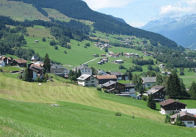
Сумвич (Sumvitg, Sumvitg)

 Hiking in Сумвич
Sumvitg, located in the Canton of Graubünden in Switzerland, is a charming village that offers stunning landscapes and a variety of hiking opportunities. The region is characterized by its beautiful valleys, alpine meadows, and stunning mountain vistas.
Hiking Opportunities
-
Trail Network: Sumvitg is connected to an extensive network of hiking trails, ranging from easy walks to more challenging mountain hikes. Trail markers are well-maintained, and many routes offer panoramic views of the surrounding peaks.
-
Difficulty Levels: Hikers can choose from various trails that suit their skill levels, including:
- Easy Trails: Ideal for families and beginners, these trails often have gentle slopes and well-defined paths.
- Moderate Trails: Suitable for those with some hiking experience, these routes may include steeper inclines or rocky sections.
- Challenging Trails: For experienced hikers looking for adventure, there are rigorous trails that can lead to higher altitudes and more remote locations.
-
Scenic Highlights: Many trails are designed to showcase the natural beauty of the region, including:
- Spectacular views of the surrounding Alps.
- Wonderful flora and fauna typical of the Swiss mountains.
- Quaint villages and traditional alpine structures.
-
Popular Routes: While specific trails can vary, some popular options include routes that lead to nearby lakes, mountain huts, or higher-altitude passes that reward the hiker with breathtaking views.
-
Seasonal Considerations: The best time for hiking in Sumvitg is generally from late spring to early autumn (May to October), when the weather is milder, and the trails are more accessible. However, winter hiking and snowshoeing can also be wonderful alternatives for those interested in a different experience.
Practical Information
-
Local Guides: If you're unfamiliar with the trails or prefer a structured hiking experience, consider booking a local guide who can provide insights on the area’s history, geology, and wildlife.
-
Equipment: Standard hiking gear is recommended, including sturdy footwear, weather-appropriate clothing, a backpack, water, and snacks. Depending on the season, trekking poles, sun protection, and navigation tools may also be useful.
-
Wildlife: Keep an eye out for local wildlife, including marmots, chamois, and a variety of bird species. Remember to respect their habitats.
-
Safety: Always inform someone of your hiking plans, check weather conditions before setting out, and be prepared for sudden changes in the mountain weather.
Whether you're looking for a leisurely stroll through picturesque landscapes or a rigorous hike with rewarding views, Sumvitg offers something for every outdoor enthusiast!
- Страна:

- Почтовый код: 7175
- Телефонный код: 081
- Код автомобильного номера: GR
- Координаты: 46° 42' 59" N, 8° 55' 59" E


- GPS треки (wikiloc): [Ссылка]
- Высота над уровнем моря: 1056 м m
- Площадь: 101.88 кв.км
- Население: 1179
- Веб сайт: http://www.sumvitg.ch
- Википедия русская: wiki(ru)
- Википедия английская: wiki(en)
- Википедия национальная: wiki(de)
- Хранилище Wikidata: Wikidata: Q64942
- Катеория в википедии: [Ссылка]
- код Freebase: [/m/0g3kcv]
- код GeoNames: Альт: [7287263]
- код VIAF: Альт: [247388734]
- ID отношения в OpenStreetMap: [1684179]
- идентификатор местоположения ArchINFORM: [1548]
- идентификатор HDS: [1617]
- код швейцарского муниципалитета: [3985]
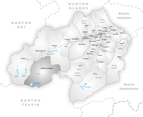
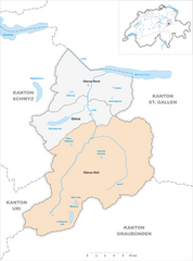
Граничит с регионами:

Оберзаксен
Hiking in Оберзаксен
Obersaxen is a beautiful region located in the scenic Swiss Alps, specifically in the canton of Graubünden. It is known for its stunning landscapes, diverse trails, and outdoor activities, making it an excellent destination for hiking enthusiasts. Here are some highlights and tips for hiking in Obersaxen:...
- Страна:
- Почтовый код: 7134
- Телефонный код: 081
- Координаты: 46° 44' 0" N, 9° 6' 0" E
- GPS треки (wikiloc): [Ссылка]
- Высота над уровнем моря: 1281 м m
- Площадь: 61.77 кв.км
- Веб сайт: [Ссылка]

Медель
Hiking in Медель
Medel, located in the municipality of Lucmagn in the Canton of Graubünden, Switzerland, is a stunning area for hiking enthusiasts. The region is characterized by its picturesque landscapes, including dramatic mountains, lush valleys, and tranquil lakes. Here are some key points to consider when planning your hiking trip to Medel:...
- Страна:
- Почтовый код: 7184
- Телефонный код: 081
- Код автомобильного номера: GR
- Координаты: 46° 37' 59" N, 8° 49' 59" E
- GPS треки (wikiloc): [Ссылка]
- Высота над уровнем моря: 1332 м m
- Площадь: 136.22 кв.км
- Население: 384
- Веб сайт: [Ссылка]


Трун
Hiking in Трун
Trun, a picturesque village located in the Surselva region of Graubünden, Switzerland, offers a range of hiking opportunities that showcase the stunning natural beauty of the Swiss Alps. Here are some key points to consider for hiking in and around Trun:...
- Страна:
- Почтовый код: 7166
- Телефонный код: 081
- Код автомобильного номера: GR
- Координаты: 46° 44' 36" N, 8° 58' 59" E
- GPS треки (wikiloc): [Ссылка]
- Высота над уровнем моря: 904 м m
- Площадь: 43.07 кв.км
- Население: 1172
- Веб сайт: [Ссылка]


Дисентис
- курорт в Швейцарии
Hiking in Дисентис
Disentis, located in the Swiss Canton of Graubünden, is a fantastic destination for hiking enthusiasts. This region is known for its breathtaking Alpine scenery, diverse landscapes, and rich cultural heritage. Here are some key points to consider when planning a hiking trip in Disentis:...
- Страна:
- Почтовый код: 7180
- Телефонный код: 081
- Код автомобильного номера: GR
- Координаты: 46° 44' 3" N, 8° 50' 51" E
- GPS треки (wikiloc): [Ссылка]
- Высота над уровнем моря: 1130 м m
- Площадь: 90.98 кв.км
- Население: 2092
- Веб сайт: [Ссылка]

Glarus Süd
Hiking in Glarus Süd
Glarus Süd, located in the canton of Glarus in Switzerland, is a fantastic destination for hiking enthusiasts. This region boasts stunning landscapes, ranging from lush valleys to rugged mountain terrains. Here are some key points about hiking in Glarus Süd:...
- Страна:
- Почтовый код: 8756, 8762, 8765, 8766, 8767, 8772, 8773, 8774, 8775, 8777, 8782, 8783, 8784
- Телефонный код: 055
- Код автомобильного номера: GL
- Координаты: 46° 59' 40" N, 9° 4' 27" E
- GPS треки (wikiloc): [Ссылка]
- Высота над уровнем моря: 521 м m
- Площадь: 430.2 кв.км
- Население: 9581
- Веб сайт: [Ссылка]