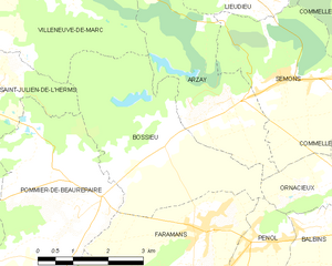
Фараман (Faramans, Faramans)

 Hiking in Фараман
Faramans is a small commune located in the Isère department in the Auvergne-Rhône-Alpes region of southeastern France. While it may not be as well-known as some of the larger hiking destinations in the area, it offers beautiful landscapes and a chance to enjoy nature in a quieter setting.
Here are a few key points about hiking in and around Faramans:
Trails and Terrain
- Diversity of Trails: The vicinity around Faramans features a variety of trails that cater to different skill levels, from easy walks to more challenging hikes. The landscape is characterized by gentle hills, forests, and open fields, as well as more rugged terrain in the nearby mountains.
- Scenic Views: Trails often provide beautiful views of the surrounding countryside, including the distant mountains that are part of the Chartreuse and Vercors ranges.
Nearby Hiking Areas
- Chartreuse Mountains: Just a short drive away, this area offers stunning trails and panoramic views. Popular hikes include those leading to the Granier massif and the numerous caves and peaks throughout the park.
- Vercors Regional Natural Park: Located a bit further but still accessible, Vercors boasts dramatic cliffs, deep gorges, and many well-marked hiking trails. It is famous for its rich biodiversity and offers various levels of hiking experiences.
Practical Information
- Best Time to Go: The ideal times for hiking in this area are spring (April to June) and early fall (September to October), when the weather is generally mild and the hiking conditions are optimal.
- Safety Considerations: Always check the weather before heading out, wear appropriate footwear, carry plenty of water, and consider bringing a map or GPS device since some trails may not be well-marked.
Additional Tips
- Local Advice: It's often helpful to speak with local tourism offices for updated trail information, maps, and recommendations for the best hiking spots.
- Respect Nature: As with any outdoor activity, be sure to follow Leave No Trace principles to preserve the natural beauty of the area.
If you’re looking for a peaceful hiking experience away from the busier tourist spots, Faramans and its surroundings can be a lovely choice!
- Страна:

- Почтовый код: 38260
- Координаты: 45° 23' 36" N, 5° 9' 49" E


- GPS треки (wikiloc): [Ссылка]
- Площадь: 10.79 кв.км
- Население: 1017
- Веб сайт: http://www.faramans38.com
- Википедия русская: wiki(ru)
- Википедия английская: wiki(en)
- Википедия национальная: wiki(fr)
- Хранилище Wikidata: Wikidata: Q1151349
- Катеория в википедии: [Ссылка]
- код Freebase: [/m/03nvjsr]
- код GeoNames: Альт: [6614596]
- номер SIREN: [213801616]
- код BNF: [15257983x]
- код муниципалитета INSEE: 38161
Граничит с регионами:

Босье
- коммуна во Франции
Hiking in Босье
Bossieu, a small commune in the Isère department of southeastern France, offers some charming opportunities for hiking enthusiasts. The region is characterized by its picturesque landscapes, which include rolling hills, forests, and views of the surrounding mountains....
- Страна:
- Почтовый код: 38260
- Координаты: 45° 25' 1" N, 5° 8' 53" E
- GPS треки (wikiloc): [Ссылка]
- Площадь: 13.48 кв.км
- Население: 281
- Веб сайт: [Ссылка]


Помье-де-Борепер
- коммуна во Франции
Hiking in Помье-де-Борепер
Pommier-de-Beaurepaire is a small commune in the Auvergne-Rhône-Alpes region of France, known for its scenic landscapes and rural charm. While it may not be as well-known as some major hiking destinations, it offers opportunities for outdoor enthusiasts to explore the beauty of the surrounding countryside....
- Страна:
- Почтовый код: 38260
- Координаты: 45° 24' 0" N, 5° 7' 11" E
- GPS треки (wikiloc): [Ссылка]
- Площадь: 19.16 кв.км
- Население: 710


Пеноль
- коммуна во Франции
Hiking in Пеноль
Penol is a scenic destination in Colombia, particularly known for its stunning landscape dominated by the iconic El Peñol Rock (La Piedra del Peñol), which offers incredible views and challenging hikes. Here are some key points about hiking in the Penol area:...
- Страна:
- Почтовый код: 38260
- Координаты: 45° 23' 25" N, 5° 11' 27" E
- GPS треки (wikiloc): [Ссылка]
- Площадь: 12.16 кв.км
- Население: 340


Паже
- коммуна во Франции
Hiking in Паже
Pajay, likely referring to a less commonly known hiking area, might not have extensive resources or documented trails like more popular hiking destinations. However, if Pajay is situated in a mountainous or nature-rich region, I can guide you on typical hiking experiences that such areas might offer....
- Страна:
- Почтовый код: 38260
- Координаты: 45° 21' 50" N, 5° 8' 22" E
- GPS треки (wikiloc): [Ссылка]
- Площадь: 14.32 кв.км
- Население: 1126
- Веб сайт: [Ссылка]