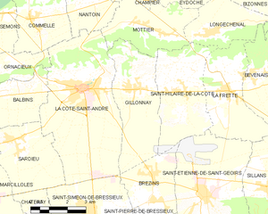
Ла-Кот-Сент-Андре (canton of La Côte-Saint-André, canton de La Côte-Saint-André)
 Hiking in Ла-Кот-Сент-Андре
Canton de La Côte-Saint-André, located in the Isère department of the Auvergne-Rhône-Alpes region in southeastern France, offers a variety of hiking opportunities amidst its beautiful landscapes. The area is characterized by rolling hills, lush forests, and scenic views of the surrounding mountains.
Hiking Trails:
-
Les Coulmes: This area features several well-marked trails that cater to different skill levels. The routes often include scenic viewpoints and opportunities to observe local wildlife.
-
Vercors Regional Natural Park: While not entirely within the canton, Vercors is nearby and offers extensive trails ranging from easy walks to more challenging hikes. The park is known for its dramatic cliffs, deep gorges, and rich biodiversity.
-
Local Forests: The forests around La Côte-Saint-André, particularly the Bois de Lavennes and the woods surrounding the town, offer peaceful trails perfect for leisurely hikes.
Tips for Hiking in the Area:
- Trail Maps: It's advisable to pick up a trail map or guide at local tourism offices or online resources before heading out for detailed trail information.
- Weather Preparedness: Always check the weather forecast as conditions can change rapidly in mountainous areas.
- Equipment: Good hiking boots are essential, along with appropriate clothing and a backpack with essentials like water and snacks.
- Respect Nature: Adhere to the principles of Leave No Trace to preserve the natural beauty of the area.
Local Attractions:
In addition to hiking, take time to explore local culture and history by visiting sites such as:
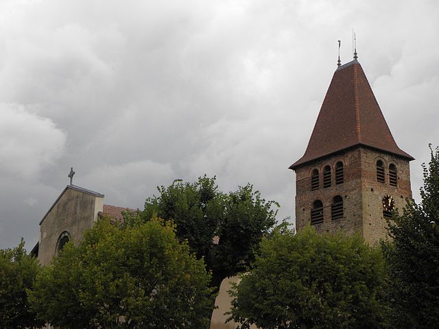
- La Côte-Saint-André: Known for its historical buildings and the nearby church of Saint-Jean-Baptiste.
- Music History: The town is associated with the composer Hector Berlioz, and there are opportunities to explore his heritage.
Whether you're looking for a scenic day hike or extended trails in a more rugged terrain, Canton de La Côte-Saint-André encompasses a delightful mix of natural beauty and cultural richness that can enhance your outdoor adventures.
- Страна:

- Столица: Ла-Кот-Сент-Андре
- Координаты: 45° 24' 24" N, 5° 13' 33" E


- GPS треки (wikiloc): [Ссылка]
- Хранилище Wikidata: Wikidata: Q379126
- код кантона INSEE: [3807]
Включает регионы:


Коммель
- коммуна во Франции
Hiking in Коммель
Commelle is a lesser-known hiking destination, but if you're referring to a specific region or trail system, I would need a bit more clarity, as there may be multiple locations with similar names around the world....
- Страна:
- Почтовый код: 38260
- Координаты: 45° 25' 41" N, 5° 13' 35" E
- GPS треки (wikiloc): [Ссылка]
- Площадь: 14.04 кв.км
- Население: 927
- Веб сайт: [Ссылка]

Босье
- коммуна во Франции
Hiking in Босье
Bossieu, a small commune in the Isère department of southeastern France, offers some charming opportunities for hiking enthusiasts. The region is characterized by its picturesque landscapes, which include rolling hills, forests, and views of the surrounding mountains....
- Страна:
- Почтовый код: 38260
- Координаты: 45° 25' 1" N, 5° 8' 53" E
- GPS треки (wikiloc): [Ссылка]
- Площадь: 13.48 кв.км
- Население: 281
- Веб сайт: [Ссылка]

Бальбен
- коммуна во Франции
Hiking in Бальбен
It seems like you might be referring to a specific location, but "Balbins" isn't widely recognized as a hiking destination. If you meant a different place, please clarify the name or provide more details....
- Страна:
- Почтовый код: 38260
- Координаты: 45° 23' 54" N, 5° 12' 51" E
- GPS треки (wikiloc): [Ссылка]
- Площадь: 7.26 кв.км
- Население: 432
- Веб сайт: [Ссылка]


Семон
- коммуна во Франции
Hiking in Семон
It seems like there may be a slight misspelling or misunderstanding regarding the location "Semons." If you meant "Semon," "Semon Mountain," or perhaps a different location known for hiking (like the area around Semons or another name similar), please clarify....
- Страна:
- Почтовый код: 38260
- Координаты: 45° 25' 56" N, 5° 11' 41" E
- GPS треки (wikiloc): [Ссылка]
- Площадь: 10.55 кв.км
- Население: 362
- Веб сайт: [Ссылка]


Пеноль
- коммуна во Франции
Hiking in Пеноль
Penol is a scenic destination in Colombia, particularly known for its stunning landscape dominated by the iconic El Peñol Rock (La Piedra del Peñol), which offers incredible views and challenging hikes. Here are some key points about hiking in the Penol area:...
- Страна:
- Почтовый код: 38260
- Координаты: 45° 23' 25" N, 5° 11' 27" E
- GPS треки (wikiloc): [Ссылка]
- Площадь: 12.16 кв.км
- Население: 340


Нантуэн
- коммуна во Франции
Hiking in Нантуэн
Nantoin, a beautiful area often associated with the scenic landscapes of the Chartreuse National Park in France, is a fantastic destination for hiking enthusiasts. Here are some key points to consider if you're planning a hike in and around Nantoin:...
- Страна:
- Почтовый код: 38260
- Координаты: 45° 26' 8" N, 5° 16' 9" E
- GPS треки (wikiloc): [Ссылка]
- Высота над уровнем моря: 609 м m
- Площадь: 9.5 кв.км
- Население: 464
- Веб сайт: [Ссылка]

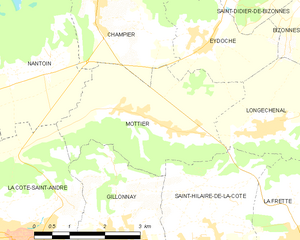
Мотье
- коммуна во Франции
Hiking in Мотье
Mottier, located in the beautiful area of Isère in the French Alps, offers a variety of hiking opportunities that cater to different skill levels and preferences. The surrounding landscape is characterized by stunning mountain views, diverse flora and fauna, and picturesque trails that are perfect for both day hikes and longer excursions....
- Страна:
- Почтовый код: 38260
- Координаты: 45° 25' 8" N, 5° 19' 2" E
- GPS треки (wikiloc): [Ссылка]
- Площадь: 10.72 кв.км
- Население: 690
- Веб сайт: [Ссылка]


Паже
- коммуна во Франции
Hiking in Паже
Pajay, likely referring to a less commonly known hiking area, might not have extensive resources or documented trails like more popular hiking destinations. However, if Pajay is situated in a mountainous or nature-rich region, I can guide you on typical hiking experiences that such areas might offer....
- Страна:
- Почтовый код: 38260
- Координаты: 45° 21' 50" N, 5° 8' 22" E
- GPS треки (wikiloc): [Ссылка]
- Площадь: 14.32 кв.км
- Население: 1126
- Веб сайт: [Ссылка]


Орнасьё
- коммуна во Франции
Hiking in Орнасьё
Ornacieux is a charming village located in the Rhône-Alpes region of France, surrounded by beautiful natural landscapes, making it a great destination for hiking enthusiasts. The area offers a variety of trails that cater to different skill levels, from leisurely walks to more challenging hikes....
- Страна:
- Почтовый код: 38260
- Координаты: 45° 24' 2" N, 5° 12' 40" E
- GPS треки (wikiloc): [Ссылка]
- Площадь: 4.89 кв.км
- Население: 416

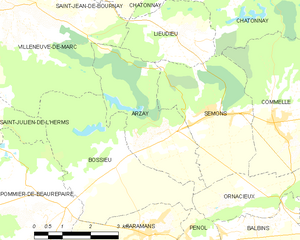
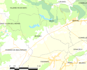
Арзе
- коммуна во Франции
Hiking in Арзе
As of my last update, there's limited information specifically about "Arzay" as a hiking destination. It's possible that you might be referring to a less-known area or there might be a misspelling. However, I can provide general hiking tips and suggestions for exploring regions that might include areas like Arzay if they are situated near popular hiking destinations....
- Страна:
- Почтовый код: 38260
- Координаты: 45° 25' 32" N, 5° 10' 13" E
- GPS треки (wikiloc): [Ссылка]
- Площадь: 9.79 кв.км
- Население: 226
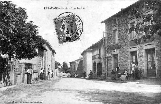

Фараман
Hiking in Фараман
Faramans is a small commune located in the Isère department in the Auvergne-Rhône-Alpes region of southeastern France. While it may not be as well-known as some of the larger hiking destinations in the area, it offers beautiful landscapes and a chance to enjoy nature in a quieter setting....
- Страна:
- Почтовый код: 38260
- Координаты: 45° 23' 36" N, 5° 9' 49" E
- GPS треки (wikiloc): [Ссылка]
- Площадь: 10.79 кв.км
- Население: 1017
- Веб сайт: [Ссылка]


Сент-Илер-де-ла-Кот
- коммуна во Франции
Hiking in Сент-Илер-де-ла-Кот
Saint-Hilaire-de-la-Côte is a picturesque mountain village located in the Isère department of the Auvergne-Rhône-Alpes region in southeastern France. It offers a variety of hiking opportunities, attracting both casual walkers and avid trekkers....
- Страна:
- Почтовый код: 38260
- Координаты: 45° 23' 26" N, 5° 19' 38" E
- GPS треки (wikiloc): [Ссылка]
- Площадь: 13.75 кв.км
- Население: 1431
- Веб сайт: [Ссылка]

Жийонне
- коммуна во Франции
Hiking in Жийонне
Gillonnay is a charming village located in the Isère department of the Auvergne-Rhône-Alpes region in southeastern France. The area offers a variety of hiking opportunities, ranging from easy walks to more challenging trails, all set against a backdrop of picturesque landscapes and natural beauty....
- Страна:
- Почтовый код: 38260
- Координаты: 45° 23' 34" N, 5° 17' 50" E
- GPS треки (wikiloc): [Ссылка]
- Площадь: 14.29 кв.км
- Население: 1014


Сардьё
- коммуна во Франции
Hiking in Сардьё
Sardieu is a beautiful destination for hiking, located in the Isère department of France, near the foothills of the Alps. This region is known for its scenic landscapes, diverse terrain, and beautiful views, making it a great spot for outdoor enthusiasts....
- Страна:
- Почтовый код: 38260
- Координаты: 45° 22' 9" N, 5° 12' 43" E
- GPS треки (wikiloc): [Ссылка]
- Высота над уровнем моря: 358 м m
- Площадь: 11.2 кв.км
- Население: 1097
- Веб сайт: [Ссылка]


Шампье
- коммуна во Франции
Hiking in Шампье
Champier is a charming village located in the Auvergne-Rhône-Alpes region of France, nestled near the northern edge of the Dauphiné region. While it might not be as famous as some larger locales, it offers a variety of beautiful hiking opportunities through picturesque landscapes that showcase the natural beauty of the area....
- Страна:
- Почтовый код: 38260
- Координаты: 45° 27' 12" N, 5° 17' 28" E
- GPS треки (wikiloc): [Ссылка]
- Площадь: 14.43 кв.км
- Население: 1387
- Веб сайт: [Ссылка]
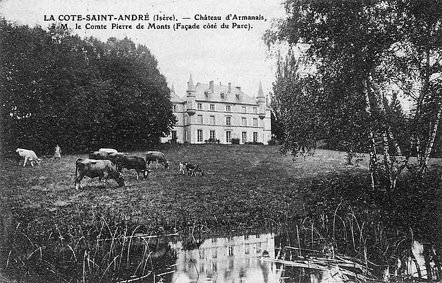
Ла-Кот-Сент-Андре
- коммуна во Франции
Hiking in Ла-Кот-Сент-Андре
La Côte-Saint-André is a charming commune located in the Isère department in the Auvergne-Rhône-Alpes region of southeastern France. It offers beautiful landscapes and a variety of hiking opportunities, making it a great destination for outdoor enthusiasts. Here are some highlights about hiking in and around La Côte-Saint-André:...
- Страна:
- Почтовый код: 38260
- Координаты: 45° 23' 37" N, 5° 15' 38" E
- GPS треки (wikiloc): [Ссылка]
- Площадь: 27.93 кв.км
- Население: 4745
- Веб сайт: [Ссылка]