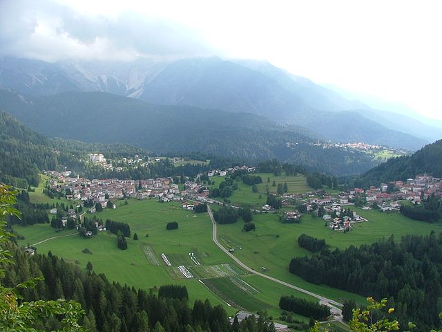
Форни-ди-Сопра (Forni di Sopra, Forni di Sopra)
.svg)
- коммуна Италии
 Hiking in Форни-ди-Сопра
Forni di Sopra is a beautiful destination for hiking enthusiasts, located in the Friuli Venezia Giulia region of northeastern Italy. Nestled in the Carnic Alps, it offers a stunning backdrop of lush valleys, rugged mountains, and pristine landscapes. Here are some key points about hiking in Forni di Sopra:
Trail Varieties
- Moderate to Challenging Trails: Forni di Sopra features a range of hiking trails suitable for different skill levels, from easy walks to more challenging hikes that lead to higher elevations.
- Scenic Routes: Many trails provide breathtaking views of the surrounding mountains and valleys, making them ideal for nature photography and enjoying the serenity of the outdoors.
Notable Trails
- Sentiero delle Vette: This high-altitude trail showcases panoramic views of the Dolomites and is a favorite among experienced hikers.
- Valle del Tagliamento: A more accessible trail that offers beautiful scenery and is suitable for families and beginners.
Flora and Fauna
The area is rich in biodiversity, with many opportunities to see unique plant species and wildlife. Keep an eye out for ibex, chamois, and various bird species along the trails.
Tips for Hiking in Forni di Sopra
- Best Time to Visit: The ideal months for hiking are late spring to early autumn (May to September) when the weather is generally more stable and the trails are generally clear of snow.
- Gear: Wear appropriate hiking boots and pack necessary equipment, including water, snacks, a map, and possibly a first-aid kit.
- Weather: Always check the weather forecast before your hike, as conditions can change rapidly in mountainous regions.
Additional Attractions
In addition to hiking, Forni di Sopra offers other outdoor activities, such as mountain biking and winter sports. After a day on the trails, visitors can enjoy local cuisine in one of the charming mountain huts or restaurants in the area.
Overall, Forni di Sopra is a fantastic destination for hikers looking for a mix of adventure and stunning natural beauty in Italy. Always remember to practice Leave No Trace principles to preserve the beauty of the landscape for future hikers.
- Страна:

- Почтовый код: 33024
- Телефонный код: 0433
- Код автомобильного номера: UD
- Координаты: 46° 25' 0" N, 12° 35' 0" E


- GPS треки (wikiloc): [Ссылка]
- Высота над уровнем моря: 907 м m
- Площадь: 81.66 кв.км
- Население: 955
- Веб сайт: http://www.fornidisopra.it
- Википедия русская: wiki(ru)
- Википедия английская: wiki(en)
- Википедия национальная: wiki(it)
- Хранилище Wikidata: Wikidata: Q53263
- Катеория в википедии: [Ссылка]
- код Freebase: [/m/0b55k6]
- код GeoNames: Альт: [6538368]
- код VIAF: Альт: [240432837]
- ID отношения в OpenStreetMap: [79114]
- код темы Quora: [Forni-Di-Sopra]
- код ISTAT: 030041
- кадастровый код Италии: D719
Граничит с регионами:

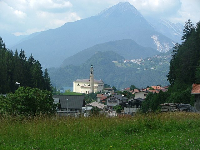
Виго-ди-Кадоре
- коммуна Италии
Hiking in Виго-ди-Кадоре
Vigo di Cadore is a picturesque village in the Dolomites, located in the Veneto region of Italy. It’s an excellent starting point for hiking enthusiasts due to its stunning landscapes, diverse trails, and rich natural and cultural heritage. Here are some highlights about hiking in Vigo di Cadore:...
- Страна:
- Почтовый код: 32040
- Телефонный код: 0435
- Код автомобильного номера: BL
- Координаты: 46° 30' 0" N, 12° 28' 0" E
- GPS треки (wikiloc): [Ссылка]
- Высота над уровнем моря: 947 м m
- Площадь: 70.07 кв.км
- Население: 1409
- Веб сайт: [Ссылка]

Домедже-ди-Кадоре
- коммуна Италии
Hiking in Домедже-ди-Кадоре
Domegge di Cadore is a charming village situated in the Dolomites region of northern Italy. It offers incredible opportunities for hiking, thanks to its stunning natural landscapes, rich biodiversity, and picturesque mountain views. Here are some highlights and information about hiking in the area:...
- Страна:
- Почтовый код: 32040
- Телефонный код: 0435
- Код автомобильного номера: BL
- Координаты: 46° 28' 0" N, 12° 25' 0" E
- GPS треки (wikiloc): [Ссылка]
- Высота над уровнем моря: 775 м m
- Площадь: 50.36 кв.км
- Население: 2392
- Веб сайт: [Ссылка]

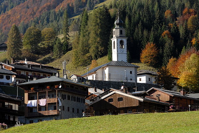
Лоренцаго-ди-Кадоре
- коммуна Италии
Hiking in Лоренцаго-ди-Кадоре
Lorenzago di Cadore, located in the heart of the Dolomites in Northern Italy, is a picturesque village that offers a wealth of hiking opportunities amidst stunning natural scenery. Here are some highlights and tips for hiking in this area:...
- Страна:
- Почтовый код: 32040
- Телефонный код: 0435
- Код автомобильного номера: BL
- Координаты: 46° 29' 0" N, 12° 28' 0" E
- GPS треки (wikiloc): [Ссылка]
- Высота над уровнем моря: 880 м m
- Площадь: 27.35 кв.км
- Население: 554
- Веб сайт: [Ссылка]


Чимолайс
- коммуна Италии
Hiking in Чимолайс
Cimolais, located in the beautiful Friuli Venezia Giulia region of Italy, is a stunning destination for hikers. Nestled in the Dolomites, it offers breathtaking landscapes, diverse trails, and a rich natural environment. Here are some highlights about hiking in and around Cimolais:...
- Страна:
- Почтовый код: 33080
- Телефонный код: 0427
- Код автомобильного номера: PN
- Координаты: 46° 17' 0" N, 12° 26' 0" E
- GPS треки (wikiloc): [Ссылка]
- Высота над уровнем моря: 652 м m
- Площадь: 100.86 кв.км
- Население: 363
- Веб сайт: [Ссылка]


Клаут
- коммуна Италии
Hiking in Клаут
Claut is a picturesque village located in the Friuli Venezia Giulia region of northeastern Italy. Nestled in the heart of the Carnic Alps, it offers excellent hiking opportunities for both beginners and experienced hikers. Here are some aspects to consider when hiking in Claut:...
- Страна:
- Почтовый код: 33080
- Телефонный код: 0427
- Код автомобильного номера: PN
- Координаты: 46° 16' 0" N, 12° 31' 0" E
- GPS треки (wikiloc): [Ссылка]
- Высота над уровнем моря: 613 м m
- Площадь: 165.91 кв.км
- Население: 946
- Веб сайт: [Ссылка]


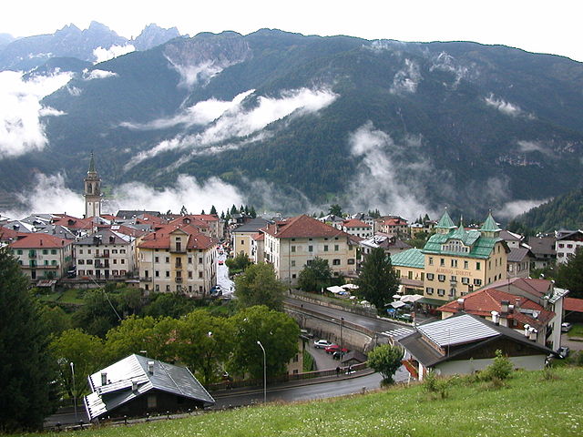
Форни-ди-Сотто
- коммуна Италии
Hiking in Форни-ди-Сотто
Forni di Sotto is a beautiful gem in the Friuli Venezia Giulia region of northern Italy, nestled in the Carnic Alps. This area is known for its stunning natural landscapes, rich biodiversity, and a variety of hiking trails suitable for all levels of experience. Here are some highlights about hiking in Forni di Sotto:...
- Страна:
- Почтовый код: 33020
- Телефонный код: 0433
- Код автомобильного номера: UD
- Координаты: 46° 24' 0" N, 12° 40' 0" E
- GPS треки (wikiloc): [Ссылка]
- Высота над уровнем моря: 777 м m
- Площадь: 93.6 кв.км
- Население: 583
- Веб сайт: [Ссылка]

Саурис
- коммуна Италии
Hiking in Саурис
Sauris, a picturesque village located in the Friuli Venezia Giulia region of Italy, is a hidden gem for hikers. Nestled in the Julian Alps, it offers stunning landscapes, rich cultural heritage, and an array of hiking trails suitable for various experience levels....
- Страна:
- Почтовый код: 33020
- Телефонный код: 0433
- Код автомобильного номера: UD
- Координаты: 46° 27' 58" N, 12° 42' 31" E
- GPS треки (wikiloc): [Ссылка]
- Высота над уровнем моря: 1212 м m
- Площадь: 41.49 кв.км
- Население: 405
- Веб сайт: [Ссылка]