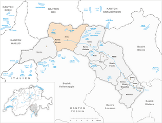
Хоспенталь (Hospental, Hospental)

- коммуна в Швейцарии
 Hiking in Хоспенталь
Hospental is a picturesque village located in the Ursern Valley of the Swiss canton of Uri, nestled within the stunning landscapes of the Swiss Alps. Hiking in and around Hospental offers a range of options for all ability levels, from easy, family-friendly trails to more challenging alpine hikes. Here are some highlights and tips about hiking in this beautiful region:
Trails and Routes
-
Susten Pass Trail: This route offers breathtaking views of the surrounding mountains and is part of the larger network of trails in the region. It is popular for its diverse landscapes and stunning vistas.
-
Via Alpina: The Via Alpina is a long-distance hiking trail that runs across the Swiss Alps. Parts of this trail pass through the Ursern Valley and near Hospental, showcasing the beauty of the alpine terrain.
-
Aare Gorge Trail: Located a short distance away, this trail provides access to the dramatic Aare Gorge, where you can hike along well-maintained paths and bridges that offer spectacular views of the gorge's cliffs.
-
Alpine Pastures: Nearby hiking trails often lead to idyllic alpine pastures where you can see cows grazing and enjoy local flora and fauna. The trails are usually signposted and vary in difficulty.
Tips for Hiking
-
Check Weather Conditions: The weather in the Alps can change rapidly. Always check the forecast and be prepared for sudden changes in temperature and conditions.
-
Footwear and Gear: Wear proper hiking boots for good ankle support and traction. Depending on the season, pack layers, a good rain jacket, and sufficient water and snacks.
-
Maps and Signage: Utilize local maps and follow trail signage. The Swiss hiking trails are well-marked, but having a map or a hiking app can enhance your experience.
-
Wildlife: Keep an eye out for local wildlife. The region is home to diverse animals like ibex, chamois, and various bird species, especially in more remote areas.
-
Local Culture: Take some time to enjoy the local Swiss culture. Hospental has quaint charm, and you can experience the traditional way of life, especially during local festivals.
-
Guided Tours: Consider joining a guided hiking tour if you want to explore more challenging routes or learn about the local ecology and history.
Accessibility
Hospental is easily accessible by train and bus, with connections from larger Swiss towns. Make sure to check local transportation schedules, especially in the off-peak seasons.
Hiking in Hospental and the surrounding areas offers an incredible opportunity to experience the dramatic beauty of the Swiss Alps. Whether you’re a seasoned hiker or a beginner, you’ll find trails that suit your needs and provide unforgettable experiences.
- Страна:

- Почтовый код: 6493
- Телефонный код: 041
- Код автомобильного номера: UR
- Координаты: 46° 37' 14" N, 8° 34' 12" E


- GPS треки (wikiloc): [Ссылка]
- Высота над уровнем моря: 1493 м m
- Площадь: 35.0 кв.км
- Население: 191
- Веб сайт: http://www.hospental.ch
- Википедия русская: wiki(ru)
- Википедия английская: wiki(en)
- Википедия национальная: wiki(de)
- Хранилище Wikidata: Wikidata: Q65681
- Катеория в википедии: [Ссылка]
- код Freebase: [/m/0fwq9d]
- код GeoNames: Альт: [2660297]
- код VIAF: Альт: [245429496]
- ID отношения в OpenStreetMap: [1683081]
- идентификатор местоположения ArchINFORM: [18200]
- идентификатор HDS: [699]
- код швейцарского муниципалитета: [1210]
Граничит с регионами:


Андерматт
- коммуна в Швейцарии
Hiking in Андерматт
Andermatt, nestled in the Swiss Alps, is a captivating hub for hiking enthusiasts. Known for its stunning alpine scenery, Andermatt offers a wide range of trails suitable for various skill levels, from beginners to seasoned hikers....
- Страна:
- Почтовый код: 6490
- Телефонный код: 041
- Код автомобильного номера: UR
- Координаты: 46° 37' 14" N, 8° 37' 53" E
- GPS треки (wikiloc): [Ссылка]
- Высота над уровнем моря: 1753 м m
- Площадь: 62.2 кв.км
- Население: 1354
- Веб сайт: [Ссылка]


Реальп
- коммуна в Швейцарии
Hiking in Реальп
Realp is a charming village located in the Uri canton of Switzerland, nestled in the heart of the Swiss Alps. It's an excellent destination for hiking enthusiasts, offering a variety of trails that cater to different skill levels and preferences. Here are some highlights for hiking in and around Realp:...
- Страна:
- Почтовый код: 6491
- Телефонный код: 041
- Код автомобильного номера: UR
- Координаты: 46° 35' 55" N, 8° 30' 11" E
- GPS треки (wikiloc): [Ссылка]
- Высота над уровнем моря: 1538 м m
- Площадь: 78.04 кв.км
- Население: 151
- Веб сайт: [Ссылка]

Airolo
Hiking in Airolo
Airolo, located in the Ticino canton of Switzerland, is an excellent destination for hiking enthusiasts. It sits at the foot of the Gotthard Pass and offers a variety of trails that cater to different skill levels, from leisurely walks to more challenging treks....
- Страна:
- Почтовый код: 6781; 6780
- Телефонный код: 091
- Код автомобильного номера: TI
- Координаты: 46° 32' 0" N, 8° 37' 0" E
- GPS треки (wikiloc): [Ссылка]
- Высота над уровнем моря: 2132 м m
- Площадь: 94.5 кв.км
- Население: 1527
- Веб сайт: [Ссылка]


Гёшенен
- коммуна в Швейцарии
Hiking in Гёшенен
Göschenen is a picturesque village in the Uri canton of Switzerland, located at the entrance to the Gotthard region, and it offers a variety of hiking opportunities for outdoor enthusiasts. Here are some highlights:...
- Страна:
- Почтовый код: 6487
- Телефонный код: 041
- Код автомобильного номера: UR
- Координаты: 46° 39' 50" N, 8° 29' 56" E
- GPS треки (wikiloc): [Ссылка]
- Высота над уровнем моря: 2430 м m
- Площадь: 10431 кв.км
- Население: 462
- Веб сайт: [Ссылка]