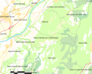
Изрон (Izeron, Izeron)

- коммуна во Франции
 Hiking in Изрон
Izeron is a charming village located in the Isère department of southeastern France, not far from the Vercors National Park. The surrounding area is characterized by its beautiful landscapes, diverse flora and fauna, and a variety of hiking trails that cater to different skill levels.
Hiking Opportunities in Izeron:
-
Trail Variety: The region has numerous hiking trails ranging from easy walks suitable for families to more challenging routes for experienced hikers. You can find paths that take you through forests, along rivers, and up to breathtaking viewpoints.
-
Scenic Views: Many trails in and around Izeron offer stunning vistas of the surrounding mountains, valleys, and the picturesque landscape of the Isère region.
-
Wildlife and Flora: Hikers can enjoy a rich biodiversity in this region, with opportunities to spot various wildlife species and an array of wildflowers, particularly in spring and early summer.
-
Seasonal Hiking: Spring and autumn are excellent times for hiking, with milder temperatures and beautiful scenery. However, summer can also be a great time to explore the trails, provided you stay hydrated and protected from the sun.
-
Vercors National Park: The proximity to Vercors National Park allows for additional hiking options. The park is well-known for its dramatic limestone cliffs and a vast network of trails. Make sure to explore some of the routes that may lead you to breathtaking views or hidden natural wonders.
Tips for Hiking in Izeron:
-
Maps and Guides: Before setting out, it’s a good idea to have a map or a GPS device to help navigate the trails, as some paths may not be well-marked.
-
Proper Gear: Ensure you have appropriate hiking gear, including sturdy shoes, comfortable clothing, and enough water and snacks.
-
Weather Awareness: Check the weather forecast before heading out, as conditions can change quickly in mountainous areas.
-
Local Regulations: Be mindful of local wildlife and regulations, especially if you’re hiking in protected areas. Always stick to marked trails to minimize your impact on the environment.
-
Hiking Groups: Consider joining a local hiking group or finding a guided tour if you’re unfamiliar with the area.
Hiking in Izeron can be a rewarding experience, allowing you to immerse yourself in nature while enjoying the tranquility and beauty of the French Alps. Whether you're a beginner or an experienced hiker, there's something to enjoy in this scenic corner of France.
- Страна:

- Почтовый код: 38160
- Координаты: 45° 8' 48" N, 5° 22' 33" E


- GPS треки (wikiloc): [Ссылка]
- Площадь: 17.19 кв.км
- Население: 701
- Веб сайт: http://izeron.sud-gresivaudan.org
- Википедия русская: wiki(ru)
- Википедия английская: wiki(en)
- Википедия национальная: wiki(fr)
- Хранилище Wikidata: Wikidata: Q585692
- Катеория в википедии: [Ссылка]
- код Freebase: [/m/03nvjxj]
- код GeoNames: Альт: [6433215]
- номер SIREN: [213801954]
- код BNF: [15258013h]
- код VIAF: Альт: [235131270]
- код муниципалитета INSEE: 38195
Граничит с регионами:


Коньен-ле-Горж
- коммуна во Франции
Hiking in Коньен-ле-Горж
Cognin-les-Gorges, located in the French Alps, is a charming destination for hiking enthusiasts. The area is known for its stunning natural landscapes, including picturesque gorges, rugged mountains, and diverse flora and fauna. Here are some highlights for hiking in Cognin-les-Gorges:...
- Страна:
- Почтовый код: 38470
- Координаты: 45° 10' 15" N, 5° 24' 42" E
- GPS треки (wikiloc): [Ссылка]
- Площадь: 12.52 кв.км
- Население: 639
- Веб сайт: [Ссылка]
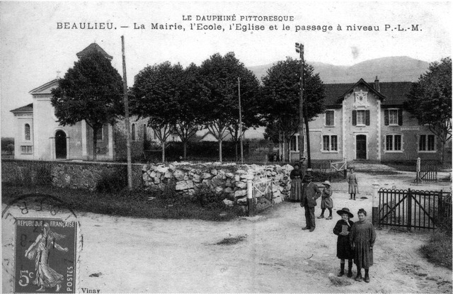

Больё
Hiking in Больё
Beaulieu in Isère is a charming destination for hiking enthusiasts, nestled in the foothills of the French Alps. The area is known for its beautiful landscapes, rolling hills, and proximity to the Chartreuse Mountains. Here are some highlights to consider if you're planning to hike in Beaulieu:...
- Страна:
- Почтовый код: 38470
- Координаты: 45° 11' 33" N, 5° 23' 32" E
- GPS треки (wikiloc): [Ссылка]
- Площадь: 8.79 кв.км
- Население: 623


Теш
- коммуна во Франции
Hiking in Теш
Têche is a beautiful region that is often celebrated for its picturesque landscapes, diverse ecosystems, and extensive trail networks, making it an excellent destination for hiking enthusiasts. Although specific details may vary, here are general aspects to consider when hiking in Têche:...
- Страна:
- Почтовый код: 38470
- Координаты: 45° 10' 58" N, 5° 22' 53" E
- GPS треки (wikiloc): [Ссылка]
- Площадь: 5.03 кв.км
- Население: 578
- Веб сайт: [Ссылка]
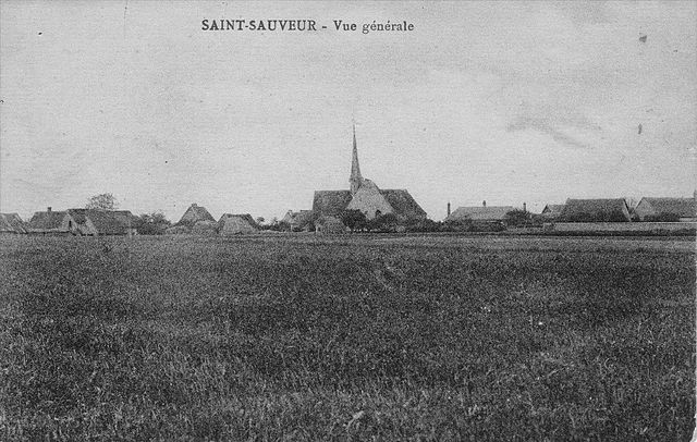
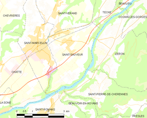
Сен-Совёр
Hiking in Сен-Совёр
Saint-Sauveur is a charming village located in the Isère department of the Auvergne-Rhône-Alpes region in southeastern France. It's known for its beautiful natural landscapes, making it a great destination for hiking enthusiasts....
- Страна:
- Почтовый код: 38160
- Координаты: 45° 9' 9" N, 5° 20' 31" E
- GPS треки (wikiloc): [Ссылка]
- Площадь: 9.42 кв.км
- Население: 2100
- Веб сайт: [Ссылка]

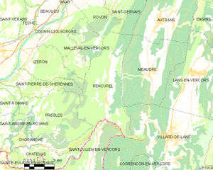
Ранкюрель
- коммуна во Франции
Hiking in Ранкюрель
Rencurel is a charming village located in the Vercors region of France, known for its stunning natural landscapes and excellent hiking opportunities. The Vercors is part of the larger Prealps, characterized by its dramatic cliffs, deep gorges, and lush forests, making it an ideal destination for outdoor enthusiasts....
- Страна:
- Почтовый код: 38680
- Координаты: 45° 6' 9" N, 5° 28' 22" E
- GPS треки (wikiloc): [Ссылка]
- Площадь: 34.63 кв.км
- Население: 304
- Веб сайт: [Ссылка]


Маллеваль-ан-Веркор
- коммуна во Франции
Hiking in Маллеваль-ан-Веркор
Malleval-en-Vercors is a picturesque village located in the Isère department of the Auvergne-Rhône-Alpes region in France. Situated in the Vercors massif, it offers stunning natural landscapes, diverse hiking trails, and a rich variety of flora and fauna....
- Страна:
- Почтовый код: 38470
- Координаты: 45° 8' 50" N, 5° 26' 15" E
- GPS треки (wikiloc): [Ссылка]
- Площадь: 14.1 кв.км
- Население: 53
- Веб сайт: [Ссылка]

Сен-Пьер-де-Шерен
- коммуна во Франции
Hiking in Сен-Пьер-де-Шерен
Saint-Pierre-de-Chérennes, located in the Isère department of the Auvergne-Rhône-Alpes region in southeastern France, offers a picturesque setting for hiking enthusiasts. The surrounding landscapes are characterized by rolling hills, lush forests, and stunning views of the nearby mountains, making it an ideal location for outdoor activities....
- Страна:
- Почтовый код: 38160
- Координаты: 45° 7' 15" N, 5° 21' 44" E
- GPS треки (wikiloc): [Ссылка]
- Площадь: 12.03 кв.км
- Население: 477
- Веб сайт: [Ссылка]