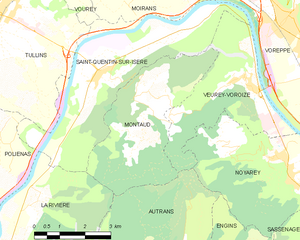
Ла-Ривьер (La Rivière, La Rivière)

 Hiking in Ла-Ривьер
La Rivière is a beautiful commune located in the Isère department of the Auvergne-Rhône-Alpes region in southeastern France. The area is characterized by stunning natural landscapes, mountains, and rivers, making it an excellent destination for hiking enthusiasts.
Hiking Trails
-
Local Trails: There are several hiking trails near La Rivière that cater to various skill levels. Many trails take you through lush forests, rocky outcrops, and provide sweeping views of the surrounding mountains.
-
GR Trails: The region is part of the Grand Randonnée (GR) network, which features well-marked long-distance hiking trails. One popular nearby GR route is the GR9, which traverses beautiful mountain areas.
-
Cascades Trail: Explore trails leading to picturesque waterfalls, such as the Cascade de la Pisserote. These trails often involve some elevation, providing a bit of a challenge but rewarding views.
Terrain & Difficulty
- Varied Terrain: Depending on the chosen trail, you'll experience a mix of flat paths, undulating hills, and steep ascents.
- Difficulty Levels: Trails vary from easy to challenging, making it important to select a hike that aligns with your physical condition and experience level.
Wildlife & Flora
- Rich Biodiversity: The area is home to diverse wildlife and plant species. Keep an eye out for local fauna like deer and various bird species during your hike.
- Scenic Views: As you hike, you’ll encounter stunning vistas of the surrounding mountains, valleys, and possibly even snow-capped peaks in the distance.
Preparation & Safety
- Gear: Ensure you wear appropriate hiking boots and carry essentials such as water, snacks, a map, and a first-aid kit.
- Weather: The weather can be unpredictable in the mountains, so check forecasts and be prepared for sudden changes in conditions.
Best Time to Visit
- Spring and Autumn: These seasons offer mild weather and beautiful natural scenery, ideal for hiking.
- Summer: While popular, it can get hot, so plan for early morning or late afternoon hikes to avoid the heat.
Getting There
- Access: La Rivière is accessible by car, and there might be public transport options available from nearby towns. Check local schedules for the best routes.
Local Culture
- Culinary Delights: After hiking, experience local cuisine in nearby towns, including traditional dishes made from local ingredients.
Whether you’re a seasoned hiker or a beginner, La Rivière offers incredible opportunities to enjoy the great outdoors. Always remember to leave no trace and respect the natural environment during your hikes!
- Страна:

- Почтовый код: 38210
- Координаты: 45° 14' 13" N, 5° 30' 29" E


- GPS треки (wikiloc): [Ссылка]
- Площадь: 18.45 кв.км
- Население: 770
- Википедия русская: wiki(ru)
- Википедия английская: wiki(en)
- Википедия национальная: wiki(fr)
- Хранилище Wikidata: Wikidata: Q1068802
- Катеория в википедии: [Ссылка]
- код Freebase: [/m/03nvk_y]
- код GeoNames: Альт: [6455950]
- номер SIREN: [213803380]
- код BNF: [15258149s]
- код муниципалитета INSEE: 38338
Граничит с регионами:


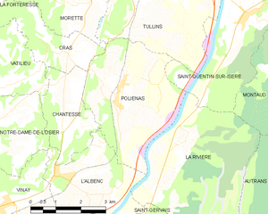
Л’Альбенк
- коммуна во Франции
Hiking in Л’Альбенк
L'Albenc is a charming village located in the Auvergne-Rhône-Alpes region of southeastern France. The area surrounding L'Albenc offers a range of hiking opportunities suited for various skill levels, with stunning views of the surrounding mountains and valleys....
- Страна:
- Почтовый код: 38470
- Координаты: 45° 13' 30" N, 5° 26' 26" E
- GPS треки (wikiloc): [Ссылка]
- Площадь: 9.86 кв.км
- Население: 1170
- Веб сайт: [Ссылка]


Сен-Жерве
Hiking in Сен-Жерве
Saint-Gervais is a beautiful commune located in the Isère department of the Auvergne-Rhône-Alpes region in southeastern France. It offers stunning landscapes, diverse trails, and a range of activities for outdoor enthusiasts, making it a fantastic destination for hikers....
- Страна:
- Почтовый код: 38470
- Координаты: 45° 12' 6" N, 5° 28' 55" E
- GPS треки (wikiloc): [Ссылка]
- Площадь: 13.15 кв.км
- Население: 567
- Веб сайт: [Ссылка]


Сен-Кантен-сюр-Изер
- коммуна во Франции
Hiking in Сен-Кантен-сюр-Изер
Saint-Quentin-sur-Isère, located in the Isère department of France, is surrounded by beautiful landscapes that are perfect for hiking enthusiasts. The region features a mix of rolling hills, forests, and views of the nearby Alps, making it a great destination for hiking....
- Страна:
- Почтовый код: 38210
- Координаты: 45° 16' 45" N, 5° 32' 32" E
- GPS треки (wikiloc): [Ссылка]
- Площадь: 19.45 кв.км
- Население: 1396
- Веб сайт: [Ссылка]

Монто
Hiking in Монто
Montaud, located in the Isère department in the Auvergne-Rhône-Alpes region of France, is a lesser-known gem for hiking enthusiasts. Nestled in the beautiful French Alps, it offers a combination of stunning landscapes, varied terrains, and a rich variety of flora and fauna....
- Страна:
- Почтовый код: 38210
- Координаты: 45° 15' 46" N, 5° 33' 40" E
- GPS треки (wikiloc): [Ссылка]
- Площадь: 14.59 кв.км
- Население: 537
- Веб сайт: [Ссылка]

Отран
- коммуна во Франции
Hiking in Отран
Autrans is a picturesque village located in the Vercors Regional Natural Park in France, renowned for its stunning landscapes and extensive network of hiking trails. The area is perfect for both casual walkers and seasoned hikers, offering a variety of routes catering to different skill levels and preferences....
- Страна:
- Почтовый код: 38880
- Координаты: 45° 10' 30" N, 5° 32' 32" E
- GPS треки (wikiloc): [Ссылка]
- Площадь: 44.02 кв.км
- Население: 1589
- Веб сайт: [Ссылка]

Польенас
- коммуна во Франции
Hiking in Польенас
Poliénas, a charming commune in the Isère department of southeastern France, is well situated for outdoor activities, including hiking. Nestled near the foothills of the Alps, the area offers stunning natural landscapes, diverse terrain, and numerous trails suitable for various skill levels....
- Страна:
- Почтовый код: 38210
- Координаты: 45° 14' 56" N, 5° 28' 17" E
- GPS треки (wikiloc): [Ссылка]
- Площадь: 14.03 кв.км
- Население: 1150
- Веб сайт: [Ссылка]