Тюллен (canton of Tullins, canton de Tullins)

 Hiking in Тюллен
The Canton of Tullins, located in the Isère department of southeastern France, offers a variety of hiking opportunities that showcase the region's natural beauty. Nestled at the foothills of the French Alps, this area is known for its diverse landscapes, including rolling hills, lush forests, and stunning panoramic views of the surrounding mountains.
Popular Hiking Trails:
-
Sentier des Cèdres: This is a scenic trail that takes you through cedar forests, providing an immersive experience in nature. The trail is suitable for various skill levels and offers several viewpoints where you can take in the breathtaking scenery.
-
The Vercors Regional Natural Park: Just a short drive from Tullins, this national park has numerous trails ranging from easy walks to challenging hikes. The Vercors is famous for its limestone plateaus, deep gorges, and rich biodiversity.
-
Belvédère de la Croix du Nivollet: This hike leads to a viewpoint offering a spectacular panorama of the valley and the mountains. It’s a moderately challenging trail, ideal for those looking to enjoy rewarding views without extreme difficulty.
Tips for Hiking in Tullins:
-
Seasonal Considerations: Spring and autumn are particularly pleasant for hiking with mild temperatures and beautiful foliage. Summer can be hot, while winter may offer snow-covered trails for those interested in snowshoeing or winter hikes.
-
Stay Hydrated: Always carry enough water and snacks, especially in warmer months when you might not have access to streams or other water sources.
-
Respect Nature: Follow the Leave No Trace principles to help preserve the natural beauty of the trails. Stay on marked paths and take your waste with you.
-
Maps and Navigation: Make sure to have a good map, especially since some trails might not be well marked. Consider downloading trail maps or using a GPS app.
-
Local Regulations: Be informed about local wildlife and plants, respecting any regulations regarding wildlife and natural habitats.
Conclusion:
Hiking in the Canton of Tullins is a rewarding experience for outdoor enthusiasts looking to explore the natural beauty of the French Alps. With a variety of trails catering to different skill levels and stunning landscapes, it's a great destination for hikers of all kinds. Whether you're planning a day hike or a longer adventure, this region offers plenty of opportunities to connect with nature.
- Страна:

- Столица: Тюллен
- Координаты: 45° 16' 23" N, 5° 28' 11" E


- GPS треки (wikiloc): [Ссылка]
- Население: 38888
- Википедия русская: wiki(ru)
- Википедия английская: wiki(en)
- Википедия национальная: wiki(fr)
- Хранилище Wikidata: Wikidata: Q909982
- код кантона INSEE: [3825]
Включает регионы:


Крас
- коммуна во Франции
Hiking in Крас
Cras, located in the Isère department of the Auvergne-Rhône-Alpes region in southeastern France, provides an excellent backdrop for hiking enthusiasts. The area is known for its stunning mountain landscapes, diverse flora and fauna, and well-marked trails. Here are some key points to consider when hiking in Cras:...
- Страна:
- Почтовый код: 38210
- Координаты: 45° 16' 8" N, 5° 27' 0" E
- GPS треки (wikiloc): [Ссылка]
- Площадь: 5.43 кв.км
- Население: 448
- Веб сайт: [Ссылка]


Ватильё
- коммуна во Франции
Hiking in Ватильё
Vatilieu is a charming commune located in the Isère department in the Auvergne-Rhône-Alpes region of southeastern France. Although it may not be as widely known as other hiking destinations, the surrounding area offers beautiful landscapes and opportunities for outdoor activities like hiking....
- Страна:
- Почтовый код: 38470
- Координаты: 45° 15' 22" N, 5° 24' 38" E
- GPS треки (wikiloc): [Ссылка]
- Площадь: 9.22 кв.км
- Население: 370
- Веб сайт: [Ссылка]


Сен-Поль-д'Изо
- коммуна во Франции
Hiking in Сен-Поль-д'Изо
Saint-Paul-d'Izeaux is a charming commune located in the Isère department of the Auvergne-Rhône-Alpes region in southeastern France. It’s a fantastic destination for hiking enthusiasts looking for beautiful landscapes and a mix of natural beauty and cultural sites....
- Страна:
- Почтовый код: 38140
- Координаты: 45° 19' 0" N, 5° 25' 46" E
- GPS треки (wikiloc): [Ссылка]
- Площадь: 7.63 кв.км
- Население: 296


Сен-Кантен-сюр-Изер
- коммуна во Франции
Hiking in Сен-Кантен-сюр-Изер
Saint-Quentin-sur-Isère, located in the Isère department of France, is surrounded by beautiful landscapes that are perfect for hiking enthusiasts. The region features a mix of rolling hills, forests, and views of the nearby Alps, making it a great destination for hiking....
- Страна:
- Почтовый код: 38210
- Координаты: 45° 16' 45" N, 5° 32' 32" E
- GPS треки (wikiloc): [Ссылка]
- Площадь: 19.45 кв.км
- Население: 1396
- Веб сайт: [Ссылка]

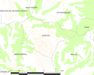
Кенсьё
- коммуна во Франции
Hiking in Кенсьё
Quincieu is not a widely recognized hiking destination in the usual lists of outdoor places, which might imply that you meant a specific region or perhaps there was a typo in the name. If you're referring to a specific area or local trail in a less popular region, I would recommend checking local hiking forums or resources for detailed information....
- Страна:
- Почтовый код: 38470
- Координаты: 45° 16' 32" N, 5° 23' 7" E
- GPS треки (wikiloc): [Ссылка]
- Площадь: 4.75 кв.км
- Население: 103


Ла-Ривьер
Hiking in Ла-Ривьер
La Rivière is a beautiful commune located in the Isère department of the Auvergne-Rhône-Alpes region in southeastern France. The area is characterized by stunning natural landscapes, mountains, and rivers, making it an excellent destination for hiking enthusiasts....
- Страна:
- Почтовый код: 38210
- Координаты: 45° 14' 13" N, 5° 30' 29" E
- GPS треки (wikiloc): [Ссылка]
- Площадь: 18.45 кв.км
- Население: 770

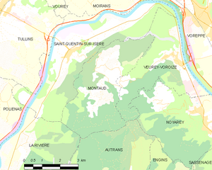
Монто
Hiking in Монто
Montaud, located in the Isère department in the Auvergne-Rhône-Alpes region of France, is a lesser-known gem for hiking enthusiasts. Nestled in the beautiful French Alps, it offers a combination of stunning landscapes, varied terrains, and a rich variety of flora and fauna....
- Страна:
- Почтовый код: 38210
- Координаты: 45° 15' 46" N, 5° 33' 40" E
- GPS треки (wikiloc): [Ссылка]
- Площадь: 14.59 кв.км
- Население: 537
- Веб сайт: [Ссылка]


Морет
- коммуна во Франции
Hiking in Морет
Morette, a charming village located in the French Alps, offers a variety of hiking opportunities that cater to different skill levels and preferences. Here are some key points to consider when planning a hike in Morette:...
- Страна:
- Почтовый код: 38210
- Координаты: 45° 17' 8" N, 5° 27' 7" E
- GPS треки (wikiloc): [Ссылка]
- Площадь: 6.27 кв.км
- Население: 415


Тюллен
- коммуна во Франции
Hiking in Тюллен
Tullins is a charming town located in the Isère department of the Auvergne-Rhône-Alpes region in southeastern France. It's ideally situated near the French Alps, offering access to a range of hiking opportunities that cater to various skill levels....
- Страна:
- Почтовый код: 38210
- Координаты: 45° 17' 51" N, 5° 29' 0" E
- GPS треки (wikiloc): [Ссылка]
- Площадь: 28.79 кв.км
- Население: 7655
- Веб сайт: [Ссылка]

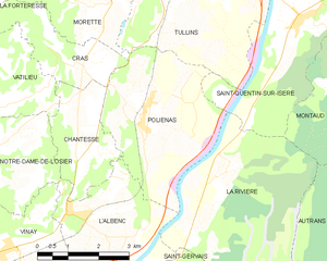
Польенас
- коммуна во Франции
Hiking in Польенас
Poliénas, a charming commune in the Isère department of southeastern France, is well situated for outdoor activities, including hiking. Nestled near the foothills of the Alps, the area offers stunning natural landscapes, diverse terrain, and numerous trails suitable for various skill levels....
- Страна:
- Почтовый код: 38210
- Координаты: 45° 14' 56" N, 5° 28' 17" E
- GPS треки (wikiloc): [Ссылка]
- Площадь: 14.03 кв.км
- Население: 1150
- Веб сайт: [Ссылка]