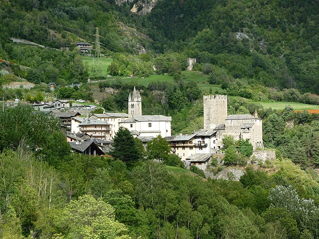
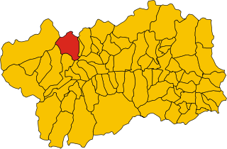
Ла-Саль (La Salle, Aosta Valley, La Salle)
.svg)
- коммуна Италии
 Hiking in Ла-Саль
La Salle, located in the Aosta Valley of Italy, is a picturesque destination for hiking enthusiasts. Nestled in the foothills of the Alps, La Salle offers a blend of stunning natural beauty, rich cultural heritage, and diverse hiking trails suitable for various skill levels.
Key Highlights:
-
Scenic Trails: The region is home to a network of well-maintained trails that wind through breathtaking landscapes, including lush meadows, dense forests, and panoramic mountain views. Whether you are looking for a leisurely walk or a challenging trek, you’ll find routes that cater to all preferences.
-
Popular Hiking Routes:
- Col de La Salle: This hike offers stunning views and is relatively accessible for families. The path guides you through scenic valleys and forests, making it a great introduction to the area’s natural beauty.
- The Mont Blanc Trail: For the more experienced hiker, this trail takes you closer to the Mont Blanc massif, providing unparalleled alpine scenery and a chance to witness local flora and fauna.
-
Flora and Fauna: The Aosta Valley is known for its rich biodiversity. As you hike, keep an eye out for various alpine plants, wildflowers, and wildlife. It’s not uncommon to spot chamois or ibex in the higher elevations.
-
Cultural Stops: Along the hiking trails, you can find charming villages and historical sites. La Salle is known for its quaint architecture, including traditional wooden chalets and ancient churches. Take the time to explore local culture and perhaps enjoy some regional cuisine in a small trattoria.
-
Seasonal Considerations: The best time to hike in La Salle is during the late spring to early fall months, typically from May to September, when the weather is milder, and trails are accessible. Snow can linger in higher elevations, so plan accordingly if you are aiming for summit hikes.
-
Safety Tips: Always carry plenty of water, wear appropriate footwear, and check the weather forecast before heading out. It’s advisable to inform someone about your hiking plans, especially for more remote trails.
-
Access and Transportation: La Salle is easily accessible by car from Aosta, the regional capital. Public transportation options, including buses, connect La Salle with surrounding towns.
Conclusion:
Hiking in La Salle, Aosta Valley, offers an extraordinary opportunity to connect with nature while enjoying the stunning backdrop of the Alps. Whether you're a seasoned hiker or a beginner, La Salle has something to offer everyone. Remember to prepare adequately, respect the environment, and enjoy your adventure in this beautiful part of Italy!
- Страна:

- Почтовый код: 11015
- Телефонный код: 0165
- Код автомобильного номера: AO
- Координаты: 45° 44' 49" N, 7° 4' 22" E


- GPS треки (wikiloc): [Ссылка]
- Высота над уровнем моря: 1001 м m
- Площадь: 83.94 кв.км
- Население: 2056
- Веб сайт: http://www.comune.lasalle.ao.it
- Википедия русская: wiki(ru)
- Википедия английская: wiki(en)
- Википедия национальная: wiki(it)
- Хранилище Wikidata: Wikidata: Q35184
- Галерея изображений в википедии: [Ссылка]
- Катеория в википедии: [Ссылка]
- Карты в википедии: [Ссылка]
- код Freebase: [/m/0ft059]
- код GeoNames: Альт: [6537031]
- ID отношения в OpenStreetMap: [45793]
- WOEID: [716899]
- код ISTAT: 007040
- кадастровый код Италии: E458
Граничит с регионами:

Авиз
- коммуна Италии
Hiking in Авиз
Avise is a charming commune in the Aosta Valley region of Italy, located in the picturesque Alpine area. It offers a variety of hiking opportunities that cater to different skill levels and preferences. Here are some highlights for those interested in hiking in Avise:...
- Страна:
- Почтовый код: 11010
- Телефонный код: 0165
- Код автомобильного номера: AO
- Координаты: 45° 42' 31" N, 7° 8' 26" E
- GPS треки (wikiloc): [Ссылка]
- Высота над уровнем моря: 775 м m
- Площадь: 52.62 кв.км
- Население: 298
- Веб сайт: [Ссылка]
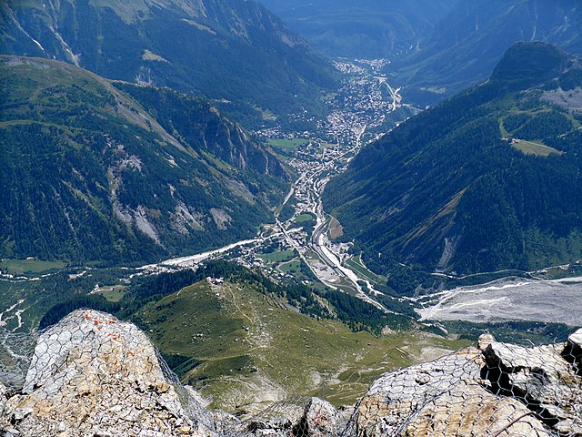

Курмайёр
- коммуна Италии
Hiking in Курмайёр
Courmayeur, located in the Aosta Valley of Italy, is a fantastic destination for hikers. Nestled at the foot of Mont Blanc, the area offers a variety of trails that cater to all skill levels, from leisurely walks to challenging alpine hikes. Here are some highlights for hiking in Courmayeur:...
- Страна:
- Почтовый код: 11013
- Телефонный код: 0165
- Код автомобильного номера: AO
- Координаты: 45° 47' 0" N, 6° 58' 0" E
- GPS треки (wikiloc): [Ссылка]
- Высота над уровнем моря: 1224 м m
- Площадь: 210 кв.км
- Население: 2798
- Веб сайт: [Ссылка]


Ла-Тюйль
- коммуна Италии
Hiking in Ла-Тюйль
La Thuile, located in the Aosta Valley region of Italy, is a fantastic destination for hiking enthusiasts. Nestled in the Alps, this area offers stunning landscapes, diverse wildlife, and a variety of hiking trails suitable for all skill levels, from beginners to experienced adventurers....
- Страна:
- Почтовый код: 11016
- Телефонный код: 0165
- Код автомобильного номера: AO
- Координаты: 45° 42' 58" N, 6° 57' 0" E
- GPS треки (wikiloc): [Ссылка]
- Высота над уровнем моря: 1450 м m
- Площадь: 125.67 кв.км
- Население: 783
- Веб сайт: [Ссылка]


Морже
- коммуна Италии
Hiking in Морже
Morgex, located in the Aosta Valley region of Italy, is a beautiful destination for hiking enthusiasts. Nestled in the Italian Alps, it offers stunning landscapes, rich wildlife, and a variety of trails suited for different skill levels. Here are some highlights and tips for hiking in and around Morgex:...
- Страна:
- Почтовый код: 11017
- Телефонный код: 0165
- Код автомобильного номера: AO
- Координаты: 45° 45' 0" N, 7° 2' 0" E
- GPS треки (wikiloc): [Ссылка]
- Высота над уровнем моря: 923 м m
- Площадь: 43.63 кв.км
- Население: 2123
- Веб сайт: [Ссылка]
Сен-Реми-ан-Босс
- коммуна Италии
Hiking in Сен-Реми-ан-Босс
Saint-Rhémy-en-Bosses is a picturesque village located in the Aosta Valley region of Italy, nestled in the Italian Alps. The area is known for its stunning landscapes, charming architecture, and many outdoor activities, including hiking....
- Страна:
- Почтовый код: 11010
- Телефонный код: 0165
- Код автомобильного номера: AO
- Координаты: 45° 49' 19" N, 7° 10' 32" E
- GPS треки (wikiloc): [Ссылка]
- Высота над уровнем моря: 1519 м m
- Площадь: 64.88 кв.км
- Население: 335
- Веб сайт: [Ссылка]