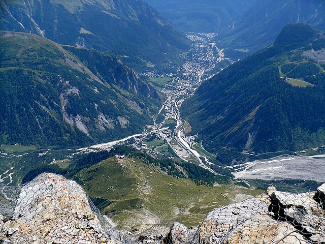
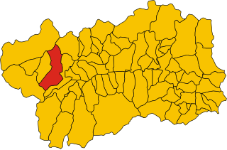
Морже (Morgex, Morgex)
.svg)
- коммуна Италии
 Hiking in Морже
Morgex, located in the Aosta Valley region of Italy, is a beautiful destination for hiking enthusiasts. Nestled in the Italian Alps, it offers stunning landscapes, rich wildlife, and a variety of trails suited for different skill levels. Here are some highlights and tips for hiking in and around Morgex:
Hiking Trails
-
Mont Blanc and the Aosta Valley: Morgex serves as a gateway to the Mont Blanc massif, providing opportunities for breathtaking views and challenging hikes. Trails range from easy walks to demanding ascents.
-
Grand Col Ferret: This trail offers incredible views and connects Morgex with the region of Switzerland, making it a perfect hike for those looking for an international experience. The trek is moderate to challenging.
-
Lac de Chavonne: A relatively easy hike leads to this picturesque lake, ideal for families and those looking for a relaxing day in nature. The trail conditions are usually good, and the scenery is stunning.
-
La Salle and beyond: The nearby town of La Salle has several trails leading into the Valle di La Salle, perfect for those wanting to explore the lush alpine environment.
Best Time to Hike
- Summer (June to September): This is the best time for hiking in Morgex, as the weather is mild and most trails are accessible. The flowers are in full bloom, making for vibrant landscapes.
- Fall (October): Offers beautiful autumn colors, but prepare for cooler temperatures and possible early snow at higher elevations.
Essentials for Hiking
- Proper Gear: Wear sturdy hiking boots, moisture-wicking clothing, and bring layers. A good backpack, sufficient water, and snacks are also crucial.
- Navigation Tools: GPS devices, local maps, or hiking apps can help you stay oriented on the trail.
- Weather Check: Always check the weather forecast before heading out, as conditions can change quickly in the mountains.
- Safety: It’s advisable to inform someone about your hiking plans and estimated return time. Consider hiking with a companion if you're exploring more remote areas.
Local Tips
- Visit the Tourist Information Center: They can provide current trail conditions and additional advice on hikes suited to your preferences.
- Cultural Stops: Take the opportunity to explore local villages, churches, and sample traditional Aosta Valley cuisine before or after your hikes.
Conclusion
Morgex offers an ideal setting for a range of hiking experiences amidst stunning alpine scenery. Whether you are an experienced hiker or a casual nature walker, Morgex and its surroundings have something to offer everyone. Enjoy your adventures in this beautiful part of the world!
- Страна:

- Почтовый код: 11017
- Телефонный код: 0165
- Код автомобильного номера: AO
- Координаты: 45° 45' 0" N, 7° 2' 0" E


- GPS треки (wikiloc): [Ссылка]
- Высота над уровнем моря: 923 м m
- Площадь: 43.63 кв.км
- Население: 2123
- Веб сайт: http://www.comune.morgex.ao.it
- Википедия русская: wiki(ru)
- Википедия английская: wiki(en)
- Википедия национальная: wiki(it)
- Хранилище Wikidata: Wikidata: Q35226
- Галерея изображений в википедии: [Ссылка]
- Катеория в википедии: [Ссылка]
- Карты в википедии: [Ссылка]
- код Freebase: [/m/0ft0dw]
- код GeoNames: Альт: [6536462]
- код VIAF: Альт: [233923527]
- ID отношения в OpenStreetMap: [45956]
- UN/LOCODE: [ITGEX]
- код ISTAT: 007044
- кадастровый код Италии: F726
Граничит с регионами:

Курмайёр
- коммуна Италии
Hiking in Курмайёр
Courmayeur, located in the Aosta Valley of Italy, is a fantastic destination for hikers. Nestled at the foot of Mont Blanc, the area offers a variety of trails that cater to all skill levels, from leisurely walks to challenging alpine hikes. Here are some highlights for hiking in Courmayeur:...
- Страна:
- Почтовый код: 11013
- Телефонный код: 0165
- Код автомобильного номера: AO
- Координаты: 45° 47' 0" N, 6° 58' 0" E
- GPS треки (wikiloc): [Ссылка]
- Высота над уровнем моря: 1224 м m
- Площадь: 210 кв.км
- Население: 2798
- Веб сайт: [Ссылка]

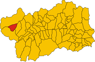
Ла-Саль
- коммуна Италии
Hiking in Ла-Саль
La Salle, located in the Aosta Valley of Italy, is a picturesque destination for hiking enthusiasts. Nestled in the foothills of the Alps, La Salle offers a blend of stunning natural beauty, rich cultural heritage, and diverse hiking trails suitable for various skill levels....
- Страна:
- Почтовый код: 11015
- Телефонный код: 0165
- Код автомобильного номера: AO
- Координаты: 45° 44' 49" N, 7° 4' 22" E
- GPS треки (wikiloc): [Ссылка]
- Высота над уровнем моря: 1001 м m
- Площадь: 83.94 кв.км
- Население: 2056
- Веб сайт: [Ссылка]


Ла-Тюйль
- коммуна Италии
Hiking in Ла-Тюйль
La Thuile, located in the Aosta Valley region of Italy, is a fantastic destination for hiking enthusiasts. Nestled in the Alps, this area offers stunning landscapes, diverse wildlife, and a variety of hiking trails suitable for all skill levels, from beginners to experienced adventurers....
- Страна:
- Почтовый код: 11016
- Телефонный код: 0165
- Код автомобильного номера: AO
- Координаты: 45° 42' 58" N, 6° 57' 0" E
- GPS треки (wikiloc): [Ссылка]
- Высота над уровнем моря: 1450 м m
- Площадь: 125.67 кв.км
- Население: 783
- Веб сайт: [Ссылка]

Пре-Сен-Дидье
- коммуна Италии
Hiking in Пре-Сен-Дидье
Pré-Saint-Didier, located in the Aosta Valley region of Italy, is a picturesque destination for hiking enthusiasts. Nestled in the foothills of the Mont Blanc massif, it offers breathtaking views, challenging trails, and a range of outdoor activities suitable for all levels of hikers....
- Страна:
- Почтовый код: 11010
- Телефонный код: 0165
- Код автомобильного номера: AO
- Координаты: 45° 45' 51" N, 6° 59' 9" E
- GPS треки (wikiloc): [Ссылка]
- Высота над уровнем моря: 1004 м m
- Площадь: 33.4 кв.км
- Население: 1025
- Веб сайт: [Ссылка]