
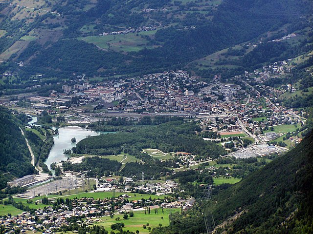
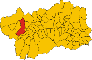
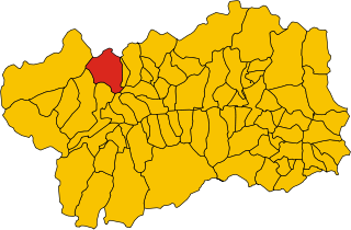
Курмайёр (Courmayeur, Courmayeur)
.svg)
- коммуна Италии
 Hiking in Курмайёр
Courmayeur, located in the Aosta Valley of Italy, is a fantastic destination for hikers. Nestled at the foot of Mont Blanc, the area offers a variety of trails that cater to all skill levels, from leisurely walks to challenging alpine hikes. Here are some highlights for hiking in Courmayeur:
Trails and Routes
-
Val Veny: This valley provides several scenic trails that offer breathtaking views of Mont Blanc and the surrounding peaks. The hike to Rifugio Elisabetta is particularly popular, taking you through lush meadows and rocky landscapes.
-
Skyway Monte Bianco: You can take the cable car up to Pointe Helbronner, which opens up access to numerous high-altitude hiking routes. The trails vary in difficulty but provide stunning panoramic views.
-
Lago della Malciaucia: A moderately challenging hike that leads you to a beautiful alpine lake surrounded by dramatic mountain scenery. It's a great spot for a picnic or simply enjoying nature.
-
Trekking in the Mont Blanc Massif: More experienced hikers can tackle sections of the Tour du Mont Blanc, which takes you through several countries and offers a mix of terrains and landscapes.
-
The Orsieres Plateau: Suitable for those looking for less strenuous hikes, the plateau features gentler trails through pine forests and meadows filled with wildflowers.
Best Times to Hike
- Summer (June to September): The weather is typically warm and the trails are mostly clear of snow, making it the best time for hiking. Popular trails can get busy, so starting early is advisable.
- Autumn (October): Offers stunning fall foliage but can be unpredictable weather-wise. Higher trails may start to be less accessible due to snow.
Tips for Hiking in Courmayeur
- Prepare for Weather Changes: Mountain weather can be unpredictable, so always carry layers, a waterproof jacket, and sun protection.
- Stay Hydrated and Energized: Bring plenty of water and snacks, especially on longer hikes.
- Navigation: Many trails are well-marked, but carrying a map or GPS device is recommended.
- Respect Nature: Follow the Leave No Trace principles, stay on marked trails, and be mindful of the local wildlife and environment.
Additional Activities
Besides hiking, Courmayeur offers opportunities for climbing, skiing in the winter, and exploring the quaint village with its shops, restaurants, and spas. The area's rich culture and stunning scenery make it a perfect destination for outdoor enthusiasts.
Always check local conditions and trail statuses before heading out, and consider hiring a local guide if you're attempting more challenging routes or are unfamiliar with the area! Enjoy your hiking adventure in Courmayeur!
- Страна:

- Почтовый код: 11013
- Телефонный код: 0165
- Код автомобильного номера: AO
- Координаты: 45° 47' 0" N, 6° 58' 0" E


- GPS треки (wikiloc): [Ссылка]
- Высота над уровнем моря: 1224 м m
- Площадь: 210 кв.км
- Население: 2798
- Веб сайт: http://www.comune.courmayeur.ao.it
- Википедия русская: wiki(ru)
- Википедия английская: wiki(en)
- Википедия национальная: wiki(it)
- Хранилище Wikidata: Wikidata: Q34993
- Галерея изображений в википедии: [Ссылка]
- Катеория в википедии: [Ссылка]
- Карты в википедии: [Ссылка]
- код Freebase: [/m/05zstg]
- код GeoNames: Альт: [6540318]
- код BNF: [11962935q]
- код VIAF: Альт: [124409918]
- ID отношения в OpenStreetMap: [46039]
- код GND: Альт: [4494735-5]
- место в MusicBrainz: [5f9d9e42-3891-4211-a39e-efbdcbb2790a]
- UN/LOCODE: [ITCMY]
- код в Большой российской энциклопедии онлайн: [2125681]
- dmoz: Альт: [Regional/Europe/Italy/Regions/Valle_d'Aosta/Localities/Courmayer/]
- код ISTAT: 007022
- кадастровый код Италии: D012
Граничит с регионами:

Бур-Сен-Морис
- коммуна во Франции
Hiking in Бур-Сен-Морис
Bourg-Saint-Maurice, located in the Savoie region of the French Alps, is a fantastic destination for hikers. It offers stunning alpine scenery, a variety of trails suitable for different skill levels, and access to some of the most beautiful landscapes in the region, including the Vanoise National Park....
- Страна:

- Почтовый код: 73700
- Координаты: 45° 37' 0" N, 6° 46' 7" E
- GPS треки (wikiloc): [Ссылка]
- Высота над уровнем моря: 744 м m
- Площадь: 179.07 кв.км
- Население: 7228
- Веб сайт: [Ссылка]

Ла-Саль
- коммуна Италии
Hiking in Ла-Саль
La Salle, located in the Aosta Valley of Italy, is a picturesque destination for hiking enthusiasts. Nestled in the foothills of the Alps, La Salle offers a blend of stunning natural beauty, rich cultural heritage, and diverse hiking trails suitable for various skill levels....
- Страна:
- Почтовый код: 11015
- Телефонный код: 0165
- Код автомобильного номера: AO
- Координаты: 45° 44' 49" N, 7° 4' 22" E
- GPS треки (wikiloc): [Ссылка]
- Высота над уровнем моря: 1001 м m
- Площадь: 83.94 кв.км
- Население: 2056
- Веб сайт: [Ссылка]


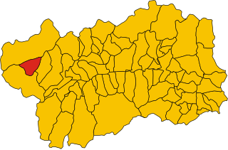
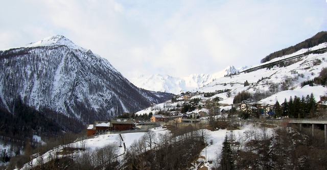
Ла-Тюйль
- коммуна Италии
Hiking in Ла-Тюйль
La Thuile, located in the Aosta Valley region of Italy, is a fantastic destination for hiking enthusiasts. Nestled in the Alps, this area offers stunning landscapes, diverse wildlife, and a variety of hiking trails suitable for all skill levels, from beginners to experienced adventurers....
- Страна:
- Почтовый код: 11016
- Телефонный код: 0165
- Код автомобильного номера: AO
- Координаты: 45° 42' 58" N, 6° 57' 0" E
- GPS треки (wikiloc): [Ссылка]
- Высота над уровнем моря: 1450 м m
- Площадь: 125.67 кв.км
- Население: 783
- Веб сайт: [Ссылка]


Морже
- коммуна Италии
Hiking in Морже
Morgex, located in the Aosta Valley region of Italy, is a beautiful destination for hiking enthusiasts. Nestled in the Italian Alps, it offers stunning landscapes, rich wildlife, and a variety of trails suited for different skill levels. Here are some highlights and tips for hiking in and around Morgex:...
- Страна:
- Почтовый код: 11017
- Телефонный код: 0165
- Код автомобильного номера: AO
- Координаты: 45° 45' 0" N, 7° 2' 0" E
- GPS треки (wikiloc): [Ссылка]
- Высота над уровнем моря: 923 м m
- Площадь: 43.63 кв.км
- Население: 2123
- Веб сайт: [Ссылка]

Пре-Сен-Дидье
- коммуна Италии
Hiking in Пре-Сен-Дидье
Pré-Saint-Didier, located in the Aosta Valley region of Italy, is a picturesque destination for hiking enthusiasts. Nestled in the foothills of the Mont Blanc massif, it offers breathtaking views, challenging trails, and a range of outdoor activities suitable for all levels of hikers....
- Страна:
- Почтовый код: 11010
- Телефонный код: 0165
- Код автомобильного номера: AO
- Координаты: 45° 45' 51" N, 6° 59' 9" E
- GPS треки (wikiloc): [Ссылка]
- Высота над уровнем моря: 1004 м m
- Площадь: 33.4 кв.км
- Население: 1025
- Веб сайт: [Ссылка]
Сен-Реми-ан-Босс
- коммуна Италии
Hiking in Сен-Реми-ан-Босс
Saint-Rhémy-en-Bosses is a picturesque village located in the Aosta Valley region of Italy, nestled in the Italian Alps. The area is known for its stunning landscapes, charming architecture, and many outdoor activities, including hiking....
- Страна:
- Почтовый код: 11010
- Телефонный код: 0165
- Код автомобильного номера: AO
- Координаты: 45° 49' 19" N, 7° 10' 32" E
- GPS треки (wikiloc): [Ссылка]
- Высота над уровнем моря: 1519 м m
- Площадь: 64.88 кв.км
- Население: 335
- Веб сайт: [Ссылка]

Les Contamines-Montjoie
- коммуна во Франции
Hiking in Les Contamines-Montjoie
Les Contamines-Montjoie is a beautiful alpine village located in the French Alps, known for its stunning mountain scenery, diverse trails, and rich natural environment. Here’s an overview of what you can expect when hiking in this region:...
- Страна:
- Почтовый код: 74170
- Координаты: 45° 49' 18" N, 6° 43' 45" E
- GPS треки (wikiloc): [Ссылка]
- Площадь: 81.35 кв.км
- Население: 1196
- Веб сайт: [Ссылка]


Сен-Жерве-ле-Бен
- коммуна во Франции
Hiking in Сен-Жерве-ле-Бен
Saint-Gervais-les-Bains, located in the Haute-Savoie region of the French Alps, is a fantastic destination for hiking enthusiasts. This charming alpine town is not only known for its ski resort but also offers a myriad of hiking trails suitable for all levels, from beginners to experienced hikers....
- Страна:
- Почтовый код: 74190
- Координаты: 45° 53' 33" N, 6° 42' 49" E
- GPS треки (wikiloc): [Ссылка]
- Площадь: 63.63 кв.км
- Население: 5534
- Веб сайт: [Ссылка]


Orsières
Hiking in Orsières
Orsières is a charming municipality located in the Valais region of Switzerland, surrounded by stunning alpine scenery, making it a great destination for hiking enthusiasts. Here are some key points to consider if you plan to hike in Orsières:...
- Страна:

- Почтовый код: 1937
- Телефонный код: 027
- Код автомобильного номера: VS
- Координаты: 45° 58' 20" N, 7° 6' 6" E
- GPS треки (wikiloc): [Ссылка]
- Высота над уровнем моря: 1897 м m
- Площадь: 165.0 кв.км
- Население: 3190
- Веб сайт: [Ссылка]

Шамони-Мон-Блан
- коммуна во Франции
Hiking in Шамони-Мон-Блан
Chamonix, located in the French Alps, is a renowned destination for hiking enthusiasts of all levels. Nestled at the foot of Mont Blanc, the highest mountain in Western Europe, Chamonix offers stunning landscapes, diverse terrain, and a variety of trails to explore. Here are some key points to consider when hiking in Chamonix:...
- Страна:
- Почтовый код: 74400
- Координаты: 45° 55' 20" N, 6° 52' 8" E
- GPS треки (wikiloc): [Ссылка]
- Высота над уровнем моря: 1030 м m
- Площадь: 116.53 кв.км
- Население: 8906
- Веб сайт: [Ссылка]