
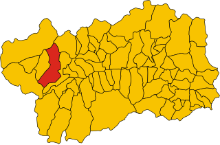
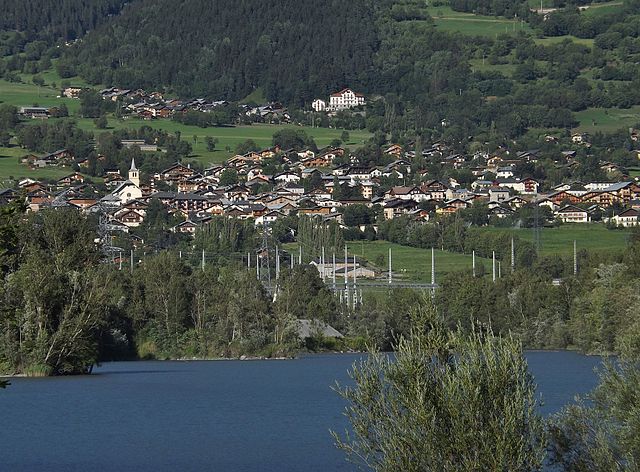
Ла-Тюйль (La Thuile, La Thuile)
.svg)
- коммуна Италии
 Hiking in Ла-Тюйль
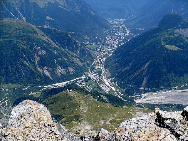
La Thuile, located in the Aosta Valley region of Italy, is a fantastic destination for hiking enthusiasts. Nestled in the Alps, this area offers stunning landscapes, diverse wildlife, and a variety of hiking trails suitable for all skill levels, from beginners to experienced adventurers.
Key Highlights of Hiking in La Thuile:
-
Scenic Trails: The region features numerous well-marked trails that showcase the natural beauty of the Alps. These trails often provide breathtaking views of the surrounding mountains, valleys, and glaciers.
-
Variety of Terrain: Hikers can enjoy a mix of terrains, including mountain passes, alpine meadows, rocky paths, and forested areas. This variety makes each hike unique and engaging.
-
Popular Hiking Areas:
- Piccolo San Bernardo Pass: This historic pass provides trails with remarkable views and connects to both Italy and France.
- Val di La Thuile: This valley offers several routes that range from easy walks to challenging hikes, with opportunities to admire local flora and fauna.
- Mont Blanc Viewpoints: Some trails offer viewpoints with stunning vistas of the Mont Blanc massif.
-
Wildlife: Hikers in La Thuile may spot a variety of wildlife, including chamois, marmots, and numerous bird species. This rich biodiversity adds to the hiking experience.
-
Seasonal Variations: The best time for hiking in La Thuile is typically from late spring to early autumn (May to September), when the weather is mild, and the trails are clear of snow. Some higher-altitude trails may still be accessible in September and early October.
-
Local Culture: Beyond hiking, La Thuile offers a glimpse into local culture, with opportunities to try authentic Aosta Valley cuisine in mountain huts and local restaurants.
-
Guided Tours: For those who prefer guided experiences, there are local companies that offer guided hikes, which can enhance your understanding of the landscape and the area’s ecology.
Tips for Hiking in La Thuile:
- Prepare Accordingly: Always check the weather conditions before heading out. Dress in layers and wear proper hiking boots.
- Stay Hydrated and Energized: Bring plenty of water and snacks to keep your energy levels up during your hikes.
- Navigation: While many trails are well-marked, carrying a map or a GPS device can be useful, especially for more remote areas.
- Respect Nature: Follow the Leave No Trace principles to minimize your impact on the environment.
La Thuile's picturesque trails and beautiful surroundings make it a rewarding destination for hikers looking to explore the natural wonders of the Aosta Valley.
- Страна:

- Почтовый код: 11016
- Телефонный код: 0165
- Код автомобильного номера: AO
- Координаты: 45° 42' 58" N, 6° 57' 0" E


- GPS треки (wikiloc): [Ссылка]
- Высота над уровнем моря: 1450 м m
- Площадь: 125.67 кв.км
- Население: 783
- Веб сайт: http://www.comune.la-thuile.ao.it
- Википедия русская: wiki(ru)
- Википедия английская: wiki(en)
- Википедия национальная: wiki(it)
- Хранилище Wikidata: Wikidata: Q35188
- Галерея изображений в википедии: [Ссылка]
- Катеория в википедии: [Ссылка]
- Карты в википедии: [Ссылка]
- код Freebase: [/m/0ft06z]
- код GeoNames: Альт: [6537032]
- код VIAF: Альт: [316741906]
- ID отношения в OpenStreetMap: [45585]
- код Цифрового атласа Римской империи: [11056]
- dmoz: Альт: [Regional/Europe/Italy/Valle_d'Aosta/Localities/La_Thuile/]
- код ISTAT: 007041
- кадастровый код Италии: E470
Граничит с регионами:

Бур-Сен-Морис
- коммуна во Франции
Hiking in Бур-Сен-Морис
Bourg-Saint-Maurice, located in the Savoie region of the French Alps, is a fantastic destination for hikers. It offers stunning alpine scenery, a variety of trails suitable for different skill levels, and access to some of the most beautiful landscapes in the region, including the Vanoise National Park....
- Страна:

- Почтовый код: 73700
- Координаты: 45° 37' 0" N, 6° 46' 7" E
- GPS треки (wikiloc): [Ссылка]
- Высота над уровнем моря: 744 м m
- Площадь: 179.07 кв.км
- Население: 7228
- Веб сайт: [Ссылка]

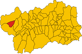
Авиз
- коммуна Италии
Hiking in Авиз
Avise is a charming commune in the Aosta Valley region of Italy, located in the picturesque Alpine area. It offers a variety of hiking opportunities that cater to different skill levels and preferences. Here are some highlights for those interested in hiking in Avise:...
- Страна:
- Почтовый код: 11010
- Телефонный код: 0165
- Код автомобильного номера: AO
- Координаты: 45° 42' 31" N, 7° 8' 26" E
- GPS треки (wikiloc): [Ссылка]
- Высота над уровнем моря: 775 м m
- Площадь: 52.62 кв.км
- Население: 298
- Веб сайт: [Ссылка]
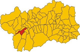
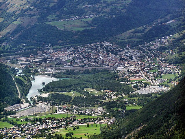
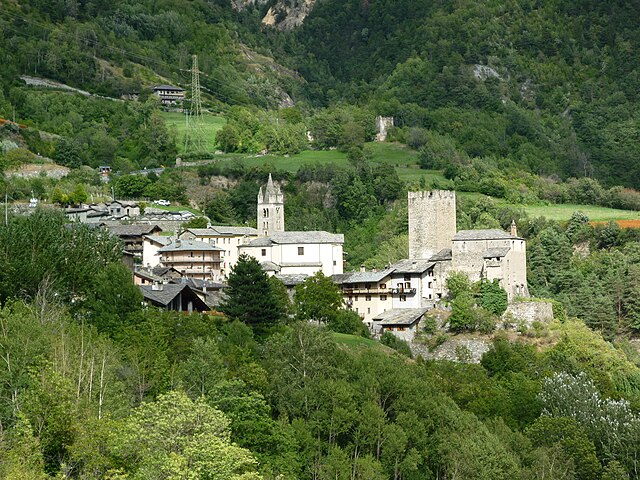
Арвье
- коммуна Италии
Hiking in Арвье
Arvier, a charming town located in the Aosta Valley region of Italy, offers a wealth of hiking opportunities surrounded by stunning alpine scenery. Here are some highlights to consider when planning a hiking adventure in and around Arvier:...
- Страна:
- Почтовый код: 11011
- Телефонный код: 0165
- Код автомобильного номера: AO
- Координаты: 45° 42' 11" N, 7° 10' 0" E
- GPS треки (wikiloc): [Ссылка]
- Высота над уровнем моря: 776 м m
- Площадь: 33.36 кв.км
- Население: 865
- Веб сайт: [Ссылка]

Курмайёр
- коммуна Италии
Hiking in Курмайёр
Courmayeur, located in the Aosta Valley of Italy, is a fantastic destination for hikers. Nestled at the foot of Mont Blanc, the area offers a variety of trails that cater to all skill levels, from leisurely walks to challenging alpine hikes. Here are some highlights for hiking in Courmayeur:...
- Страна:
- Почтовый код: 11013
- Телефонный код: 0165
- Код автомобильного номера: AO
- Координаты: 45° 47' 0" N, 6° 58' 0" E
- GPS треки (wikiloc): [Ссылка]
- Высота над уровнем моря: 1224 м m
- Площадь: 210 кв.км
- Население: 2798
- Веб сайт: [Ссылка]

Ла-Саль
- коммуна Италии
Hiking in Ла-Саль
La Salle, located in the Aosta Valley of Italy, is a picturesque destination for hiking enthusiasts. Nestled in the foothills of the Alps, La Salle offers a blend of stunning natural beauty, rich cultural heritage, and diverse hiking trails suitable for various skill levels....
- Страна:
- Почтовый код: 11015
- Телефонный код: 0165
- Код автомобильного номера: AO
- Координаты: 45° 44' 49" N, 7° 4' 22" E
- GPS треки (wikiloc): [Ссылка]
- Высота над уровнем моря: 1001 м m
- Площадь: 83.94 кв.км
- Население: 2056
- Веб сайт: [Ссылка]


Морже
- коммуна Италии
Hiking in Морже
Morgex, located in the Aosta Valley region of Italy, is a beautiful destination for hiking enthusiasts. Nestled in the Italian Alps, it offers stunning landscapes, rich wildlife, and a variety of trails suited for different skill levels. Here are some highlights and tips for hiking in and around Morgex:...
- Страна:
- Почтовый код: 11017
- Телефонный код: 0165
- Код автомобильного номера: AO
- Координаты: 45° 45' 0" N, 7° 2' 0" E
- GPS треки (wikiloc): [Ссылка]
- Высота над уровнем моря: 923 м m
- Площадь: 43.63 кв.км
- Население: 2123
- Веб сайт: [Ссылка]

Пре-Сен-Дидье
- коммуна Италии
Hiking in Пре-Сен-Дидье
Pré-Saint-Didier, located in the Aosta Valley region of Italy, is a picturesque destination for hiking enthusiasts. Nestled in the foothills of the Mont Blanc massif, it offers breathtaking views, challenging trails, and a range of outdoor activities suitable for all levels of hikers....
- Страна:
- Почтовый код: 11010
- Телефонный код: 0165
- Код автомобильного номера: AO
- Координаты: 45° 45' 51" N, 6° 59' 9" E
- GPS треки (wikiloc): [Ссылка]
- Высота над уровнем моря: 1004 м m
- Площадь: 33.4 кв.км
- Население: 1025
- Веб сайт: [Ссылка]


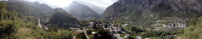
Вальгризанш
- коммуна Италии
Hiking in Вальгризанш
Valgrisenche is a beautiful and relatively lesser-known valley located in the Aosta Valley region of Italy, nestled within the western Alps. It offers stunning natural scenery, alpine landscapes, and various hiking opportunities suitable for different skill levels. Here are some highlights and tips for hiking in Valgrisenche:...
- Страна:
- Почтовый код: 11010
- Телефонный код: 0165
- Код автомобильного номера: AO
- Координаты: 45° 37' 48" N, 7° 3' 52" E
- GPS треки (wikiloc): [Ссылка]
- Высота над уровнем моря: 1664 м m
- Площадь: 113.48 кв.км
- Население: 192
- Веб сайт: [Ссылка]


Montvalezan
- коммуна во Франции
Hiking in Montvalezan
Montvalezan, nestled in the Savoie region of the French Alps, offers a stunning backdrop for hiking enthusiasts. This area is particularly known for its proximity to the vast Ski Paradiski area, which includes Les Arcs and La Plagne, but it also boasts fantastic summer hiking opportunities....
- Страна:
- Почтовый код: 73700
- Координаты: 45° 36' 43" N, 6° 50' 48" E
- GPS треки (wikiloc): [Ссылка]
- Площадь: 25.9 кв.км
- Население: 695

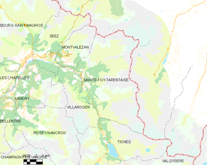
Sainte-Foy-Tarentaise
- коммуна во Франции
Hiking in Sainte-Foy-Tarentaise
Sainte-Foy-Tarentaise, located in the French Alps, is a fantastic destination for hiking enthusiasts. This region boasts stunning landscapes, diverse trails, and a variety of experiences for hikers of all levels. Here's what you can expect when hiking in Sainte-Foy-Tarentaise:...
- Страна:
- Почтовый код: 73640
- Координаты: 45° 35' 21" N, 6° 53' 2" E
- GPS треки (wikiloc): [Ссылка]
- Площадь: 100.15 кв.км
- Население: 737
- Веб сайт: [Ссылка]

Séez
- коммуна во Франции
Hiking in Séez
Séez, located in the Auvergne-Rhône-Alpes region of France near the Italian border, is a gateway to some beautiful hiking experiences in the the French Alps. Here’s what you need to know about hiking in and around Séez:...
- Страна:
- Почтовый код: 73700
- Координаты: 45° 37' 22" N, 6° 48' 3" E
- GPS треки (wikiloc): [Ссылка]
- Площадь: 42.55 кв.км
- Население: 2398
- Веб сайт: [Ссылка]