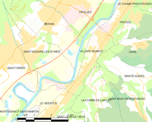
Лавальд (Laval, Laval)

 Hiking in Лавальд
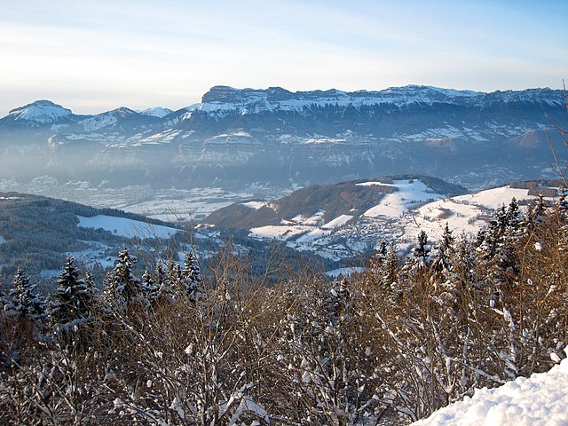
Laval, located in the Isère department of the Auvergne-Rhône-Alpes region in France, is surrounded by stunning natural landscapes that provide excellent hiking opportunities. Here are some key points about hiking in and around Laval, Isère:
-
Scenic Trails: The region offers a variety of hiking trails, ranging from easy walks suitable for families to more challenging hikes for experienced trekkers. The terrain includes forests, mountains, and rivers, with beautiful views at every turn.
-
Routes and Maps: It's advisable to obtain local hiking maps or guides that outline the different trails in the area. Some popular routes may include circuits around the Chartreuse massif or paths that lead towards the Vercors Regional Nature Park.
-
Natural Attractions: You may encounter unique flora and fauna as well as various natural landmarks such as waterfalls, cliffs, and scenic overlooks. The nearby Belledonne and Vercors ranges offer more rugged terrain and are known for their breathtaking landscapes.
-
Weather Considerations: The weather can change rapidly in the mountains, so it’s important to check forecasts before heading out. Be prepared for varying conditions, particularly at higher altitudes.
-
Safety Tips: Always inform someone about your hiking plans, bring enough water and food, and carry appropriate gear, including sturdy hiking boots and weather-appropriate clothing. It’s also helpful to have a charged mobile phone for emergencies.
-
Local Hiking Clubs: Consider joining local hiking clubs or guided hikes, which can enhance your experience by providing insights into the natural history and geology of the region.
-
Nearby Attractions: Take advantage of your hiking trip to explore other attractions in the region, including quaint villages, historical sites, and local cuisine in the Isère area.
Whether you are a novice or an experienced hiker, Laval offers a rich experience for enjoying the great outdoors!
- Страна:

- Почтовый код: 38190
- Координаты: 45° 15' 11" N, 5° 55' 57" E


- GPS треки (wikiloc): [Ссылка]
- Площадь: 25.33 кв.км
- Население: 988
- Веб сайт: http://www.laval-en-belledonne.fr
- Википедия русская: wiki(ru)
- Википедия английская: wiki(en)
- Википедия национальная: wiki(fr)
- Хранилище Wikidata: Wikidata: Q261801
- Катеория в википедии: [Ссылка]
- код Freebase: [/m/03nvk4s]
- код GeoNames: Альт: [6613711]
- номер SIREN: [213802069]
- код BNF: [152580214]
- код муниципалитета INSEE: 38206
Граничит с регионами:


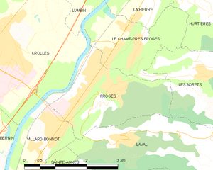
Ле-Шам-пре-Фрож
- коммуна во Франции
Hiking in Ле-Шам-пре-Фрож
Le Champ-près-Froges is a picturesque village located in the Auvergne region of France, surrounded by beautiful landscapes that make it an ideal destination for hiking enthusiasts. Here are some key aspects to consider when planning a hiking trip in this area:...
- Страна:
- Почтовый код: 38190
- Координаты: 45° 16' 51" N, 5° 56' 20" E
- GPS треки (wikiloc): [Ссылка]
- Площадь: 4.83 кв.км
- Население: 1220
- Веб сайт: [Ссылка]

Лез-Адре
- коммуна во Франции
Hiking in Лез-Адре
Les Adrets, located in the Var department in the Provence-Alpes-Côte d'Azur region of France, offers beautiful hiking opportunities that showcase the stunning landscapes of the French Riviera and Provençal countryside. Here are some key points about hiking in this area:...
- Страна:
- Почтовый код: 38190
- Координаты: 45° 16' 18" N, 5° 57' 52" E
- GPS треки (wikiloc): [Ссылка]
- Площадь: 16.15 кв.км
- Население: 1004
- Веб сайт: [Ссылка]

Аллемон
- коммуна во Франции
Hiking in Аллемон
Allemont is a picturesque village located in the French Alps, specifically in the Isère department. It serves as a gateway to the Vaujany valley and nearby hiking routes in the Oisans region, making it a great base for outdoor enthusiasts. Here are some highlights and considerations for hiking in and around Allemont:...
- Страна:
- Почтовый код: 38114
- Координаты: 45° 7' 49" N, 6° 2' 15" E
- GPS треки (wikiloc): [Ссылка]
- Площадь: 44.75 кв.км
- Население: 1006
- Веб сайт: [Ссылка]


Ла-Ферьер
Hiking in Ла-Ферьер
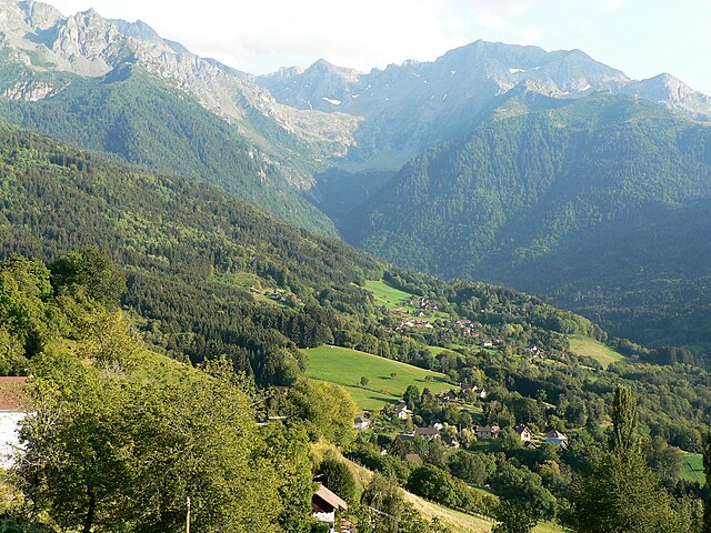
La Ferrière, located in the Isère department in France, is a charming village nestled in the French Alps. It offers a variety of hiking opportunities for both beginners and experienced hikers. The region is known for its stunning landscapes, featuring picturesque valleys, rugged mountain terrain, and lush forests....
- Страна:
- Почтовый код: 38580
- Координаты: 45° 19' 11" N, 6° 5' 14" E
- GPS треки (wikiloc): [Ссылка]
- Площадь: 54.33 кв.км
- Население: 231
- Веб сайт: [Ссылка]

Сент-Аньес
Hiking in Сент-Аньес
Sainte-Agnès, located in the Isère department in the Auvergne-Rhône-Alpes region of France, offers a variety of hiking opportunities that showcase stunning alpine scenery, lush meadows, and charming mountain villages. Here are some insights into hiking in this beautiful area:...
- Страна:
- Почтовый код: 38190
- Координаты: 45° 14' 12" N, 5° 55' 16" E
- GPS треки (wikiloc): [Ссылка]
- Площадь: 26.85 кв.км
- Население: 567
- Веб сайт: [Ссылка]

Фрож
- коммуна во Франции
Hiking in Фрож
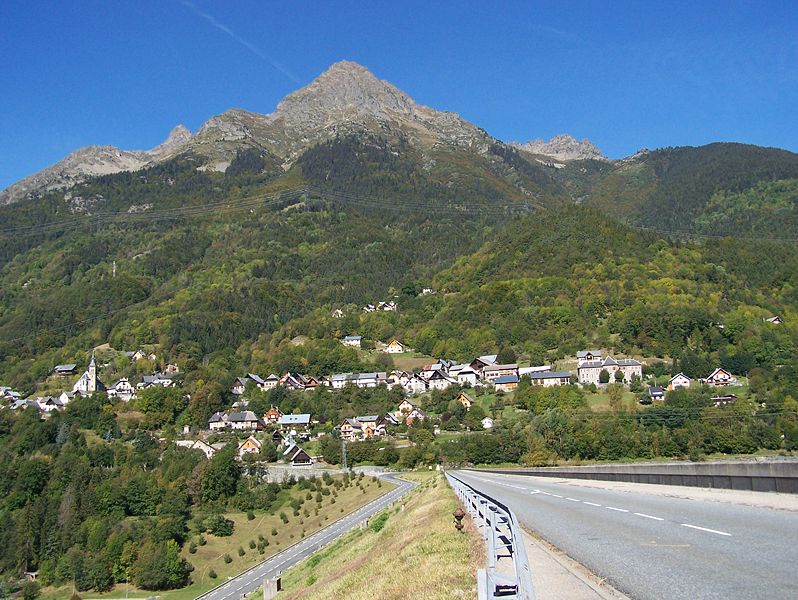
Froges is a charming commune located in the Isère department, nestled in the picturesque Auvergne-Rhône-Alpes region of southeastern France. This area is well-known for its stunning natural landscapes, which makes it a great destination for hiking enthusiasts....
- Страна:
- Почтовый код: 38190
- Координаты: 45° 16' 24" N, 5° 55' 30" E
- GPS треки (wikiloc): [Ссылка]
- Площадь: 6.43 кв.км
- Население: 3291
- Веб сайт: [Ссылка]

Виллар-Бонно
- коммуна во Франции
Hiking in Виллар-Бонно
Villard-Bonnot, located in the French Alps near Grenoble, offers an excellent opportunity for hiking enthusiasts. With its picturesque landscapes, diverse trails, and stunning mountain views, the area is appealing to both beginners and experienced hikers....
- Страна:
- Почтовый код: 38190
- Координаты: 45° 14' 17" N, 5° 53' 18" E
- GPS треки (wikiloc): [Ссылка]
- Площадь: 5.84 кв.км
- Население: 7096
- Веб сайт: [Ссылка]