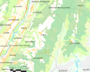
Лез-Адре (Les Adrets, Les Adrets)

- коммуна во Франции
 Hiking in Лез-Адре
Les Adrets, located in the Var department in the Provence-Alpes-Côte d'Azur region of France, offers beautiful hiking opportunities that showcase the stunning landscapes of the French Riviera and Provençal countryside. Here are some key points about hiking in this area:
Scenic Views
- Panoramic Landscapes: Hikes in Les Adrets reward trekkers with breathtaking views of the surrounding hills, valleys, and the Mediterranean coastline. The diverse terrain includes forests, vineyards, and rocky outcrops.
Trail Options
- Variety of Trails: There are several trails ranging from easy walks suitable for families to more challenging hikes for experienced hikers. Popular trails may include routes through the nearby Esterel Massif, which is famous for its unique red rock formations.
- Marked Paths: Many trails are well marked, making navigation straightforward for hikers. It's advisable to carry a map or use a hiking app for added guidance.
Flora and Fauna
- Biodiversity: The region is rich in flora and fauna, including Mediterranean vegetation and various wildlife. Birdwatchers and nature lovers will appreciate the diverse ecosystems found along the trails.
Best Times to Hike
- Optimal Seasons: Spring (April to June) and fall (September to October) are ideal times to hike in Les Adrets due to mild temperatures and lower chances of crowds. Summer can be quite hot, so early morning hikes are recommended to avoid the heat.
Recommendations
- Hydration and Gear: Always carry enough water and wear appropriate hiking footwear. The terrain can vary, so consider trekking poles for added stability on uneven paths.
- Local Guidance: Engaging with local hiking groups or guides can enhance your experience and offer insights into the best trails and hidden gems in the area.
Access
- Transportation: Les Adrets is accessible by car, and there may be public transport options from nearby towns. Check local schedules for the most current information.
Hiking in Les Adrets provides not only physical activity but also a chance to immerse yourself in the natural beauty of this enchanting region. Remember to respect nature and follow Leave No Trace principles during your adventures!
- Страна:

- Почтовый код: 38190
- Координаты: 45° 16' 18" N, 5° 57' 52" E


- GPS треки (wikiloc): [Ссылка]
- Площадь: 16.15 кв.км
- Население: 1004
- Веб сайт: http://www.le-gresivaudan.fr/-Les-Adrets-
- Википедия русская: wiki(ru)
- Википедия английская: wiki(en)
- Википедия национальная: wiki(fr)
- Хранилище Wikidata: Wikidata: Q1069668
- Катеория в википедии: [Ссылка]
- код Freebase: [/m/03g_7ph]
- код GeoNames: Альт: [6457196]
- номер SIREN: [213800022]
- код BNF: [15257832r]
- код муниципалитета INSEE: 38002
Граничит с регионами:


Ле-Шам-пре-Фрож
- коммуна во Франции
Hiking in Ле-Шам-пре-Фрож
Le Champ-près-Froges is a picturesque village located in the Auvergne region of France, surrounded by beautiful landscapes that make it an ideal destination for hiking enthusiasts. Here are some key aspects to consider when planning a hiking trip in this area:...
- Страна:
- Почтовый код: 38190
- Координаты: 45° 16' 51" N, 5° 56' 20" E
- GPS треки (wikiloc): [Ссылка]
- Площадь: 4.83 кв.км
- Население: 1220
- Веб сайт: [Ссылка]

Те
- коммуна во Франции
Hiking in Те
Theys is a charming commune in the French Alps, situated in the Isère department. It's a fantastic location for hiking enthusiasts, offering a variety of trails that cater to different skill levels. Here are some key points about hiking in Theys:...
- Страна:
- Почтовый код: 38570
- Координаты: 45° 18' 1" N, 5° 59' 49" E
- GPS треки (wikiloc): [Ссылка]
- Площадь: 35.77 кв.км
- Население: 1943
- Веб сайт: [Ссылка]


Ла-Ферьер
Hiking in Ла-Ферьер
La Ferrière, located in the Isère department in France, is a charming village nestled in the French Alps. It offers a variety of hiking opportunities for both beginners and experienced hikers. The region is known for its stunning landscapes, featuring picturesque valleys, rugged mountain terrain, and lush forests....
- Страна:
- Почтовый код: 38580
- Координаты: 45° 19' 11" N, 6° 5' 14" E
- GPS треки (wikiloc): [Ссылка]
- Площадь: 54.33 кв.км
- Население: 231
- Веб сайт: [Ссылка]


Юртье
Hiking in Юртье
Hurtières is a beautiful area located in the Savoie region of the French Alps, known for its stunning natural landscapes and various hiking opportunities. Here are some key points to consider if you're planning a hike in the Hurtières area:...
- Страна:
- Почтовый код: 38570
- Координаты: 45° 17' 17" N, 5° 58' 14" E
- GPS треки (wikiloc): [Ссылка]
- Площадь: 3.35 кв.км
- Население: 168

Лавальд
Hiking in Лавальд
Laval, located in the Isère department of the Auvergne-Rhône-Alpes region in France, is surrounded by stunning natural landscapes that provide excellent hiking opportunities. Here are some key points about hiking in and around Laval, Isère:...
- Страна:
- Почтовый код: 38190
- Координаты: 45° 15' 11" N, 5° 55' 57" E
- GPS треки (wikiloc): [Ссылка]
- Площадь: 25.33 кв.км
- Население: 988
- Веб сайт: [Ссылка]

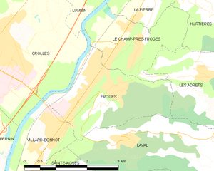
Фрож
- коммуна во Франции
Hiking in Фрож
Froges is a charming commune located in the Isère department, nestled in the picturesque Auvergne-Rhône-Alpes region of southeastern France. This area is well-known for its stunning natural landscapes, which makes it a great destination for hiking enthusiasts....
- Страна:
- Почтовый код: 38190
- Координаты: 45° 16' 24" N, 5° 55' 30" E
- GPS треки (wikiloc): [Ссылка]
- Площадь: 6.43 кв.км
- Население: 3291
- Веб сайт: [Ссылка]