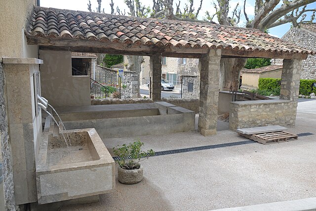
Lemps (Lemps)

- коммуна во Франции
 Hiking in Lemps
Lemps, located in the Drôme department of France, offers a charming setting for hiking enthusiasts with its picturesque landscapes and varied terrain. The region is characterized by rolling hills, vineyards, and small villages, providing a peaceful backdrop for outdoor adventures.
Hiking Trails
-
Local Trails: There are numerous walking paths and trails around Lemps, many of which are part of larger hiking networks in the Drôme region. These trails can range from easy strolls through the countryside to more challenging hikes that involve elevation changes and rocky terrain.
-
GR Trails: You might be within reach of some sections of the Grande Randonnée (GR) hiking trails, which are long-distance paths that crisscross France. These trails offer well-marked routes and can lead you through more extensive natural parks and scenic areas.
-
Nature Reserves: The nearby regional nature reserves and parks, like the Parc Naturel Régional du Vercors, provide incredible opportunities for hiking, with options for different skill levels.
Key Highlights
- Scenic Views: As you hike, expect to be rewarded with stunning views of the surrounding valleys, vineyards, and perhaps even the distant peaks of the Alps on clear days.
- Flora and Fauna: The Drôme region is home to a diverse array of plants and wildlife, making it an excellent spot for nature lovers and birdwatchers.
Practical Tips
- Best Time to Visit: The spring and early autumn months are ideal for hiking in this region, as the weather is generally mild and the landscapes are particularly beautiful during these seasons.
- Preparation: Ensure you have the right gear, including sturdy hiking boots, appropriate clothing, and plenty of water. It’s also a good idea to have a map or GPS device, as some trails can be less well-marked.
Local Experience
Don't miss out on the opportunity to experience local culture. After a day of hiking, you can enjoy the local cuisine in nearby villages, sampling regional delicacies and perhaps some fine Rhône wines.
Overall, hiking in Lemps and the surrounding Drôme region can be a delightful way to immerse yourself in nature while enjoying the beauty and tranquility of the French countryside.
- Страна:

- Почтовый код: 26510
- Координаты: 44° 21' 4" N, 5° 25' 8" E


- GPS треки (wikiloc): [Ссылка]
- Высота над уровнем моря: 774 м m
- Площадь: 16.04 кв.км
- Население: 47
- Википедия английская: wiki(en)
- Википедия национальная: wiki(fr)
- Хранилище Wikidata: Wikidata: Q634887
- Катеория в википедии: [Ссылка]
- код Freebase: [/m/03mhht6]
- код GeoNames: Альт: [6616252]
- номер SIREN: [212601611]
- код BNF: [152530228]
- код муниципалитета INSEE: 26161
Граничит с регионами:

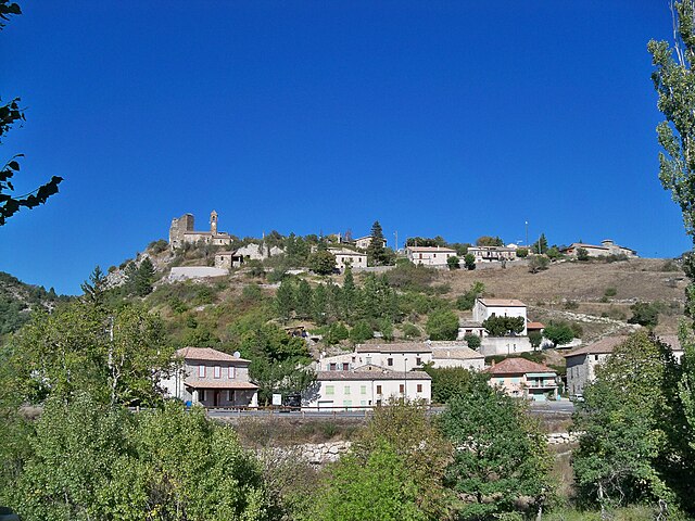
Розан
- коммуна во Франции
Hiking in Розан
Rosans is a charming village located in the Hautes-Alpes region of southeastern France, known for its picturesque landscapes, diverse flora, and a range of hiking opportunities. Here are some key points about hiking in and around Rosans:...
- Страна:
- Почтовый код: 05150
- Координаты: 44° 23' 30" N, 5° 28' 12" E
- GPS треки (wikiloc): [Ссылка]
- Площадь: 30.39 кв.км
- Население: 492
- Веб сайт: [Ссылка]

Saint-Sauveur-Gouvernet
- коммуна во Франции
Hiking in Saint-Sauveur-Gouvernet
Saint-Sauveur-Gouvernet is a charming commune located in the Auvergne-Rhône-Alpes region of France. It is known for its beautiful natural surroundings, making it an excellent destination for hiking enthusiasts. Here are some highlights about hiking in and around Saint-Sauveur-Gouvernet:...
- Страна:
- Почтовый код: 26110
- Координаты: 44° 20' 14" N, 5° 21' 3" E
- GPS треки (wikiloc): [Ссылка]
- Площадь: 19.32 кв.км
- Население: 184
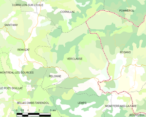
Verclause
- коммуна во Франции
Hiking in Verclause
Verclause, while not a widely known hiking destination, offers beautiful natural scenery and outdoor activities for hiking enthusiasts. It is likely part of a region that features picturesque landscapes, including perhaps rolling hills, forests, and potentially even rivers or lakes, depending on its geography....
- Страна:
- Почтовый код: 26510
- Координаты: 44° 22' 50" N, 5° 25' 40" E
- GPS треки (wikiloc): [Ссылка]
- Площадь: 26.14 кв.км
- Население: 62


Montferrand-la-Fare
- коммуна во Франции
Hiking in Montferrand-la-Fare
Montferrand-la-Fare is a charming commune located in the Provence-Alpes-Côte d'Azur region of southeastern France, particularly known for its picturesque landscapes and natural beauty. Hiking in this area can provide you with a wonderful experience, as it combines scenic views with the tranquility of rural France....
- Страна:
- Почтовый код: 26510
- Координаты: 44° 21' 36" N, 5° 26' 59" E
- GPS треки (wikiloc): [Ссылка]
- Высота над уровнем моря: 670 м m
- Площадь: 11.24 кв.км
- Население: 31


Bellecombe-Tarendol
- коммуна во Франции
Hiking in Bellecombe-Tarendol
Bellecombe-Tarendol is a picturesque area located in the Auvergne-Rhône-Alpes region of France, which offers a range of hiking opportunities for both novices and experienced hikers. Nestled in the foothills of the Alps, the region is known for its stunning natural beauty, including rolling hills, dense forests, and diverse wildlife....
- Страна:
- Почтовый код: 26110
- Координаты: 44° 21' 6" N, 5° 21' 11" E
- GPS треки (wikiloc): [Ссылка]
- Площадь: 13.48 кв.км
- Население: 86