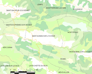
Saint-Sauveur-Gouvernet (Saint-Sauveur-Gouvernet)

- коммуна во Франции
 Hiking in Saint-Sauveur-Gouvernet
Saint-Sauveur-Gouvernet is a charming commune located in the Auvergne-Rhône-Alpes region of France. It is known for its beautiful natural surroundings, making it an excellent destination for hiking enthusiasts. Here are some highlights about hiking in and around Saint-Sauveur-Gouvernet:
Scenic Trails
-
Diverse Landscapes: The region features a variety of terrains including mountains, forests, and rolling hills, providing hikers with diverse landscapes to explore.
-
Well-Marked Trails: The area boasts a network of well-marked hiking trails suitable for different skill levels, from leisurely walks to more challenging hikes.
-
Panoramic Views: Many trails offer breathtaking views of the surrounding valleys and mountains, especially the Monts du Velay, making for great photography opportunities.
Nature and Environment
-
Flora and Fauna: As you hike, you'll have the chance to encounter a diverse range of flora and fauna. Keep an eye out for local wildlife and unique plant species native to the region.
-
Natural Parks: Nearby natural parks may also offer additional trails and hiking experiences, featuring protected landscapes and natural beauty.
Cultural Aspects
-
Historical Sites: Some trails may lead you to historical landmarks, providing insight into the local culture and history of the area.
-
Local Amenities: The commune is small but may have local shops or eateries where you can rest and enjoy traditional French cuisine after a day of hiking.
Tips for Hiking
-
Prepare: Always check the weather forecast and dress accordingly. Bring plenty of water, snacks, and a map or a GPS device for navigation.
-
Wildlife Respect: Follow Leave No Trace principles, and respect the natural environment as well as local wildlife.
-
Safety: Inform someone about your hiking plans and expected return time, especially if you're hiking alone or on less-traveled paths.
-
Join a Group: If you're new to the area or hiking in general, consider joining a guided tour or group hike to help you navigate the trails and make new friends.
Hiking in Saint-Sauveur-Gouvernet is sure to be a rewarding experience, combining beautiful outdoor scenery with a taste of local culture!
- Страна:

- Почтовый код: 26110
- Координаты: 44° 20' 14" N, 5° 21' 3" E


- GPS треки (wikiloc): [Ссылка]
- Площадь: 19.32 кв.км
- Население: 184
- Википедия английская: wiki(en)
- Википедия национальная: wiki(fr)
- Хранилище Wikidata: Wikidata: Q219342
- Катеория в википедии: [Ссылка]
- код Freebase: [/m/03mhl23]
- код GeoNames: Альт: [6616265]
- номер SIREN: [212603294]
- код BNF: [15253189t]
- код муниципалитета INSEE: 26329
Граничит с регионами:

Сент-Обан-Сюр-л'Увез
- коммуна во Франции
Hiking in Сент-Обан-Сюр-л'Увез
Saint-Auban-sur-l'Ouvèze is a charming village located in the Drôme department in southeastern France, known for its picturesque landscapes and diverse hiking opportunities. Nestled in the Vercors Regional Natural Park, it offers a range of trails suitable for different skill levels, making it an excellent destination for hikers. Here are some key points to consider if you're planning a hiking trip there:...
- Страна:
- Почтовый код: 26170
- Координаты: 44° 17' 18" N, 5° 24' 59" E
- GPS треки (wikiloc): [Ссылка]
- Площадь: 16.55 кв.км
- Население: 216


Vercoiran
- коммуна во Франции
Hiking in Vercoiran
Vercoiran is a charming commune located in the Drôme department in southeastern France, known for its beautiful natural landscapes and outdoor activities, including hiking. The region offers various trails that cater to different levels of hikers, from beginners to more experienced outdoor enthusiasts....
- Страна:
- Почтовый код: 26170
- Координаты: 44° 18' 3" N, 5° 20' 45" E
- GPS треки (wikiloc): [Ссылка]
- Площадь: 19.95 кв.км
- Население: 144


Montferrand-la-Fare
- коммуна во Франции
Hiking in Montferrand-la-Fare
Montferrand-la-Fare is a charming commune located in the Provence-Alpes-Côte d'Azur region of southeastern France, particularly known for its picturesque landscapes and natural beauty. Hiking in this area can provide you with a wonderful experience, as it combines scenic views with the tranquility of rural France....
- Страна:
- Почтовый код: 26510
- Координаты: 44° 21' 36" N, 5° 26' 59" E
- GPS треки (wikiloc): [Ссылка]
- Высота над уровнем моря: 670 м m
- Площадь: 11.24 кв.км
- Население: 31


Lemps
- коммуна во Франции
Hiking in Lemps
Lemps, located in the Drôme department of France, offers a charming setting for hiking enthusiasts with its picturesque landscapes and varied terrain. The region is characterized by rolling hills, vineyards, and small villages, providing a peaceful backdrop for outdoor adventures....
- Страна:
- Почтовый код: 26510
- Координаты: 44° 21' 4" N, 5° 25' 8" E
- GPS треки (wikiloc): [Ссылка]
- Высота над уровнем моря: 774 м m
- Площадь: 16.04 кв.км
- Население: 47


Bellecombe-Tarendol
- коммуна во Франции
Hiking in Bellecombe-Tarendol
Bellecombe-Tarendol is a picturesque area located in the Auvergne-Rhône-Alpes region of France, which offers a range of hiking opportunities for both novices and experienced hikers. Nestled in the foothills of the Alps, the region is known for its stunning natural beauty, including rolling hills, dense forests, and diverse wildlife....
- Страна:
- Почтовый код: 26110
- Координаты: 44° 21' 6" N, 5° 21' 11" E
- GPS треки (wikiloc): [Ссылка]
- Площадь: 13.48 кв.км
- Население: 86


Sainte-Euphémie-sur-Ouvèze
- коммуна во Франции
Hiking in Sainte-Euphémie-sur-Ouvèze
Sainte-Euphémie-sur-Ouvèze is a quaint village located in the Vaucluse department in the Provence-Alpes-Côte d'Azur region of southeastern France. Nestled within the picturesque landscape of the foothills of the Mont Ventoux, it offers a variety of hiking opportunities for outdoor enthusiasts....
- Страна:
- Почтовый код: 26170
- Координаты: 44° 18' 2" N, 5° 22' 46" E
- GPS треки (wikiloc): [Ссылка]
- Площадь: 11.28 кв.км
- Население: 72


Le Poët-Sigillat
- коммуна во Франции
Hiking in Le Poët-Sigillat
Le Poët-Sigillat is a small village located in the Drôme department of the Auvergne-Rhône-Alpes region in southeastern France. The area is known for its picturesque landscapes and tranquil environment, making it a great destination for hiking enthusiasts....
- Страна:
- Почтовый код: 26110
- Координаты: 44° 22' 8" N, 5° 19' 1" E
- GPS треки (wikiloc): [Ссылка]
- Площадь: 15.36 кв.км
- Население: 119


Bésignan
- коммуна во Франции
Hiking in Bésignan
Bésignan is a small, picturesque village located in the Drôme department of southeastern France. Nestled in the foothills of the Vercors Mountains, it offers a range of beautiful hiking opportunities for outdoor enthusiasts....
- Страна:
- Почтовый код: 26110
- Координаты: 44° 19' 13" N, 5° 19' 31" E
- GPS треки (wikiloc): [Ссылка]
- Площадь: 8.94 кв.км
- Население: 70