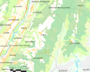
Гонселен (canton of Goncelin, canton de Goncelin)
 Hiking in Гонселен
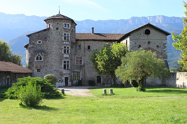
Canton de Goncelin, located in the Isère department of the Auvergne-Rhône-Alpes region in southeastern France, offers a variety of hiking opportunities that cater to different skill levels and preferences. The area features stunning landscapes, including mountains, valleys, and natural parks, primarily due to its proximity to the Chartreuse and Belledonne mountain ranges.
Key Features for Hiking in Canton de Goncelin:
1. Scenic Trails:
- Diverse Terrain: The trails in this region often vary from easy walks through lush green valleys to more challenging ascents in the mountains. You can expect a mix of forest paths, rocky outcrops, and panoramic viewpoints.
- Vistas: Many trails offer breathtaking views of the surrounding landscapes, including the impressive peaks and valleys that characterize the region.
2. Popular Hiking Areas:
- Belledonne Massif: This mountain range offers some of the more rugged and challenging hikes, with trails suited for experienced hikers. The higher elevations provide rewarding views and the chance to explore unique alpine flora.
- Chartreuse Mountains: Known for their limestone cliffs and deep gorges, these mountains also offer various hiking paths, including easier trails that are perfect for families and beginners.
3. Trail Difficulty:
- Beginner to Expert: There are trails ranging from family-friendly routes that are well-marked and easy to follow, to more demanding ascents that require good physical condition and possibly some technical skills.
4. Nature and Wildlife:
- The region is rich in biodiversity, and while hiking, you can spot various flora and fauna unique to the alpine environment. Birdwatchers will also find plenty of opportunities to observe local species.
5. Seasonal Considerations:
- Summer Hiking: Typically, May to September is considered the best period for hiking in this region. Trails are more accessible, and the weather is generally stable.
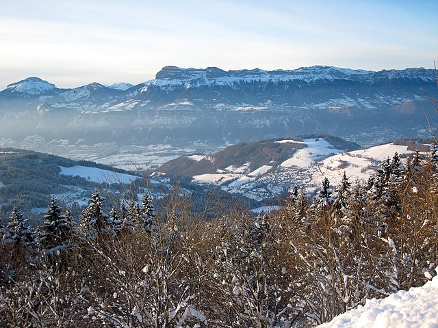
- Winter Activities: In winter, the Canton de Goncelin can transform into a destination for snowshoeing and cross-country skiing, so check local resources if you're interested in winter sports.
Tips for Hiking in Canton de Goncelin:
- Prepare Adequately: Bring sufficient water, snacks, and appropriate clothing for changing weather conditions. Sturdy hiking boots are essential for rocky or unpaved paths.
- Trail Maps: Utilize local maps or apps to navigate the trails effectively. While many paths are marked, having a map can be helpful, especially in more remote areas.
- Respect Nature: Follow the Leave No Trace principles—stay on marked trails, and be mindful of wildlife.
Local Resources:
- Consider visiting local tourism offices for updated trail maps, guided hikes, and information on any events or seasonal activities available in the area.
With its stunning natural beauty and diverse terrain, hiking in Canton de Goncelin can be a rewarding experience for both novice and experienced hikers alike. Enjoy your adventures in this picturesque region!
- Страна:

- Столица: Гонселен
- Координаты: 45° 19' 45" N, 5° 58' 42" E


- GPS треки (wikiloc): [Ссылка]
- Хранилище Wikidata: Wikidata: Q1725368
- код кантона INSEE: [3810]
Включает регионы:


Гонселен
- коммуна во Франции
Hiking in Гонселен
Goncelin is a small commune located in the Isère department in the Auvergne-Rhône-Alpes region of southeastern France. Nestled in the picturesque Belledonne mountain range, it offers various hiking opportunities that combine beautiful scenery, diverse landscapes, and the chance to explore the local flora and fauna....
- Страна:
- Почтовый код: 38570
- Координаты: 45° 20' 34" N, 5° 58' 45" E
- GPS треки (wikiloc): [Ссылка]
- Площадь: 14.36 кв.км
- Население: 2334
- Веб сайт: [Ссылка]

Ле-Шелас
- коммуна во Франции
Hiking in Ле-Шелас
Le Cheylas, located in the French Alps near the Isère River, is an excellent destination for hiking enthusiasts. The area offers stunning landscapes, picturesque valleys, and a variety of trails suitable for different skill levels. Here are some highlights you might consider if you're planning a hike in Le Cheylas:...
- Страна:
- Почтовый код: 38570
- Координаты: 45° 22' 17" N, 5° 59' 33" E
- GPS треки (wikiloc): [Ссылка]
- Площадь: 8.44 кв.км
- Население: 2612
- Веб сайт: [Ссылка]


Ле-Шам-пре-Фрож
- коммуна во Франции
Hiking in Ле-Шам-пре-Фрож
Le Champ-près-Froges is a picturesque village located in the Auvergne region of France, surrounded by beautiful landscapes that make it an ideal destination for hiking enthusiasts. Here are some key aspects to consider when planning a hiking trip in this area:...
- Страна:
- Почтовый код: 38190
- Координаты: 45° 16' 51" N, 5° 56' 20" E
- GPS треки (wikiloc): [Ссылка]
- Площадь: 4.83 кв.км
- Население: 1220
- Веб сайт: [Ссылка]

Лез-Адре
- коммуна во Франции
Hiking in Лез-Адре
Les Adrets, located in the Var department in the Provence-Alpes-Côte d'Azur region of France, offers beautiful hiking opportunities that showcase the stunning landscapes of the French Riviera and Provençal countryside. Here are some key points about hiking in this area:...
- Страна:
- Почтовый код: 38190
- Координаты: 45° 16' 18" N, 5° 57' 52" E
- GPS треки (wikiloc): [Ссылка]
- Площадь: 16.15 кв.км
- Население: 1004
- Веб сайт: [Ссылка]

Те
- коммуна во Франции
Hiking in Те
Theys is a charming commune in the French Alps, situated in the Isère department. It's a fantastic location for hiking enthusiasts, offering a variety of trails that cater to different skill levels. Here are some key points about hiking in Theys:...
- Страна:
- Почтовый код: 38570
- Координаты: 45° 18' 1" N, 5° 59' 49" E
- GPS треки (wikiloc): [Ссылка]
- Площадь: 35.77 кв.км
- Население: 1943
- Веб сайт: [Ссылка]


Юртье
Hiking in Юртье
Hurtières is a beautiful area located in the Savoie region of the French Alps, known for its stunning natural landscapes and various hiking opportunities. Here are some key points to consider if you're planning a hike in the Hurtières area:...
- Страна:
- Почтовый код: 38570
- Координаты: 45° 17' 17" N, 5° 58' 14" E
- GPS треки (wikiloc): [Ссылка]
- Площадь: 3.35 кв.км
- Население: 168


Тансен
- коммуна во Франции
Hiking in Тансен
Tencin, located in the Auvergne-Rhône-Alpes region of France near Grenoble, offers beautiful hiking opportunities amidst stunning natural landscapes. The area features diverse terrain, including hills, forests, and views of the Chartreuse Mountains, making it ideal for hikers of all skill levels....
- Страна:
- Почтовый код: 38570
- Координаты: 45° 18' 34" N, 5° 57' 37" E
- GPS треки (wikiloc): [Ссылка]
- Площадь: 6.75 кв.км
- Население: 1984
- Веб сайт: [Ссылка]

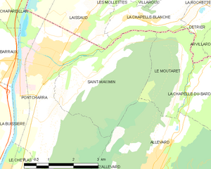
Сен-Максимен
Hiking in Сен-Максимен
Saint-Maximin, located in the Isère department in the Auvergne-Rhône-Alpes region of France, offers a range of beautiful hiking opportunities. Surrounded by the picturesque landscape of the Vercors and Chartreuse mountain ranges, it provides hikers with stunning views, diverse terrain, and a variety of trails suitable for different skill levels....
- Страна:
- Почтовый код: 38530
- Координаты: 45° 25' 35" N, 6° 2' 16" E
- GPS треки (wikiloc): [Ссылка]
- Площадь: 10.35 кв.км
- Население: 643
- Веб сайт: [Ссылка]

Моретель-де-Май
- коммуна во Франции
Hiking in Моретель-де-Май
Morêtel-de-Mailles is a picturesque village located in the Canton of Vaud in Switzerland, surrounded by beautiful natural landscapes that are ideal for hiking enthusiasts. Here are some highlights and tips for hiking in and around this area:...
- Страна:
- Почтовый код: 38570
- Координаты: 45° 22' 3" N, 6° 1' 0" E
- GPS треки (wikiloc): [Ссылка]
- Площадь: 6.71 кв.км
- Население: 476
- Веб сайт: [Ссылка]


Ла-Пьер
- коммуна во Франции
Hiking in Ла-Пьер
La Pierre, which could refer to various locations depending on the region, features stunning landscapes and diverse hiking opportunities. If you're specifically referring to a popular hiking region called La Pierre, please provide more details such as the country or specific park name, and I can give you tailored information....
- Страна:
- Почтовый код: 38570
- Координаты: 45° 17' 37" N, 5° 56' 54" E
- GPS треки (wikiloc): [Ссылка]
- Площадь: 3.31 кв.км
- Население: 570
- Веб сайт: [Ссылка]

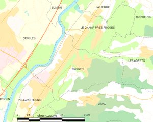
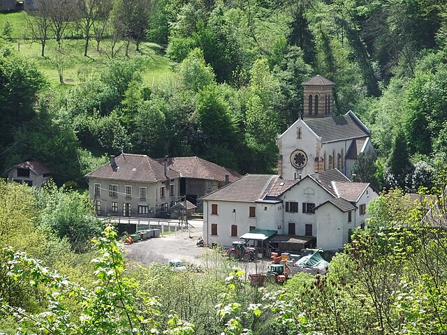
Фрож
- коммуна во Франции
Hiking in Фрож
Froges is a charming commune located in the Isère department, nestled in the picturesque Auvergne-Rhône-Alpes region of southeastern France. This area is well-known for its stunning natural landscapes, which makes it a great destination for hiking enthusiasts....
- Страна:
- Почтовый код: 38190
- Координаты: 45° 16' 24" N, 5° 55' 30" E
- GPS треки (wikiloc): [Ссылка]
- Площадь: 6.43 кв.км
- Население: 3291
- Веб сайт: [Ссылка]